501-918-3025
calsfoundation@cals.org
calsfoundation@cals.org
As settlers populated Arkansas in the 1800s, new towns would vie to become the county seat, as employment and business activity generated by county activities helped a town become established and grow. However, county seats could and did relocate, and railroad construction played a major part in that.
As railroads were constructing new lines, unless a town ahead was so prosperous that the railroad needed the town more than the town needed the railroad, the new rail route might bypass the existing town and instead develop a new town near the existing one. Often, the townspeople had little choice but to pick up, relocate to the new “railroad town,” and purchase lots from the railroad developers. Sometimes railroads demanded financial compensation, such as donations of land or cash, from an existing town so the railroad would come through. If the townspeople did not acquiesce, then the railroad would build elsewhere.
A new rail line might bypass an existing town for other reasons, too. Sometimes, the topography was such that it was easier and cheaper to construct the new railroad line elsewhere, or the owner of a tract of land could be either unwilling to sell or asking a price the railroad was unwilling to pay.
Regardless of the underlying reason, railroad developers learned there was money to be made by creating new towns and selling lots. In the last half of the 1800s and into the early 1900s, many an Arkansas county seat would find the plug pulled on its prosperity when the railroad built elsewhere. There were also cases, however, in which the existing county seat town did survive being bypassed by the main line.
Railroads that affected the locations of county seats are as follows (in chronological order of the development of the railroad).
| Railroad | Notes |
| Memphis & Little Rock | Construction on the Memphis & Little Rock commenced before the Civil War, but the route was not completed until 1871. |
| Cairo & Fulton (later the St. Louis, Iron Mountain & Southern)
|
Although the Arkansas General Assembly granted a charter to the Cairo & Fulton (of Arkansas) in 1853, meaningful construction did not begin until 1871. The line between Texarkana (Miller County) and the Missouri state line, near Corning (Clay County), was fully opened with the completion of the bridge across the Red River in early 1874. |
| Little Rock & Fort Smith | In spite of its namesake cities being on the south side of the Arkansas River, the entire length was sited on the north side. Construction began in earnest in 1870. The line was completed in 1876 to Cherokee, Indian Territory, across the river from Fort Smith. A ferry conveyed passengers and freight across the river. |
| Texas & St. Louis | What became known as the Cotton Belt Route was completed between Texarkana and the Missouri state line, near Piggott (Clay County), in 1883. |
| Arkansas & Louisiana | After completion of the Cairo & Fulton, various efforts were made to construct a branch to connect bypassed Washington (Hempstead County) to the main line. The branch eventually became the Arkansas & Louisiana, extending from Hope (Hempstead County) to Nashville (Howard County) in 1884. The Iron Mountain would acquire the railroad. |
| St. Louis, Iron Mountain & Southern Memphis Branch | In the 1880s, the Iron Mountain became the predominant railroad in the state. Ever expanding, it opened a line between Memphis, Tennessee, and Bald Knob (White County) in 1888. |
| Kansas City, Pittsburg & Gulf (later the Kansas City Southern) | With construction of its own, combined with acquisitions of other railroad lines, the “Pee Gee” completed its route that hugged the Arkansas-Oklahoma border in 1897. |
The following table of county seats bypassed by developing railroad lines is grouped by railroad line, in chronological order of development. Note that a few of the following county sections mention a Military Road. The U.S. Army Corps of Engineers would build numerous so-called military roads in the developing American frontier, and there were many roads known by that name.
| Railroad | County | Old County Seat | New County Seat | Notes |
| Memphis & Little Rock | St. Francis | Madison | Forrest City | From approximately 1841 onward, except for one year, the seat of St. Francis County was at Madison. Situated on the east side of Crowley’s Ridge and the west bank of the St. Francis River, the town was served by steamboats. Before the Civil War, the Memphis & Little Rock Railroad reached the east river bank, and construction proceeded on a bridge to span the flow.
Construction on the segment west of Madison resumed after war, leading to the 1869 platting of a new town about four miles west of Madison, Forrest City. At a much higher elevation than riverside Madison, Forrest City was less flood-prone. Although both towns were on the rail line, the county voted to move the seat to Forrest City in 1874. |
| Memphis & Little Rock | Lonoke | Brownsville | Lonoke | Brownsville, on the Memphis–Little Rock Military Road, was the Prairie County seat until that was moved to DeValls Bluff after the Civil War. The western part of the Memphis & Little Rock, completed in 1862 between DeValls Bluff and a point across the river from Little Rock, was routed a couple of miles south of Brownsville. When the new county of Lonoke was carved out of existing counties, the seat was set at the new town on the railroad, Lonoke. Brownsville all but disappeared. |
| Cairo & Fulton | Lawrence | Powhatan | Walnut Ridge | Going back to territorial days, Lawrence County encompassed much of the state. As parts were carved out to create other counties, the seat moved. It arrived at Powhatan, in rolling terrain on the west bank the Black River, in 1869.
When the Cairo & Fulton was constructed across the county in the early 1870s, the surveyors sought the flatlands farther east and bypassed the town. The settlement of Walnut Ridge relocated to be on the new railroad; it was designated as a second county seat. Then, in 1883, the Kansas City, Springfield & Memphis built a line that crossed the first railroad one and a half miles southwest of Walnut Ridge; Hoxie sprang up at this crossing. In spite of its favorable rail-junction location, Hoxie did not overshadow Walnut Ridge. Decades later, Powhatan lost its status as a county seat. |
| Cairo & Fulton | Jackson | Jacksonport | Newport | Jacksonport sits at the confluence of the White and Black rivers, near where the flat Delta lands bump into the rolling perimeter of the Ozark Plateau. The town was incorporated and named the county seat in the 1850s, while the downstream place called Newport was rather insignificant. But when Cairo & Fulton chose to build across the White River at Newport in the early 1870s, the fortunes of the two towns were reversed. The seat was relocated to Newport in 1891. |
| Cairo & Fulton | Hot Spring | Rockport | Malvern | Rockport was where the Military Road to Texas crossed the Ouachita River. The seat of Hot Spring County was moved from Hot Springs to Rockport in 1846.
The Cairo & Fulton chose to not cross the river at Rockport, but instead passed through about two miles southeast of the river, at what became Malvern. It took less than a decade for the seat to move to Malvern, and Rockport declined. |
| Cairo & Fulton | Nevada | Rosston | Prescott | When organized in 1871, the county had no incorporated cities or towns, so the seat was established at Mount Moriah Church. Rosston became the county seat in 1872. A few towns would spring up along the Cairo & Fulton, constructed through the northwest side of the county in 1873. The most successful of these was Prescott, which became the seat in 1877. |
| Cairo & Fulton | Hempstead | Washington | Hope | Washington was one of the few towns along the Military Road to Texas in territorial days. The Confederate capital was relocated there during the Civil War.
In the 1870s, the Cairo & Fulton tracklayers plotted a path about eight miles south of Washington, so the die was cast, even though it was many decades before the seat was shifted to Hope. |
| Little Rock & Fort Smith | Conway | Lewisburg | Morrilton | For most of the county’s early existence, the seat was either at Springfield or Lewisburg. While it was centrally located after sections of land were carved out to create new counties, Springfield was in undulating terrain. On the county’s south side, Lewisburg’s spot on the north bank of the Arkansas River allowed riverboat service, but it was also in rolling terrain.
As the Little Rock & Fort Smith was pushing west in 1870, it chose a much flatter area, about a mile to the north of Lewisburg. The new town of Morrilton was established on the railroad, named for the landowner. Initially, the railroad listed the stop as Lewisburg, even though the station was out of town. The county seat went from Springfield to Lewisburg in 1873, then relocated to Morrilton in 1883. |
| Little Rock & Fort Smith | Pope | Dover | Russellville | Pope County was created before Arkansas became a state. Its seat moved around before coming to rest at centrally located Dover in 1840. As the Little Rock & Fort Smith passed through in the early 1870s, the surveyors sought easier terrain closer to the Arkansas River. One formerly insignificant burg, Russellville, prospered on the new rail line, becoming the seat in the late 1880s. |
| Texas & St. Louis | Clay | Boydsville | Corning, Piggott | After the county was formed in 1873, the seat was contested between Corning (which seems to have sprung up about the same time as the newly built Cairo & Fulton passed through in the west part of the county) and Boydsville (in the eastern part of the county). The state in 1881 allowed both to be seats.
The Texas & St. Louis would soon complete its route through the east side of the county. One community that arose along the Texas & St. Louis tracks adopted the name of a post office that relocated to the site, Piggott. Piggott was chosen to be the eastern seat in 1891. |
| Texas & St. Louis | Greene | Gainesville | Paragould | The St. Louis, Iron Mountain & Southern branch from Knobel (Clay County) southward toward Helena passed through the county seat, Gainesville. But it also met the new Texas & St. Louis line about seven miles to the south. The new town served by two railroads was named Paragould, reflecting the names of the heads of the two railroads, Paramore and Gould. The county seat relocated to Paragould in 1884, and Gainesville rapidly declined. |
| Texas & St. Louis | Cleveland | Toledo | Rison | With the creation of what was originally called Dorsey County in 1873, the seat was established at a place renamed Toledo. The Texas & St. Louis built its route in 1882 about two miles northwest of town. After the courthouse burned in 1889, other towns saw an opportunity to snatch the seat. Rison, a creation of the railroad, was successful. |
| Texas & St. Louis | Dallas | Princeton | Fordyce | Dallas County and its seat, Princeton, developed in the 1840s. But the route built by the Texas & St. Louis in 1882 barely nicked the southeast corner of the county, where the town of Fordyce developed. Fordyce prospered and would push Princeton off its perch when the seat relocated in 1908. |
| Texas & St. Louis | Lafayette | Lewisville | Lewisville | Same name, different town. In the early 1880s, the Texas & St. Louis was routed about two miles south of Lewisville. Over time, the town migrated to the new location. A courthouse was built in “new Lewisville” in 1890. The original became known as Old Lewisville or North Lewisville. |
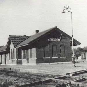
| Arkansas & Louisiana | Howard | Center Point | Nashville | When established in 1873, the county seat was set at Center Point. Construction of what became the Arkansas & Louisiana from a main line at Hope ended at Nashville in 1884.
In the decade between 1880 and 1890, Nashville’s population had increased from 172 to 810. After a devastating fire in Center Point, in 1905 the seat moved to Nashville, even though the town is less than two miles from the eastern boundary of the county. |
| Iron Mountain Memphis Branch | Cross | Wittsburg | Vanndale, Wynne | After Cross County was formed during the Civil War, the seat bounced around, but in 1868 it was returned to Wittsburg, on the east side of Crowley’s Ridge and near the St. Francis River. The construction of a north-south St. Louis, Iron Mountain & Southern route along the west side of Crowley’s Ridge in 1882, called the Crowley Ridge Branch, redirected economic activity to a town on the new line, Vanndale. But when the Iron Mountain opened an east-west Memphis-Bald Knob line in 1888, the focal point of the county once again moved, this time to where the two lines crossed, at Wynne. |
| Kansas City, Pittsburg & Gulf | Polk | Dallas | Mena | Preliminary maps showed a projected north-south rail line through the county seat, Dallas, but when the Kansas City, Pittsburg & Gulf arrived in 1896, it passed by Dallas, three miles to the northwest.
Around the end of June, land agent Fred Hornbeck began selling lots in Mena, anticipating the August arrival of the rails. By 1898, county residents were ready to move the seat to Mena. |
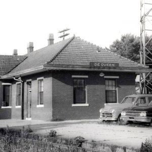
| Kansas City, Pittsburg & Gulf | Sevier | Lockesburg | De Queen | After land was split off to create a separate county, the seat of the remaining Sevier County was moved to a more central location, Lockesburg, in 1869. However, the Texarkana & Fort Smith, constructed in the late 1880s and early 1890s, was routed toward the west side of the county. The railroad, acquired by the Kansas City, Pittsburg & Gulf, promoted a new town on the line, De Queen, in 1897. Even though the DeQueen & Eastern short line extended through Lockesburg, the 1900 federal census listed De Queen with more than twice the population of Lockesburg. A 1905 vote moved the seat to De Queen. |
| Kansas City, Pittsburg & Gulf | Little River | Rocky Comfort, Richmond | Ashdown | Both Rocky Comfort and Richmond were at one time the county seat. However, neither of these two were on one of the two rail lines built across the county in the late 1880s into the 1890s. A 1906 election sent the seat to the town at the junction of the two railroads, Ashdown. |
Not all railroad development that skirted a county seat resulted in the relocation of the seat of county government, even when the railroad-connected town grew larger, raising the issue of which community was the predominate one. The following is a chart of some interesting exceptions:
| Railroad | County | County Seat | Notes |
| Cairo & Fulton | White | Searcy | The Cairo & Fulton bypassed Searcy by about three miles. Searcy responded by completing a horse-powered line with twenty-pound rails between Searcy and West Point in 1879. More substantial rail connections would come later. Searcy thrived. |
| St. Louis–San Francisco Railway | Benton | Bentonville | When the St. Louis and San Francisco Railway (Frisco) Arkansas Division tracklayers entered the state, they followed an alignment that passed about five miles east of Bentonville in 1881. The new town of Rogers would grow to become larger than Bentonville, but Bentonville remained the county seat. |
| Texas & St. Louis | Calhoun | Hampton | The Texas & St. Louis passed through the northern tip of the county in 1882, but unlike in nearby Dallas County, a new town on the line did not eclipse the established seat, Hampton. In the early 1900s, a north-south Rock Island line crossed the east side of the county, and a short-lived timber short line, Thornton & Alexandria, began serving Hampton. |
| Iron Mountain Memphis Branch | Woodruff | Augusta | As the Civil War approached, Augusta was an established riverboat town atop a bluff on the east side of the White River. When the St. Louis, Iron Mountain & Southern was constructing the Memphis-Bald Knob line in the mid-1880s, town leaders thought that riverboat traffic would sustain the economy. The book Shortline Railroads of Arkansas describes the town leaders rebuffing the Iron Mountain emissary. The Iron Mountain routed the tracks about a mile to the south and established a New Augusta station. Soon realizing that the new economy demanded rail service, a mule-powered line connecting downtown with the mainline was built in 1887. The company would eventually use mechanical power over its 1.6-mile length and be called Augusta Railroad. It applied to the Interstate Commerce Commission for permission to cease operation in 1958. Through all of this, the pre-railroad town area remained predominate. |
| Little Rock, Pine Bluff & New Orleans | Lincoln | Star City | The Little Rock, Pine Bluff & New Orleans was routed through the very flat Delta lands in the northeastern corner of Lincoln County in the mid-1870s, a dozen or so miles away from the county seat, Star City. Even without a rail line until Gould Southwestern extended a branch line into town in January 1909, the seat remained at Star City. |
| Iron Mountain White River Line | Marion | Yellville | The Missouri Pacific/Iron Mountain White River line passed through this remote Ozarks county in 1904. It was routed less than two miles north of Yellville. Even though Summit or North Yellville developed around the new railroad depot, the courthouse and Yellville remained in place. |
| Choctaw, Oklahoma & Gulf | Perry | Perryville | The Choctaw, Oklahoma & Gulf expanded to form a line from Memphis to northeastern New Mexico. The segment from Indian Territory to Little Rock was completed in 1899. Northwest of Little Rock, the alignment made a path between the Arkansas River bottoms on one side and the mountains on the other. It then turned west, through river valleys lying between the east-west–oriented ridge lines. In Perry County, the rails followed Cypress Creek for three miles and a ridgeline north of the county seat, Perryville. The new town on the tracks, Perry (initially called North Perryville), did not supplant the county seat. |
| Gurdon & Fort Smith | Montgomery | Mount Ida | In the early 1900s, the Gurdon & Fort Smith was formed to branch off an existing line at a spot labeled Pike Junction, about half a mile east of Antoine (Pike County). Under Iron Mountain control, construction crept northward along the Antoine River valley, then to Caddo Gap (Montgomery County). Land speculator Walter E. Womble laid out a new town north of the railhead and named it after himself. Railroad construction, continuing under the name Gurdon & Fort Smith Northern, ended in Womble at the end of 1907. Womble promoters made three unsuccessful attempts to move the seat from Mount Ida (Montgomery County). In the mid-1920s, the town of Womble voted to change its name to Norman. Mount Ida never had a permanent railroad, but it held on to the seat. |
For additional information:
Adams, Walter M. The White River Railway: A History of the White River Division of the Missouri Pacific Railroad Company, 1901–1951. North Little Rock, AR: Walter Adams, 1991.
Hull, Clifton E. Shortline Railroads of Arkansas. Norman: University of Oklahoma Press, 1969.
McCommas, Betty. The History of Sevier County and Her People. Dallas: Taylor Publishing, 1980.
Woods, Stephen E. “The Development of Arkansas Railroads, Part I.” Arkansas Historical Quarterly 7 (Summer 1948): 103–140.
———. “The Development of Arkansas Railroads, Part II.” Arkansas Historical Quarterly 7 (Autumn 1948): 155–193.
J. L. Gattis
University of Arkansas, Fayetteville


Comments
No comments on this entry yet.