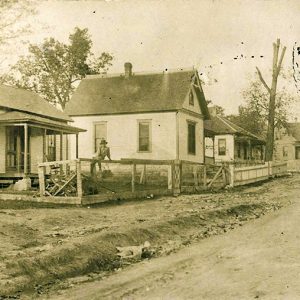
 Cotter Street Scene
Entry Category: Counties, Cities, and Towns - Starting with C
Cotter Street Scene
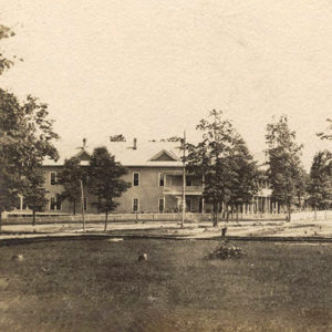
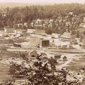 Cotter View
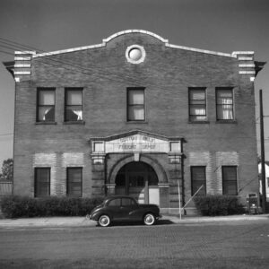 Cotton Belt Depot, North Little Rock
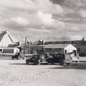
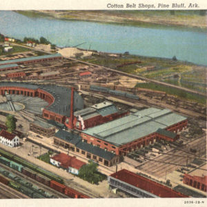 Cotton Belt Railroad Yard
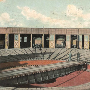 Cotton Belt Roundhouse
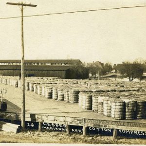 Cotton Compress
 Cotton Seed
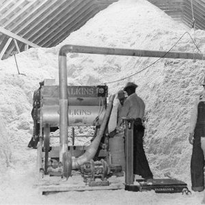
 Cotton Oil Plant
Cotton Plant (Woodruff County)
Cotton Plant, once the cultural center of Woodruff County, is in a rich cotton-producing area. Though the population has dwindled, it is still one of the most historical sections of the county. Louisiana Purchase through Early Statehood In 1820, the first white men came to the area from Mississippi, Tennessee, Virginia, and the Carolinas. They were settlers who subsisted on hunting and on trade. The small settlement was first called Richmond, though it is not known why, and included a blacksmith’s shop and a grocery store. In 1832, a group of settlers arrived from Kentucky and took up squatters’ claims. William Lynch arrived from Mississippi in 1846 and built a house and a store. Beside the store, he planted cottonseed …
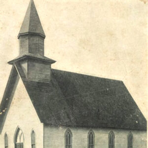 Cotton Plant Church
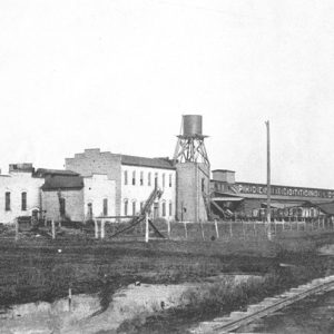
 Cottonseed Oil Mill
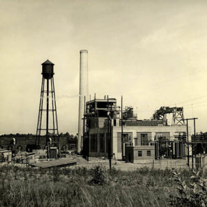 Couch Power Plant in Stamps
Counties
Counties are administrative and political sub-units of a state. Some states, particularly Alaska and Louisiana, use the terms “borough” and “parish,” respectively, to designate the same type of entity. The county government is based within a community designated the county seat and typically consists of a county judge (who serves as the chief executive officer), county clerk, circuit clerk, assessor, sheriff, coroner, and the legislative body known as the quorum court; some counties have or had other positions such as county superintendent, surveyor, or collector. Some counties possess dual county seats due to local geographical conditions making travel to a single county seat difficult at certain times of the year, as with some counties that are divided by a river. …
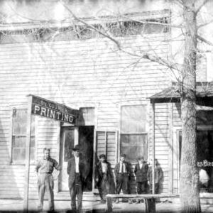 Courier Printing
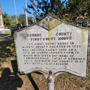 Courthouse Historical Sign
 Coury House
Cove (Polk County)
Cove is a town on U.S. Highway 71 in western Polk County. It is home to Van-Cove High School, part of the Cossatot River School District. The rugged hills of the Ouachita Mountains remained sparsely settled until after the Civil War, although Cove appears on maps as early as the 1850s. It is not clear why the name Cove was chosen for the community. The Skirmish of Sulphur Springs was fought near the location of Cove on January 25, 1864. Henry McDaniel purchased land in the area in 1876 and began clearing land for his farming operation. By 1890, Cove was noted as “an enterprising and good business village” with five general stores, a drugstore, three blacksmith shops, a wagon …
Cove Creek (Hot Spring County)
Cove Creek is an unincorporated community in Hot Spring County. Located about six miles northwest of Malvern (Hot Spring County), the community is directly south of Magnet Cove (Hot Spring County) and directly east of Jones Mills (Hot Spring County). An alternate name of the community is LeCroy, named after a local landowner. Early landowners in the area included John M. Ross, who obtained 162 acres in the section in 1858 using Choctaw scrip. Nehemiah Woods obtained 160 acres the same year, also using Choctaw scrip. Settlement of the area occurred slowly until the construction of the Diamond Joe Railroad. Officially known as the Hot Springs Branch Railroad, the more colorful nickname honored founder Joseph Reynolds. A section crew stationed …
 Cove School
 Cow Sale
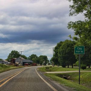 Coy
Coy
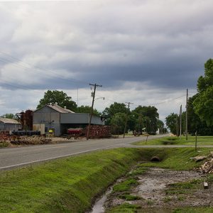 Coy
Coy
Coy (Lonoke County)
The story of Coy is the same as that of many rural Arkansas communities that have almost disappeared since the inception of the automobile and mechanized farming. It was the hub of the cotton growing and ginning industry in south Lonoke County from 1900 until the early 1960s. On November 3, 1896, Abby M. Coy—wife of “Colonel” Lucien W. Coy, who established the town—purchased the land that would become Coy from one F. Gates. Lucien Coy had been a first lieutenant with the Union in Missouri’s First Engineering Regiment, Company B, and he came south after the Civil War and engaged in lending money and land speculation in Little Rock (Pulaski County). The exact date of the town’s establishment is …
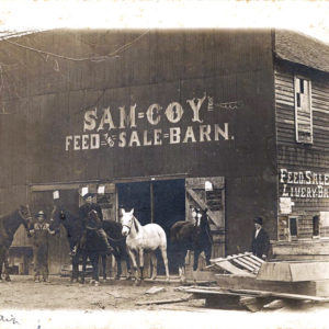 Coy Feed and Sale Barn
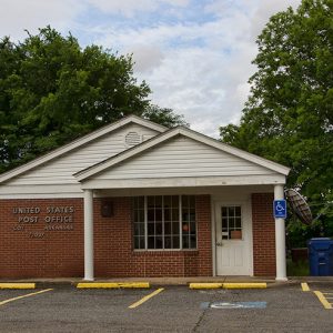 Coy Post Office
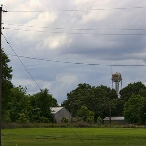 Coy Water Tower
Craighead County
Craighead County is located in northeast Arkansas and was created as Arkansas’s fifty-eighth county in 1859. It is unusual not only in the circumstances of its creation and naming but also in that it has two county seats, Jonesboro and Lake City. The unique formation called Crowley’s Ridge runs through its center. Along with Jonesboro and Lake City, Craighead County also includes the towns of Bay, Black Oak, Bono, Brookland, Caraway, Cash, Claunch, Egypt, and Monette. It is the home of Arkansas State University (ASU), one of the state’s largest universities. Pre-European Exploration Of significance for early habitation of Craighead County is Crowley’s Ridge, a crescent-shaped outcropping running roughly from Cape Girardeau, Missouri, to Helena-West Helena (Phillips County). It rises …
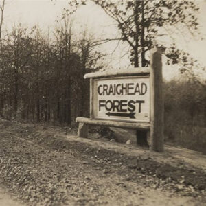 Craighead Forest
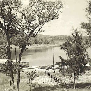 Cranfield Landing
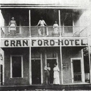 Cranford Hotel
Crawford County
Crawford County is situated in northwest Arkansas in the Ozark Mountains. The Boston Mountains on the north and the Arkansas River Valley on the south provide a diverse landscape and play an important role in the economy of the past and present. The county is centrally located within the nation, thus allowing desirable north-south and east-west transportation networks to support industrialization, manufacturing, and tourism growth. Pre-European Exploration The area that became Crawford County has been inhabited since the end of the Ice Age, about 12,000 BC. Paleoindians hunted and gathered wild plants and other resources, residing in open air campsites and occasionally using rock shelters. Agricultural settlements began to be established during the Mississippian Period (AD 900—1600). Pictographs (paintings on …
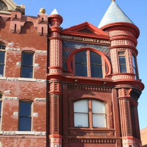 Crawford County Bank Building
Crawfordsville (Crittenden County)
Crawfordsville is a second-class city located on U.S. Highway 64 in central Crittenden County, about halfway between Earle (Crittenden County) and Marion (Crittenden County). Crawfordsville benefits from a slightly higher elevation (ten to fifteen feet) in comparison to its immediate neighbors, and its history is largely unblemished by the devastation that floods have exacted on nearby communities. City establishment began as an outgrowth of the timber industry in eastern Arkansas during the post–Civil War era, and the opening of a railroad line through the community sustained city growth as its economy transitioned from timber to farming during the early twentieth century. Unlike other communities in Crittenden County that diminished or disappeared once the timber-rich acreage had been cleared, Crawfordsville continued …
 Crawfordsville Baptist Church
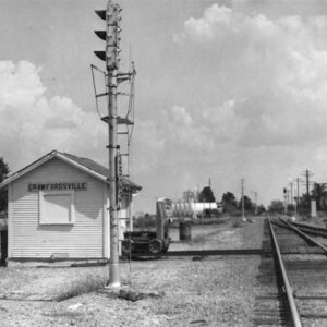 Crawfordsville Depot
 Crescent College
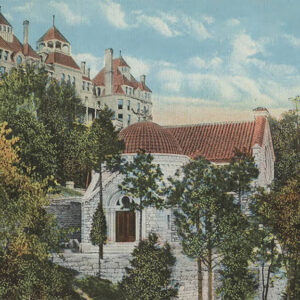
 Crescent Hotel
 Crigler Church
Crittenden County
Crittenden County is located in east-central Arkansas. Its eastern and southern boundaries are the Mississippi River. To its west are Lee, St. Francis, and Cross counties. Mississippi County and Poinsett County form its northern borders. According to historian Margaret Woolfolk, “Crittenden is entirely on the bottom land of the Mississippi River….Total thickness of the sediment exceeds 100 feet.” Because of its astonishing fertility, the area became an obvious location for agricultural development. In the modern era, it has also become a major transportation thoroughfare. European Exploration and Settlement Artifacts found in Crittenden County—including effigy pipes, stone ear plugs, and ornaments—testify to a long habitation of the area by Native Americans. Some archaeologists place the location of Pacaha, visited by …
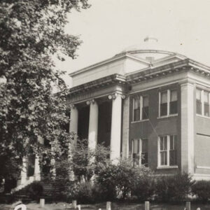 Crittenden County Courthouse
 Crockett's Bluff
Cross County
Cross County is one of the state’s leading producers of soybeans and rice, the location of the only copper tube mill in Arkansas, and the home of two state parks: Village Creek State Park and Parkin Archeological State Park. Created during the Civil War, the county was largely shaped by railroad development during the Gilded Age, with small industry and tourism becoming more of a focus in the late twentieth and early twenty-first centuries. Geologically, the county is divided roughly into thirds. Crowley’s Ridge, a glacial age erosional remnant covered with a unique loessal topsoil, traverses the county north to south, rising seventy-five to 100 feet above ancient deltaic alluvial floodplains on either side. The eastern third is drained primarily …
Cross Roads (Hot Spring County)
Cross Roads is an unincorporated community located in far western Hot Spring County. It is also known as Crossroads. The community is located about one mile southwest of Bonnerdale (Hot Spring County) and nine miles northeast of Glenwood (Pike County). Cross Roads is located about three-quarters of a mile east of the Montgomery County line. The community of Bismarck (Hot Spring County) was also known as Cross Roads in the nineteenth century. The first settlers arrived in the area in the early nineteenth century, but the first federal land patents in the area were not issued until 1897. In that year, Jesse and Samuel Ballard each obtained about 160 acres in the Cross Roads area. Samuel Ballard was a North …
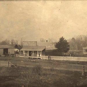
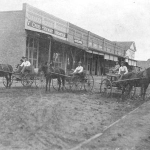 Cross Stewart Mercantile
Crossett (Ashley County)
In the last quarter of the nineteenth century, the demand for wood fiber for a growing country led lumbermen, investors, and speculators into the vast forest that stretches from east Texas across the lower Mississippi River Valley to the Florida panhandle. Demand having outstripped the forest resources of the Great Lakes region, other sources for timber were sought. One result of the interest in the forestland of the South was the founding of Crossett (Ashley County). Crossett was founded in the late 1890s by three investors from Davenport, Iowa— Edward Savage Crossett, Austria native Dr. John Wenzel Watzek, and Charles Warner Gates. Today, Crossett is one of the state’s leading manufacturing centers, billing itself as the “Forestry Capital of the …
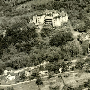
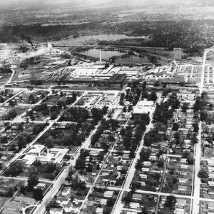 Crossett Arial View
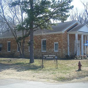
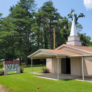
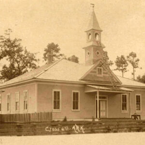 Crossett Church
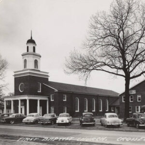 Crossett Church
 Crossett Hotel
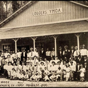 Crossett Loggers


