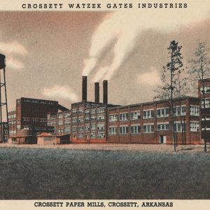
 Crossett Mill
Entry Category: Counties, Cities, and Towns - Starting with C
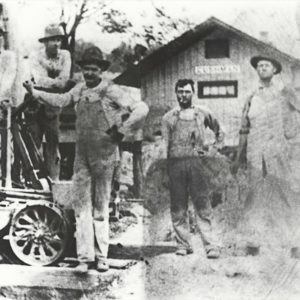
Crossett Mill
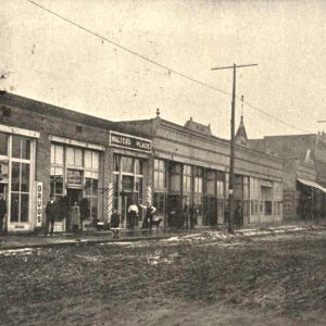
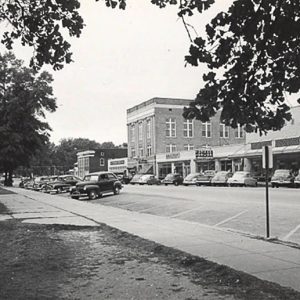 Crossett Street Scene
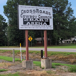 Crossroads Church Sign
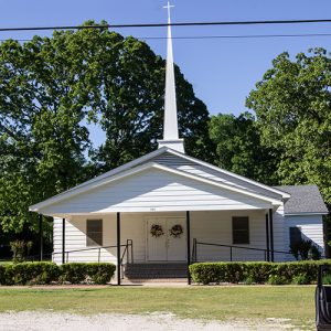
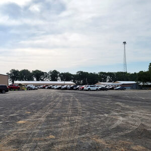 Crossroads Cowboy Church
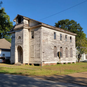
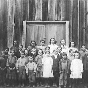 Crossroads School
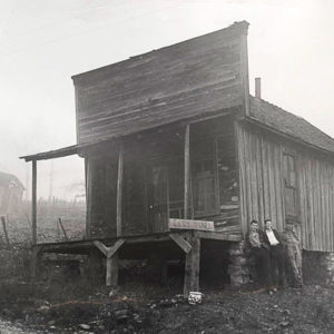
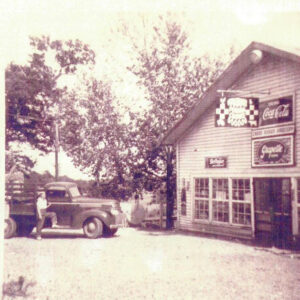 Crossroads Store
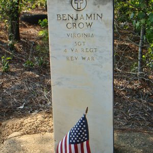 Crow Memorial
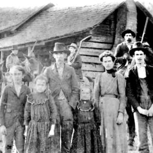 J. J. Crow Family
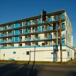 Crown Motel
Crows (Saline County)
Crows, often referred to as Crows Station, is an unincorporated rural community in Dyer Township of Saline County, located at the intersection of Arkansas State Highways 9 and 5, approximately thirteen miles west of Benton (Saline County) and twenty-one miles east of Hot Springs (Garland County). The community takes its name from Jehu Crow, a notable Saline County sheriff, county, and probate judge. Early settlers to the area farmed and hunted the rich lands along the Saline River and eastern Ouachita Mountains. One of the earliest families to arrive in the area was the Dyer family, in whose honor the township was named. Charles Dyer and sons Given, Hassary, John, and Charles came to Saline County from Kentucky in 1835. …
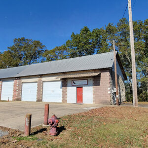 Crows Fire Department
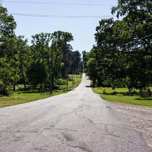
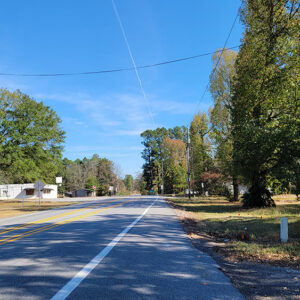 Crows Street Scene
Crystal Hill (Pulaski County)
Crystal Hill is a geological formation on the north side of the Arkansas River near Murray Lock and Dam. It is also the name of a neighborhood in the city of North Little Rock (Pulaski County). Nearby Pyeatte-Mason Cemetery contains the graves of some of the early settlers of Crystal Hill. The formation, about seven miles upstream from downtown Little Rock (Pulaski County)—although many early travelers exaggerated the distance to fifteen miles—is a bluff consisting of sandstone and shale. It also contains significant amounts of iron pyrite, which sparkles in the sunlight. River travelers, seeing the sparkle, gave the hill its poetic name. East Arkansas settlers displaced by the New Madrid Earthquakes of 1811–1812 began to settle this part of …
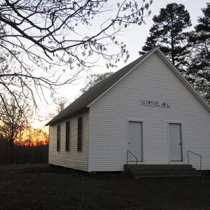 Crystal Hill Church
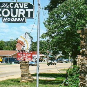 Crystal River Tourist Camp
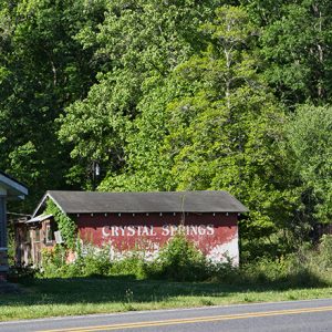
 Crystal Springs
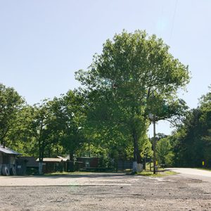 Crystal Springs
 Crystal Springs
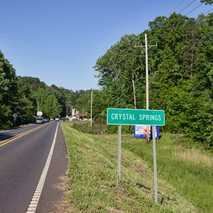
Crystal Springs (Garland County)
Crystal Springs (Garland County) is an unincorporated community located south of Lake Ouachita in the Ouachita National Forest. The community is about five miles west of Royal (Garland County) and seventeen miles west of Hot Springs (Garland County). The community is less than two miles south of Crystal Springs Campground on the shore of the lake. The Crystal Springs area was part of Montgomery County during its earliest settlement. On February 23, 1917, the easternmost portion of Montgomery County, including Crystal Township where Crystal Springs is located, was transferred to Garland County. Settlement of the area did not begin until after the end of the Civil War. Early settlers in the area include Francis Springer, who obtained 160 acres from …
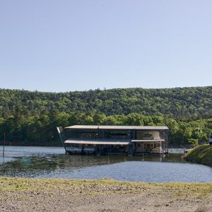 Crystal Springs Marina
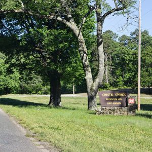 Crystal Springs Recreation Area
 Culp Hotel
 Cumberland College
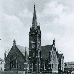 Cumberland Presbyterian Church
 Cumberland Presbyterian Church
Curia (Independence County)
The historic community of Curia (pronounced Curie) was located near Curia Creek, a tributary of the Black River, east of Highway 25 between Saffell (Lawrence County) and Cord (Independence County). The remains of this community, like Hazel Grove (Independence County), are on private land with restricted public access. It was located in Barren Township. Curia Lake is a popular fishing spot noted for its perch and crappie. The place name of Curia (a.k.a. Bayou Cura, Bayou Cure, and Cura Creek) is mentioned in a written description of the boundaries of the new Independence County on October 23, 1820, which included, “All that portion of the county of Lawrence bounded as follows, to wit: Beginning at a point in Big Black …
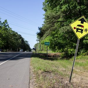 Curtis
 Curtis
Curtis (Clark County)
Curtis is an unincorporated community located along State Highway 67, nine miles south-southwest of the Clark County seat of Arkadelphia. Originally used as a refueling stop for trains along the Iron Mountain Railroad, it became a timber community heavily dependent on the surrounding forests. During the mid-1900s, the community became home to a successful semi-professional baseball team. Today, like many of its neighbors, the community has dwindled due to the decline in the area’s timber industry. The community was established in the 1870s, largely due to promotional brochures distributed by the railroad, advertising the area and encouraging people to settle there. It was originally established as a fuel chute along the Iron Mountain Railroad. At first, the fuel chute only …
 Curtis Baptist Church
Cushman (Independence County)
Cushman, established in 1886 as the result of an accident, was an important shipping and trade center for the next seventy-two years. The center of the tremendously valuable manganese mining industry, Cushman also served as a shipping point for businesses and farmers in northern Independence County and most of Izard County. William Einstein of St. Louis established a mining operation on what is now known as Polk Southard Mine, near what is now Sandtown Road, in about 1866. At the time, this was just a wild wooded area. In 1885, the Keystone Mining Company, an Andrew Carnegie company, began operations on Southard Hill. Shortly thereafter, the St. Louis Mining Company came to the area and began operations near Polk Southard. …
 Cushman City Hall
 Cushman Depot
 Cypress Street
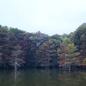 Cypress Trees


