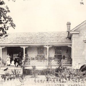
 W. H. Toland House
Entry Category: Counties, Cities, and Towns - Starting with W
W. H. Toland House
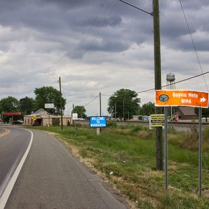 Wabbaseka
 Wabbaseka
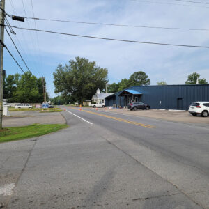
Wabbaseka (Jefferson County)
Wabbaseka is a town in northern Jefferson County. It is on the conjoined highways U.S. 63 and U.S. 79 between Humphrey (Arkansas and Jefferson counties) and Altheimer (Jefferson County). When Arkansas became part of the United States, the land where Wabbaseka would later be founded was a forested swamp that attracted few settlers. Antoine Barraque visited Quapaw chief Heckaton at what was referred to as Wadittesha Wattiska, or Black Clay Bayou, in January 1826. Surveyor William Pelham noted “Bayou Wabbaseekee” in 1836, calling it “a stream with a gentle current.” High land next to the bayou was noted during a flood in 1844, leading Jordan Embree to purchase the “island” in 1853. On his map of Jefferson County in 1872, …
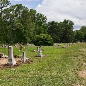 Wabbaseka Cemetery
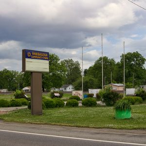 Wabbaseka Community Park
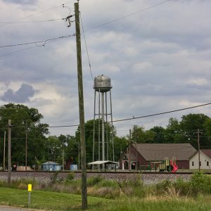 Wabbaseka Water Tower
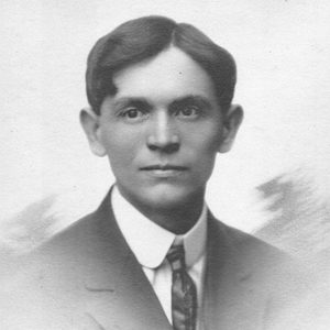
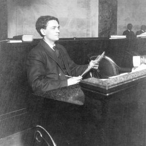 W. J. Waggoner at Desk
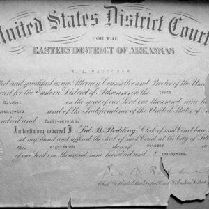 W. J. Waggoner Bar Admission
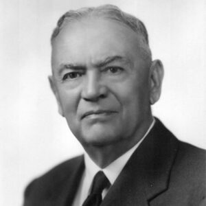 William J. Waggoner
 William J. Waggoner
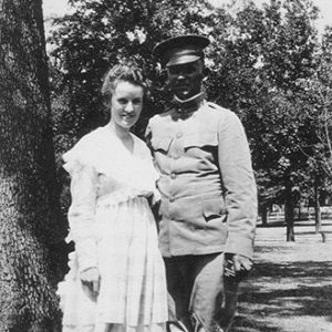 William J. Waggoner and Ruth Bradford
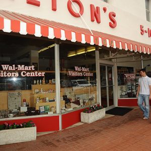 Wal-Mart Visitors Center
 First Opening of Wal-Mart
Waldenburg (Poinsett County)
Waldenburg is an incorporated town in Owen Township of Poinsett County. Located west of Crowley’s Ridge, the town lies at the intersection of State Highways 14 and 49. It is located south of Weiner (Poinsett County) and approximately twenty-five miles from Jonesboro (Craighead County). Originally known as the German Settlement, then Bern, and later Youngville, Waldenburg was incorporated in 1958. Early in its settlement, the town was a small milling community predominately settled by German immigrants whose descendants still make up the majority of the population. The construction of the St. Louis Southwestern Railway (commonly called the Cotton Belt) in 1881 established a firm foundation for the town, and many businesses began to appear. Waldenburg’s milling and agricultural economy soon …
Waldo (Columbia County)
Like many small cities throughout the state of Arkansas, Waldo (Columbia County) owes its existence to the construction of the railroad through the area in the 1880s. With a connection to the outside world, it soon became a thriving commercial area with as many as seven lumbering operations located in the immediate vicinity. Waldo owes its founding and development to the construction of the St. Louis, Arkansas and Texas Railroad into the surrounding timberlands in 1883. At that time, Lamartine (Columbia County) was a thriving town in the area. But when the tracks were put down approximately three miles to the south, citizens began to move there, with businesses soon to follow. Once the Lamartine post office was relocated along …
Waldron (Scott County)
Surrounded by forested ridges and wide fertile valleys, Waldron is located fifty miles south of Fort Smith (Sebastian County), near the Oklahoma border in Scott County. It is situated on the South Fork of the Poteau River in the Ouachita Mountains. The town, the seat of Scott County, is centrally located on the north-south highway artery on the western side of the state and is within easy reach of air, train, or truck shipping facilities. Louisiana Purchase through the Gilded Age The founder of Waldron, William Grandison (W. G.) Featherston, moved to the area in 1832 with his mother, wife, and four children. He built a store/tavern on his property where Main Street was later constructed. A post office named …
 Waldron Aerial View
 Waldron Church
 Waldron Commercial Historic District
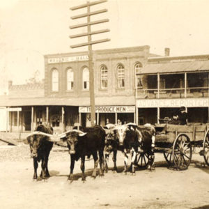 Waldron Produce
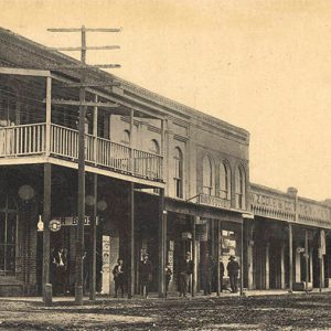 Waldron Street Scene
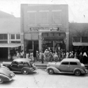 Waldron Western Auto Store
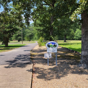 Walking Trail
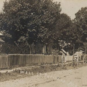 Wall Street
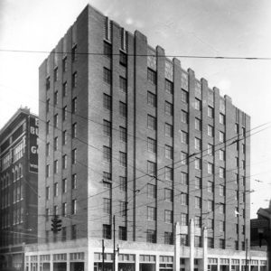 Wallace Building
Wallaceburg (Hempstead County)
Wallaceburg is an unincorporated community located in northeastern Hempstead County. The community is about two miles northeast of Blevins (Hempstead County) and sixteen miles north of Hope (Hempstead County). It is located in Wallaceburg Township. Early landowners in the area include William Hasley, who obtained eighty acres as part of a land patent in 1837. Other early landowners include the Philip Graves family, who obtained forty acres in 1854, and James Wood, who received a patent for 160 acres in 1856. The name of the community may come from Stephanus Wallace, who obtained eighty acres of land in the area in 1875, or Marcus Wallace, who acquired forty acres the same year. The first courthouse in Hempstead County stood about …
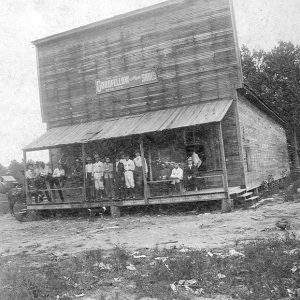 Wallaceburg Store
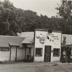 Wally's Cafe
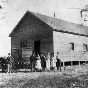
Walnut Grove (Independence County)
The Walnut Grove Cemetery on Walden Road just north of Cord (Independence County) is all that is left of the historically important community of Walnut Grove, located on the Jackson Military Road (named for President Andrew Jackson) built parallel to the old Southwest Trail in the early 1830s. A main road ran nearby from the county seat of Batesville (Independence County) to Elgin (Jackson County), seven miles southeast, where a ferry crossed Black River. Before it was called Walnut Grove, the area was referred to on the census reports as Black River Township. The Military Road then ran through Hazel Grove (Independence County) to Walnut Grove along Curia Creek, where the marker is located today at the entrance to the …
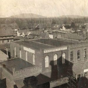
Walnut Ridge (Lawrence County)
Walnut Ridge, county seat of Lawrence County, is located in northeast Arkansas. In response to World War II, the United States government opened the Walnut Ridge Army Flying School in 1942 on the northern outskirts of the town. The flying school was essential in the training of World War II pilots and in the dismantling of planes and other military equipment at the end of the war. Today, Walnut Ridge is the home of Williams Baptist University and is located on a major railroad line. The town also recently opened a museum dedicated to the World War II Army Flying School. Pre-European Exploration Earliest inhabitants in Lawrence County were Native Americans. During the Mississippian Period (approximately AD 900–1600), the Osage, …
 Walnut Ridge Businesses
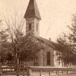
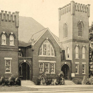
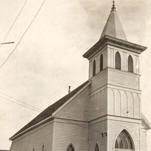 Walnut Ridge Church
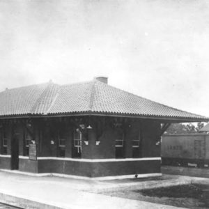
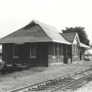 Walnut Ridge Depot
 Walnut Ridge Laundry
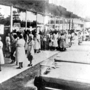
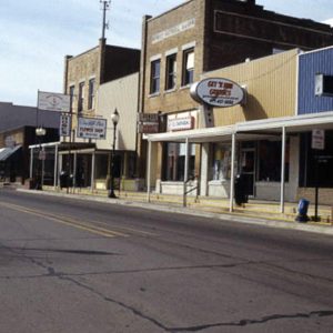
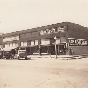
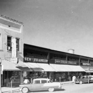 Walnut Ridge Street Scene
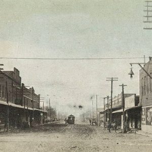 Walnut Ridge Street Scene
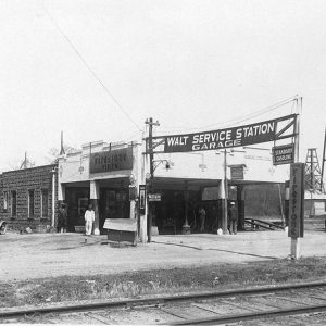 Walt Garage
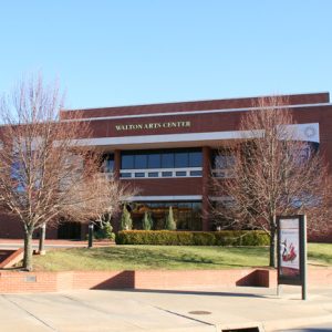 Walton Arts Center
Ward (Lonoke County)
The town of Ward is a farming community located in northern Lonoke County on the western edge of Arkansas’s Grand Prairie along the old Southwest Trail, today known as U.S. Highway 67. It is bisected by the Missouri-Pacific Railroad tracks. The railroad first reached the town in the 1870s as the Cairo and Fulton Railroad Company, and it was the main reason for the town to prosper as a prime shipping point for the area’s corn, wheat, cotton, strawberries, and other crops. The lush hardwood forests, rich alluvial soil, abundant game, and ample water supplies found here in this part of the state drew settlers to this area. Ward is believed to have been named for W. D. (probably William) …
 Ward Community Building
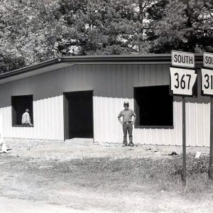
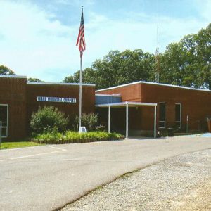 Ward Municipal Building
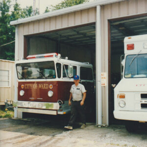 Ward Rescue Vehicles
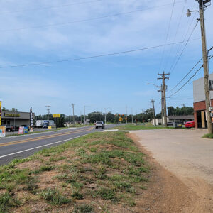 Ward Street Scene
 Ward Street Scene
 George Cabot Ward
Warren (Bradley County)
Warren has been the Bradley County seat of justice since the county’s organization on December 18, 1840. Located in the southeastern part of the state, the town continues to be the county’s commercial, educational, and health care center. It is located on what was variously called the Chicot Trace, Gaines Landing Road, Fort Towson Road, and Washita Road. Early Statehood through Reconstruction Warren once served as the official center of the territory now composed of Calhoun, Cleveland, Ashley, and Drew counties. The first circuit court met on April 26, 1841, at Hugh Bradley’s house. The naming of Warren remained clouded in conjecture for a long time; according to local family tradition, the town was named for Hugh Bradley’s slave, Warren …
 Warren Church
 Warren Depot
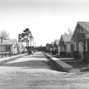 Warren Mill Worker Housing


