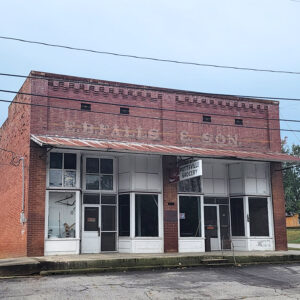
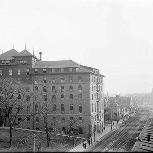
 E. B. Falls & Son Building
Entry Category: Counties, Cities, and Towns - Starting with E
E. B. Falls & Son Building
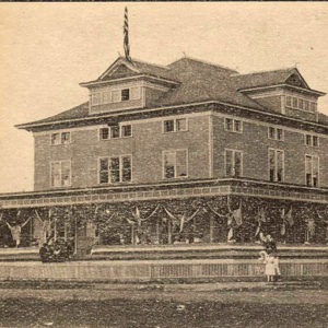 E. S. Crossett Club
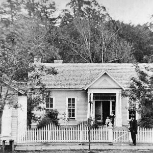
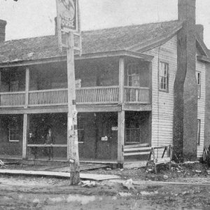 Eagle Hotel
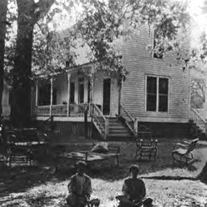 Eagle House
 Eagle Rangers
Earle (Crittenden County)
Earle is an incorporated city in western Crittenden County located on U.S. Highway 64 near the border with neighboring Cross County. The history of Earle is really that of two towns—Earle and Norvell—which grew alongside each other for decades and were separated only by a boundary line running down present-day Ruth Street in Earle. Both towns arose as a result of the timber industry boom following the Civil War and shared most of the same civic and business leaders. In 1888, a railroad line through the southern part of Earle was established, which benefited Earle more than its smaller neighbor, as the route of the railroad bypassed Norvell entirely. Talks of merging the two towns lingered for more than sixty …
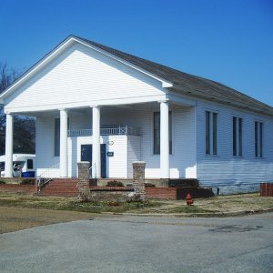
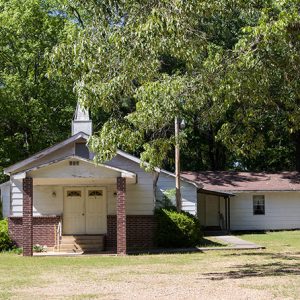
 Earle Baptist Church
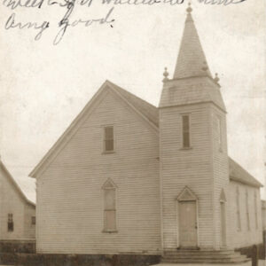
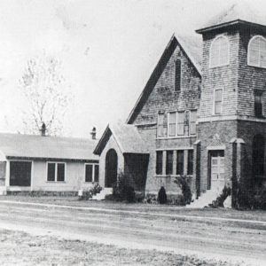
 Earle Church
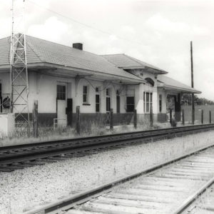 Earle Depot
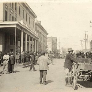
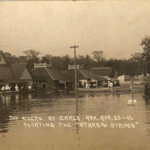 Earle Flood
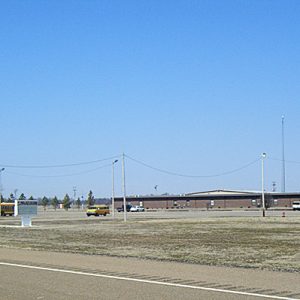 Earle High School
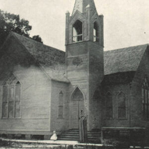
 Earle Methodist Church
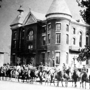
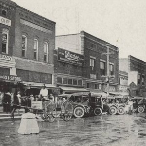
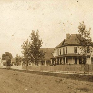 Earle Street Scene
Earnheart (Independence County)
Earnheart is a community on the north bank of the White River about three miles southeast of Bethesda (Independence County) and about four miles southwest of Limedale (Independence County). Across the White River from Earnheart is Earnheart Island near Lock and Dam No. 2. Created by the River and Harbors Act of March 1899, Lock and Dam No. 2 is presently own by Independence County; the old lock is being converted into a hydro-electric generating station. The Missouri Pacific Railroad runs through Earnheart. The Mitchell family from Alabama was among the first to settle in the Earnheart area of Washington Township. Shortly after the Civil War, Charles Pierce Mitchell homesteaded 140 acres along Rock Branch (a.k.a. Rocky Branch), a stream …
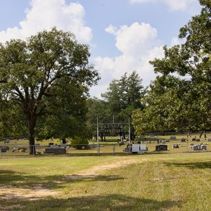
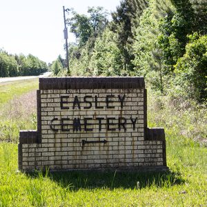 Easley Cemetery
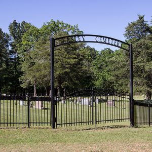 Easley Cemetery
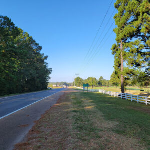 Entering East Camden
East Camden (Ouachita County)
East Camden is the only city in Arkansas that was constructed by the U.S. Navy. It is located on Highways 274 and 278, several miles from Camden (Ouachita County). A remnant of the Shumaker Naval Ammunition Depot, East Camden is now recognized largely as the home of the Highland Industrial Park. The Ouachita River valley of southern Arkansas has been inhabited for centuries. During the historic era, the Caddo lived in several villages near the river. The expedition of Hernando de Soto traveled along the river in 1542, and French explorers and settlers later frequented the region. The settlement first known as Ecore Fabre later became the city of Camden, the county seat of Ouachita County and a major mercantile center of …
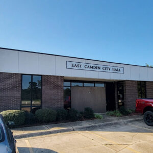 East Camden City Hall
 East Camden Court
 East Camden Fire Department
 East Camden Street Scene
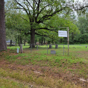
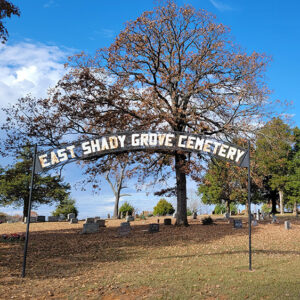 East Shady Grove Cemetery
 East Whelen Baptist Church
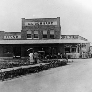
 Eastman Hotel
Ebenezer (Hot Spring County)
A small unincorporated community in Hot Spring County, Ebenezer is located about three miles southwest of Malvern (Hot Spring County) and less than two miles northeast of Central (Hot Spring County). The community is centered on U.S. Highway 67. Few people lived in the area before the Civil War. Small numbers of settlers began to arrive in the mid-1870s after the construction of the Cairo and Fulton Railroad about one mile to the west. The establishment of Malvern to the northeast in 1873 attracted people to the area, as large tracts of land were still available for settlement and the railroad offered a nearby option to ship goods to market. Early settlers included Huston Robinson, who obtained a land patent …
 Ebenezer Cemetery
 Ebenezer Cemetery
Edgemont (Cleburne County)
Edgemont is an unincorporated community in northern Cleburne County. It is located on the northern side of the Edgemont Bridge, which spans a segment of Greers Ferry Lake. Old Edgemont is located beneath the lake. Prior to 1808, most of the inhabitants of the area that would become Cleburne County were Osage. They controlled most of northern Arkansas and used the area that includes modern Cleburne County as hunting grounds. In 1808, the United States purchased the land from the Osage, and the first Euro-American settlers entered the area. In 1817, the United States established a treaty with the Cherokee, who were given the land between the White and Arkansas rivers west of a line stretching from near Morrilton (Conway …
 Zeb Edmiston
Edmondson (Crittenden County)
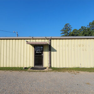
Edmondson is a town on State Highway 131 about three miles south of Interstate 40. As of the 2010 census, two-thirds of the population of Edmondson is African American. Much of Crittenden County was forested swampland when the county was established in 1825. Fifty years later, the Edmondson area was described as a “terrible canebrake full of bear, panther, wolves, possum, and squirrel.” Land was being cleared before the Civil War for cotton plantations, and a settlement was named for Andrew Edmondson, who arrived from Virginia in the 1840s and died in 1852. His family remained, and a post office bearing their name was established in 1859. A Methodist church for white citizens was built in Edmondson before the war. …
Egypt (Craighead County)
Egypt is a small town located approximately sixteen miles west of Jonesboro (Craighead County) on State Highway 91 near the Cache River. Today, little remains of the once prosperous farming and timber town. Early settlers to the area included W. R. and Lucinda Cureton, as well as C. T. Downs, who settled there by 1850. Others were attracted to the area after the establishment of Logan’s Ferry across the Cache River. No real town began to develop until about 1898. About that time, New York businessmen Will Smith and Van Lane traveled to the area with interests in the abundant timber. The area was being described as “a promised land” by the promoters. In 1902, the local township was given …
El Dorado (Union County)
El Dorado is the county seat of Union County in south central Arkansas and a center for oil production and refining. Called once by boosters the “Queen City of South Arkansas” and, more recently, “Arkansas’s Original Boomtown,” the city was the heart of the 1920s oil boom in South Arkansas. Early Statehood through the Gilded Age The city was founded in 1843 when Matthew Rainey set up a retail store in the area. Some reports state that Rainey had become stranded and sold his belongings to tide him over. So impressed with the sales to local settlers, he decided to stay permanently and named the site El Dorado, most often translated as “the Gilded Road” in Spanish. In 1843, El …
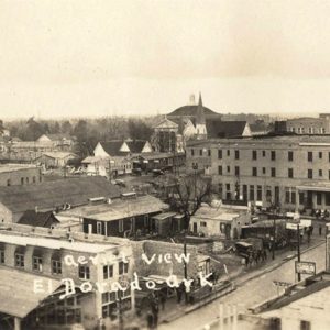 El Dorado Aerial View
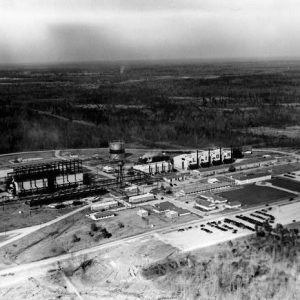 El Dorado Oil Company
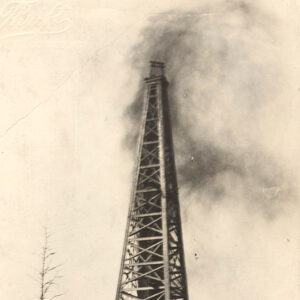 El Dorado Oil Well
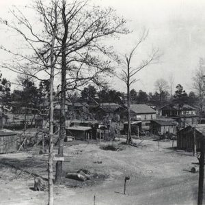 El Dorado Street
 El Dorado Street Scene
 El Dorado Street Scene
El Paso (White County)
El Paso is a small community located on the southern slope of Cadron Ridge in the southwestern corner of White County near the intersection of U.S. Highway 64 and State Highway 5. It is one of the county’s early settlements and entertained hopes of being chosen as the county seat in 1835. Settlers began arriving at the valley created by two parallel ridges, Cadron Ridge and Bull Mountain, in the 1830s. Attracted by area springs and fertile lands, they first established themselves on the southern slope of Bull Mountain at a place called Peach Orchard Gap. The name was chosen due to the peach trees growing there. Over time, settlers passed through the gap to the southern slope of Cadron …
Elaine (Phillips County)
The name of Elaine (Phillips County) will always be linked with a race massacre that broke out in the fall of 1919, leaving scores of African Americans dead. Aside from this one memorable incident, the city is representative of life in the Delta region that includes eastern Arkansas. When Arkansas became a state in 1836, the area of present-day Elaine was still swampland. It was designated as such by the Swamp and Overflow Act, passed by the U.S. Congress in 1850. Silas Craig and John Martin purchased Phillips County land from the State of Arkansas under the provisions of that act, and the land passed through several owners—including the State of Arkansas a second time, due to unpaid taxes—but was …
 Elaine Methodist Church
 Elaine Street Scene
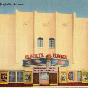 Elberta Theater
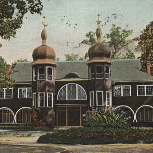 Electric Park Pavilion
Elgin (Jackson County)
Elgin is located on Jackson County Road 64 about six miles west-southwest of Tuckerman (Jackson County) and about three miles east-southeast of Cord (Independence County). Elgin lies in the Black River bottoms, excellent terrain for large productive farms, although devastating floods sometimes occur. The bridge on Highway 37 occasionally closes because of high water. The bottoms once grew mainly cotton, but today soybeans and other crops dominate. Historically, Elgin was an important riverboat town, with its ferry being on the main road between Batesville (Independence County) and Jacksonport (Jackson County), about eight and a half miles south of the confluence of the Black and White rivers. Elgin was the name of a 3,000-acre plantation in the Black River bottoms owned …
Elizabeth (Jackson County)
Elizabeth (sometimes called Elizabethtown) thrived as a port on the White River and became the seat of Jackson County in 1839. However, the river later shifted course and eroded away what remained of the community. Native Americans were the first to take advantage of the Black and White rivers for transportation and trade, followed by French hunters, trappers, and fur traders, many of them from Canada, who plied the area’s rivers during the eighteenth century and continued after the Louisiana Purchase of 1803 until about 1815. Keelboats were an early mode of transportation for the early settlers, who could use them on the upper White River to maneuver the sharp bends, rapids, and low water levels along the river during …
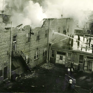 Elk's Lodge Fire
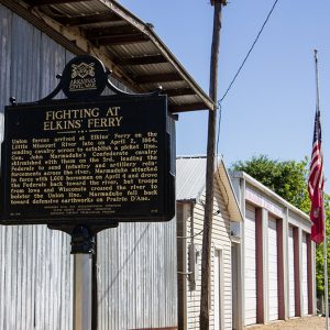 Elkin's (or Elkins') Ferry Sign
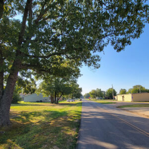
Elkins (Washington County)
Washington County’s community of Elkins (comprising the former Harris and Hood communities) borders Arkansas Highway 16, the entrance to the “Pig Trail,” a scenic drive in the Ozarks. Two tributaries of the White River flow through the town, providing excellent canoeing, fishing, and swimming. Nearby are the Ozark National Forest and the Ozark Highlands National Recreation Trail. Elkins has numerous antebellum homes and the one-lane bridge on Mount Olive Road that was a centerpiece of the 1982 television miniseries The Blue and the Gray. There is evidence of prehistoric settlement in the area, most notably in a mound complex commonly dubbed the Elkins Mounds. This Mississippian Period complex likely consisted of five mounds originally, though one has since been destroyed. …


