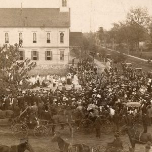
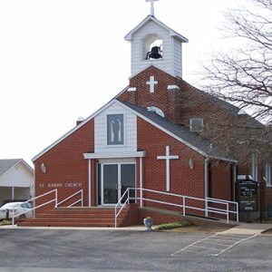
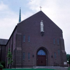
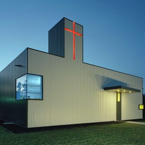
 St. Edward Catholic Church
Entry Type: Place - Starting with S
St. Edward Catholic Church
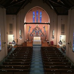
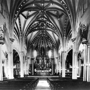 St. Edward Catholic Church Interior
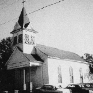
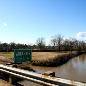
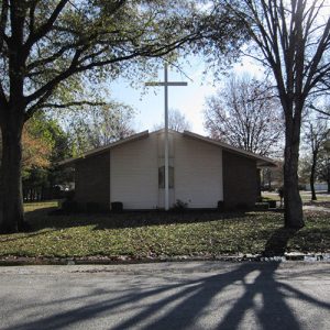
St. Elizabeth (Conway County)
St. Elizabeth in Conway County is a small unincorporated community located on State Highway 154, about eight miles south of Morrilton (Conway County) and near Oppelo (Conway County) in Martin Township. The farming community, originally settled by German Catholic immigrants, is bounded on the north by the Arkansas River. It was named in honor of a thirteenth-century Hungarian saint who, though born into royalty, committed her life to working with the poor and sick. The first white settlers to the area were members of the Bahr family, who established the community in 1874. The Joseph and Julia Hoyt family arrived about four years later. Within the next few years, other families moved to the area, attracted by the fertile farmland. …
 St. Elizabeth's Catholic Church
St. Francis (Clay County)
The city of St. Francis in northeastern Arkansas was a prosperous community relying on the timber industry in the late nineteenth and early twentieth centuries. Since that time, it has remained a quiet community adjacent to the Missouri bootheel. North of St. Francis lies Chalk Bluff, the name of the white clay outcroppings that constitute the northern face of Crowley’s Ridge. A military road crossed the St. Francis River at this location, and a ferry served travelers using the road. Around 1840, the first permanent settlers arrived. They included Abraham, Jacob, David, and George Seitz, who raised horses and cattle, operated the ferry, and ran a small store to provision travelers. In 1850, a post office with the name of Chalk …
 St. Francis and Mississippi Rivers
 St. Francis Catholic Church
St. Francis County
St. Francis County in eastern Arkansas is divided north-south by Crowley’s Ridge, which forms the high ground upon which the county seat, Forrest City, was founded. The St. Francis and L’Anguille rivers further subdivide the county and provide the resources for the agricultural industries that have long been central to the county’s economy. Pre-European Exploration Ample evidence of prehistoric habitation of St. Francis County exists, including head pots. Clarence Bloomfield Moore conducted extensive excavations along the St. Francis River, including two Indian mound sites in St. Francis County, and later archaeologists have returned to some of these sites for further investigation. Louisiana Purchase through Early Statehood The first permanent white settlers, along with their slaves, arrived in St. Francis County …
 St. Francis County Museum
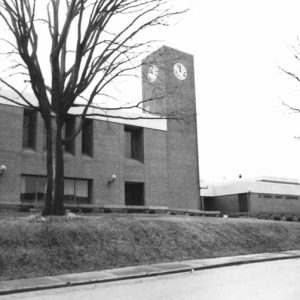 St. Francis County Courthouse
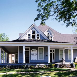
St. Francis County Museum
The St. Francis County Museum in Forrest City (St. Francis County) is an initiative of the St. Francis County Cultural Foundation. It was established to preserve the history and heritage of the St. Francis County area. The museum’s scope includes agriculture, business, military history, genealogy, education, transportation, and prominent figures of the area. The St. Francis County Museum was originally located at 419 Front Street in Forrest City. It opened at this location in 1995 but quickly outgrew its environment. The members of the Rush family were contacted by Brad Beavers, a local attorney, to move the museum into their former residence, located in downtown Forrest City at 603 Front Street. The St. Francis County Museum bought the Rush-Gates Home …
St. Francis National Scenic Byway
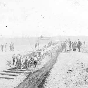
The St. Francis Scenic Byway is a twenty-one-mile stretch of road wholly within the St. Francis National Forest linking Helena-West Helena (Phillips County) and Marianna (Lee County) and traversing the hilly southern portion of Crowley’s Ridge; it is designated a National Forest Scenic Byway. The route merges Arkansas Highway 44 and Forest Service Road 1900, combining nine miles of pavement and fourteen miles of well-tended gravel. Rambling across national forest lands, this corridor is included in both the Crowley’s Ridge Parkway and the Great River Road. The Federal Highway Administration oversees the National Scenic Byways Program, America’s Byways, yet the title “byway” may be bestowed by some 600 byway organizations, both government and private. The National Forest Service initiated its …
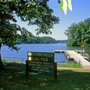 Storm Creek Lake
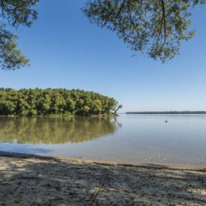
 St. Francis River
St. James (Stone County)
St. James is a community on Highway 14 (East Main Street) between Batesville (Independence County) and Mountain View (Stone County). The White River is about two and a half miles west and can be reached by the Younger Access. Nearby Penters Bluff (Izard County) overlooks the river. St. James was first known as Shave Navel (a.k.a. Shaved Navel), though the origin of the name is unknown; it was later called Buck Horn (a.k.a. Buckhorn). How it received the name St. James is unclear, although a few residents have associated the name with the outlaw Jesse James. Buck Horn resident Walter Canard maintained that Jesse James had spent the night at his house when the outlaw was on his way to …
 St. Joe
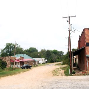
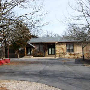
St. Joe (Searcy County)
St. Joe is a town in northwestern Searcy County, located on U.S. Highway 65. Like many similar communities in Arkansas, St. Joe has an Old Town that was settled before the arrival of the railroad and a New Town that was built nearer the railroad. During World War I, St. Joe was a shipping center for the region’s lead and zinc mines. Osage were traveling from the north to hunt and fish in the rugged Boston Mountains of northern Arkansas when the region became part of the Louisiana Purchase in 1803. Eventually, treaties with the U.S. government moved the Osage farther west, and the land was opened for white settlement. The first settlers in the St. Joe vicinity were Bill …
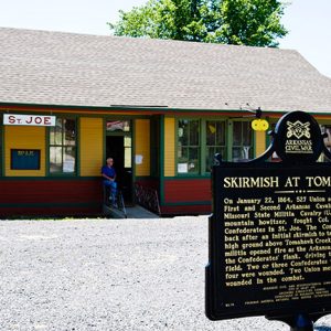
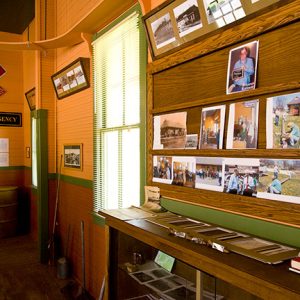
St. Joe Historical Missouri and North Arkansas Depot and Museum
The St. Joe Historical Missouri and North Arkansas Railroad Depot and Museum, which is located in St. Joe (Searcy County), is a repository of railroad and local history. It also serves as an area tourist information center. The museum, which opened in May 2011, is housed in the 1902 Missouri and North Arkansas (M&NA) Railroad depot. When the M&NA ended area service in 1946, the depot closed after over forty-three years of operation. Over the next few years, the building was used as a church, to provide classrooms for the local school district, and as a feed store. Once the feed store went out of business, the vacant building began to deteriorate into a community eyesore. A movement to preserve …
 St. Joe Depot
 St. Joe Depot
 St. John's Episcopal Church
 St. John's Lutheran
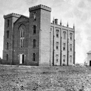
 St. John's Seminary Building
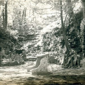 St. John's Grotto
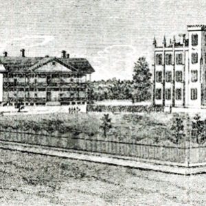 St. Johns' College
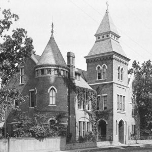
 St. Johns College and U.S. Hospital
 St. Johns' College
St. Joseph Colony
St. Joseph Colony, covering land throughout Conway, Faulkner, and Pope counties, served Roman Catholics living along the Arkansas River Valley and the German-speaking Catholic immigrants who later settled these lands. Father Joseph Strub of the Holy Ghost Fathers, a Roman Catholic missionary society, founded the colony in 1878. St. Joseph Colony attracted immigrants to Arkansas until the middle of the 1880s, though the presence of the colony is still felt today. Chancellor Otto von Bismarck of Prussian-dominated Germany expelled Strub and other Holy Ghost Fathers in 1873 by means of his anti-Catholic policy, Kulturkampf. The Holy Ghost Fathers fled Germany and crossed the Atlantic Ocean to Pennsylvania. In Pennsylvania, Strub learned of railroads offering land in Arkansas for settlement. Strub …
 St. Joseph's Catholic Church
 St. Joseph's Catholic Church Parish Hall
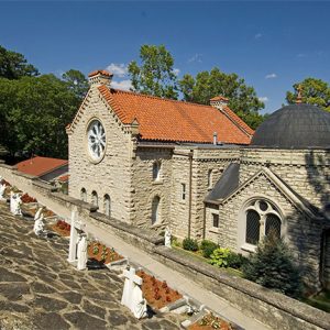
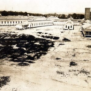
St. Joseph’s Home
aka: St. Joseph Center
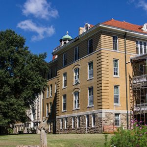
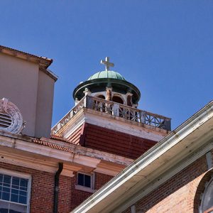
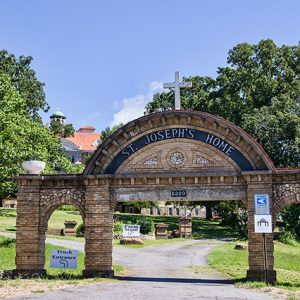
St. Joseph’s Home sits on a summit overlooking North Little Rock (Pulaski County) and offers picturesque views of the Arkansas River and Pinnacle Mountain. Since 1910, the home has been a source of refuge for many Arkansans, children and elderly, as well as U.S. Army officers of World War I. It was placed on the National Register of Historic Places on May 4, 1976. Now called St. Joseph Center, it is home to a non-profit organization that offers urban farming opportunities. The Catholic Diocese of Little Rock, under the directive of Bishop John Baptist Morris, built St. Joseph’s Home. On July 1, 1907, Morris purchased a 720-acre farm, which at the time, was about four miles north of what is now …
 St. Joseph's Home
 St. Joseph's Home Detail
 St. Joseph's Home Entrance
 St. Louis and North Arkansas Railroad
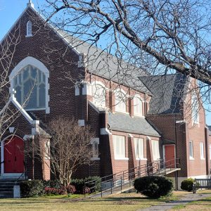
St. Mary’s Catholic Church (Helena-West Helena)
St. Mary’s Catholic Church is a Gothic Revival–style building along Columbia Street in Helena-West Helena (Phillips County), designed by renowned architect and designer Charles Eames and his architectural partner Robert Walsh. Charles Eames was born and raised in St. Louis, Missouri. He attended Washington University in St. Louis for a few years before opening an architecture firm with Charles Grey and Walter E. Pauley. After a solo trip to Mexico in 1933, Eames started a new firm with Walsh in St. Louis in 1934. During the 1930s, Eames and Robert Walsh worked on several projects in and around St. Louis as well as two Catholic churches in eastern Arkansas: one in Helena-West Helena and one in Paragould (Greene County). Eames …
 St. Mary's Catholic Church
 St. Mary's Catholic Church Interior
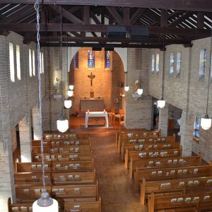 St. Mary's Catholic Church Interior
 St. Mary's Catholic Church
St. Mary’s Catholic Church (Paragould)
St. Mary’s Catholic Church in Paragould (Greene County) is a brick-and-steel structure designed by renowned architect Charles Eames and his architectural partner Robert Walsh in 1935. Charles Eames was born and raised in St. Louis, Missouri, where he attended Washington University before opening an architecture firm with Charles Grey and Walter E. Pauley. After a solo trip to Mexico in 1933, Eames started a new firm with Robert Walsh in 1934. During the next few years, Eames and Walsh worked on several projects in and around St. Louis, as well as two Catholic churches in eastern Arkansas: one in what is now Helena-West Helena (Phillips County) and one in Paragould. Eames eventually gained an international reputation as an architect and …
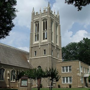
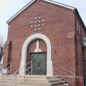
St. Mary’s Church (Altus)
aka: Our Lady of Perpetual Help Catholic Church (Altus)
Our Lady of Perpetual Help Catholic Church, more commonly known as St. Mary’s Church, was founded in Altus (Franklin County) in 1879. It has been located atop Pond Creek Mountain, better known as St. Mary’s Mountain, since its inception. The congregation was founded by and for immigrants from Germany and Switzerland. The Franco-Prussian War of 1870–71 and the Kulturkampf (religious persecution) of the 1870s in Germany drove many Catholics out of Europe and to the Altus region of Arkansas. As these new immigrants did not speak English, there was a conscious effort on the part of the Church to get a German-speaking priest in order to maintain these immigrants in the Catholic faith. After St. Mary’s became established, the fact …
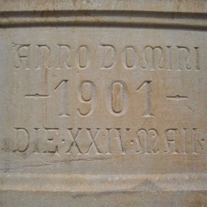 St. Mary's Church Datestone
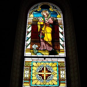 St. Mary's Church Stained Glass
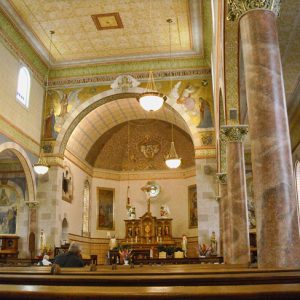 St. Mary's Church Interior
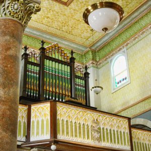 St. Mary's Church Organ
 St. Mary's Convent
 St. Michael's School
 St. Nicholas Church
 St. Norbert’s Catholic Church


