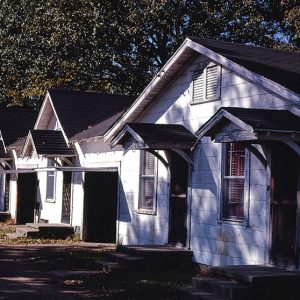
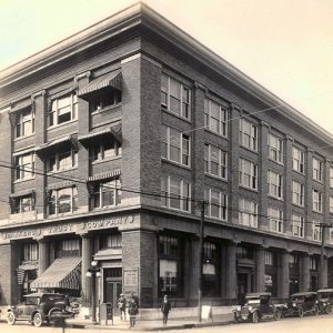
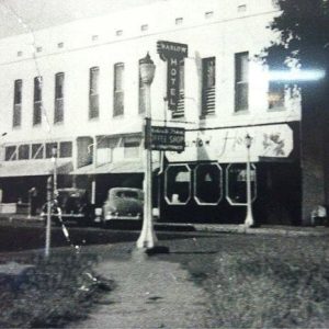
 B&A Motel
Entry Type: Place - Starting with B
B&A Motel
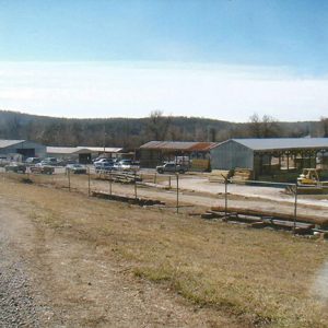 B&B Supply
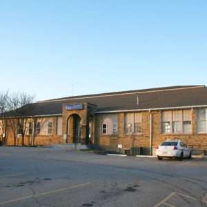
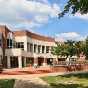 Bailey Library
 Bailey's Pour Off
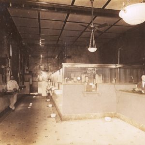
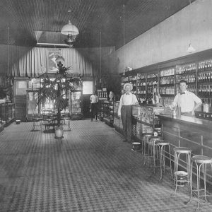 Baker Drugs
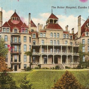 Baker Hospital
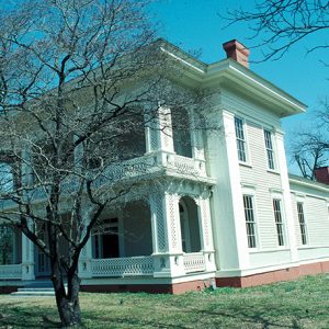
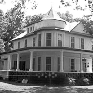
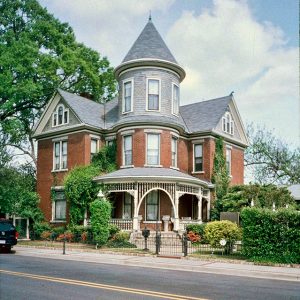 Baker House
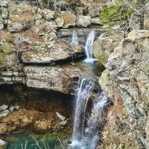
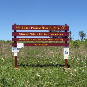 Baker Prairie Natural Area
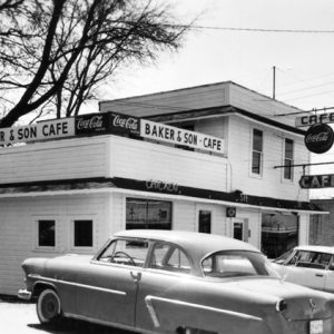 Baker's Cafe
Bald Knob (White County)
Located on the southern edge of the Ozarks, White County’s Bald Knob was named for a large outcropping of layered stone that was a natural landmark, especially if approached from the White River and Little Red River floodplains east and south of town. The completion of the St. Louis, Iron Mountain, and Southern Railroad in 1872 triggered economic development in the region. Liberty Valley, south of Bald Knob, is the site of prehistoric salt extraction. Some scholars hypothesize that this is the site of Palisima, a Native American village mentioned in documents from the Hernando de Soto expedition. During the Civil War, workers extracted about two bushels of salt a day by boiling the water in large kettles. …
Bald Knob National Wildlife Refuge
The Bald Knob National Wildlife Refuge (NWR) consists of 14,800 acres of forest wetlands and croplands lying along the Little Red River in White County. The refuge provides a habitat for migratory waterfowl and other birds and various endangered species, as well as recreational and environmental educational opportunities. The refuge is located approximately two miles south of Bald Knob (White County). The Bald Knob refuge was acquired as part of the North American Waterfowl Management Plan in 1993. Most of the land consists of a rice farm that had been owned by John Hancock Insurance Company. Unlike many wildlife refuges, Bald Knob NWR includes cropland that continues to be farmed, but much of the crop is left unharvested to feed …
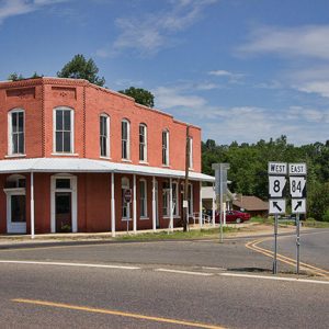
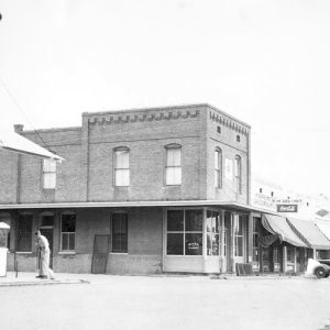
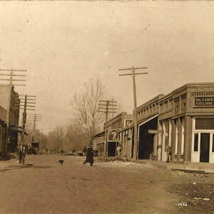 Bald Knob Street Scene
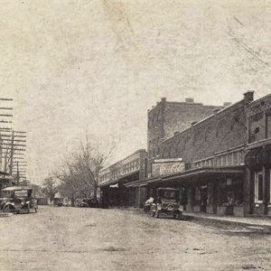 Bald Knob Street Scene
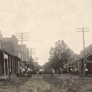 Bald Knob Street Scene
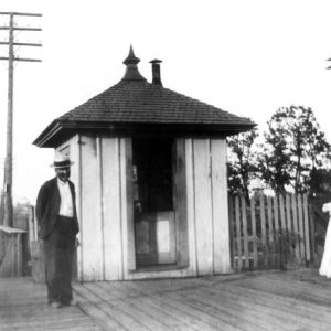
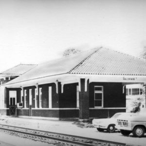 Bald Knob Train Depot
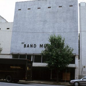
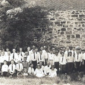
Band Museum
The Band Museum in Pine Bluff (Jefferson County) housed an extensive collection of wind instruments and offered a history of the American band movement. Beginning as the personal collection of its founder, the museum grew to approximately 1,500 antique instruments and was, before its closure, the only museum in the United States devoted entirely to the history of band music and instruments. Jerry Horne, founder of the Band Museum and a member of the American Musical Instrument Society, began collecting unusual instruments when he purchased the Wallick Music Company in 1970. His first was an old helicon (similar to a sousaphone), made by the C. G. CONN Company in 1925, which he found in the Wallick family’s garage. Soon, he began scouring …
 Band Museum
 Bank of Amity Building
 Bank of Cabot
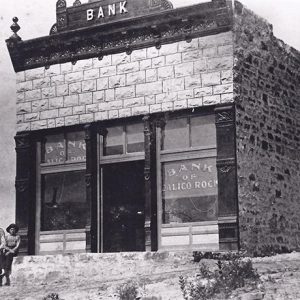 Bank of Calico Rock
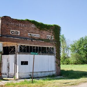 Bank of Carthage
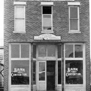 Bank of Centerton
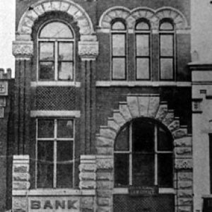 Bank of Commerce
 Bank of Malvern
 Bank of Osceola
 Bank of Prescott
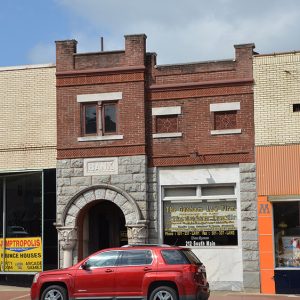
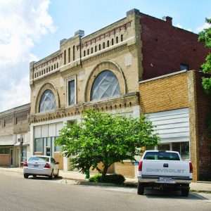
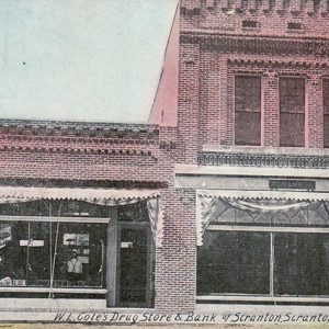 Bank of Scranton
 Bankers' Trust Company
Banks (Bradley County)
Banks is one of only three incorporated communities in Bradley County. Once known for its relationship to the railroads and the timber industry, the town is now chiefly considered a center for hunters in the southern Arkansas forests. Caddo lived in the region where Banks is located as much as 5,000 years ago. Eventually, European and American explorers and settlers arrived in what is now Arkansas, and the Caddo were moved farther west. Among the first landowners in the area were John McFarlin (who obtained his land grant in 1856), John Evans, and Pleasant D. Morgan—the latter two claiming their land in 1860. Before the Civil War, some land was cleared in the area for the construction of the Mississippi, Ouachita …
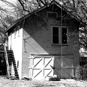 Banks Home
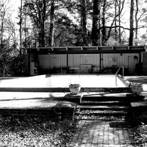 Banks Swimming Pool
Banner (Cleburne County)
Banner is located on Highway 87 (also called Floral Road) less than two miles from the point at which Floral Road joins Highway 25 N (Heber Springs Road) in Concord (Cleburne County). Floral (Independence County) is nearby. Until Cleburne County was formed on February 20, 1883, Banner was in Independence County; the community has close ties with both counties. A colorful pioneer of Banner was Elijah (Lige) Collard, a Kentuckian who blazed a trail to Healing Springs Township (then in Independence County) between 1845 and 1850. Collard supposedly spent time with Native Americans around the mineral springs in what is today Heber Springs (Cleburne County). One day in the 1850s, he was confronted on his trek to the springs by …
 Baptist Convention
Barber (Logan County)
Barber is an unincorporated community located in southwestern Logan County; it was originally in Scott County, until the county boundaries were changed in 1903. The community was established north of the Petit Jean River along Washburn Creek. Agriculture and the railroad have historically contributed to the economy and way of life in Barber. The community was likely named after a member of the Barber family who lived in the area. Prior to European exploration, the area surrounding Barber was wilderness. Several species of wildlife that no longer inhabit the area, such as elk and buffalo, were present throughout the region. Numerous archaeological sites and burial mounds can be found along the banks of prominent waterways such as the Petit Jean …
Baring Cross (Pulaski County)
West of Pike Avenue in North Little Rock (Pulaski County)—across from the Union Pacific Railway shops—Baring Cross was a Pulaski County town consisting primarily of middle-class railroad workers. It took its name from the first steel bridge to span the Arkansas River in 1873. From 1896 to 1905, the municipality of Baring Cross encompassed a smaller area than it does today. North Little Rock annexed the town, which became the city’s Fifth Ward and home to several mayors and aldermen, in 1905. Following national trends, Baring Cross decayed economically in the 1960s and 1970s. Urban Renewal did little to reverse the decline, but reinvestment through the federal Neighborhood Stabilization Program as well as private investment spurred revitalization in 2010. The …
 Baring Cross Bridge Tender's Office
 James E. M. Barkman House
Barling (Sebastian County)
Barling (Sebastian County) is located between one of Arkansas’s major cities, Fort Smith (Sebastian County), and an important twentieth-century army post, Fort Chaffee. The town, originally named Spring Hill, saw its greatest growth to date occur largely because of the founding of Fort Chaffee in 1941. Barling was established by Aaron Barling, a former soldier stationed at Fort Smith in 1817. He purchased land about eight miles east of Fort Smith on Little Rock Road in November 1830. His farm—and the surrounding area—became known as Spring Hill because of some springs located on his farm at the foot of a hill travelers used as a campsite. The town experienced little growth early on, with only one log structure used for …
 Barling City Hall
 Barlow Hotel
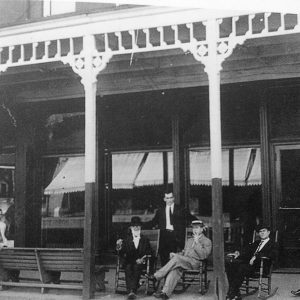 Barlow Hotel Porch
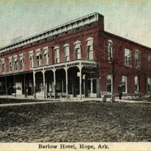 Barlow Hotel Postcard
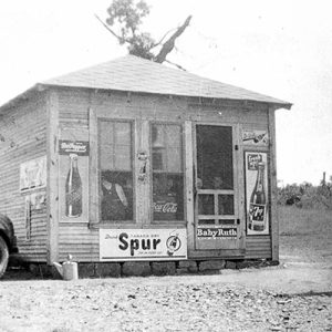 Barnett's Store
Barringer (Clark County)
Barringer is a community located in southern Clark County about one mile northwest of Whelen Springs (Clark County) and about four miles south of Gurdon (Clark County). The community is located along Arkansas Highway 53 north of the intersection with Arkansas Highway 51. The earliest mention of the settlement appears in 1885 when John A. Barringer opened a sawmill in the area. The opening of the Gurdon and Camden Branch Railroad from Camden (Ouachita County) to Gurdon made the shipment of timber in the area lucrative. In 1888, the company cut and shipped 2,000,000 board feet of timber. By the 1920s, the mill annually produced between eight and ten million board feet. During this period, the mill employed between forty-five …
 Barron-Craig House
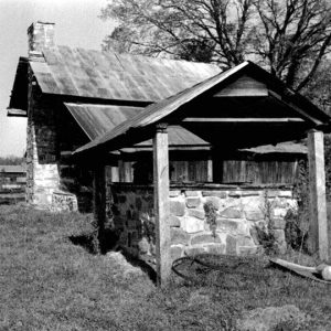 Barron-Craig House
 Barron-Craig House
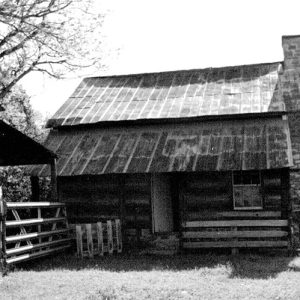
 Bartell House
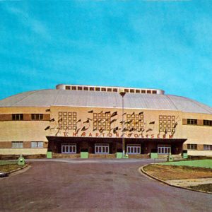 Barton Coliseum
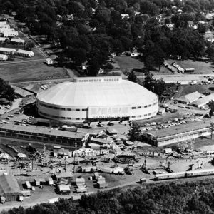 Barton Coliseum


