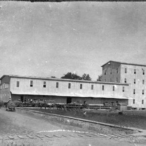
 L. A. Black Rice Mill
Entry Type: Place - Starting with L
L. A. Black Rice Mill
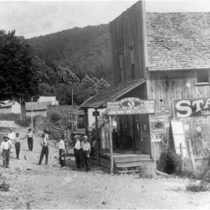 L. G. Young Store
 Lacey
Lacey
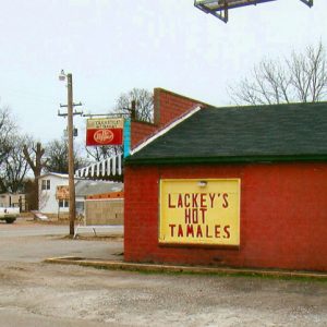 Lackey's Hot Tamales
LaCrosse (Izard County)
The community of LaCrosse in the twenty-first century is practically a ghost town, with only a few occupied houses remaining. This is a striking contrast to earlier decades, when it was a bustling small town, with the LaCrosse Collegiate Institute having a statewide reputation. Located in rolling prairie land, that area of Izard County was first settled in 1845 by three brothers: William Frederick Watkins, James Davis Watkins, and Dr. Owen Thomas Watkins, a graduate of the Medical College at Louisville, Kentucky. The brothers were natives of Tennessee. Land patent records reveal their far-reaching land acquisitions, which extended into Fulton, Sharp, and Independence counties. Their farming ventures included cotton, cattle, blooded horses, hogs, and cotton ginning. Dr. Owen Watkins’s practice extended …
LaCrosse Collegiate Institute
The LaCrosse Collegiate Institute was established in 1868 by Michael Shelby Kennard, under the name LaCrosse Male and Female Academy, in the community of LaCrosse (Izard County), which then boasted of five businesses, three churches, a Masonic hall, two physicians, and one druggist. A year later, Kennard changed the name of the school to the LaCrosse Collegiate Institute, which better described the curriculum offered to students. His son, writing in 1917, said that an average of 100 or more boarding students attended the institute yearly. According to an article in the Sharp County Record newspaper, the institute educated more than 3,000 young men and women, both local and boarding students, during its existence. A native of Sumter County, Alabama, and …
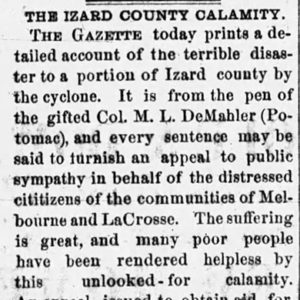 LaCrosse Tornado Article
Lafayette County
Lafayette County has always been important to the history of Arkansas, but it was particularly so from its first four decades as a territory through the Civil War. This was partly because one of its residents, James Sevier Conway, was the state’s first governor. European Exploration and Settlement Before the arrival of Europeans, the area’s inhabitants were mostly of the Caddo tribe, and numerous significant archaeological sites relating to the Caddo, some dating back thousands of years, can be found within Lafayette County. Archaeological sites in the county include Battle Mound. The last Caddo village on the Great Bend of the Red River was abandoned around 1778, twenty-five years before the Louisiana Purchase added this land to the United States. …
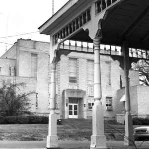 Lafayette County Courthouse
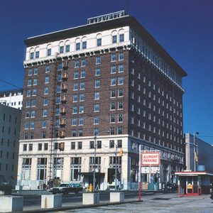 Lafayette Hotel
Lafe (Greene County)
Lafe is a town situated on Crowley’s Ridge in northern Greene County. Much like similar communities on the Grand Prairie farther south, Lafe was founded by German-American settlers, and the community has remained centered around the Lutheran church. No settlers had made a home in the area that was to become Lafe before German immigrant Herman Toelkin arrived in 1886. Toelkin had previously settled in Franklin County, Missouri, and his family was still there when he arrived in Greene County by train. Toelkin took a job with the St. Louis and Iron Mountain Railroad, harvesting trees and making railroad ties. When he had saved forty dollars from his earnings, he bought forty acres of land, constructed a log cabin, and …
LaGrange (Lee County)
LaGrange is a town in southern Lee County, between Marianna (Lee County) and Helena-West Helena (Phillips County). It is near the St. Francis National Forest’s lands that include the southern portion of Crowley’s Ridge. LaGrange appears to be one of the earliest settlements in the area; its French name translates as “the farm.” Settlers were already present when the first government land grant was given to Jonathan Howell in 1820. New Hope Baptist Church was founded at LaGrange in 1848, and a Methodist church also was built before the Civil War. A U.S. post office was established in 1852. At this time, LaGrange was in Phillips County, as Lee County was not created until 1873. By the time of the Civil War, …
 Lake Bennett
 Lake Bennett
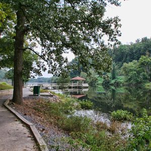
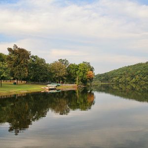
Lake Catherine State Park
Lake Catherine State Park in southwest Arkansas provides access to fishing, water sports, and lakeside recreation while conserving natural features representative of the Ouachita Mountains, such as waterfalls, mountain streams, and rock outcroppings. Three stone-and-wood cabins, a former concessions building, and a bridge located within the park are listed on the National Register of Historic Places as examples of the rustic architecture style used by the Depression-era Civilian Conservation Corps (CCC), which built the park. In August 1935, Harvey Couch, founder of the Arkansas Power and Light Company, donated to the state 2,048 acres of his land along the shore of Lake Catherine. The 1,940-acre lake had been created by Remmel Dam, the state’s first major hydroelectric project, in 1924. …
 Lake Catherine State Park
 Lake Catherine State Park
 Lake Catherine State Park: Park Location
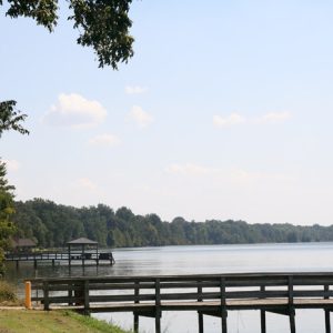
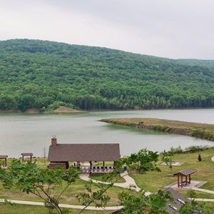
Lake Charles State Park
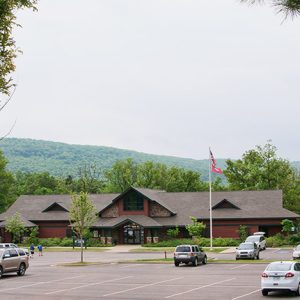
When Lake Charles State Park was constructed in the 1960s, it was the first of its kind and size in the nation. It is located in the foothills of the Ozarks near the Black River in Lawrence County and is a very popular family recreation area in northeastern Arkansas. Lake Charles was originally planned as a watershed/flood protection project near the Black River in Lawrence County. In 1956, the Lawrence County Soil and Water Conservation District Board of Supervisors sponsored an application under the U.S. Department of Agriculture’s Watershed Protection and Flood Prevention Program. When the application was submitted, the sponsors were thinking only of watershed protection on the uplands and flood prevention on the bottomlands. However, before an intensive …
 Lake Charles State Park
 Lake Charles State Park: Park Location
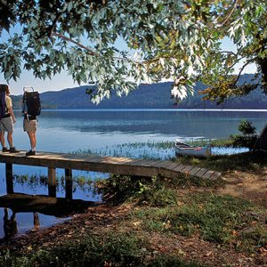
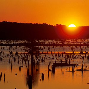
Lake Chicot State Park
Lake Chicot State Park, located near Arkansas’s southeastern corner, provides recreational access to Arkansas’s largest natural lake, Lake Chicot, a twenty-mile-long oxbow created by the Mississippi River hundreds of years ago. Activities at the lake and its environs include fishing and bird watching. Early in the twentieth century, the pure waters of the lake were used untreated by the city of Lake Village (Chicot County). The area became popular for its fishing, boating, and other recreational activities. The forests surrounding the lake served as a rich habitat for wildlife. The lake was polluted by a flood in 1916 and, beginning in 1920, work on the Mississippi River levee polluted it even more. Dredging, increased cultivation around the lake, and the …
 Lake Chicot State Park
 Lake Chicot State Park: Park Location
Lake City (Craighead County)
Lake City is located in eastern Craighead County near the St. Francis River, in the northeast corner of the state. Along with Jonesboro (Craighead County) in the western side of the county, Lake City acts as one of two county seats, serving the Eastern District of Craighead County. Louisiana Purchase through Early Statehood Nineteenth-century records indicate that a settlement was established at the approximate location of Lake City in the late 1830s. Situated on the St. Francis River at the site of a former Native American camp, it was originally called “Old Town.” A trader and trapper named Jesse Morgan was probably the first white man to settle at the current location of the town. The 1848 field notes of …
Lake Conway
aka: Craig D. Campbell Lake Conway Reservoir
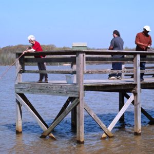
Lake Conway, located three miles south of Conway (Faulkner County) on Interstate 40, is the largest lake ever constructed by a state wildlife agency and the first lake constructed by the Arkansas Game and Fish Commission (AGFC). It is one of the state’s most popular fishing spots due to its size, central location, and large populations of bass, catfish, crappie, bluegill, and redear. As early as 1900, Conway residents wanted a fishing lake close to town. In 1940, Dr. James H. Flanagin Sr., a local dentist and a member of the Faulkner County chapter of the Arkansas Wildlife Federation (AWF), was asked by William D. Cole, president of the Conway Chamber of Commerce, to research the feasibility of constructing a …
 Lake Conway
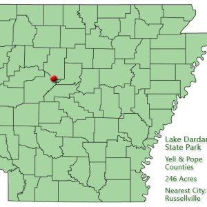
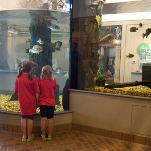
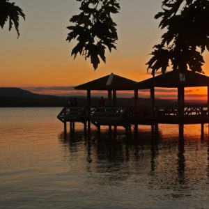
Lake Dardanelle State Park
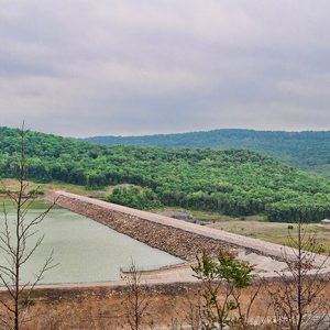
Lake Dardanelle State Park is a popular camping and fishing destination located on the shores of a 34,300-acre man-made reservoir on the Arkansas River near the cities of Russellville (Pope County) and Dardanelle (Yell County). The park combines outdoor recreational opportunities with state-of-the-art facilities, exhibits, and technology. In 1964, construction was completed on the Dardanelle Dam, located near the river crossing between Dardanelle and Russellville. Lake Dardanelle was created in 1965. Construction on the lock and powerhouse was completed in 1969. The dam, built by the U.S. Army Corps of Engineers, was part of the McClellan-Kerr navigation project that made the Arkansas River navigable to commercial vessels. At the urging of Russellville civic leaders, the Arkansas Publicity and Parks Commission …
 Lake Dardanelle State Park: Park Location
 Lake Dardanelle State Park
 Lake Dardanelle State Park
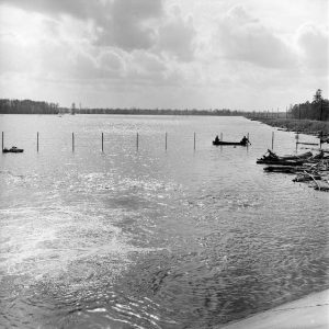
Lake Dick
The area of Lake Dick, a U-shaped oxbow lake in Jefferson County, was the site of a New Deal program in agriculture during the first administration of President Franklin D. Roosevelt. The experiment involved the “resettlement” of struggling urban and farm families. How the lake got its name has been a source of speculation. Located one mile west of Arkansas Highway 88 and four miles south of Altheimer (Jefferson County), Lake Dick was at one time the site of farmsteads for some eighty white families who had been moved into the area. In 1936, the Resettlement Administration—later to be made a part of the Farm Security Administration—acquired 3,453 acres of farmland in Jefferson County with the twin goals of establishing …
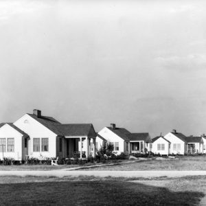 Lake Dick Housing
 Lake Dunn
 Lake Enterprise
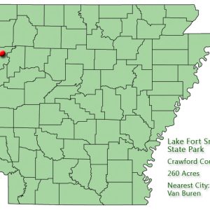
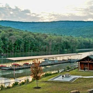
Lake Fort Smith State Park
Although it first became a state park in 1967, making it Arkansas’s twenty-third state park, the opening of Lake Fort Smith State Park in the spring of 2008 in a new location with entirely new facilities made it the newest of Arkansas’s state parks. At the park’s official dedication on June 19, 2008, park officials and local leaders celebrated the site that overlooks Lake Fort Smith and that in many ways reproduces the environment of the earlier park. The park was originally developed in the late 1930s as a city recreational park when Crawford County, along with the City of Fort Smith (Sebastian County) decided to utilize Lake Fort Smith as a tourism destination, called the Mountainburg Recreational Facility, as well …
 Lake Fort Smith State Park: Park Location
 Lake Fort Smith Marina
 Lake Fort Smith State Park
 Lake Fort Smith State Park
 Lake Fort Smith Dam
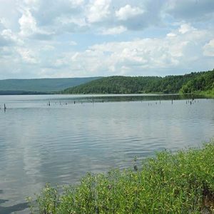
Lake Frierson State Park
Lake Frierson State Park provides a variety of recreational activities on the shores of 335-acre Lake Frierson, which fronts the western slopes of picturesque Crowley’s Ridge in northeast Arkansas. Constructed in the 1970s by the U.S. Soil Conservation Service, Lake Frierson is one of ten reservoirs—not all of them state parks—along Crowley’s Ridge managed by the Arkansas Game and Fish Commission. The Arkansas Department of Parks and Tourism has a lease agreement with the Game and Fish Commission for the park’s 114 acres. The lake was named for Charles Frierson, a Jonesboro (Craighead County) attorney who played a major role in securing the property. Funding for Lake Frierson State Park came from legislative appropriations in 1975, and construction started in …
 Lake Frierson State Park
 Lake Frierson State Park: Park Location
 Lake Georgia Pacific
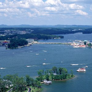 Lake Hamilton
 Lake Hinkle
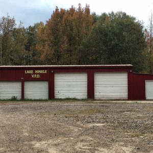 Lake Hinkle VFD
Lake Lucerne
Lake Lucerne is an artificial lake about a mile and a half south of Eureka Springs (Carroll County). The story of Lake Lucerne begins with Mountain Lake Dam, which was a log-constructed dam built in 1884. Next, the site was called Silver Lake, where the locals swam, and then Sanitarium Lake, Crystal Lake, Spring Lake, and, finally, Lake Lucerne, which became the Lake Lucerne Resort. Dr. Charles E. Davis was a Chicago physician who was born in 1844 and came to Eureka Springs in 1881 because of his wife’s illness. Each time they went there, she would improve, and when they went back to Chicago, her troubles returned. By 1883, he was in residence in Eureka Springs with an office …
 Lake Maumelle


