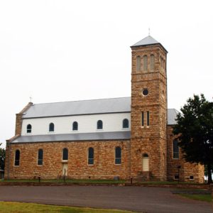
 Sacred Heart Catholic Church
Entry Type: Place - Starting with S
Sacred Heart Catholic Church
Saddle (Fulton County)
The small community of Saddle in Fulton County was first known as Sharp’s Mill, having been founded by Ephraim Sharp of Fulton County, the nephew of Ephraim Sharp of Sharp County—for whom he was named. It is located in eastern Fulton County on Arkansas Highway 289. Sharp left Indiana for Arkansas around 1850, eventually settling in Fulton County. He married Mary Elizabeth Wainwright, the daughter of William Wainwright, a prominent businessman in Fulton County. Sharp purchased 120 acres on the South Fork of the Spring River and continued to add to his tract, reaching 400 acres or more. In about 1868, he and his father-in-law established a mercantile business, and Sharp became the sole owner of it in 1873. About …
Saenger Theatre
The Saenger Theatre, which opened in Pine Bluff (Jefferson County) on November 17, 1924, was called “The Showplace of the South” and made Pine Bluff an entertainment center for people in southeast Arkansas. It was one of over 300 such theaters the Saenger brothers built in the South during the 1920s, of which fewer than 100 remain. The Saenger Theatre is now owned and operated by a local non-profit agency, Old Towne Centre Theatres, Inc. It is located across the street from the Community Theatre on West 2nd Avenue. O. C. Hauber owned an old store building that he converted into the Hauber Theatre in 1912. It changed hands twice and became the Saenger. It later burned due to a …
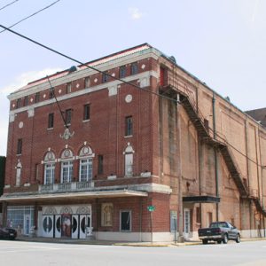 Saenger Theatre
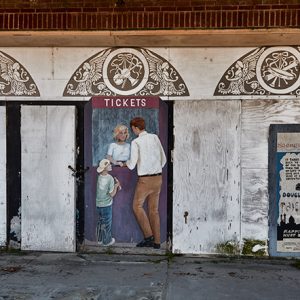 Saenger Theatre Detail
Saffell (Lawrence County)
Saffell is an unincorporated community in Reeds Creek Township located at the junction of Arkansas Highway 25 and Arkansas Highway 361 about three and a half miles south-southeast of Strawberry (Lawrence County). Saffell lies approximately four miles northwest of the confluence of the Strawberry and Black rivers. Farming is important to the livelihood of the community. In 2015, the population of the Saffell area was estimated at 190. Osage Indians once claimed the Strawberry and Black river bottoms, along with most of northern Arkansas, as their hunting grounds. Burial mounds are located across the Strawberry River from Saffell on the old White Plantation. French hunters, trappers, and fur traders, mostly from Canada, plied the Strawberry and Black rivers in the …
 Saffell Gin
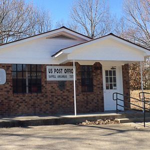 Saffell Post Office
 Sage Meadows Country Club
Saginaw (Hot Spring County)
Saginaw is an unincorporated community located in Hot Spring County about eight miles southwest of Malvern (Hot Spring County) and four miles northeast of Midway (Hot Spring County). The community’s settlement was closely associated with the Ouachita River, which is about one mile to its east. Early landowners include Joseph Cunningham, who obtained a land patent for just under 120 acres in 1837. Robert Stribling received a land patent for forty acres located near Saginaw in 1845. At the same time, he received title to an additional eighty acres in a neighboring section. In the 1850 census, Stribling appears with his wife and five sons, as well as twenty-one slaves. He owned $5,500 in real estate and continued to acquire …
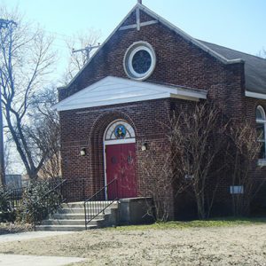
 Saint Mary’s Catholic Church
 Saint Mary’s Catholic Church
Salado (Independence County)
Salado is one of the oldest communities in Arkansas, with history going back to territorial days. Salado is located in the Ozark foothills about seven miles southeast of Batesville (Independence County) on Highway 14 (also called Newport Road) and about a mile southwest of the White River. The most colorful account of town’s name stems from the oft-told tale of how a young woman named Sally was washing clothes in a creek when a deer suddenly appeared. She attacked the deer with a battling stick and brought home a doe for supper, hence “Sally killed a doe,” or “Sallydoe.” Most likely, however, the name is of Spanish or French origin. The French term “sal d’eau,” roughly translated as “salty water,” …
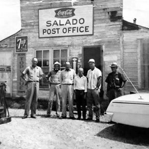 Salado Post Office
 Salado School
 Salado Creek Bridge
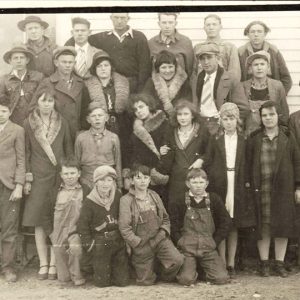 Salado Students
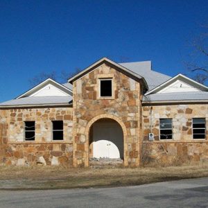
Salem (Fulton County)
Salem, the seat of Fulton County, is located at the foot of Pilot Knob. The clear water of the South Fork of the Spring River runs through the northeastern boundaries of Salem and provides recreational opportunities, such as fishing and floating, as does the nearby Strawberry River. The hills and rivers provide scenic views for the many tourists who visit the Salem area each year. Louisiana Purchase through Early Statehood William P. Morris is credited with establishing the town of Salem when he came to the area in 1839. When he saw Pilot Knob, he decided to stake the land grant claim he received for serving in the War of 1812 near it. Fulton County was organized in 1842 by …
Salem (Saline County)
The unincorporated community of Salem is approximately two and a half miles north of Benton (Saline County) within Salem Township in Saline County. The community owes its existence to its association with the Salem United Methodist Church and the family of William Milton Scott. While there were early settlers in the vicinity of Salem, the community developed after 1833 with the migration of the Scott family from Alabama. In that year, William M. Scott and his family settled on the Military Road about three miles northeast of Benton. Being active in the Methodist denomination, he erected a brush arbor for a camp meeting as early as 1834. It was known locally as Scott’s Campground. Scott’s son, Patrick M. Scott, professed …
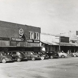
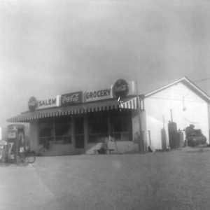 Salem Grocery
 Salem Methodist Church
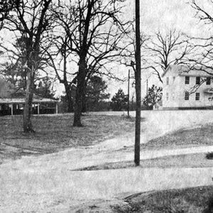
 Salem Street Scene
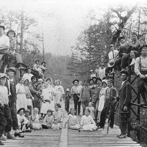
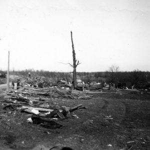 Salem Tornado, 1947
Salesville (Baxter County)
Salesville is a city in Baxter County that remained a small unincorporated settlement until construction of the Norfork Dam. The city is located a few miles north of the city of Norfork (Baxter County) on State Highway 5. Salesville was incorporated in 1968. Salesville is named for John Sales, who moved to Arkansas from South Carolina before 1860. His first land grant was received in May 1860. He built a house near the Old Salt Trail, a road used to transport salt and other staples that had been shipped by steamboat to the Jacob Wolf House on the White River and were on their way north to customers in northern Arkansas and southern Missouri. John’s wife, Peggy, made and sold yellow cheese …
Saline County
Saline County is one of the state’s oldest counties, having been formed in 1835 when Arkansas was still a territory. Named for the salt works that were established in the area during the county’s early years, it was a key county in the mid-twentieth century and served as a center of activity for workers from the Aluminum Company of America (Alcoa) and Reynolds mining operations. At one time, the mines produced more than ninety percent of all aluminum ore produced in the United States. Saline County contains a diverse geography, ranging from the mountainous areas of the northwest to the flatter plain areas of the southeast. The Saline River runs roughly north to south; its tributaries are in the hills …
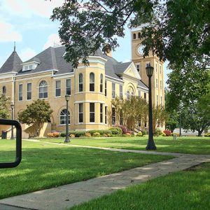 Saline County Courthouse Lawn
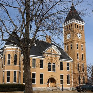 Saline County Courthouse
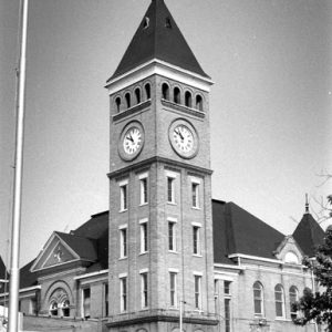 Saline County Courthouse
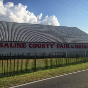 Saline County Fairgrounds
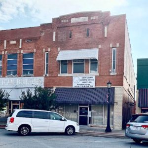 Saline County History and Heritage Society
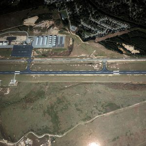 Saline County Regional Airport
Saline Crossing (Saline County)
aka: Saline Crossings
Saline Crossing was a community in Saline County that once vied for the position of county seat. During the late territorial period, in 1831, William Lockhart was granted the right to build a toll bridge there, although people could still ford the stream for free. This site was later used by Native American tribes during their removal through Arkansas until 1840. Every traveler following the Old Military Road or Southwest Trail from Little Rock (Pulaski County) to Rockport (Hot Spring County) crossed the Saline River at that location. In the twenty-first century, the area that once hosted the historical community lies around the Old River Bridge at the end of River Street in Benton (Saline County). No physical remnants of …
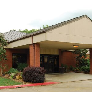
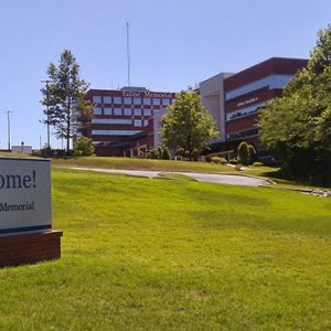 Saline Memorial Hospital
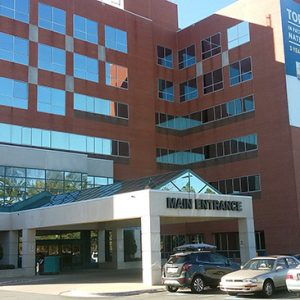 Saline Memorial Hospital
 Saline River
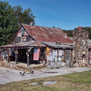
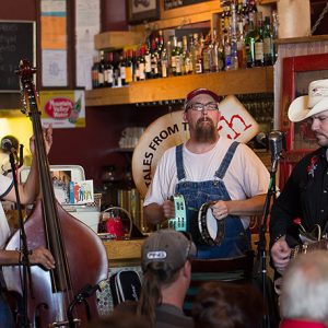 Salty Dogs at Tales from the South
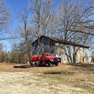
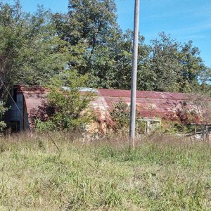
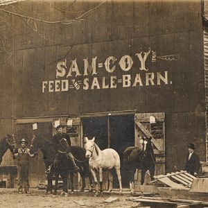 Sam Coy Feed and Sale Barn
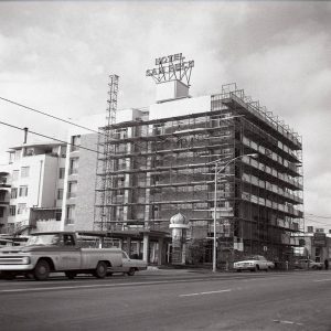 Sam Peck Hotel Remodel
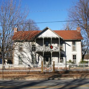
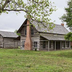 Sam Terry House
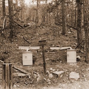 Sampling Plots
Sanders (Hot Spring County)
Sanders is an unincorporated community in Hot Spring County located about one mile northeast of De Roche (Hot Spring County) and thirteen miles west of Malvern (Hot Spring County). The community is along Arkansas Highway 128 just north of its intersection with Arkansas Highway 84. The community’s name came from early settler Elihu Sanders. Sanders received a Federal Land Patent for forty acres in the area in 1850. Born in North Carolina, Sanders operated a farm and lived with his wife, Margaret Sanders, and their eight children according to the 1850 federal census. A post office operated from 1886 to 1917. Sources show that Sanders served as the initial postmaster and that the post office was named in his honor, …
 Sanders Cemetery
 Sanders Library
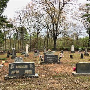
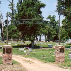 Sandhill Cemetery
Sandtown (Independence County)
Sandtown is an unincorporated community of about twenty families located on Sandtown Road in Jefferson Township about five and a half miles west-southwest of Cave City (Sharp and Independence counties) and about nine and a half miles north of Batesville (Independence County). Local historian Charles Prier believes the settlement’s name comes from the white sand (or silica) found on the sandbar at the confluence of Sullivan Creek and Dry Creek in Sandtown. By 1849, a large range of manganese ore deposits had been discovered in northwestern Independence County with a spillover into Sharp, Izard, and Stone counties. This discovery came to be labeled the Batesville District, with Cushman (Independence County) at its center; the district also contained Sandtown. William Einstein …
 Sandtown Store
 Sandtown Road Building
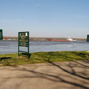 Sans Souci Landing
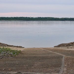 Sans Souci Landing
 Sarah Bird Northrup Ridge House


