Counties, Cities, and Towns

Entry Category: Counties, Cities, and Towns

Prim (Cleburne County)

Prim is an unincorporated community located at the junction of Arkansas Highway 225 (Sunny Slope Road) and Highway 263 (Prim Road), nine miles north-northeast of the resort area of Greers Ferry (Cleburne County) and ten miles north-northwest of Heber Springs (Cleburne County), the county seat. Devil’s Fork, a tributary of the Little Red River, is at Prim, and Turkey Creek is to the north. The Osage once lived in the area. In 1812, the year the Missouri Territory was carved from the Louisiana Territory, John Benedict and his wife, Rebecca Standlee Benedict, came from Kentucky—along with Rebecca’s three brothers—to settle in Arkansas. They cleared thirty acres of land and built two cabins on Little Red River below Devil’s Fork. The …

Princeton (Dallas County)

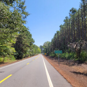
A once thriving town, Princeton had become a small community with a population of only thirteen by the 2020 federal census. Although it was the first seat of Dallas County, the town was supplanted by Fordyce (Dallas County) as the leading community in the county in the early twentieth century. Founded in 1845, Dallas County was formed from Clark and Bradley counties. The site for the town was selected later that year, and work began on a courthouse. An early name for the community was Dallastown. Winthrop Colbath received a federal land patent for the area that would become Princeton on July 10, 1848. The eighty-acre plot was divided into smaller lots and sold. Several public structures were built in …

Pulaski County

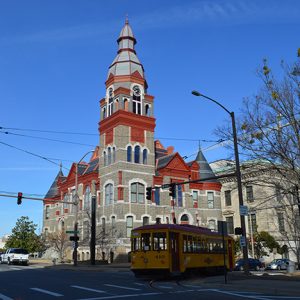
Pulaski County has a diverse population, economy, natural setting, and social structure influenced by state and local government, business and industry, and finance and nonprofit sectors. Three of Arkansas’s six natural divisions converge in Pulaski County—the Ouachita Mountains, the Mississippi Alluvial Plain (the Delta), and the Coastal Plain—representing the state’s wealth of flora, fauna, and geological features. Located in central Arkansas, Pulaski County is one of the state’s five original counties and has been at the center of state government, politics, business, art, and culture for almost two centuries. Pre-European Exploration The Plum Bayou culture flourished in central Arkansas between AD 600 and 1050, as can be seen in sites such as the Plum Bayou Mounds Archeological State Park in …

Pulaski Heights (Pulaski County)

Pulaski Heights, an affluent neighborhood in Little Rock (Pulaski County), was originally a suburban development located on the outskirts of the state’s capital city. Work began on the Pulaski Heights development in the late nineteenth century, and it incorporated as its own town in 1905. The Pulaski Heights development marked the beginning of Little Rock’s westward expansion, a trend that greatly accelerated in the late twentieth and early twenty-first centuries. Like many suburban developments of the late nineteenth and early twentieth centuries, it was racially exclusive, enforcing an all-white residence primarily by means of restrictive covenants. Pulaski Heights was the project of Michigan industrialist Henry Franklin (H. F.) Auten, who settled in Little Rock by 1890 and later organized the …

Puryear (Scott County)

Puryear is an unincorporated community in western Scott County. Puryear was established in 1915 along Haw Creek. The agriculture and timber industries have contributed the economy and way of life in Puryear. Prior to European exploration, the area surrounding Puryear was a wilderness. Several species of wildlife that no longer inhabit the area, such as elk and buffalo, were present throughout the region. Numerous archaeological sites and burial mounds can be found along the banks of prominent waterways such as the Fourche La Fave River and Black Fork Creek. Archaeological findings have provided evidence of early inhabitants dating to the Archaic, Woodland, and Mississippian periods. Further archaeological evidence has indicated that the people of the Caddo tribe later inhabited the …

Pyatt (Marion County)

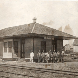
Pyatt is a town located on Crooked Creek in Marion County. It is connected by U.S. Business Highway 62 to U.S. Highway 62, which crosses the creek a few miles south of Pyatt. Native Americans were frequent visitors to the Crooked Creek valley before white settlers began arriving in the area. The first land survey conducted in Marion County found that the land along the creek had been cleared and planted with cotton by 1832. Settlers referred to the early settlement as Stringtown because of the way homesteads were strung along the creek. When a post office was established at the settlement in 1855, it was given the name Clear Creek. The community had a cotton gin and a steam …

Quitman (Cleburne and Faulkner Counties)
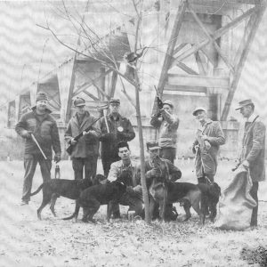
Quitman, originally a part of Van Buren County, is now located in both Cleburne and Faulkner counties. Twelve miles southwest of the Cleburne County seat of Heber Springs, the small commercial center was once home to Quitman Male and Female College. White settlers began to arrive in the area in 1840, attracted to readily available land and plentiful water. Early families were the Witts, McClures, and Newells. Methodists played an important role in the early years. In 1843, they founded Goodloe’s Chapel, the first church. At about that time, the settlement was known as Red River Mission. In 1848, a post office was established with Jesse Witt as postmaster. The budding town was named after Mexican War brigadier general John …

Raggio (Lee County)

The town of Raggio existed briefly on the east bank of Alligator Bayou, about a mile from the St. Francis River, in Lee County. A logging community that was served by the railroad, the town was destroyed by fire around 1916 and was never rebuilt. Until after the Civil War, the site that would become Raggio was largely unclaimed wetland with abundant trees. Hunting and fishing occupied the few visitors to the area, and steamboats traveled the river. Following the war, a logging settlement was established at Raggio; the community was named for a local merchant who had come to Arkansas from Italy. Logs were bound together as rafts to be transported by water to sawmills. Shortly after Lee County was created, …

Randolph County

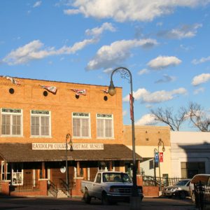
Randolph County’s five rivers, proximity to land transportation routes, and rich agricultural promise drew settlers to the area before the Louisiana Purchase. As dependence on water-based transportation fell, land and railroad routes allowed agriculture and industry to maintain the county’s economic prominence in northeastern Arkansas. The county is home to the Rice-Upshaw House, the oldest standing structure in the state, and Davidsonville Historic State Park, devoted to one of Arkansas’s earliest settlements. The county has six incorporated communities: Biggers, Maynard, O’Kean, Pocahontas, Ravenden Springs, and Reyno. Pre-European Exploration Hundred of archaeological sites exist in Randolph County, some dating back to 11,000 BC or perhaps earlier. As time progressed from the Dalton Period through the Archaic,the number of sites and the duration …

Ratcliff (Logan County)

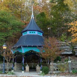
Halfway between Paris (Logan County) and Charleston (Franklin County) on Highway 22, Ratcliff in Logan County has 202 residents as of the 2010 census. The area that is now northwestern Logan County was sparsely populated prior to the Civil War. Alexander Kannady and Jerry Nunnellee filed papers in Clarksville (Johnson County) in 1861 claiming ownership of the land; Nunnellee is said to have operated a plantation in that area for many years prior to this claim. Early in the 1870s, the area became an attraction due to five natural springs of mineral water that were thought to have healing benefits. Stone pavilions sheltered three of the five springs for the comfort of visitors, and a community called National Springs came into existence. …

Ravenden (Lawrence County)

Ravenden, a small Lawrence County town near the Spring River, owes its origin to the completion of the railroad in the 1880s. With the development of the town along the tracks, it soon became an important trade center in the area. The business sector is no longer located on the original site. In 1947, the business sector slowly began to move to the newly completed U.S. Highway 63, where it remains today. Long before white settlers began to develop the land along the Spring River, the Osage used the area as hunting grounds. The first important white settler to the area was William J. Ball, the son of a former British soldier who had fought in the Napoleonic Wars and …

Ravenden Springs (Randolph County)

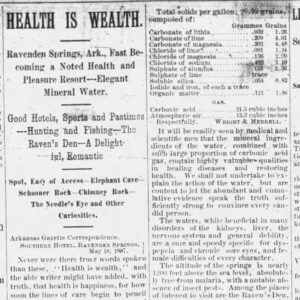
The town of Ravenden Springs is located in the easternmost extension of the Ozark Mountains in western Randolph County, an area that is among the oldest settled areas of Arkansas. In 1809, John Janes, a Revolutionary War veteran, settled on the large creek that now bears his name just south of present-day Ravenden Springs and established a trading post there. One of the earliest mail routes in Arkansas ran from Dry Springs on the Missouri border to Lanes’s Store (successor to Janes’ Trading Post) to Batesville (Independence County). Two villages grew up around Lanes’s Store—Walnut Hill and Kingsville—both of which disappeared in time. In 1820, Caleb Lindsey started what has been documented as the first school in Arkansas. “School Cave” …