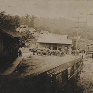
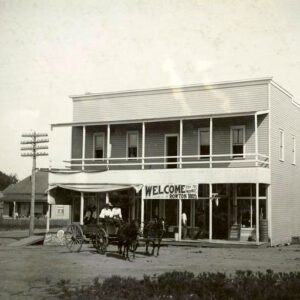
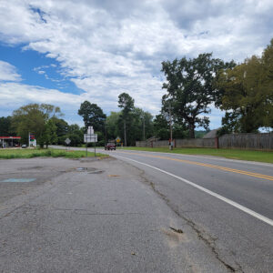
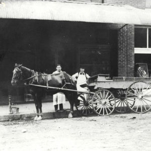
 Winslow Street Scene
Entry Category: Counties, Cities, and Towns - Starting with W
Winslow Street Scene
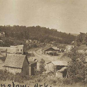 Winslow Street Scene
 Winslow Street Scene
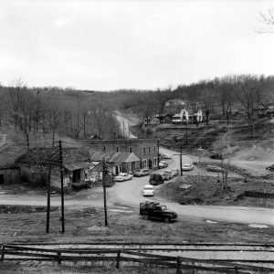
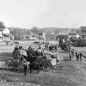
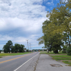
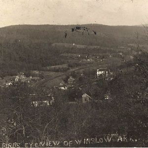 Winslow View
Winthrop (Little River County)
Winthrop is located in Little River County, in the extreme southwestern portion of the state of Arkansas. It is situated on Highway 234, approximately eight miles north of Foreman (Little River County) and fifteen miles northwest of Ashdown (Little River County). Winthrop does not lie on any main traffic route, since most traffic passes through on Highway 71 to the east and Highway 41 to the west. Winthrop is perhaps best known as the 1964 and 1966 kick-off headquarters for Winthrop Rockefeller’s campaigns to serve as governor of Arkansas. In April 1860, Kinion Whittington obtained a patent from the United States for the area that would later become the central portion of the town of Winthrop. Early records indicate that …
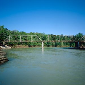 Wire Ford Bridge
Wirth (Sharp County)
Wirth is a small, isolated community located on an approximately fifteen-mile-long north-south plateau rising from the Spring River in northern Sharp County. At its peak, the community was a commercial and social center that attracted a number of German settlers. The first non–Native American settlers to the area may have come as early as the 1700s, with one source reporting a Spanish family by the name of Munz settling there. More likely, the first to settle were Buck Baldridge and Dee Arnold, who established themselves by 1848. No significant settlement occurred until the 1880s, when a substantial number of German immigrants were enticed to move to the area. Apparently, many people read glowing accounts published by railroad companies in German-language …
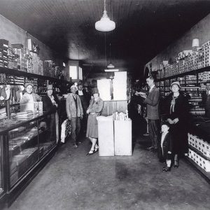
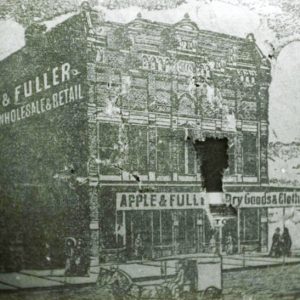 Witcherville Retailer
Witherspoon (Clark County)
Two unrelated communities in Clark County are named Witherspoon. The first was located about half a mile south of Hollywood (Clark County). Over the years, the name of the community evolved to Spoonville; it was under this name that the post office located in the community operated. The second is an unincorporated community in eastern Clark County just south of the community of the same name in Hot Spring County. Early settlement in the Witherspoon area began in the 1820s. Samuel Rutherford obtained a federal land patent for eighty acres in the area in 1823. Samuel moved to Arkansas from Tennessee in 1817. His brother, Archibald, moved to the state in 1831 and obtained a federal land patent for eighty …
Witherspoon (Hot Spring County)
Witherspoon is an unincorporated community in southwestern Hot Spring County. Located about four miles west of Brown Springs (Hot Spring County) and six miles southwest of Donaldson (Hot Spring County), the community was founded as a railroad stop. Originally part of Clark County, the area became part of Hot Spring County when the county was created in 1829. One of the early settlers in the area was Archibald Brumbelow. In 1860, he received forty acres of land near the future location of Witherspoon and farmed it with his family. The opening of the Cairo and Fulton Railroad in 1873 led to the establishment of a railroad stop in the area. A post office opened in Witherspoon in 1875; it operated …
Wittsburg (Cross County)
Located on the eastern slope of Crowley’s Ridge in the St. Francis River watershed, Wittsburg developed near the intersection of the roads on Crowley’s Ridge, the St. Francis River, and the Congressional (Military) Road from Memphis, Tennessee, to Little Rock (Pulaski County). Incorporated in 1848, the town functioned as the Cross County seat from 1862 to 1865 and again from 1868 to 1884. Rebounding after the Civil War and surviving a major fire in 1874, the town grew due to the trade in cotton and dry goods. Wittsburg began to fade after being bypassed by two railroad lines in 1882 and 1887 that drew trade to the west side of Crowley’s Ridge and Wynne (Cross County). European Exploration and Settlement Due …
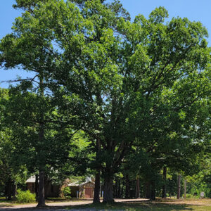
Wolf Bayou (Cleburne County)
Wolf Bayou is located on the Wolf Bayou Cutoff Road (Highway 90) near Concord (Cleburne County) and Drasco (Cleburne County). According to local historian Louie Clark, French explorers called the local runoff-fed creek a “bayou,” and when the post office was established in 1851 the word “wolf” was added because the timberland along the creek was the home of many wolves. The area was sparsely populated by a few hunters and trappers by 1818. Even with the coming of the post office, not many lived in the area, and only gradually did the region increase in population. The creek later became popular with kayakers. The Old Cherokee Boundary Line goes through the northwestern part of Wolf Bayou and runs diagonally across …
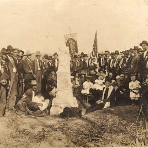 Wolf Cemetery Monument Dedication
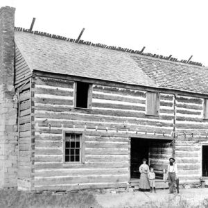 Jacob Wolf House
 Wolfe Dress Shop
 Womble Businesses
 Womble, 1914
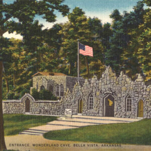 Wonderland Cave Entrance
 Wonderland Cave Visitors
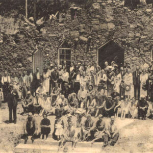
Woodruff County
Woodruff County, a level, fertile plain watered and drained by the White and Cache rivers, was once home to many Native Americans who inhabited the area when the first white settlers arrived. Little is known about the early inhabitants, but the mounds they built for worship, burial, and living can be found in many areas of the county, particularly near Cotton Plant and McCrory, though farming operations have leveled most of the sites. The White River forms most of the western boundary of Woodruff County. The Cache River and Bayou DeView, confluents of the White River, also cut through the county. The five incorporated towns in Woodruff County are Augusta (the county seat), McCrory, Cotton Plant, Patterson, and Hunter. Louisiana …
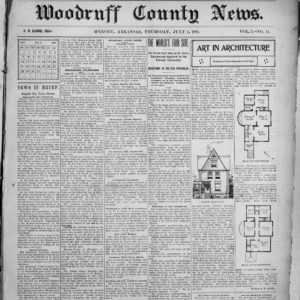 Woodruff County News
Woodson (Pulaski County)
Woodson is a community in southern Pulaski County, north of Hensley (Pulaski County) and east of Interstate 530. Although it was incorporated on January 17, 1882, as a timber town and a stop on the Little Rock, Mississippi River and Texas Railroad, Woodson continued to operate as an unincorporated area, leading to confusion eighty years later. William D. Pennington acquired land in the area that would become Woodson in 1843. His son, William Q. Pennington, established a post office called Pennington’s Mills in 1855. In 1860, James Jones and John Little also purchased land in the area. The Civil War had little direct impact upon the area during the course of the fighting, but the conclusion of the war reshaped the …
 Woodson Post Office
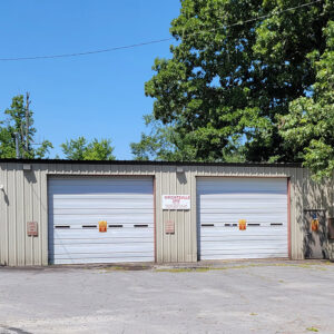
 Woodson Street Scene
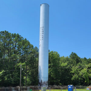 Woodson-Hensley Water Tower
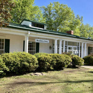 Woolfolk Library
Wooster (Faulkner County)
Wooster is a city in Faulkner County, seven miles north of Conway (Faulkner County) and four miles west of Greenbrier (Faulkner County). Although it was settled in the later years of the nineteenth century, it did not incorporate until 1958. Land grants were given to Frederick Campbell, Alexander Ferguson, John Lewis, and John Wiser in 1820 for the section of land where Wooster would be developed. Evidently, they farmed the land without developing a community, since the first recorded structure in the area was a store built by N. E. Adams around the middle of the nineteenth century. Adams also maintained a sawmill and a cotton gin. Adams sold his store to J. P. Wooster in 1881. The community was …
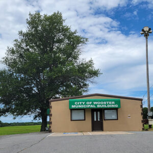 Wooster Municipal Building
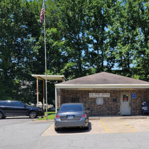
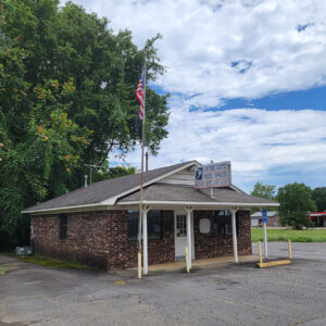 Wooster Post Office
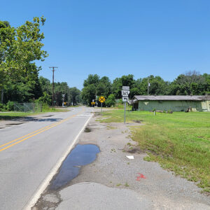
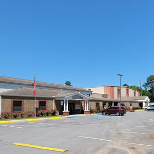
 Wooster Street Scene
 Wooster Street Scene
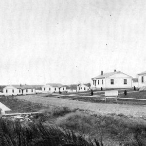 Worker Village
Wrightsville (Pulaski County)
The city of Wrightsville, located on Highway 365 in southeastern Pulaski County, existed as an unincorporated settlement for more than a century before it was incorporated late in the twentieth century. Since 1981, it has been home to a major Arkansas Department of Correction facility, which is the principal employer in the city. The area that became Wrightsville was largely wetland, lying in the vicinity of the Arkansas River, when nearby cities such as Little Rock (Pulaski County) and Pine Bluff (Jefferson County) were developed in the nineteenth century. Although some plantations had been established to the north and west of the site, the actual location of Wrightsville remained unclaimed until construction of the Little Rock, Mississippi, and Texas Railroad in …
 Wrightsville AME Church
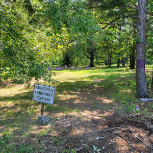 Wrightsville Cemetery
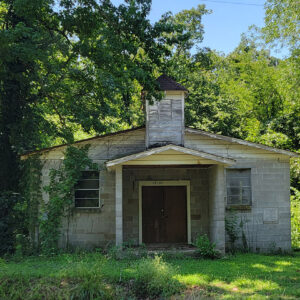
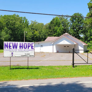 Wrightsville Church
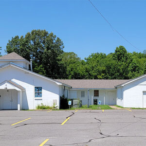 Wrightsville Church
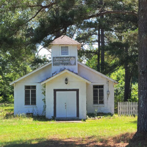 Wrightsville Church
 Wrightsville Fire Department
 Wrightsville Municipal Buildings
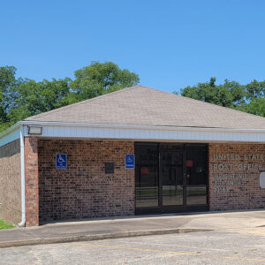 Wrightsville Post Office
 Wrightsville Street Scene
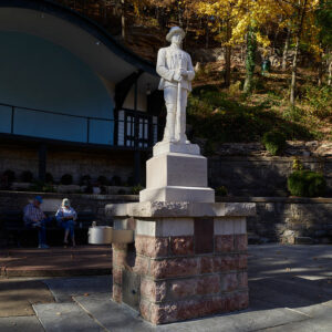 WWI Memorial
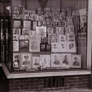 WWII Soldiers and Sailors
Wyandotte (Hot Spring County)
Located about one mile northeast of Gifford (Hot Spring County) and five miles northeast of Malvern (Hot Spring County), Wyandotte is an unincorporated community in Hot Spring County. The community is centered on the rail line that continues to run through the area in the twenty-first century and is paralleled by the phonetically spelled Wine Dot Road. Early landowners included Benjamin Clardy, who between 1838 and 1854 obtained 520 acres through federal land patents, either alone or with a partner. Born around 1797 in South Carolina, Clardy appears in the 1850 federal census with his wife, Agnes, and their five sons. In the 1860 census, Clardy is listed as owning twenty-one enslaved people—seven female and fourteen male. Clardy died in …
 Wye United Methodist Church
Wynne (Cross County)
Wynne is located with the west slope of Crowley’s Ridge to the east and the L’Anguille River on the west side of town. Wynne started off as a small railroad town but soon became the county seat of Cross County. In the last 100 years, the city of Wynne has progressed and is now a great attraction for industry, recreation, and is becoming a popular place to reside. The newest attraction to Wynne is the twenty-seven-hole golf course at Village Creek State Park. Reconstruction through the Gilded Age The town can date its history to 1882, when the St. Louis, Iron Mountain and Southern Railroad laid tracks in the area. A train derailed and left behind a boxcar, which was turned …
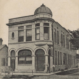 Wynne Bank
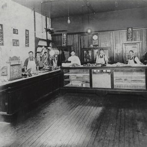 Wynne Butcher
 Wynne Butcher


