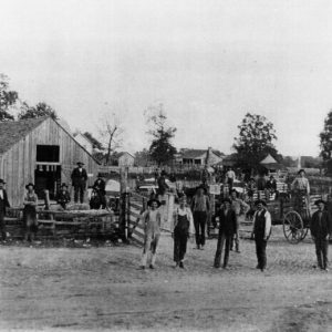
 Entering Caulksville
Entry Category: Counties, Cities, and Towns - Starting with C
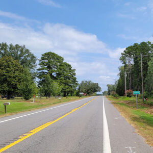
Entering Caulksville
Caulksville (Logan County)
Caulksville is a town in northwestern Logan County, located at the intersection of State Highways 22 and 23. While it incorporated at a much later date than the bordering town of Ratcliff (Logan County), Caulksville is the older settlement of the two. Caulksville was named for Robert Caulk, who received a land patent at the location of the town in 1860. He and his family are said to have arrived in the area in the 1830s. Available records do not show that Caulk served in any army during the Civil War. After the war, more settlers arrived in the area, and Caulk opened a post office in 1870. A Missionary Baptist church was built a few miles north of …
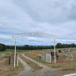
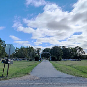 Caulksville Cemetery
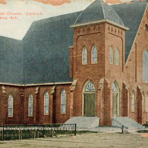
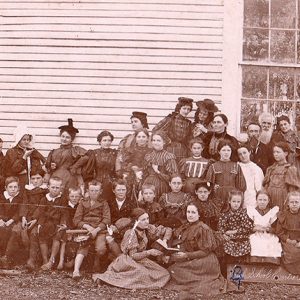
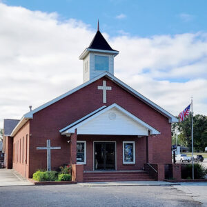 Caulksville Church
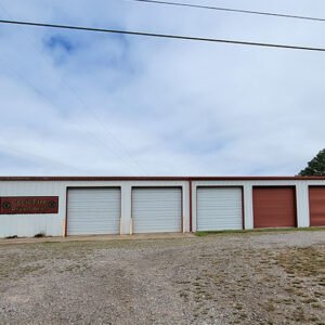
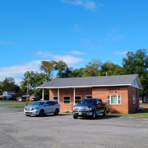 Caulksville City Hall
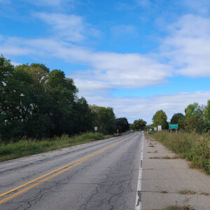
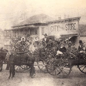
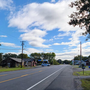 Caulksville Street Scene
Cauthron (Scott County)
The town of Cauthron is an unincorporated community located in western Scott County along Highway 28. The town was established along the Poteau River, which runs west into eastern Oklahoma. Cauthron was incorporated circa 1876; however, the area was initially known as Piney. Piney was never officially an incorporated town, and it is unclear when the area began being called Cauthron, although it was likely in the 1870s when the first governmental buildings were being built. Before European contact, the wilderness area’s first inhabitants included natives from the Archaic, Woodland, and Mississippian periods. The Caddo later made their homes along the Poteau River and other waterways in the area. It is probable that during the late seventeenth and early eighteenth …
Cave City (Sharp and Independence Counties)
Cave City is a small community that straddles the northern Independence and southern Sharp County border in north-central Arkansas, having ended up there when a three-mile strip of Independence County was transferred to Sharp County in 1879. For administrative purposes, the town belongs to Sharp County, but it hosts voting stations for townships in both Independence and Sharp counties. The town takes its name from the large multi-room Crystal River Cave, which is located directly beneath the city. The cave has played a pivotal role in the history of the entire community. For thousands of years, it has served as a temporary shelter, source of water, and a fascinating place to visit. Settlers in the nineteenth century also used the …
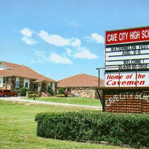 Cave City High School
Cave Springs (Benton County)
The city of Cave Springs, nestled in the hills of northwest Arkansas, Benton County, is known more for recreational opportunities than for its role in industry or agriculture. Incorporated in 1910, the second-class city stands on Highways 112 and 264 and is often the first community seen by visitors to Arkansas who arrive at the Northwest Arkansas National Airport. Cave Springs is named for two caves and for the water source that flows from the northernmost of those caves. The north cave, which has been closed to the public since the 1980s, is said to consist of several rooms and to contain two beautiful waterfalls. It is home to many bats and to the largest known population of the rare …
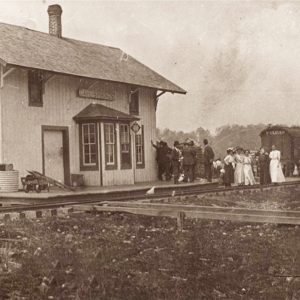 Cave Springs Depot
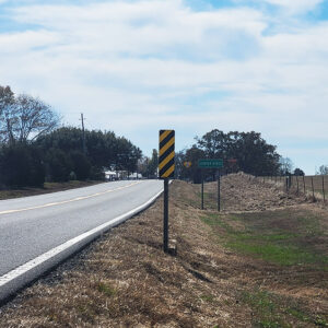
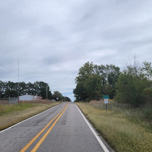 Entering Cecil
 Cecil Cemetery
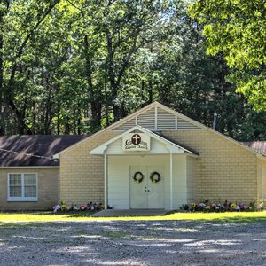
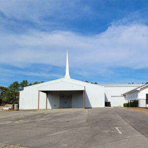
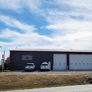
 Cecil Fire Department
Cedar Creek (Scott County)
The unincorporated community of Cedar Creek is located along Highway 28 in eastern Scott County. The town was established in 1852 near the Fourche La Fave River between two of its tributaries. Originally, Cedar Creek was broken up into two different communities that were about three miles apart: Little Cedar and Big Cedar. The communities were named after the two tributaries of the Fourche La Fave River: Little Cedar Creek and Big Cedar Creek; to avoid confusion, the residents simply began calling the area Cedar Creek. Before European exploration, Cedar Creek was a wilderness containing various species of wildlife, some of which no longer inhabit the area. Early inhabitants included peoples of the Archaic, Woodland, and Mississippian periods. Several hundred …
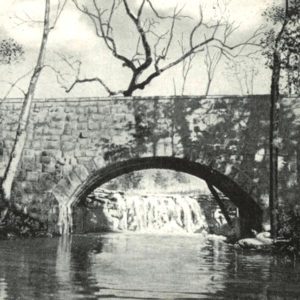 Cedar Creek Bridge
Cedar Glades (Garland County)
The community of Cedar Glades, located on the upper Ouachita River in Garland County, served as a transportation and commercial center amidst the sparsely settled Ouachita Mountains before the Civil War. The town typified rural upland Arkansas with its small farms and reliance on agriculture. Following the construction of Blakely Mountain Dam in the 1950s, the waters of Lake Ouachita covered Cedar Glades and the surrounding area. The lake’s completion necessitated a total, permanent evacuation of the town, and it ceased to exist. Extensive archaeological remains exist in the upper Ouachita River valley; many fields bordering on the river contain evidence of Native American presence in the area. Caddo occupied the Ouachita Mountains in relatively small, widely dispersed settlements in the northern part …
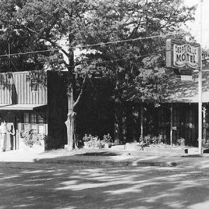 Cedar Grill
Cedar Grove (Independence County) [Northeast]
There are two communities named Cedar Grove in Independence County, one south of the White River between Floral and Pleasant Plains, and the other north of the White River near Charlotte and Cave City (Sharp and Independence counties); the two communities are often confused. Both are historical communities dating back to before the Civil War. Both are said to take their names from clusters of cedar trees found in the areas where log homes were built by the first settlers. Each one has a Cedar Grove Cemetery. Cedar Grove in the northeastern part of the county is located in Dota Township on Curia Creek seven miles southeast of Cave City and about fourteen miles east-northeast of Batesville (Independence County). It …
Cedar Grove (Independence County) [Southwest]
There are two communities named Cedar Grove in Independence County—one south of the White River near Floral (Independence County) and Pleasant Plains (Independence County), and the other north of the White River near Charlotte (Independence County) and Cave City (Sharp and Independence counties). This has led to much confusion, as each one has a Cedar Grove Cemetery. The two locations are often confused on the Internet as well. Both are historical communities dating back to before the Civil War, and both are said to take their names from clusters of cedar trees found in the areas where log homes were built by early settlers. Cedar Grove in the southwestern part of the county lies on Highway 87 (Floral Road) between …
Cedarville (Crawford County)
Cedarville (Crawford County) is in northwestern Arkansas, five and a half miles east of the Oklahoma border and ten miles north of Van Buren (Crawford County). It is located at the intersection of Highways 59, 162, and 220. Situated in the Webber Valley of Lee’s Creek in the foothills of the Boston Mountain range of the Ozark Mountains, it is the fourth-largest town in Crawford County. Approximately three miles north of Cedarville is a rock formation believed by some to be the foundation of an old fort. It measures about 450 by 150 feet. While some people believe that the formation is natural, others attribute the formation to Native Americans or even to Hernando de Soto and his men. The …
 Centennial Baptist Church
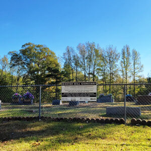 Center Hill Cemetery
Center Point (Clark County)
Center Point is a small community in Clark County located about four miles northwest of Gurdon (Clark County). The community is centered at the intersection of Center Point Road and Arkansas Highway 53. The first landowner in the area was Lewis Randolph, who received a land patent of just under 600 acres on December 1, 1838. The issuance of the patent took more than a year to process, as Randolph died on September 24, 1837, more than a year before the patent received approval. The population in the area grew slowly before the Civil War. After the end of the war, the population began to grow and small-scale farming began. With the opening of the Cairo and Fulton Railroad in …
Center Point (Howard County)
Center Point was the first county seat of Howard County, serving in that capacity from 1873 until 1905. Although it is near the geographical center of the county, it received its name when the post office was established in 1849 because the crossroads at that location served as the central point of trade in southwestern Arkansas west of Washington (Hempstead County). Center Point in the twenty-first century is a small unincorporated community at the intersection of U.S. Highway 278 (formerly State Highway 4) and State Highway 26. Around 1818, Robert Messer, with his wife and two daughters, traveled by river to Fulton (Hempstead County) and then by land into the forested wilderness of southwestern Arkansas. Messer built a log cabin …
 Center Point Baptist Church
 Center Point Methodist Church
 Center Point School
 Center Point Street Scene
 Entering Center Ridge
Center Ridge (Conway County)
The history of Center Ridge, an unincorporated community in northeastern Conway County, spans and connects to some of the key developments in Arkansas history, from the bitter division during the Civil War to the evolution of the rural economy of upland Arkansas—which developed from subsistence agriculture to row crops, animal husbandry, and more recently, natural gas extraction. Archaeological excavations made prior to the construction of Brewer Lake, in central Conway County, indicate that Native Americans occupied the area for thousands of years. The upland portion of Conway County was largely uninhabited by the late 1830s, when white settlers began to arrive. The first community in the area, about four miles west of present-day Center Ridge, was Lick Mountain, and the …
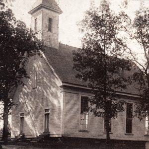
 Center Ridge Church
 Center Ridge Cotton Gin
 Center Ridge Fire Department
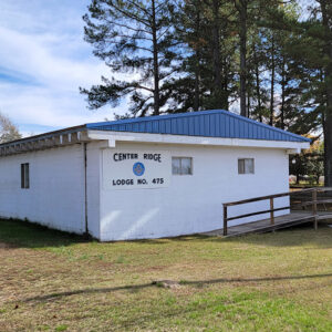 Center Ridge Masons
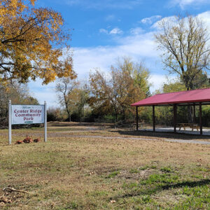 Center Ridge Park
 Center Ridge Post Office
 Center Ridge Street Scene
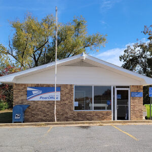
Centerton (Benton County)
The city of Centerton, named for its location at the center of Benton County, was first established as a railroad stop and as a processing center for Benton County’s apple industry. The city declined in size by the middle of the twentieth century due to earlier troubles in the apple and railroad industries, but the rapid growth of Benton County brought about by the poultry industry and by Walmart Inc. has made Centerton a successful city in the twenty-first century. Louisiana Purchase through Early Statehood Northwest Arkansas was claimed as hunting territory by the Osage, who lived in Missouri, at the time of the Louisiana Purchase. Local historians believe that the Osage regularly visited the McKissick Spring, an early landmark …
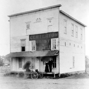 Centerton Grist and Feed Mill
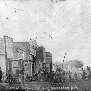 Centerton Street Scene
Central (Hot Spring County)
Central is a community located in Hot Spring County along U.S. Highway 67 about five miles south of Malvern (Hot Spring County). The community centered on the school that existed there in the early twentieth century. Early landowners in the area included John Ross and Sha Tah O Ka, who obtained land through the Treaty of Dancing Rabbit Creek, which took land from Choctaw east of the Mississippi River while giving them land in Arkansas and the Indian Territory. Ross received a total of 318 acres in 1851, with most of it around the Central area but with additional land in what is now White County and Cleveland County. In 1857, William Ballard obtained 160 acres in the area. More …
 Central Church
Central City (Sebastian County)
Located at the crossroads of Arkansas Highways 22 and 255 in Sebastian County, Central City is a suburb of nearby Fort Smith (Sebastian County), the second-largest city in Arkansas. The community borders the city of Lavaca (Sebastian County) to its east. Central City is bordered to its south by Fort Chaffee. In an effort to connect Fort Gibson with the early settlement of Fort Smith (on the edge of Indian Territory), the U.S. Congress made provisions to build a military road. This transportation route followed former Native American trails almost paralleling the Arkansas River and went directly through what became Central City. All of the “Five Civilized Tribes” (Seminole, Muscogee Creek, Choctaw, Cherokee, and Chickasaw) traveled through the area in the …
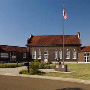 Central Delta Depot Museum
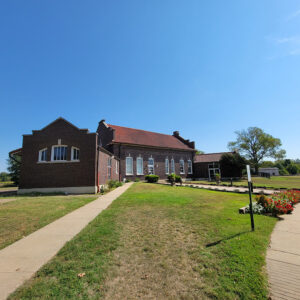 Central Delta Depot Museum
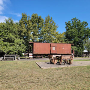 Central Delta Depot Museum Train
 Central Street Scene
 Central Street Scene
Chalybeate Springs (Stone County)
Chalybeate Springs (a.k.a. Chalybeate) is located in the township of Arbana about three and a half miles southwest of Pleasant Grove (Stone County) and about eleven miles southeast of Mountain View (Stone County), the county seat. The community is south of Misenheimer Road, near the confluence of Chalybeate Spring Creek and Little Raccoon Creek, off Tuttle Ridge Road. The locals pronounce the name of the community “Clee’-bit.” Chalybeate Spring is located at the foot of the Boston Mountains about two miles to the east of the Chalybeate community. It forms the waters of one of the small tributaries of Coon Creek, which flows into the Devil’s Fork of the Little Red River. Water from the spring was believed to have …


