calsfoundation@cals.org
Crawford County
| Region: | Northwest |
| County Seat: | Van Buren |
| Established: | October 18, 1820 |
| Parent County: | Pulaski |
| Population: | 60,133 (2020 Census) |
| Area: | 595.27 square miles (2020 Census) |
| Historical Population as per the U.S. Census: | |||||||||
|
1810 |
1820 |
1830 |
1840 |
1850 |
1860 |
1870 |
1880 |
1890 |
1900 |
|
– |
– |
2,440 |
4,266 |
7,960 |
7,850 |
8,957 |
14,740 |
21,714 |
21,270 |
|
1910 |
1920 |
1930 |
1940 |
1950 |
1960 |
1970 |
1980 |
1990 |
2000 |
|
23,942 |
25,739 |
22,549 |
23,920 |
22,727 |
21,318 |
25,677 |
36,892 |
42,493 |
53,247 |
|
2010 |
2020 |
|
|
|
|
|
|
|
|
|
61,948 |
60,133 |
|
|
|
|
|
|
|
|
| Population Characteristics as per the 2020 U.S. Census: | ||
| White |
48,610 |
80.8% |
| African American |
897 |
1.5% |
| American Indian |
1,486 |
2.5% |
| Asian |
947 |
1.6% |
| Native Hawaiian or Other Pacific Islander |
35 |
0.1% |
| Some Other Race |
2,342 |
3.9% |
| Two or More Races |
5,816 |
9.7% |
| Hispanic Origin (may be of any race) |
4,567 |
7.6% |
| Population Density |
101.0 people per square mile |
|
| Median Household Income (2019) |
$46,828 |
|
| Per Capita Income (2015–2019) |
$24,547 |
|
| Percent of Population below Poverty Line (2019) |
17.2% |
|
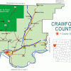
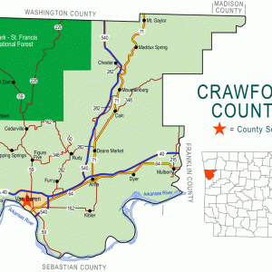
Crawford County is situated in northwest Arkansas in the Ozark Mountains. The Boston Mountains on the north and the Arkansas River Valley on the south provide a diverse landscape and play an important role in the economy of the past and present. The county is centrally located within the nation, thus allowing desirable north-south and east-west transportation networks to support industrialization, manufacturing, and tourism growth.
Pre-European Exploration
The area that became Crawford County has been inhabited since the end of the Ice Age, about 12,000 BC. Paleoindians hunted and gathered wild plants and other resources, residing in open air campsites and occasionally using rock shelters. Agricultural settlements began to be established during the Mississippian Period (AD 900—1600). Pictographs (paintings on rock surfaces) and petroglyphs (carvings in rock surfaces) dating from fall or winter months sometime between AD 1195 and 1495 have been found in Crawford County. Various theories speculate that the artwork and settlements in Crawford County were left by ancestors of the Osage, Quapaw, Wichita, Tunica, or Caddo tribes.
Louisiana Purchase through Early Statehood
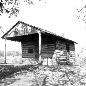
Osage hunting parties visited the land that became the American frontier with the Louisiana Purchase. Between 1818 and 1828, much of the future county was within a Cherokee reservation and therefore unavailable to American settlers. As early as 1814, however, Thomas Martin claimed a site on the Arkansas River at the location where the seat of Crawford County would later be established. David E. Boyd (1800–1885), an Irishman of large stature living in a canebrake on the river, is credited with constructing the first log building for Martin in 1818. The Phillips family arrived and purchased the claim of Thomas Martin and established the first businesses—a boat dock and wood yard to fuel steamboats. This strategic site became known as Phillips Landing—an outfitting place for expeditions into Indian Territory and Texas, as well as a distribution point for goods being shipped up and down the river. It eventually became a small village with a post office named Van Buren.
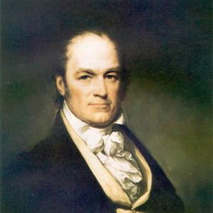
When originally created on October 18, 1820, Crawford County encompassed a large part of Indian Territory and all or part of five present-day counties—Scott, Sebastian, Franklin, Washington, and Pope. It was named in honor of William H. Crawford of Georgia, then the secretary of the treasury. Due to the extensive geographical area, it was often referred to as the “empire county.”
The current area of 595.4 square miles of Crawford County was constituted predominately out of Lovely County, with a small portion from the Cherokee reservation. It shares the western border with Oklahoma, the northern boundary line with Washington County, the eastern boundary with Franklin County, and on the south, outlined by the Arkansas River, is Sebastian County.
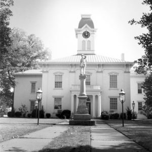
Two politically aggressive businessmen, John Drennen and David Thompson, seeing opportunities in the territory of Arkansas, settled in Crawford County in 1834. They purchased Phillips Landing, the post office, and surrounding lands in 1836. Drennen represented Crawford County in 1835 in the drafting of the first constitution of the state of Arkansas. In 1837, reassured by Arkansas statehood, Drennen and Thompson donated land to establish the county seat in Van Buren. At the death of Thompson in 1839, Drennen became the wealthiest and most prominent member of the community.
A business partner with Sam Houston, Drennen also chartered the Chihuahua Trading Company. He conducted the allotment of the Cherokee immigrants of 1839 (during Indian Removal) and, as superintendent of the Western Territory (1849), he represented the governmental affairs with the Cherokee, Choctaw, Chickasaw, Seminole, Creek, Osage, Caddo, and Quapaw.
As early as 1821, about 100 individuals paid taxes on houses, horses, slaves, and cattle in the original Crawford County. By 1840, approximately 4,000 people had arrived, and settlements sprang up all over the mountains, valleys, and the river valley.
A new era for western Arkansas, particularly Crawford County, was marked in May 1838 when the famed Santa Fe trader Josiah Gregg outfitted forty wagons with merchandise from his brother’s store in Van Buren to trade in Chihuahua, Mexico, which was 1,100 miles away. The California gold rush also created a business boom in Van Buren, where hundreds gathered to be outfitted and to join wagon trains departing for the gold fields in 1849.
By 1850, immigrants and freight could enter the county by traveling the State Road (Wire Road) from the north, paralleling the western boundary, from Springfield, Missouri, to the Arkansas River. In 1851, law and order came to the frontier. The U.S. District Court was divided into two districts with Van Buren as the designated place for court to be convened in the Western District.
Telegraph lines reached Crawford County via the State Road in 1856, and the Butterfield Overland Mail Company stagecoach arrived in September 1858. These two means of communication, along with the first newspaper, the Arkansas Intelligencer, which appeared in print in 1842, greatly enhanced communications on the western frontier.
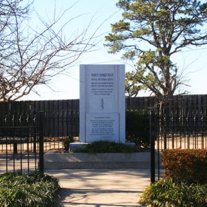
Member of the Quorum of the Twelve Apostles of the Church of Jesus Christ of Latter-Day Saints Parley Pratt was murdered in Crawford County in 1857. He is buried near the present-day city of Rudy.
Civil War through Reconstruction
Jesse Turner and Hugh Thomason represented Crawford County at the 1861 Secession Convention. Both men were lawyers, and Turner owned two enslaved people at the time of the 1860 census. Approximately eleven percent of the county’s population of 7,850 was enslaved in 1860.
The Civil War came early to Crawford County, as did great devastation, deprivation, pain, and suffering. After the Federals entered the northwest part of the state in the spring of 1862, two major battles were fought there: Pea Ridge in March and Prairie Grove in December. Thereafter, the strategic balance of the war shifted in favor of the Union. During the month of December 1862, the Confederate forces had twice marched the length of the county and returned, followed closely by the Federals. By the end of 1862, the Union army had marched southward down the State Road, entering Van Buren via Log Town Hill, and occupied the area.
Multiple engagements took place within the boundaries of Crawford County. Skirmishes were fought at Vine Prairie and at Van Buren in August 1864 and April 1865. Van Buren served as an important hospital site for Confederate forces, with those who died buried in the Fairview Cemetery where a monument stands honoring their service.
As the freed slaves migrated westward, a large population of African Americans settled in the Riverside community near Van Buren. They built Mount Olive United Methodist Church, one of the oldest black churches west of the Mississippi River in Van Buren, which stands today. However, the area was subject to frequent flooding, and many relocated to Indian Territory, where they married into the tribes or moved westward. The 2020 census noted that respondents who claimed only African American heritage made up 1.8 percent of the population or approximately 1,086 residents.
Rebuilding after the war was difficult as outlaws roamed the area, taking what they wanted before racing across the border to a safe haven in Indian Territory. In spite of difficulties, the first free public school opened in 1867. In 1871, the Western District Circuit Court was moved across the river to Fort Smith (Sebastian County).
Post Reconstruction through the Gilded Age
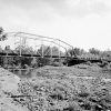
Crawford County never experienced phenomenal growth at any one time, but with the advent of the railroads in 1870–1880, there came a significant population increase, along with economic growth and development. Van Buren became the transportation junction of the St. Louis and San Francisco Railway, the Little Rock and Fort Smith Railroad, and the St. Louis, Iron Mountain and Southern Railway, a branch of the Missouri Pacific Railroad system. The waterway traffic preferred the Van Buren landing and ferry. The construction of an iron bridge across the Arkansas River in 1891 greatly enhanced transportation.
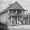
Railroad-related businesses sprang up immediately along the tracks. Van Buren citizens established an ice and coal company in 1887. A Missouri Pacific Hotel with fifty guest rooms opened near the railroad depot, and railroad ties were hewn from trees in the forest and sold to the railroad.
Topographically, the county is arranged on a series of terraces, with a distance of twenty-two miles from the river plain to the summit of the Boston Mountains and an elevation difference between the two of 1,500 feet. The streams issuing from the mountains and fertile valleys established terraces at various elevations. Soil of almost every type is represented in the county—river bottom, creek valley, and mountain—and crops of all kinds yield abundantly. The temperate climate rendered it suitable for growing large quantities of berries, fruits, melons, potatoes, soybeans, and cotton. In 1898, a net aggregate sum of $687,000 of these products was shipped.
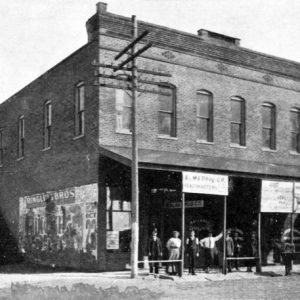
Van Buren is the only major city in Crawford County and, by the 1890s, had a wide variety of businesses, banks, realtors, lawyers, photographers, and schools, and a public water system and electrical power plant were operational. The flood of 1898, however, put many of these businesses under four to six feet of water.
Early Twentieth Century
Twenty-two men from Crawford County died during World War I. By 1920, coal was being mined in Crawford County with power generated from natural gas wells in the Kibler area of the county. One of the two natural gas fields in the state reaches from Alma westward into Oklahoma. This cheap fuel also powered the public utilities of Van Buren.
Racial unrest came to a head in the county in 1923 when a white woman was murdered near Catcher. The violence that followed became known as the Catcher Race Riot and entailed the expulsion of a black community.
The Flood of 1927 destroyed levees and brought six feet of water to the Van Buren business district. Crawford County residents and businesses along the Arkansas River lost boats, houses, barns, warehouses, and businesses full of merchandise, and railroads were disabled. In 1943, another flood brought more damage and death. Military units nearby assisted in transporting people and reclaiming land.
The economy associated with the lumber industry, farm products, and allied businesses was greatly diminished during the Great Depression, and many citizens relocated to California. A Civilian Conservation Corps (CCC) camp was established near Lock, employing 260 in road building and forest reclamation.
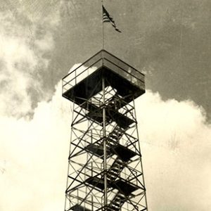
With the automobile came tourists to the Boston Mountains, where villages and motels sprang up in the 1930s. The Mount Gaylor Tower and gift shop near the Boston Mountains summit became a tourist attraction, and Artist’s Point became the most photographed point in the Ozark Plateau. The Masons built the exclusive Amrita Grotto Country Club near Mountainburg in 1925.
The automobile also brought outlaws to the county with the arrival of Bonnie and Clyde in 1933. While Bonnie Parker recovered in Fort Smith from burns suffered in a car crash in Texas, Clyde Barrow and other members of the gang robbed a store in Fayetteville. Returning to Fort Smith, the group encountered law enforcement officers north of Alma, and a shootout led to the death of Alma city marshal Henry Humphrey.
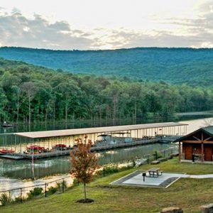
In 1936, the Works Progress Administration (WPA) constructed the Lake Fort Smith dam and lake near Mountainburg. A public park was also constructed near the dam. In 1967, the Arkansas Department of Parks and Tourism assumed control of the park.
World War II through the Faubus Era
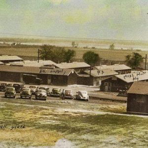
Camp Jesse Turner, a unique thirty-five-acre military railway training camp, was established in Van Buren in 1942. All soldiers were handpicked and received special training from the local Central Division of the Missouri Pacific Railway in the operation and maintenance of military railroad lines. After the war, the land became the site of the Crawford County Hospital and the Van Buren Housing Authority. About 2,829 Crawford County soldiers served in the armed forces during World War II; seventy-five died.
In 1960, the population of Crawford County was 21,318, representing a reduction of over 2000 people from the pre–World War II census. The Great Depression and the out-of-state defense work associated with the war were responsible for the decline.
Modern Era
The public schools in Van Buren integrated beginning with the high school grades in 1957. Funding for public school districts in the county became part of the 1979 lawsuit Jim Du Pree et al. v. Alma School District No. 30 et al.
By 2010, the population reached 61,948. The economic base shifted from yeoman to commercial farming; local manufacturing became national and international, as did poultry food processing by Tyson Foods Inc. and Simmons Foods Inc. The Van Buren Industrial Park has international and national businesses, and tourism thrives in historic sites, the Boston Mountains, and improved state parks.
Van Buren continues to be a national transportation crossroads, and, beginning in 1971, the McClellan-Kerr Arkansas River Navigation System ushered in flood control and cheaper transportation on the Arkansas River. Towboat and barge traffic can access Crawford County via the Port Authority at Van Buren James W. Trimble Lock and Dam. Interstate 40 and the northern portion of Interstate 540 intersect near Alma.
In 2005, the University of Arkansas at Fort Smith (UAFS) and the Department of Arkansas Heritage purchased the home of Van Buren founder John Drennen. The Drennen-Scott Historic Site, as it is known, has been restored as a museum open to the public and a laboratory for students of history and historic preservation.
By 2006, a total of 11,247 students were attending the five independent school districts in Alma, Cedarville, Mountainburg, Mulberry, and Van Buren. In each community, a free public library supports the schools.
The population increase in the last four decades can be attributed to the return of many former residents reaching retirement, the moderate climate, increased industrialization, and the low cost of living.
Famous Residents
Bass Reeves, noted African American lawman, was born into slavery in Crawford County in 1838. Judge Jesse Turner, a prominent citizen, established a law office on Main Street in 1838. His accomplishments were of national significance, as he served as an unsuccessful Whig presidential candidate, a U.S. attorney, and an Indian agent. He was also a state representative, state senator, and constitutional convention representative in both 1861 and 1874, as well as a judge on the Arkansas Supreme Court. He died in 1894.
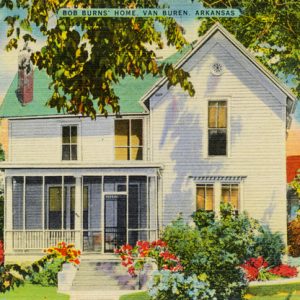
Local citizen Bob Burns became a radio comedian, newspaper columnist, and movie star in the 1930s and 1940s. He told jokes about his mythical relatives in Crawford County and invented a musical instrument called a “bazooka.” The soldiers in World War II nicknamed the army’s shoulder-held rocket launcher after it.
Attractions
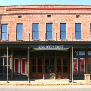
The historic King Opera House on Main Street in Van Buren presents a variety of plays and musicals. Other cultural institutions are the Center for Art and Education and the Alma Performing Arts Center.
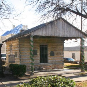
The historic preservation of downtown Van Buren gained Hollywood attention in the filming of the television miniseries The Blue and the Gray and other movies. Built during settlement days, the historic buildings lining the city’s Main Street are listed on the National Register of Historic Places and today are a tourist attraction. Local resident James “Jay” Cotton, writer and director of the movie Sugar Creek, actively promotes county and state motion-picture filming.
In 2002, the city of Fort Smith began an effort to increase its water supply at Lake Fort Smith near Mountainburg. The height of the dam was increased, Lake Fort Smith was merged with Lake Sheppard Springs, and the surface area of the lake was increased to 1,393 acres. The lake project was completed in 2005 and reached water capacity in June 2006. The Arkansas Department of Parks and Tourism relocated, redesigned, and enlarged the original Lake Fort Smith State Park; the new park was dedicated in June 2008.
For additional information:
Anthony, Michael. “Otherwise, You Will Have to Suffer the Consequences: The Racial Cleansing of Catcher, Arkansas.” PhD diss., University of Arkansas, 2023. Online at https://scholarworks.uark.edu/etd/4834/ (accessed October 23, 2023).
Bolton, S. Charles. Arkansas, 1800–1860: Remote and Restless. Fayetteville: University of Arkansas Press, 1998.
———. Territorial Ambition: Land and Society of Arkansas 1800–1840. Fayetteville: University of Arkansas Press, 1993.
Eno, Clara B. History of Crawford County, Arkansas. Van Buren, AR: Press Argus, 1950.
Goodspeed’s Biographical and Memoirs of Northwest Arkansas: Benton, Washington, Carroll, Madison, Crawford, Franklin and Sebastian County. Chicago: Goodspeed Publishing Co., 1889.
Herndon, Dallas T. Centennial History of Arkansas. Vol. 1. Chicago: S. J. Clarke Publishing Company, 1922.
The Heritage. Van Buren, AR: Crawford County Historical Society (1957–).
Hopkins, Eula, and Wanda M. Gray. History of Crawford County, Arkansas. Van Buren, AR: Historical Preservation Association of Crawford County, 2001.
Panning for Nuggets of Old. Alma, AR: Crawford County Genealogical Society (1980–).
Wanda M. Gray
Fort Smith, Arkansas
Revised 2022, David Sesser, Henderson State University




I’m looking for information on a resort from around 1890 to 1920. This was located in Crawford County a few miles north of Alma. Evidently it was a big attraction at the time because I read that there was a railroad to bring customers from Fort Smith. I looked this up during the early 1970s and found information about it. At that time there were still traces of the facility.