


501-918-3025
calsfoundation@cals.org
calsfoundation@cals.org
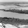
The Arkansas River originates high in the Sawatch Range of the Rocky Mountains near Leadville, Colorado, and it ends in eastern Arkansas at the confluence with the Mississippi River where the town of Napoleon (Desha County) once stood. The river is 1,460 miles long and flows across three states before making its way into Arkansas. The Arkansas River is the second-longest tributary in the Mississippi-Missouri river system, the sixth-longest river in the United States, and the forty-fifth-longest river in the world. Three major cities are situated along the banks of this river that drains nearly 160,500 square miles of land: Wichita, Kansas; Tulsa, Oklahoma; and Little Rock (Pulaski County).
Significance to Arkansas
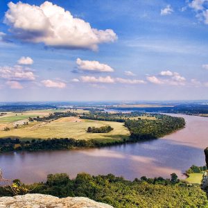
The Arkansas River, flowing east and southeast across the entire width of Arkansas, has had a significant impact on the state’s natural environment (landform features), settlement patterns, and economy. The valley carved by the river is thirty to forty miles wide and extends across the western half of the state. The valley landform feature was designated as one of Arkansas’s six natural regions and has been named the Arkansas Valley (also called the Arkansas River Valley). It separates the Ozark Mountains from the Ouachita Mountains and is made up of a relatively flat landscape with some rolling hills. Several scenic, flat-topped mountains extend into the region, however. Some of the highest points in the state are located in the Arkansas Valley region.
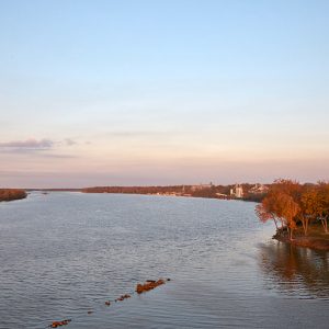
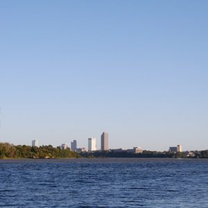
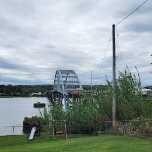
The Arkansas River deposited deep alluvial and agriculturally productive soil along its floodplain and provided numerous settlement sites for cities and towns. It transitions from the Arkansas Valley as it flows near Conway (Faulkner County) on its way through Little Rock into the Arkansas Delta region of eastern Arkansas. The Arkansas River has also had a significant impact on the state’s economy because of its value as a transportation artery and source of water for agricultural irrigation, industrial use, and recreation.
Physical Characteristics
Of all the processes functioning to alter the surface of the earth, none is more important than the work of streams. This was the case with the Mississippi River Valley more than 8,000 years ago when glacial melt water carved channels through the glacial debris. These channels served as the flow-path for the Mississippi River and its tributaries. One of these important tributaries is the Arkansas River. This lengthy river, flowing across the central United States, has three distinct sections: upper, middle, and lower.
The upper portion of the Arkansas River cascades out of the rugged Rocky Mountains and drops 10,000 feet in only 125 miles. This steep mountain torrent has several popular whitewater rafting sites and is noted for its exceptional trout fishing.
The middle portion extends across the Great Plains. After the Arkansas River rushes through the Royal Gorge at Cañon City, Colorado, it widens and flattens dramatically. Its gradient continues to decline as it moves onto the Great Plains west of Pueblo, Colorado, where it becomes a typical Great Plains river with a wide and shallow channel and a meandering flood plain that is subject to significant fluctuations in flow. Major tributaries include the Canadian and Cimarron rivers, each exceeding 600 miles in length.
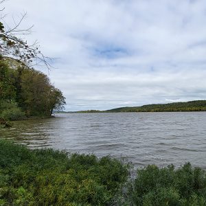
The lower portion of the Arkansas River has many of the characteristics of its master stream, the Mississippi River. It slowly meanders back and forth across an extremely flat landscape. Like the Mississippi, the Arkansas River is a classic example of a stream in equilibrium, in which stream erosion and deposition combine to produce a gradient that allows the stream to carry a sediment load that is in balance with the load that is delivered to the stream by its tributaries.
Historical Significance
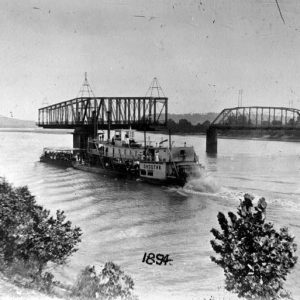
The Arkansas River was known to early French explorers as “Riviere des Ark” or “Riviere d’Ozark” and to early Spanish explorers as “Rio Napestie.” It eventually derived its present-day name from the Quapaw, who lived and hunted along its banks. The name “Arkansas,” which had applied only to the lower reaches of the stream, was carried westward by American traders and trappers.
Hernando de Soto became the first European to explore the river on his journey to the American Southwest in 1541. More than 100 years later, French explorers Louis Jolliet and Jacques Marquette reached the mouth of the Arkansas River. In 1686, Henri de Tonti established Arkansas Post, the first and most significant European settlement in Arkansas. This important historic site is located near the mouth of the Arkansas River in southeastern Arkansas.
The Arkansas River has played an important role in western expansion. Early explorers such as Zebulon Pike followed it westward. The river served as the boundary between the United States and Mexico from 1820 to 1846, and the Santa Fe Trail followed the Arkansas River through much of Kansas.
Economic Significance
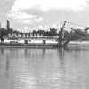
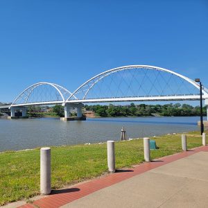
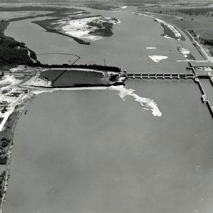
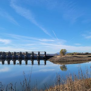
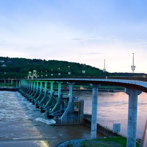
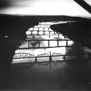
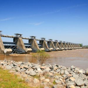
The natural character of the lower portion of the Arkansas River was changed forever with the completion of the McClellan-Kerr Arkansas River Navigation System (MKARNS). The system begins at the Port of Catoosa in Tulsa, Oklahoma, and extends southeast through Oklahoma and Arkansas to the Mississippi River. This navigation system includes eighteen locks and dams that artificially deepened and widened the river to create a commercially navigable body of water. The portion of the river that includes the MKARNS sustains commercial barge traffic and is suitable for recreational use or personal transportation. The reservoirs that were created are connected by several channels and locks that complete the navigation system. The first section of the system, which included the stretch of river that runs through Little Rock, opened in 1968. The first barge reached the Port of Catoosa in Oklahoma in late December 1970.
The completion of the MKARNS provided a variety of benefits for the lower Arkansas River Basin, including water supply, navigation, fish and wildlife conservation, recreation, hydropower generation, and flood control. While all of these are significant, one of the most important for boosting the economy is navigation and the growth and development associated with the five public ports that are located along the river, including ports at Catoosa and Muskogee in Oklahoma and Fort Smith (Sebastian County), Little Rock, and Pine Bluff (Jefferson County) in Arkansas. More than ninety industries with a total of 5,200 employees are located at the five public ports. Since 1985, the MKARNS has created 54,000 jobs, paying $78 million annually with an indirect payroll of well over $1 billion. It is also responsible for $1 billion to $2 billion in trade transportation in Arkansas each year and $100 million to $1 billion in trade transportation in Oklahoma. Several communities along the river have taken advantage of the activity along the river and have created or expanded riverfront development. Good examples are the River Market area and the William J. Clinton Presidential Center and Park in Little Rock.
Many commodities are shipped through the MKARNS each year, including chemical fertilizer, farm products, sand, gravel, rock, iron, steel, petroleum products, wheat, and soybeans. These products and others resulted in a total tonnage shipped of 12,896,887 in 2004. An active inland waterway system such as MKARNS provides competitive shipping rates and helps keep truck and rail transportation costs low. It also provides an ideal transportation environment for new or expanding industries.
For additional information:
Andrus, Edward N. “The River Gave and the River Hath Taken Away: How the Arkansas River Shaped the Course of Arkansas History.” PhD diss., University of Arkansas, 2019. Online at https://scholarworks.uark.edu/etd/3536/ (accessed February 4, 2026).
Bolton, Charles S. 25 Years Later: A History of the McClellan-Kerr Arkansas River Navigation System in Arkansas. Little Rock: U.S. Army Corps of Engineers, Little Rock District, 1995.
Cech, Thomas V. Principles of Water Resources: History, Development, Management, and Policy. 2nd ed. Hoboken, NJ: John Wiley & Sons, Inc., 2005.
Corbet, John. Physical Geography Manual. 6th ed. Dubuque, IA: Kendall/Hunt Publishing Company, 2006.
Foti, Thomas, and Gerald Hansen. Arkansas and the Land. Fayetteville: University of Arkansas Press, 1992.
Hubert B. Stroud
Arkansas State University


Comments
No comments on this entry yet.