
501-918-3025
calsfoundation@cals.org
calsfoundation@cals.org
Interstate 40 (often called “I-40”) is a major U.S. interstate highway that crosses Arkansas from west to east, roughly dividing the state in half. The full route of Interstate 40 crosses the country from California to North Carolina, and the Arkansas segment measures just under 285 miles in length, making I-40 the longest interstate highway in Arkansas. Interstate 40 has played a significant role in the economic development of Arkansas, crossing a dozen counties across the state.
History
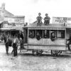
Interstate 40 is one of the original trunk highways that formed the backbone of the U.S. interstate highway system. Along with Interstate 30 and Interstate 55, Interstate 40 was one of only three major Arkansas routes included in the first plan for U.S. interstates, 1955’s so-called yellow book.
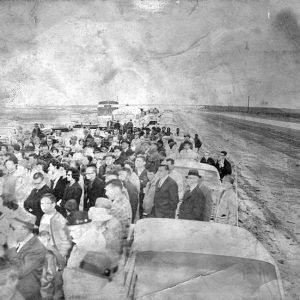
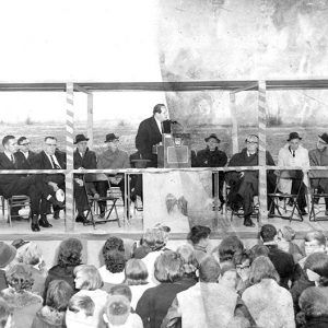
The first stretch of Interstate 40 in Arkansas was built in the 1950s, though this stretch was shared with Interstate 55 in West Memphis (Crittenden County). The first non-shared part of I-40 in Arkansas continued for a few miles west of the I-55 interchange in West Memphis and was completed in the early 1960s. On November 30, 1962, the I-40 and I-30 interchange in North Little Rock (Pulaski County) was officially dedicated, and a few additional miles of paved I-40 access first appeared in the Little Rock (Pulaski County) metropolitan area.
The rest of the 1960s saw rapid construction of Interstate 40 in Arkansas, and by 1970, only about thirty miles of Interstate 40 remained incomplete in the state, with most of the incomplete mileage located between Exit 24 in Mulberry (Crawford County) and Exit 55 in Clarksville (Johnson County). In 1972, the final stretch of the interstate to be completed entirely in Arkansas was opened between Ozark (Franklin County) and Clarksville. The Hernando de Soto Bridge, an Interstate 40–dedicated Mississippi River crossing on the border with Tennessee, connecting that city with West Memphis, opened in August 1973, completing Interstate 40 in Arkansas.
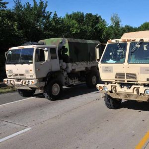
Several expansion projects were undertaken on I-40 in the twenty-first century, such as widening the highway to six lanes (three going each direction) in North Little Rock during the 2000s and from North Little Rock to Conway (Faulkner County) during the 2010s. According to official traffic counts, the busiest stretch of Interstate 40 in Arkansas is between the Interstate 30 and U.S. Highway 67/167 interchanges in North Little Rock.
On average, I-40 has slightly more traffic in eastern Arkansas than in western Arkansas, likely due to the high prevalence of trucks in that corridor. On a few rural stretches between Little Rock and Memphis, it is estimated that well over sixty percent of vehicles on I-40 are large eighteen-wheeler trucks.
In May 2021, the Hernando de Soto Bridge was temporarily closed for repairs after inspection discovered cracks in a steel support beam near Arkansas-Tennessee state line. The repaired bridge reopened later that summer.
Route
Interstate highways are measured from west to east (or south to north) in each U.S. state. Mile 0 for I-40 in Arkansas is at the Arkansas-Oklahoma border near Dora (Crawford County). I-40 connects to I-540 at Van Buren (Crawford County) and to I-49 near Alma (Crawford County). For the next 100 miles, I-40 follows the Arkansas River Valley, though never crossing the Arkansas River. At Exit 35 near Ozark, I-40 intersects Arkansas State Highway 23, known as the “Pig Trail.” I-40 then cuts through Clarksville, crossing U.S. Highway 64 twice in less than ten miles. Near Russellville (Pope County), I-40 passes Arkansas Nuclear One, the only nuclear plant in the state, and continues on toward Morrilton (Conway County).
At Conway, I-40 temporarily turns south toward the Little Rock metro area. To accommodate more city traffic, Interstate 40 has three lanes in each direction between Exit 125 and Exit 157. I-40 does not officially pass through Little Rock, instead edging around Maumelle (Pulaski County) and passing through North Little Rock as the highway straightens back to a west-east path. In North Little Rock, Interstate 40 encounters four major interchanges, meeting Interstate 430, Interstate 30, U.S. Highway 67/167, and Interstate 440/Arkansas State Highway 440.
Leaving the Little Rock metro area, I-40 heads through the flatter, agrarian eastern Arkansas, going by towns such as Lonoke (Lonoke County), Hazen (Prairie County), Brinkley (Monroe County), and Forrest City (St. Francis County). Just east of Forrest City, Interstate 40 gains nearly 100 feet of elevation as it crosses over the hilly formation known as Crowley’s Ridge. A few miles later, the highway loses elevation as it reenters the Delta. Passing through West Memphis, I-40 meets I-55 at two different interchanges. Finally crossing the Mississippi River at the Hernando de Soto Bridge, Interstate 40 in Arkansas comes to an end at the Arkansas-Tennessee border, 284.7 miles after it started.
For additional information:
“Arkansas Road Inventory.” Arkansas Department of Transportation, GIS Database. Online at https://gis.arkansas.gov/product/arkansas-road-inventory/ (accessed August 29, 2023).
Historical Review, Volume Two: Arkansas State Highway Commission and Arkansas State Highway and Transportation Department, 1913–2003. Little Rock: Arkansas State Highway and Transportation Department, 2004.
“Interactive ADT Web App: Average Daily Traffic.” Arkansas Department of Transportation. https://gis.ardot.gov/portal/apps/webappviewer/index.html?id=7c81a313f4174b99b2a01713c328bb7a (accessed August 29, 2023)
McLaren, Christie. Arkansas Highway History and Architecture, 1910–1965. Little Rock: Arkansas Historic Preservation Program, 1999.
McNichol, Dan. The Roads That Built America: The Incredible Story of the U.S. Interstate System. New York: Sterling, 2006.
Patrick Hagge
Arkansas Tech University


Comments
No comments on this entry yet.