


501-918-3025
calsfoundation@cals.org
calsfoundation@cals.org
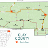
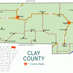
| Region: | Northeast |
|---|---|
| County seats: | Corning, Piggott |
| Established: | March 24, 1873 |
| Parent counties: | Greene, Randolph |
| Population: | 14,552 (2020 Census) |
| Area: | 639.22 square miles (2020 Census) |
| Historical population as per the U.S. Census: | |||||||||
|
1810 |
1820 |
1830 |
1840 |
1850 |
1860 |
1870 |
1880 |
1890 |
1900 |
|---|---|---|---|---|---|---|---|---|---|
|
– |
– |
– |
– |
– |
– |
– |
7,213 |
12,200 |
15,886 |
|
1910 |
1920 |
1930 |
1940 |
1950 |
1960 |
1970 |
1980 |
1990 |
2000 |
|
23,690 |
27,276 |
27,278 |
28,386 |
26,674 |
21,258 |
18,771 |
20,616 |
18,107 |
17,609 |
|
2010 |
2020 |
|
|
|
|
|
|
|
|
|
16,083 |
14,552 |
|
|
|
|
|
|
|
|
| Population Characteristics as per the 2020 U.S. Census: | ||
| White |
13,731 |
94.4% |
|---|---|---|
| African American |
42 |
0.3% |
| American Indian |
44 |
0.3% |
| Asian |
15 |
0.1% |
| Native Hawaiian or Other Pacific Islander |
8 |
0.1% |
| Some Other Race |
97 |
0.7% |
| Two or More Races |
615 |
4.2% |
| Hispanic Origin (may be of any race) |
327 |
2.2% |
| Population Density |
22.8 people per square mile |
|
| Median Household Income (2019) |
$37,233 |
|
| Per Capita Income (2015–2019) |
$22,505 |
|
| Percent of Population below Poverty Line (2019) |
21.1% |
|
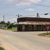
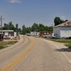
Clay County is a predominantly rural area with small cities and towns located in northeastern Arkansas. Light industry in the area supplements the agriculture-based economy. Hunting, fishing, and boating are the area’s primary recreational offerings.
Clay County lies within the Mississippi River Alluvial Plain. The county is divided into unequal halves by Crowley’s Ridge, following a northeast to southwest direction. In general, soils in the county range from sandy to clay and gravel, and lignite deposits can be found along Crowley’s Ridge. Eastern Clay County has petrified wood, pieces of which can be seen outside the courthouse in Piggott and have even been used to make tombstones. The St. Francis, Cache, Black, and Current rivers flow through the county. Approximately twenty-two percent of the county is upland, with the remainder consisting of bottomland. It is the combination of land and water that greatly shaped the settlement and later development of Clay County.
Pre-European Exploration through European Exploration and Settlement
Native American tribes dispersed in northeast Arkansas included the Quapaw as well as Osage who hunted in the area but whose villages were located in Missouri. Records indicate the presence of an Indian mound located at West 1st and Pine streets within present-day Corning. Artifacts and as many as nine skeletons were removed from the mound by the early twentieth century, when the mound was razed to build a home. The skeletal remains have been lost to time, and the artifacts have most likely passed down to later generations and/or collectors.
Native American artifacts can still be found in northeast Arkansas. These include arrowheads, spear points, bird points, awls, celts, boatstones, plummetts, and pottery. An extensive artifact collection can be viewed at the Matilda and Karl Pfeiffer Museum and Study Center in Piggott.
European settlement in the Clay County area began in the early 1800s with Pierre LeMieux, a Frenchman who settled east of the Black River. His settlement, Petit Baril, was called Peach Orchard by Americans and was near the present-day town of Peach Orchard.
Louisiana Purchase through Early Statehood
By the time Congress created Arkansas Territory on March 2, 1819, the Clay County area was already growing. In addition to French settlers near present-day Peach Orchard, veterans of the War of 1812 who were given land grants in Arkansas began to settle in the area. Although the present-day town of St. Francis was formally begun in 1882–1883 with the railroad construction, settlement of the area began much earlier, and a post road was established to deliver mail weekly between St. Francis and Helena (Phillips County) from 1816 to 1819.
Overland roads were crude, and travel by water, usually in keelboats and flatboats, was used where practical. Steamboat travel was faster and more comfortable, and steamboats could carry more freight. Steamboats traveled both the St. Francis and the Black rivers in Clay County. In 1836, the Gladiator completed a six-day trip from New Orleans to the town of St. Francis on the St. Francis River. In the 1840s, Abraham Seitz established a home and ferry on the St. Francis River above the town of St. Francis, providing a crossing for settlers traveling west or east. It was another thirty to forty years before railroads replaced water transport as the preferred method of moving goods and people.
Congress passed the Swamp Land Acts of 1849 and 1850. Public swampland was transferred to Arkansas, and then the land was sold cheaply. This, coupled with state and federal programs, drainage projects, and efforts to increase flood protection, eventually led to huge wetland losses in the Delta region, though it facilitated crop production and the raising of livestock.
Civil War through Reconstruction
Skirmishes were fought at Scatterville (near present-day Rector) on August 3, 1862, and July 28, 1864. The Skirmish at Chalk Bluff was fought May 1–2, 1863. Guerrilla forces proved a hardship for settlers during wartime. The trading post near Peach Orchard was raided often, and women and children were sent into hiding near the Cache River with what they could carry. Settlers hid livestock, foodstuffs, and valuables wherever they could, and even then much was lost to raiding parties.
During Reconstruction, Clayton County was created by the Arkansas legislature on March 24, 1873, taking portions of Greene and Randolph counties. The new county was named in honor of state senator John M. Clayton. County citizens were displeased that the namesake of Clayton County was the brother of Powell Clayton, the first Republican Reconstruction governor, who had declared martial law in the area (then part of Greene County), due to violence targeted toward freedmen and Southern Unionists, and who did not allow the county to participate in the fall elections of 1868. Following the successful bill submitted by attorney E. Foster Brown, the Arkansas General Assembly of 1875 changed the name of Clayton County to Clay County in honor of Secretary of State Henry Clay.
Post Reconstruction through the Gilded Age
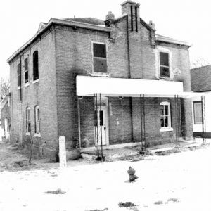
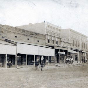
The location of the county seat was highly debated, alternating between Corning and Boydsville several times between 1873 and 1881. Finally legislation was passed by the state legislature on February 23, 1881, to divide the county into two judicial districts. Corning served as the county seat to the western district, while Boydsville served the eastern district. In July 1888, the court was petitioned to move the eastern district county seat, with Piggott being chosen in 1891. In January 1893, a fire destroyed the court building and the county records at Piggott.
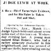
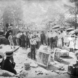
The first issue of the Corning Express, the first newspaper published in Clay County, was printed on May 6, 1875. It generally supported the Ku Klux Klan (KKK), which terrorized the western district of Clay County during the late 1870s and early 1880s. The main klavern was near Palatka and led by Luther Bent Taylor. Taylor and KKK member William Mulhollen from the Corning area were indicted in 1881 for the murder of Klansman Riley Black. Taylor was later hanged at the gallows in the Goose Pasture in 1882.
Railroad expansion developed rapidly in the years following the Civil War. The Missouri Pacific was laid through the western portion of Clay County. The St. Louis Southwestern Railroad, or Cotton Belt, entered northeastern Clay County and extended to the southwest, eventually entering Texas.
Railroads did more than provide a new avenue for export and import of raw and finished products. They also brought more settlers into the area. In 1883, Dr. James Rouse came by railroad, relocating south of Piggott, and in 1889 he established the Rouse Springs Sanitarium, housed in an addition to his home that could accommodate up to fifty patients. A world traveler, soldier, physician, and knight (knighted by Queen Victoria), Rouse grew medicinal herbs and plants and served as both a local pharmacist and a surgeon for the railroad. Rouse believed in the curative powers of the local water, which contained “silica, iron, magnesium, iodine, potassium, sodium, and manganese,” according to studies out of Washington University in St. Louis, Missouri.
Crop failures due to flooding or drought, low crop prices, and the lack of reputable lending businesses placed farmers in a depression. Citizens had to rely on merchants and wealthier locals for loans in the absence of lending facilities that could make loans against real estate. Adding to their troubles, in 1871 a population explosion of squirrels in the Scatterville area threatened row crops. Men were hired, given as much ammunition as needed, and directed to shoot as many squirrels as they could to protect area crops.
The southern boundary between Clay and Greene counties was changed in 1895 by an act of the Arkansas General Assembly, adding a small area of land to southeastern Clay County.
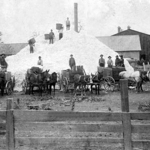
The sale of freshwater pearls found in 1897 by a survey party attracted attention to the area. Pearls and button blanks created from mussel shells fished from area rivers provided an alternative income until stocks were depleted. From 1895 to 1898, the pearling industry was concentrated upon the Black River, though the nearby St. Francis River also provided pearls.
The county was the site of at least three extrajudicial killings in the late nineteenth century, although none of the events appear to be racially motivated. Elias Hensen was killed for horse theft in 1879, William Herrig was killed for murder in 1887, and Bud Brake was killed in 1899 for complicity in murder.
Early Twentieth Century
At the start of the twentieth century, the timber industry reached its zenith. Drainage of lowlands brought about the development of large farming operations. Property values shifted during this time. Timber became less desirable than cleared, drained, tillable land. Arriving by railroad in 1909, Paul M. Pfeiffer, former resident of St. Louis, Missouri, acquired over 13,000 acres and began draining the lowlands. Eventually, Pfeiffer became the largest landowner in Clay County and one of its most public-minded citizens. Pfeiffer’s daughter Pauline married writer Ernest Hemingway, who wrote portions of A Farewell to Arms at the Pfeiffer mansion in Piggott. In 1932, the town hosted the world premier of the movie based on the novel.
In 1912, a county home, or poorhouse, was established at Piggott so that the county could “relieve its own poor” as ordered by the U.S. government. It served the area from 1912 to 1954. The sites of the poorhouse and accompanying cemetery are on the National Register of Historic Places. In 1914, C. M. Harris of Piggott organized the first Scout troop west of the Mississippi River.
By the mid-1900s, clearing and leveling of land became key to the growing expansion of rice production. Drainage of lowlands for crop production, coupled with the discovery of rice’s success even in heavy soils, created a boom in northeast Arkansas. But despite the high prices during World War I that fostered the continued growth of the rice industry, the 1920s and 1930s saw an economic downturn for agricultural areas, including Clay County. It was not until the late 1930s and 1940s that the economic conditions improved. During World War II, rice production was limited only by the “available land and machinery.” Rice continues to be a major crop in Clay County today.
In 1938, the U.S. Fish and Wildlife Service built a fish hatchery in Corning that operated until 1983. The Arkansas Game and Fish Commission (AGFC) then took control and renamed it the William H. Donham State Fish Hatchery. The hatchery primarily produces largemouth bass, bluegill, sunfish, white and black crappie, and channel catfish.
Although towns in the area had developed light and power stations in the past, Clay County Electric was first energized on October 30, 1939.
World War II through the Faubus Era
The men and women of Clay County served their country abroad and at home. Clay County participated in the sale of war bonds for World War II. Piggott raised enough money through bond sales to purchase a new P-47 Thunderbolt fighter plane, which was given to the Fourth Fighter Group at Debden Airfield in England. With the words “The town of Piggott, Ark.” painted on its side, the Thunderbolt served with others as bomber escort on bombing runs into enemy territory over Europe.
In 1956, Piggott became the setting for the film A Face in the Crowd, starring Patricia Neal and Andy Griffith. In 1957, AGFC began acquiring land for what is known today as the Dave Donaldson/Black River Wildlife Management Area near Corning.
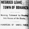
As the nation watched, Governor Orval Faubus resisted the desegregation of public schools in Little Rock (Pulaski County) in September 1957. Clay County, however, was practically an all-white county at the time (many of its towns have been regarded as “sundown towns”), and local schools did not experience integration as in other areas of the state. Even as of the 2020 census, Clay County is approximately ninety-five percent white, with the largest minority being people of Hispanic origin—at less than three percent. With increased agricultural mechanization, the population of the county has fallen from a high of 28, 386 in 1940 to 14,552 in 2020.
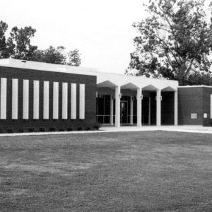
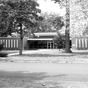
After a fire destroyed the Western District Courthouse in Corning in 1963, the county constructed new courthouses in both Corning and Piggott in 1966–1967. Both buildings are on the National Register of Historic Places.
Modern Era
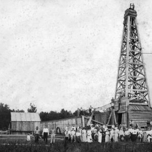
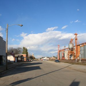
Agriculture remains vital to the local economy. Over seventy-five percent of the county’s land is devoted to farming. Crops grown within the county include rice, cotton, wheat, soybeans, and sorghum. Light industry supplements the local economy. Light industry in the county includes lumber production, petroleum production, freight transportation, metal works (parts production), furniture fixtures, lumber production, nursery and garden centers, sale of farm machinery and seed, and healthcare services in nursing homes, hospitals, and medical and dental clinics.
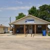
Travel within the county has greatly improved since the rough blazed trails of the 1800s with the establishment of modern U.S. and state highways. Clay County is crossed by the Crowley’s Ridge Parkway National Scenic Byway. Much of the area remains farmland and forest. Corning, Piggott, and Rector are actively participating with the Economic Coalition of Northeast Arkansas in an effort to attract new industries to the area, an effort that includes renovating historical buildings in their communities for business purposes and beautification projects.
Attractions
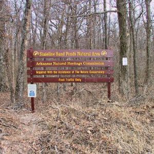
Chalk Bluff hosts an annual Civil War Weekend encampment each June, featuring a reenactment of the Skirmish at Chalk Bluff. The Dave Donaldson/Black River Wildlife Management Area, located south of Corning, provides fishing and hunting opportunities. The Stateline Sand Ponds Natural Area, owned by the Arkansas Natural Heritage Commission and protected by the Nature Conservancy, is located northwest of Corning. Arkansas State University’s Hemingway-Pfeiffer Museum and Educational Center is located on West Cherry Street in Piggott. The Matilda and Karl Pfeiffer Museum is also located in Piggott and hosts a large collection of Native American artifacts found in Clay County; the museum also has over 1,400 mineral specimens and geodes.
Yearly attractions include Fourth of July picnics in Corning and Piggott and a Labor Day picnic in Rector, just to name a few. Rector has a museum housing articles donated by the community; initially located in the town’s library, it was moved to a historic building on Main Street in 2014. The county was also the site of the first two crop circles reported in the state.
For additional information:
Goodspeed. Biographical and Historical Memoirs of Clay County, Arkansas. Chicago: Goodspeed Publishing Co., 1889.
Laymon, Sherry. Pfeiffer Country: The Tenant Farms and Business Activities of Paul Pfeiffer in Clay County, Arkansas, 1902–1954. Little Rock: Butler Center Books, 2008.
Matilda & Karl Pfeiffer Museum & Study Center. Piggott, Arkansas. Online at http://www.pfeifferfoundation.com (accessed September 8, 2022).
Memoirs of Early Days in Clay County, Arkansas. Edited by Laud M. Payne. N.p.: 1972.
Webb, Robert T., Bruce Brown, and Patsy Truscott, compilers. History and Traditions of Clay County. Piggott, AR: Webb, Truscott, and Brown, 1933.
Tracy L. Johnson
Alma, Arkansas
Revised 2022, David Sesser, Henderson State University


Abraham Seitz’s daughter married Timothy Dalton, and they ran the ferry at Chalk Bluff, Arkansas. I have the ferry book listing people who crossed and what they paid.