
501-918-3025
calsfoundation@cals.org
calsfoundation@cals.org
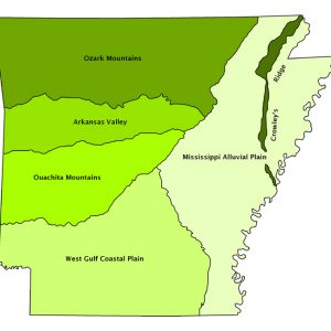
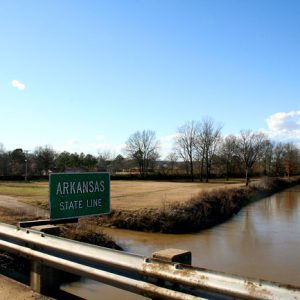
Crowley’s Ridge is a small yet distinctive natural region. It ranges in width from one to twelve miles and extends from southern Missouri across eastern Arkansas to Helena-West Helena (Phillips County). It is made up of a continuous series of rolling hills except for a slight break at Marianna (Lee County); this break or gap was created by the L’Anguille River as it flowed across the ridge. The ridge received its name from Benjamin Crowley, the first white settler to reach the area near present-day Paragould (Greene County), sometime around 1820. Also of note is that the Civil War Skirmish at Chalk Bluff was fought on Crowley’s Ridge on May 1–2, 1863. The Chalk Bluff Natural Area in Clay County commemorates this event.
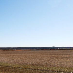
Crowley’s Ridge is an unusual geological formation that rises above the Alluvial Plain of the Mississippi Embayment (Mississippi Alluvial Plain, or Delta). The ridge contrasts sharply with the surrounding flat table land of the Delta. In terms of formation, the ridge is generally thought to have once been an island between the Mississippi River and the Ohio River. It became a long and narrow hilly ridge after the rivers changed course millions of years ago. Prior to the change in course, the Mississippi River flowed along the west side of what is now Crowley’s Ridge, with the Ohio River meandering along the east side. The work of these major rivers and their subsequent shifting in course resulted in the formation of an erosional remnant that is now Crowley’s Ridge.
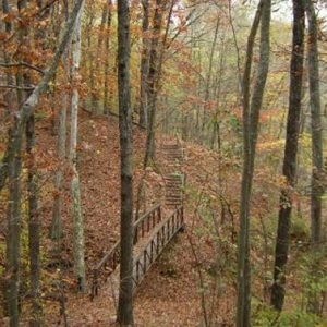
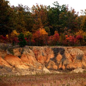
Crowley’s Ridge, completely surrounded by the Mississippi Alluvial Plain, is clearly visible because it rises some 250 feet above a relatively flat landscape. The ridge is capped by a deep layer of wind-deposited (loessial) soils, a fine-grained soil created millions of years ago as glaciers moved across the continent. Extensive areas, including the Mississippi Alluvial Plain and Crowley’s Ridge, were covered by windblown soil. Rivers and streams that continued to meander across the plain washed away the loessial material. On Crowley’s Ridge, however, the loess continued to collect, up to fifty feet in depth in some locations. Since loess is very easily eroded, steep slopes and deep valleys characterize much of Crowley’s Ridge.
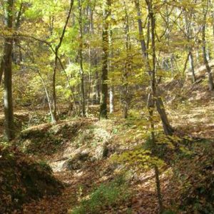
One of the unique features of Crowley’s Ridge is its natural vegetation. Interestingly, many of the trees that make up the forest on Crowley’s Ridge are similar to those found in the western Appalachian Mountains. The ridge is covered with a lush mixed forest including oak and hickory and uncommon hardwood trees such as American beech, sugar maple, and the tuliptree or yellow poplar.
Crowley’s Ridge also has extensive areas of pasture. Although the soil is relatively fertile, row crops such as soybeans and wheat are limited almost entirely to small floodplains along and near streams that flow out of the region onto the Alluvial Plain. This is due to the highly erosive nature of the wind-blown soils of Crowley’s Ridge; these soils need a protective vegetative cover of some type (such as pasture grasses or forests) to combat severe soil erosion.
This region is the location of some of eastern Arkansas’s largest cities. Important ridge cities include Paragould, Wynne (Cross County), Forrest City (St. Francis County), Helena-West Helena, and Jonesboro (Craighead County). Jonesboro (the fifth-largest city in the state) is sometimes referred to as the hub of Crowley’s Ridge.
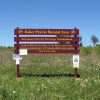
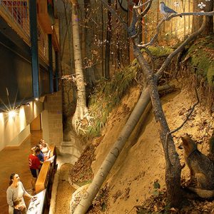
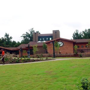
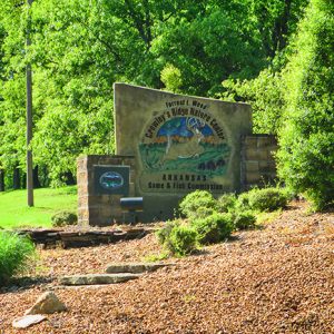
Crowley’s Ridge is a popular tourist destination, with state parks including Crowley’s Ridge State Park at Walcott (Greene County), which occupies the former homestead and the grave site of Benjamin Crowley; Village Creek State Park near Wynne; Lake Poinsett State Park; and Lake Frierson State Park. These and other parks, including the Forrest L. Wood Crowley’s Ridge Nature Center in Jonesboro, allow visitors to experience the distinctive character of this unique natural region.
For additional information:
Arkansas Department of Planning. Arkansas Natural Area Planning. Little Rock: State of Arkansas, 1974.
Deadrick, Michael R. “A Survey of Civil War Combat along Crowley’s Ridge.” Arkansas Historical Quarterly 80 (Autumn 2021): 353–374.
Morris, Jodi. “On High Ground: A Natural History of Crowley’s Ridge—Conclusion.” Craighead County Historical Quarterly 45 (January 2007): 20–22.
———. “On High Ground: A Natural History of Crowley’s Ridge—Part 1.” Craighead County Historical Quarterly 44 (October 2006): 26–28.
Stroud, Hubert B., and Gerald T. Hanson. Arkansas Geography: The Physical Landscape and the Historical-Cultural Setting. Little Rock: Rose Publishing Company, 1981.
Hubert B. Stroud
Arkansas State University


Shark teeth can be found in some creeks and around lakes such as Austelle and Lake Dunn located in Village Creek State Park. The lakes were dug out during construction of these lakes and some teeth and other fossils were found, especially in constructing the dams. The deep soil preserved all sorts of fossils going back millions of years. After a rain you can sometimes find them along the banks of these dams, the soil washed away exposing them.