


501-918-3025
calsfoundation@cals.org
calsfoundation@cals.org
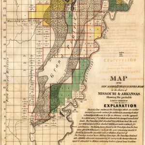
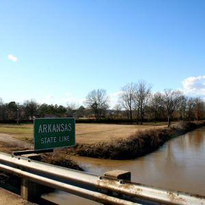
The St. Francis River originates in the northeast corner of Iron County, Missouri, and flows for twenty-five miles through the St. Francois Mountains, where it is a clear, fast-flowing whitewater stream until it reaches the Mississippi Alluvial Plain north of Poplar Bluff, Missouri, at which point the river becomes a sluggish, silt-laden stream. The river there turns south and travels 207 miles, forming the boundary between the Missouri bootheel and northeastern Arkansas and then coursing between Crowley’s Ridge and the Mississippi River. The mouth of the St. Francis where it flows into the Mississippi is in the St. Francis National Forest just north of Helena-West Helena (Phillips County).
The St. Francis River valley has been the site of human habitation since approximately 10,000 BC, as evidenced by the numerous Dalton Period sites that have been excavated in the river basin. However, the most famous Native American settlement along the river is probably a Mississippian Period village settled between AD 1000 and 1250. This village site, complete with an Indian mound, entered the historical record when the expedition of Hernando de Soto encountered it in 1541, and what remains is preserved as the Parkin Historic Site at the Parkin Archeological State Park in Cross County. Archeologist Clarence Bloomfield Moore found other Indian mounds along the St. Francis River in St. Francis County. The next Europeans to visit Arkansas, Father Jacques Marquette and Louis Joliet, explored part of the lower St. Francis River and likely gave the river its name, though it is uncertain which saint served as the namesake, perhaps either St. Francis of Assisi or St. Francois Xavier. From the 1780s to the 1820s, the St. Francis River basin was again the site of Native American settlement as Cherokee moved to the area and established homes.
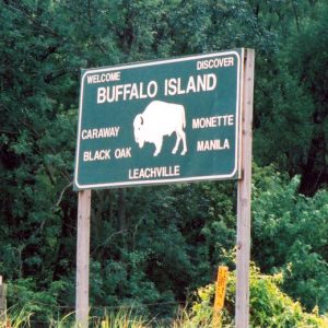
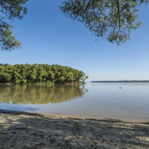
Part of the St. Francis River between Lake City (Craighead County) and Marked Tree (Poinsett County) is known as St. Francis Lake or the “Sunken Lands.” Here, the river dropped six to eight feet during the New Madrid Earthquakes of 1811–1812, causing the river to “drown” and form a large, swampy overflow area. The Arkansas Game and Fish Commission now conserves more than 27,000 acres of this overflow area as the St. Francis Sunken Lands Wildlife Management Area.
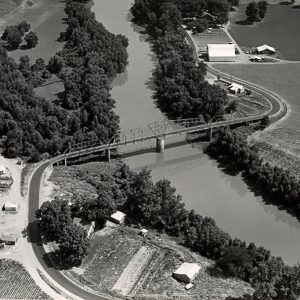
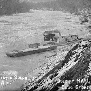
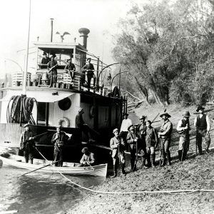
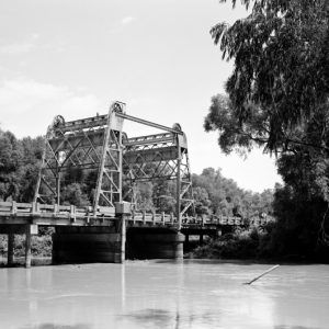
The St. Francis River was not navigable in its natural state, having numerous snags and rafts. In 1836 and 1837, W. Bowling Buion surveyed the river under the auspices of the federal government with an eye toward improving navigation, but nothing came of it. Only after the Civil War did the U.S. Congress begin funding the clearing of the river. Numerous clearing and dredging operations made the St. Francis navigable from its mouth up to Wappapello, Missouri. Because the swampy “Sunken Lands” impeded progress on railroad construction until the land began to be drained in the late 1890s and early 1900s, steamboats continued to operate on the river until well into the early twentieth century.
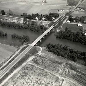
The St. Francis Levee District was created in 1893 and began constructing levees and drainage canals to control flooding. These measures were strengthened and increased after the catastrophic Flood of 1927 and the passage of the Flood Control Act of 1928. These measures have greatly affected the natural course of the river and have included a number of diversion ditches that run somewhat parallel to the river along its course from southeastern Craighead County down through Lee County, thus providing an outlet for excess water in time of flood.
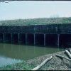
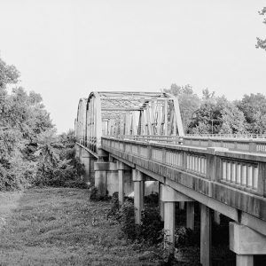
The U.S. Army Corps of Engineers installed the world’s largest siphons on the St. Francis at Marked Tree in 1939 to help with flood control. The Marked Tree Siphons are listed on the National Register of Historic Places. The corps built the W. G. Huxtable Pumping Plant southeast of Marianna (Lee County) in 1977 to prevent Mississippi River floodwater from moving into the St. Francis. It also removes water held back by the St. Francis River levee system. It is considered the world’s largest pumping plant of its kind.
For additional information:
Myers, Robert A. “Cherokee Pioneers in Arkansas: The St. Francis Years, 1785–1813.” Arkansas Historical Quarterly 56 (Summer 1997): 127–157.
“St. Francis River.” Arkansas Department of Parks and Tourism. https://www.arkansas.com/trumann/outdoors-nature/st-francis-river (accessed February 22, 2022).
Wintory, Blake J. “Environmental and Social Change in Lee County, Arkansas, and the St. Francis River Basin, 1865–1905.” PhD diss., University of Arkansas, 2005.
Jodi Morris
National Park Service
Staff of the CALS Encyclopedia of Arkansas


Comments
No comments on this entry yet.