Entry Type: Thing

Turney Wood Products, Inc.

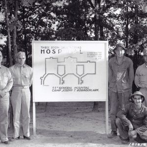
In 1946, Claude H. Turney opened Turney Wood Products, Inc. (TWP) in Harrison (Boone County). It began operation in a garage, building furniture for the First Church of the Nazarene in Harrison. For more than twenty years, TWP used hardwood lumber—mainly red and white oak—from the surrounding Ozark Mountain forests to manufacture laminated church furniture, including pews, altars, pulpits, and lecterns. According to a 1965 company newsletter, “Operating in every timber activity from the forest to the finished product…this company has become the largest exclusive church furniture manufacturer in the western hemisphere.” The company closed in 1968. In the mid-1950s, TWP employed more than 100 workers. The company eventually grew to employ more than 300, with three plants for different phases …

Turpentine Creek Wildlife Refuge

Turpentine Creek Wildlife Refuge near Eureka Springs (Carroll County) is a 501(c)(3) nonprofit organization providing lifetime homes for abandoned, abused, and neglected big cats and other endangered wildlife. With over 450 acres and more than 120 exotic cats, the refuge is one of the largest big cat sanctuaries in North America licensed by the U.S. Department of Agriculture (USDA). The sanctuary is rated a “Must See” attraction by the Arkansas Department of Parks and Tourism and is one of the most popular destinations in the Eureka Springs area. Don Jackson, a former employee of the Dallas Zoo, along with his wife, Hilda, and their daughter, Tanya Smith, founded the refuge in 1992. After a friend acquired a lion cub and realized …

Tuskegee Airmen, The [Movie]

The Tuskegee Airmen was a 1995 movie dramatization of the wartime actions of the Tuskegee Airmen, a group of African American military pilots and air support crew who fought in World War II. They were the first Black flying squadron, as well as the first such squadron to deploy overseas. While the film had a brief theatrical release, it was originally made for HBO and was intended for cable television. Location shooting for the movie took place at Fort Chaffee, right outside of Fort Smith (Sebastian County). In addition, the Fort Smith Frisco Railroad Station was also utilized in filming. The barracks at Fort Chaffee had been used previously in the 1988 wartime film Biloxi Blues. Arkansas actress Natalie Canerday …

Twelve Oaks

The Twelve Oaks estate, located in a rural setting just south of Harrison (Boone County), is listed on the National Register of Historic Places, which notes its local significance for its Craftsman- and Colonial Revival–style architecture. The house is one of the best examples of a Craftsman/Colonial Revival estate—and an unusually large example of the style—in the Harrison area. With the rise of the railroad industry in Harrison in the early twentieth century, a building boom hit the city. Among those who had worked on many high-profile buildings in Harrison was J. W. Bass, a steel contractor based in Detroit, Michigan. His J. W. Bass Erecting Company and Atlas Iron & Steel Company had offices in Detroit; Chicago, Illinois; and …

Two Bayou Methodist Church

The Two Bayou Methodist Church and Cemetery are located near Camden (Ouachita County). The oldest marked graves in the cemetery date to 1846, and the church was constructed around 1875. The site was added to the National Register of Historic Places on July 9, 1998. The first church services at the location were held under brush arbors well before the Civil War. A log building offered worshippers a more permanent structure but was destroyed during the war. Another log building was used by the congregation until the construction of the current building by J. T. Mendenhall in 1875. The congregation was served by various circuits over the decades. Research indicates that services held prior to 1848 were likely part of …

Two Rivers Museum

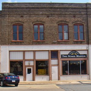
The Two Rivers Museum, located on the corner of Constitution Avenue (Highway 71) and Main Street in Ashdown (Little River County), opened in 2005. The museum, which was created by the nonprofit Little River County Historical Society has a mission of preserving the history of the local community. The museum gets its name from the two major rivers that flow through Little River County: the Red River and Little River. The Two Rivers Museum is located in the Bishop building in the Ashdown Commercial Historic District. The building is a renovated hundred-year-old storefront that was once a pharmacy and, more recently, an antique store. The Bishop building, built in 1908, is a two-story brick structure with a flat roof and …

Typhoid

Typhoid is among the earliest diseases reported in Arkansas and was a significant public health problem up through the early twentieth century. Though it became less common in the modern era, typhoid had a significant impact upon state health in times and places where poor sanitation was the norm. Typhoid, like cholera, is transmitted through the ingestion of food or water that has been contaminated with the feces of an infected individual; the spread of the disease is therefore greatly linked with a lack of proper sanitation. Victims experience high fevers, sweating, inflammation of the gastrointestinal tract, and diarrhea. In most cases, the disease is not fatal, though fevers can last well over a month. Some individuals may become asymptomatic …

Tyronza Water Tower

The Tyronza Water Tower, located northeast of the junction of Main and Oliver streets in Tyronza (Poinsett County), was constructed in 1935 and installed with assistance from the Public Works Administration (PWA), a New Deal public relief agency. It was listed on the National Register of Historic Places on September 20, 2007. As the United States struggled with the Depression of the 1930s, President Franklin D. Roosevelt’s administration enacted the National Industrial Recovery Act (NIRA) to ease the effects of businesses closing. The act created an organization called the Federal Emergency Administration of Public Works (or Public Works Administration), which was established on June 16, 1933, to help finance federal construction projects and create jobs. The farming community of Tyronza …

Tyson Family Commercial Building

Located in downtown Camden (Ouachita County), the Tyson Family Commercial Building is an example of early-twentieth-century commercial architecture that continues to be utilized for that purpose in the twenty-first century. Constructed around 1923, the building was added to the National Register of Historic Places on November 21, 1994. Founded on the Ouachita River in the early 1800s, Camden became an important regional commercial hub. Crops grown in the surrounding area were taken to the city for shipment downriver. In 1873, the Iron Mountain Railroad constructed a line to Camden, increasing economic activities. By the early twentieth century, the town served as a major industrial and agricultural center in southern Arkansas, with numerous businesses operating in the area. One of the …

Tyson Foods, Inc.

Founded in 1935 in Springdale (Washington and Benton counties), Tyson Foods has emerged as one of Arkansas’s most prominent companies, employing more than 100,000 workers. By the end of the twentieth century, it had become one of the largest meat-processing companies in the world, with millions of customers in the United States and in more than eighty countries worldwide. Forbes magazine currently lists it as one of America’s 100 largest companies, and it continues to play a pivotal role in the state’s economy. Following the collapse of the fruit industry in northwest Arkansas in the late 1920s, many farmers turned to raising poultry as a source of income. The connection of Highway 71 to Midwest markets such as Kansas City, …

U.S. Army Corps of Engineers, Little Rock District

Although technically a part of the U.S. Army, the U.S. Army Corps of Engineers (USACE) has played a vital role in the development of civilian transportation infrastructure and water resources since Congress passed the first river and harbors bill in 1824 and charged the corps with maintaining navigational channels. Work on the Ohio, Missouri, and Mississippi rivers received first priority, but as settlers moved farther west, attention soon focused on other navigable streams. Until 1916, Congress authorized only navigational improvements on rivers. Flood control only entered the corps’ mandate indirectly, as levees were considered navigational aids. However, as agricultural and transportation needs grew and the national economic importance of the lower Mississippi River Valley became evident, politicians found it easier …

U.S. Highway 62

aka: Highway 62
U.S. Highway 62 crosses the northern counties of Arkansas. It passes through eleven counties, from Washington County in the west to Clay County in the east. Some portions of Highway 62 were proposed by William Hope “Coin” Harvey, who wanted to facilitate automobile traffic to his tourist destination, Monte Ne (Benton County). Route U.S. Highway 62 begins in El Paso, Texas, and runs through ten states to Niagara Falls, New York. It is the only east-west highway in the United States that connects Mexico to Canada. The entire length of the highway is 2,245 miles, of which 329.9 miles cross the state of Arkansas. U.S. Highway 62 enters Arkansas from Oklahoma as a two-lane highway. It runs through Summers (Washington …

U.S. Highway 63

U.S. Highway 63 enters Arkansas at Junction City (Union County) and leaves Arkansas at Mammoth Spring (Fulton County). Between these two cities, it also serves Pine Bluff (Jefferson County), West Memphis (Crittenden County), and Jonesboro (Craighead County). Much of the highway is part of the interstate system, including sections of I-530, I-40, I-55, and I-555. Route U.S. Highway 63 extends from Ruston, Louisiana, to Benoit, Wisconsin, a path of 1,286 miles. In Arkansas, it travels through fourteen counties, covering a little more than 400 miles. The highway enters Arkansas in Junction City, a municipality that exists in both Arkansas and Louisiana, making it the southernmost community in Arkansas. The four-lane highway runs concurrently with U.S. Highway 167 from its origin …

U.S. Highway 64

aka: Highway 64
aka: U.S. 64
U.S. Highway 64 crosses the state of Arkansas, connecting Fort Smith (Sebastian County) to West Memphis (Crittenden County). It passes through eleven counties of the state. In western Arkansas, it travels the Arkansas River Valley and parallels Interstate 40; in eastern Arkansas, it transverses the Mississippi River Delta significantly north of the Arkansas River and the interstate highway. Route Highway 64 runs 2,326 miles from Arizona to North Carolina, passing through six states, including Arkansas. Its route covers 246 miles in Arkansas. The highway enters Arkansas as a four-lane bridge over the Arkansas River. It rises over the Harry E. Kelley River Park, Belle Point, and the Fort Smith National Historic Site and continues through Fort Smith as Garrison Avenue. …

U.S. Highway 65

aka: Highway 65
aka: U.S. 65
U.S. Highway 65 is a major north-south corridor in Arkansas. Passing through eleven counties, the highway includes Pine Bluff (Jefferson County), Little Rock (Pulaski County), Conway (Faulkner County), and Harrison (Boone County) among the cities it serves. Route U.S. Highway 65 begins in Clayton, Louisiana, and crosses Arkansas, Missouri, and Iowa before ending in Minnesota. The entire highway is 966 miles, of which 313 miles are in Arkansas. The highway enters Arkansas as a two-lane road in Chicot County not far from the Mississippi River. It runs parallel to the railroad tracks through Eudora (Chicot County), Chicot (Chicot County), and Lake Village (Chicot County), where it widens to four lanes. The highway continues north to McGehee (Desha County) before cutting …

U.S. Highway 67

aka: Highway 67
U.S. Highway 67 stretches from the southwestern corner of Arkansas in Texarkana (Miller County) to the northeastern corner of the state north of Corning (Clay County). It passes through thirteen counties, generally following the course of the military road known as the Southwest Trail, which was established across Arkansas during territorial times. In 2009, the Arkansas General Assembly designated a portion of the road as the Rock ’n’ Roll Highway—a reference to the musical heritage of the road. Route U.S. Highway 67 extends 1,560 miles, beginning in Presidio, Texas, at the border with Mexico, and ending near Sabula, Iowa. The Arkansas portion of the highway is roughly 280 miles. The highway enters Arkansas in the city of Texarkana as a …

U.S. Highway 70

U.S. Highway 70 runs from southwestern Arkansas through Hot Springs (Garland County) and Little Rock (Pulaski County) to West Memphis (Crittenden County). It passes through thirteen counties in Arkansas. Until the completion of Interstate 40, it was the main highway linking Little Rock to Memphis, Tennessee, and it continues to be the principal route bringing travelers to Hot Springs. Route U.S. Highway 70 begins in Globe, Arizona—originally a mining settlement—and runs east 2,385 miles to Atlantic, North Carolina—an unincorporated community on the East Coast. About 280 of those highway miles are in Arkansas. The highway enters Arkansas about eight miles west of De Queen (Sevier County), where it is called the Collin Raye Highway. In De Queen, it runs through …

U.S. Highway 71

In Arkansas, U.S. Highway 71 stretches from the southwestern border of the state south of Kiblah (Miller County) to the northwestern corner north of Bella Vista (Benton County). It passes through nine counties in Arkansas, generally following an alignment of the Ozark Trail. Route U.S. Highway 71 extends 1,532 miles beginning near Krotz Springs, Louisiana, and passes through Louisiana, Texas, Arkansas, Missouri, Iowa, and Minnesota before ending at the U.S.-Canadian border north of Bemidji, Minnesota. The Arkansas portion is approximately 300 miles. The highway enters Arkansas south of Kiblah as a two-lane highway heading north, passing through Doddridge (Miller County) and Fouke (Miller County) before reaching Texarkana (Miller County). At Texarkana, Highway 71 has a short concurrence with U.S. Highway …

U.S. Marshals Museum

The U.S. Marshals Service, the nation’s oldest law enforcement agency, was established in 1789 by President George Washington when he signed the Judiciary Act into law. A Smithsonian exhibit about the U.S. Marshals Service, “America’s Traveling Star,” was displayed at locations throughout the United States and then housed in Laramie, Wyoming, from 1991 until 2002. After the museum in Laramie closed, the Marshals Service began an active search for a new museum site. Several cities indicated interest in the new museum, including Fort Smith (Sebastian County). Community leaders in Fort Smith felt that the city was a logical choice for the museum because of Fort Smith’s western heritage, the presence of Judge Isaac Parker’s court, the work of early intrepid …

U.S. Marshals Service (USMS)

The U.S. Marshals Service (USMS) is the oldest federal law enforcement agency in the nation. Divided into ninety-four districts, the agency’s structure aligns with that of the United States district courts. Arkansas has two districts—the Western District headquartered in Fort Smith (Sebastian County) and the Eastern District headquartered in Little Rock (Pulaski County). During the nineteenth century, fugitives often fled to Indian Territory (present-day Oklahoma) in an effort to escape prosecution. Apprehending these criminals was a dangerous assignment for the U.S. deputy marshals—consequently, there are more deputy and special deputy marshals buried in the Fort Smith region than anywhere else in the nation. On September 24, 1789, George Washington signed Senate Bill 1, which included the Judiciary Act, of which …

U.S. Senator Hattie Caraway Gravesite

The first woman to be elected to the U.S. Senate, the first to preside over a session of the Senate, the first to chair a committee, and the first to preside over a Senate hearing was Hattie Ophelia Wyatt Caraway of Jonesboro (Craighead County). On September 20, 2007, her Jonesboro gravesite was added to the National Register of Historic Places. Caraway was born on February 2, 1878, in Tennessee. While attending college at Dickson Normal College in Dickson, Tennessee, she met her future husband, Thaddeus Horatius Caraway of Clay County, Arkansas. They were married in 1902 and moved to Jonesboro. Thad Caraway was elected to the U.S. House of Representatives in 1912 and the U.S. Senate in 1920. After his …

UA Little Rock Benton Campus

aka: Benton Learning Center
aka: Benton Center
aka: UALR Benton
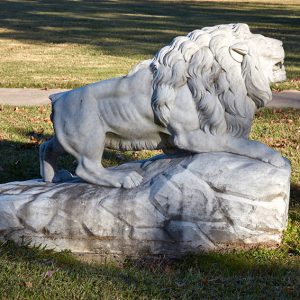
The former UA Little Rock Benton Campus was located in Benton (Saline County) at 410 River Street near the Benton Commercial Historic District. It began operations in 1994 as the Benton Center, and in 2016, its name was changed to reflect its status as a full branch of the University of Arkansas at Little Rock (once known as UALR, then UA Little Rock). By 2018, the UA Little Rock Benton Campus offered three four-year programs and three two-year programs in addition to several nursing prerequisites. Due in part to a substantial decrease in student enrollment, however, it was closed in June 2020. UA Little Rock held night classes at Benton High School beginning in 1975. In 1991, Benton native and …

Under Siege

The television movie Under Siege was first broadcast over two nights in February 1986. It was filmed in and around Little Rock (Pulaski County) in 1985, with the Arkansas State Capitol standing in for the nation’s capitol building in Washington DC. Today, the movie is notable for its prescient storyline of a suicide terrorist attack by Arab nationals against the U.S. mainland, an idea considered improbable at the time. This movie should not be confused with a 1992 Steven Seagal martial-arts movie of the same title. The 136-minute film—which, with commercials, filled two ninety-minute showings on two evenings—was billed as a “Special Event Miniseries” on the NBC network. Under Siege was directed by Roger Young, who also directed the movies …

Underground Hospital

aka: Fifty-fifth General Hospital
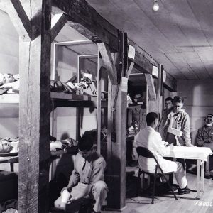
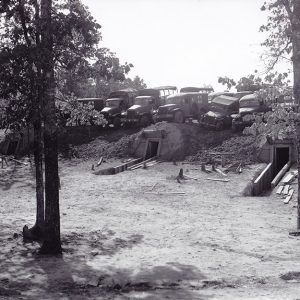
The Fifty-fifth General Hospital, “the Underground Hospital,” at Robinson Maneuver Training Center in Pulaski County was activated on May 25, 1943, during the United States’ involvement in World War II. Documents relating to the hospital were declassified on September 27, 1958; these stated that the Underground Hospital was the brainchild of then commanding officer Lieutenant Colonel Charles Chute Gill of the United States Army Medical Corps. Prior to other modern medical ventures, such as the Mobile Army Surgical Hospital (MASH) units implemented during the Korean War, the Underground Hospital experiment sought to simulate battle conditions and assess the potential for providing protected medical care at or near the frontlines. Gill, a graduate of the Medical School at the University of …

Union County Courthouse

The Union County Courthouse is located in downtown El Dorado (Union County), a 1920s oil boomtown about twenty miles from the Louisiana state border. The four-story Union County Courthouse, like others across the state, is situated in a public square where businesses, banks, and law offices occupy rows of buildings around the seat of justice. The Arkansas Historic Preservation Program recognizes the courthouse as historically and architecturally significant for its symbolism of El Dorado’s growth and its example of the Classical Revival style. It was added to the National Register of Historic Places on June 30, 1983. The first building used as a courthouse in Union County was a storeroom owned by Albert Rust at Champagnolle (Union County) in the …