Water

Subcategories:
  • No categories
Clear

Entry Category: Water
Arkadelphia City [Steamboat]

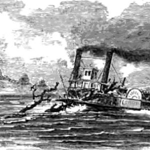
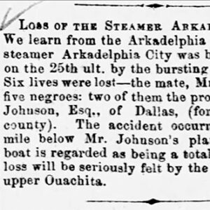
The Arkadelphia City was a Ouachita River steamboat that suffered a disastrous boiler explosion on April 25, 1863, that killed six people. The Arkadelphia City was a fifty-three-ton sternwheel paddleboat built by Tennison, Britton & Carpenter at New Albany, Indiana, in 1859 for the Arkadelphia Home Packet Company, using machinery salvaged from the steamer Joe Jakes. Owned by Captain T. R. Tennyson and Captain M. S. Carpenter, the vessel “was run regularly on the Ouachita River” under the command of Captain W. A. Britton. On April 25, 1863, the Arkadelphia City was steaming on the Ouachita River near DeCeipher Shoals about twelve miles below Arkadelphia (Clark County) when it was “blown to pieces…by the bursting of her boilers.” The vessel’s …

Arkansas Inland Maritime Museum

The Arkansas Inland Maritime Museum (AIMM) in North Little Rock (Pulaski County) is home to Arkansas’s only historic naval vessel open to the public for tours, the USS Razorback (SS 394). It also includes a U.S. Navy tugboat, the USS Hoga. The museum also offers a small research library and a number of permanent and rotating exhibits on submarines and naval history. Hearing of the Razorback’s approaching decommission, a group of submarine veterans initiated an effort to return the submarine to the United States. They approached Mayor Patrick Henry Hays of North Little Rock in 2002 about the possibility of docking the Razorback in Arkansas. At that time, the city was already working to acquire the Hoga, a tugboat present at …

Arkansas River

The Arkansas River originates high in the Sawatch Range of the Rocky Mountains near Leadville, Colorado, and it ends in eastern Arkansas at the confluence with the Mississippi River where the town of Napoleon (Desha County) once stood. The river is 1,460 miles long and flows across three states before making its way into Arkansas. The Arkansas River is the second-longest tributary in the Mississippi-Missouri river system, the sixth-longest river in the United States, and the forty-fifth-longest river in the world. Three major cities are situated along the banks of this river that drains nearly 160,500 square miles of land: Wichita, Kansas; Tulsa, Oklahoma; and Little Rock (Pulaski County). Significance to Arkansas The Arkansas River, flowing east and southeast across …

Arkansas Traveler [Steamboat]

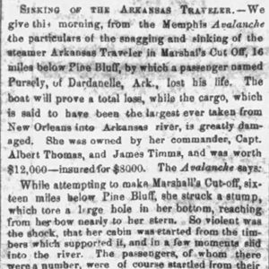
The Arkansas Traveler was a steamboat that sank after hitting a snag in the Arkansas River below Pine Bluff (Jefferson County) on March 21, 1860, killing a passenger. The Arkansas Traveler was a 170-ton sternwheel paddleboat built in 1856 in New Albany, Indiana. Owned by Captain Albert Thomas, who ran the vessel, and Captain James Timms (or Timmons), the steamboat regularly carried passengers and cargo between New Orleans, Louisiana, and Fort Smith (Sebastian County). The steamboat was heading up the Arkansas River on the night of March 21, 1860, carrying a cargo “said to be the largest ever taken from New Orleans into Arkansas river,” including 200 barrels of sugar and 800 sacks of salt, when it struck a snag …

Arkansas Waterways Commission

The Arkansas Waterways Commission was established by Act 242 of 1967, and its powers and duties were amended by Act 414 of 1973. It became a division of the Arkansas Department of Commerce in 2019. The mission of the Arkansas Waterways Commission is to develop, promote, and protect the commercially navigable waterways of Arkansas for waterborne transportation and to promote economic development to benefit the people of Arkansas. The navigable waterways in Arkansas include the Arkansas, Mississippi, White, Red, and Ouachita rivers. The Arkansas Waterways Commission is composed of seven commissioners appointed by the governor, with the advice and consent of the Arkansas Senate. Each commissioner serves a seven-year term. Five of the commissioners represent five navigable stream basin areas …

Arkansas, Steamboats Named

At least twenty nineteenth-century steamboats were called Arkansas or a derivative of the state’s name, according to information in the Herman T. Pott National Inland Waterways Library at the University of Missouri–St. Louis and Way’s Packet Directory. One of these steamboats famously sank on state waters in 1844. The earliest known Arkansas was a sidewheel steamboat built in 1818. Little is known about it, but the Arkansas Gazette wrote about it on December 29, 1821, in an article about four companies of the U.S. Seventh Infantry passing by on the steamboat Courier, adding that “the remaining two companies were detained at Grand Point in consequence of the steam-boat Arkansas, on board of which they had been embarked, having burst a …

B. M. Runyan [Steamboat]

The steamboat B. M. Runyan was carrying a regiment of Union soldiers when it struck a snag in the Mississippi River off Chicot County on July 21, 1864, and sank, killing as many as 150 people. The B. M. Runyan was a sidewheel paddleboat built in Cincinnati, Ohio, in 1858 for Captain James Miller and his partners, who intended to use it for runs between Cincinnati and New Orleans, Louisiana. A Mr. Mitchell of Alton, Illinois, bought the Runyan in June 1862 for voyages between Alton and St. Louis, Missouri. The vessel sank in shallow waters below Alton that December and was raised and sent to St. Louis for repairs. Returned to service in 1864, the B. M. Runyan again …

Baring Cross Bridge

The Baring Cross Bridge is located in downtown Little Rock (Pulaski County) over the Arkansas River at river mile 166.2. It is the western-most bridge of the six bridges spanning the Arkansas River in downtown Little Rock. The first Baring Cross Bridge, the first bridge built across the Arkansas River, opened in 1873. In the 1850s and 1860s, the Cairo and Fulton Railroad Company (C&F) developed two divisions north and south of the Arkansas River. Before the bridge was constructed, the railroad company used ferries to transport equipment, people, animals and commercial freight across the river. Ferries, however, were slow and had a limited amount of cargo space, which caused frequent backups in service. Also, cargo was lost in ferry …

Bart Tully [Steamboat]

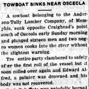
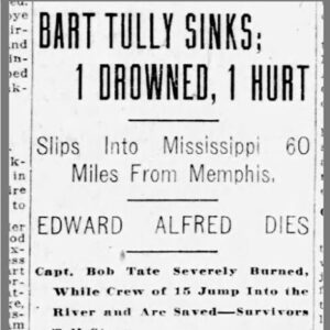
The Bart Tully was a steam towboat that abruptly sank on the Mississippi River near Osceola (Mississippi County) on September 3, 1922; a crew member drowned in the disaster. The Bart Tully, hailed as “one of the best towboats of her size on the Mississippi,” was built at Dubuque, Iowa, in 1891. Originally called the Joy Patton, the Tully was owned by the Patton-Tully Transportation Company in 1922 and was engaged in hauling loads of logs on the Mississippi River. At around 6:30 a.m. on September 3, 1922, the vessel, which had a crew of fourteen men and two women who cooked for them, was near Craighead Point about eleven miles south of Osceola when it “suddenly turned over and …

Belle Zane [Steamboat]

The Belle Zane was a sternwheel river packet that struck a snag on the Mississippi River about twelve miles below the mouth of the White River on the night of December 18–19, 1845. As many as fifty passengers and crew members perished in the accident. The Belle Zane was a 128-ton sternwheel steam packet built in Zanesville, Ohio, in 1844, described as a fast-running and light draught steamer, drawing only twenty-three inches. While the vessel normally ran a route between Zanesville, Marietta, and Cincinnati, Ohio, the Belle Zane set out on December 18, 1845, for a run to New Orleans, Louisiana, carrying a cargo of flour, corn, oats, beans, and potatoes and around 125 passengers and crew. The vessel, commanded …

Blakely Mountain Dam

aka: Blakely Dam
aka: Lake Ouachita
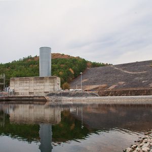
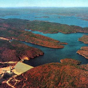
Blakely Mountain Dam, located approximately ten miles northwest of Hot Springs (Garland County), was created to provide hydroelectric power and to control flooding along the Ouachita River. It impounds Lake Ouachita, the largest lake completely within the state of Arkansas at over 40,000 acres. In 1870, the U.S. Congress authorized a survey of the Ouachita River to investigate improving its navigability and preventing floods along its course. However, nothing was done until the 1920s, when Harvey Couch and his company, Arkansas Power and Light (AP&L), began searching for sites for hydroelectric dams along the Ouachita River. AP&L built Remmel Dam and Carpenter Dam, which were in place by the early 1930s. Plans for a third, larger dam were announced in …

Brandywine [Steamboat]

The Brandywine was a steamboat that caught fire in early April 1832, resulting in a significant loss of life among its passengers. The wreckage became the core of an island that the changing course of the Mississippi River eventually left on the Arkansas side of the channel east of Turrell (Crittenden County). The 483-ton steamboat Brandywine left New Orleans, Louisiana, at 5:00 p.m. on April 3, 1832, with a full load of cargo and 145 passengers and crew members, bound for Louisville, Kentucky. When it was about thirty miles north of Memphis, Tennessee, on the evening of April 9, pilot Benjamin T. Head discovered that several carriage wheels and parts that had been packed in straw for transport had caught …

Bridges

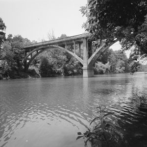
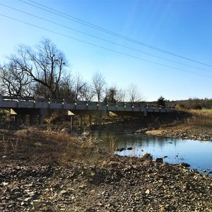
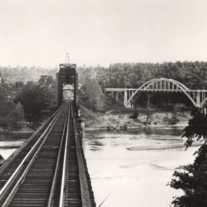
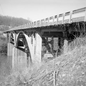
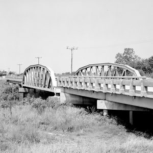
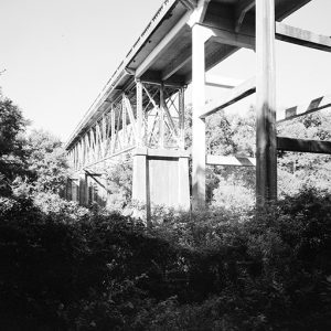
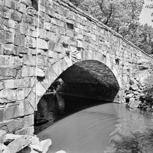
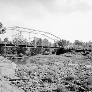
At the time Arkansas became a territory, most water crossings were fords. When travelers came to a body of water such as a small river or stream, they would look for the shallowest place and cross there. Generally, these fords were adequate for the small number of early travelers in the territory. But as the population of the state slowly grew and a system of military roads was developed, it became necessary to bridge larger bodies of water to make travel faster and easier for the military and the local population. The first attempts at bridge-building in Arkansas were by private individuals. These individuals applied for a franchise to build a toll bridge, which was granted by the territorial legislature. …

Bull Shoals Dam and Lake

Bull Shoals Dam site is located on the White River about ten miles west of Mountain Home (Baxter County), where the river divides Baxter and Marion counties. The site is named after its location at a shoal (a shallow and swift reach of river), borrowing from the French “Boill,” meaning a large spring. Private power companies had explored the possibility of building a dam at Wildcat Shoals above Cotter (Baxter County) as early as 1902 but never began any work toward it. Congress approved the construction of six reservoirs in the White River Basin in the Flood Control Act of 1938. A U.S. Army Corps of Engineers report in 1930 had recommended the Wildcat Shoals site along with seven others …

Cache River

The Cache River arises near the Arkansas-Missouri border at the confluence of a few agricultural ditches and flows south-southwesterly through Arkansas until it empties into the White River just east of Clarendon (Monroe County). Though it is not a major transportation corridor, the Cache River has nonetheless had an important place in Arkansas history, especially in debates about environmental conservation. The town of Cash (Craighead County) takes its name from the river. The Cache River was an important water resource for prehistoric Native Americans; for instance, important Indian mound sites connected to the Plum Bayou culture lie within the Cache River floodplain. These early peoples could exploit the variety of natural resources provided by the river and surrounding area, which was …

Caddo River

The Caddo River of west-central Arkansas is known widely as the Natural State’s premier family float stream. This scenic river is named after the Caddo Indians who settled the Ouachita Mountain drainage area. Since that time, many generations have settled, explored, and enjoyed this watercourse. This spring fed Ouachita Mountain stream offers something for everyone. Visitors to the Caddo can experience diverse recreational opportunity in a safe, easily accessible, natural setting. For centuries, this unique waterway has carved its way through sedimentary rock formations, creating a broad shallow river valley and leaving miles of gravel along its path. In some places, the nearly vertical beds of sandstone and novaculite create rapids and water gaps. The Caddo, known for extremely clear …

Cambridge [Steamboat]

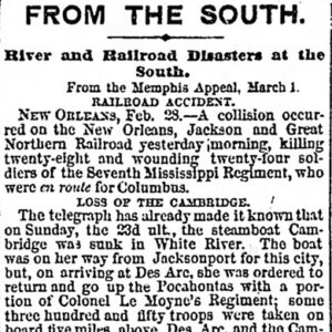
The steamboat Cambridge was carrying a regiment of Confederate soldiers on the White River when it struck a snag and sank near Grand Glaise (Jackson County) on February 23, 1862. The Cambridge was a 242-ton sternwheel paddleboat built in 1856 for Captain William Dean, who ran it on a route going from Pittsburgh, Pennsylvania, to Cincinnati, Ohio, to St. Louis, Missouri. Around January 1862, Captain John Williams bought the Cambridge for $7,000, operating out of Memphis, Tennessee. The Cambridge became a troop transport by coincidence. Colonel G. W. LeMoyne had assembled his Seventeenth Arkansas Infantry Regiment (CS) in Little Rock (Pulaski County) and was preparing to go to Pocahontas (Randolph County) when a measles outbreak struck the Confederate troops. LeMoyne …

Car of Commerce [Steamboat]

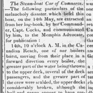
The Car of Commerce was a steamboat that burst a boiler north of Osceola (Mississippi County) on May 14, 1828, killing at least twenty-one passengers and crew members. While heading from New Orleans, Louisiana, to St. Louis, Missouri, an engineer on the Car of Commerce shut down the vessel’s engines briefly around 10:00 a.m. on May 14, 1828, at an area on the Mississippi River known as the Canadian Reach, to examine the force pump. Moments after the engines were restarted, one of the boilers burst, “moving from their place in a forward direction every boiler, the greater part of the water being thrown to the upper deck, several of the deck passengers, and the greater part of the crew …

Caroline [Steamboat]

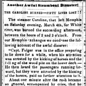
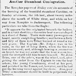
The Caroline was a steamboat that caught fire while traveling up the White River on March 5, 1854, and sank, with forty-five passengers and crew members losing their lives in the disaster. The Caroline was a 150-ton sternwheel paddleboat built in Pittsburgh, Pennsylvania, in 1853. The vessel was 134 feet long and twenty-four feet wide with a draft of 3.5 feet. The Caroline left Memphis, Tennessee, on March 4, 1854, with a full load of cargo and passengers, many of whom were immigrant families. The steamboat was in the White River about twenty miles from its mouth on the afternoon of March 5 when a wood pile near the boilers caught fire, soon enveloping the entire boat in flames. The …

Carpenter Dam

aka: Lake Hamilton
Carpenter Dam is the second of three dams constructed along the Ouachita River in the vicinity of Hot Springs (Garland County), following Remmel Dam (completed in 1924) and preceding Blakely Mountain Dam (completed in the 1950s). The concrete gravity dam was built by Arkansas Power and Light (AP&L), which later became Entergy, for purposes of producing hydroelectric power. It impounds the 7,200-acre Lake Hamilton. Carpenter Dam was listed on the National Register of Historic Places on September 4, 1992, in recognition of its role in the growth and development of Hot Springs. Flavius Josephus (Flave) Carpenter, an associate of AP&L president Harvey Couch, selected the site for the construction of Carpenter Dam, ten miles upstream from Remmel Dam, and so …

Carpenter, Flavius Josephus (Flave)

Flavius Josephus (Flave) Carpenter was a steamboat captain, U.S. marshal, and businessman. He is credited with selecting sites for two Arkansas Power and Light (AP&L, now Entergy) dams on the upper Ouachita River. Carpenter Dam, which created Lake Hamilton, is named for him. Flave Carpenter was born on March 24, 1851, in Franklin County, Georgia, to Martin Sims Carpenter and Martha Weeks Carpenter. The family moved to Arkansas in 1857, settling in Clark County. Carpenter’s father owned and operated a steamboat that plied the Ouachita River from Arkadelphia (Clark County) to points south, including New Orleans, Louisiana. As a young man, Carpenter accompanied his father and learned to pilot the boat. On June 28, 1875, Carpenter married Jane Elizabeth Wallis …

Cherokee [Steamboat]

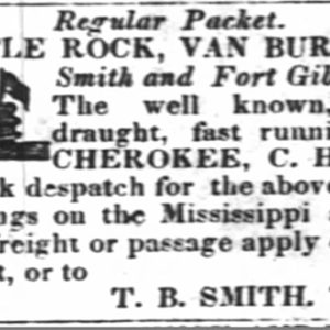
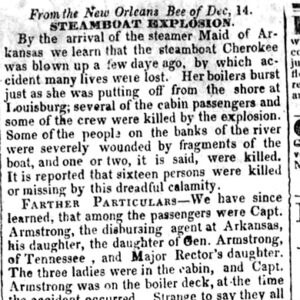
The Cherokee was a steamboat that sustained a devastating and deadly boiler explosion at Lewisburg (Conway County) on December 11, 1840. The Cherokee, under the command of twenty-seven-year-old New York native Charles Harris, was advertised as a “well-known, very light draft, fast running steamboat.” The vessel made regular runs carrying passengers and cargo from New Orleans to Little Rock (Pulaski County), Fort Smith (Sebastian County), and Fort Gibson in the Indian Territory (present-day Oklahoma). The steamboat arrived at the river town of Lewisburg around sunrise on December 11, 1840. After stopping for about fifteen minutes, the Cherokee pulled out into the Arkansas River, and almost immediately the flue of one boiler collapsed and another exploded, casting forth scalding steam and …