Land

Subcategories:
  • No categories
Clear

Entry Category: Land

Little Missouri River Bridge

aka: Nachitoch Bluff Bridge
The Little Missouri River Bridge, also known as the Nachitoch Bluff Bridge, is a through-truss bridge located north of the Interstate 30 crossing of the Little Missouri River, connecting Clark and Nevada counties. Beirne (Clark County) and Gurdon (Clark County) are the two closest communities to the bridge. The bridge was added to the National Register of Historic Places on April 9, 1990, and is depicted on a mural in Prescott (Nevada County) at the intersection of Main and First streets. It closed to traffic in the mid-1990s. Details about the construction of the bridge are scarce. Documentation suggests that it was constructed in 1908 by the Morava Construction Company. The main span of the bridge measures 185 feet and was …

Little Rock and Fort Smith Railroad

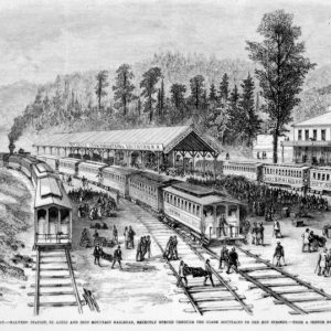
The Little Rock (Pulaski County) to Fort Smith (Sebastian County) railroad span was organized in November 1853 as the Little Rock and Fort Smith Branch of the Cairo and Fulton Railroad Company. In 1859, while it was still a company only on paper, the Arkansas General Assembly passed a proposed act allowing the Little Rock and Fort Smith Branch to merge with the Memphis and Little Rock Railroad, forming the Central Pacific Railroad. This merger never happened, but it clearly shows the manipulation of railroad markets in Arkansas. The start of the Civil War in 1861 postponed plans for the proposed Little Rock and Fort Smith Branch. Following the war, in 1866, Congress gave the State of Arkansas ten alternating …

Little Rock Railway & Electric Company (LRREC)
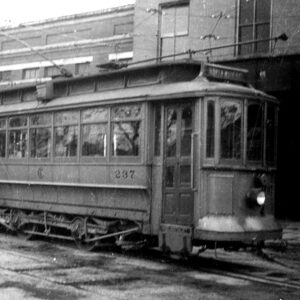
The Little Rock Railway & Electric Company (LRREC) played a key role in the electrification, modernization, and continued operation of the intra-urban streetcar transportation system that served the citizens of Little Rock (Pulaski County) in the late nineteenth and early twentieth centuries. Prior to electrification, the intra-urban streetcar system in Little Rock consisted of animal-drawn conveyances along the first rail lines built in 1877 by the Citizens’ Street Railway Company by businessmen from Little Rock and Hot Springs (Garland County). Over the next decade, technological developments, including the electric lamp (streetlight), more efficient power generation/distribution, and trolley pole systems allowed animal-drawn streetcars to be gradually replaced with electric streetcars. Early on, several streetcar companies—such as Capital City Street Railway Company, …

Little Rock to Cantonment Gibson Road

The Little Rock to Cantonment Gibson Road was constructed between 1825 and 1828 to connect Little Rock (Pulaski County) and Fort Smith (Sebastian County) to the military post at Cantonment Gibson in the Indian Territory (modern-day Oklahoma). The road was used extensively during the forced removal of Native Americans from the southeastern United States to the Indian Territory during the 1830s. On March 3, 1825, Congress approved a bill to establish a road from Little Rock to the Indian Territory, continuing the Memphis to Little Rock Road between the Mississippi River and Little Rock that was authorized a year before. In addition to the $10,000 funding, Congress appointed Arkansas pioneers Benjamin Moore of Crawford County, Morgan Magness of Independence County, …

Main Street Bridge (Little Rock–North Little Rock)
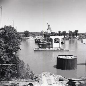
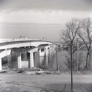
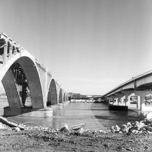
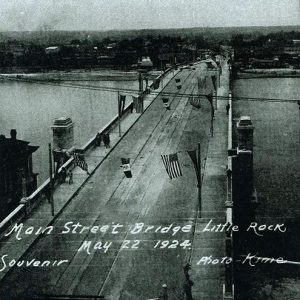
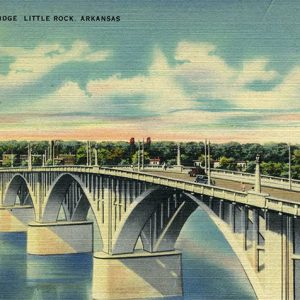
The Main Street Bridge was originally constructed in 1924 as a vehicular structure, replaced in 1973, and altered in 1998; it is one of six bridges linking the downtown areas of Little Rock (Pulaski County) and North Little Rock (Pulaski County). As the downtown areas of Little Rock and Argenta (now North Little Rock) developed in the 1880s, it became apparent that a toll-free bridge independent of the railroad bridges across the Arkansas River was needed. Some people supported the idea of a bridge at the foot of Little Rock’s Main Street, while others thought it should start at Broadway. After years of debate and a series of bridge commissions, the Main Street site was adopted, and the Groton Bridge …

Marr’s Creek Bridge

The Marr’s Creek Bridge is a reinforced concrete bridge with an open spandrel arch. It was built to carry U.S. Highways 62 and 67, as well as South Bettis Street, over Marr’s Creek in Pocahontas (Randolph County) near its confluence with Black River, although the bridge is no longer an active part of Highway 67. The Marr’s Creek Bridge was an important component of New Deal recovery programs in Arkansas and was constructed in 1934 as one of the Public Works Administration (PWA) projects in Arkansas. The construction of Highway 67 and its subsequent bridges, including the 135-foot-long Marr’s Creek Bridge, was a part of a larger modernization campaign to rebuild Highway 67 into Pocahontas. This campaign created jobs within …

Maumelle River Bridge

The Maumelle River Bridge formerly carried Arkansas Highway 300 over the Maumelle River, approximately half a mile southwest of the town of Natural Steps (Pulaski County), before the highway was relocated. However, the bridge remains a part of the Ouachita National Recreation Trail and was listed on the National Register of Historic Places on January 21, 2020. The Maumelle River Bridge is an example of a Pratt through truss, which is a type of bridge developed by Caleb Pratt in 1844. Pratt truss bridges are characterized by diagonals in tension and verticals in compression. The through truss is designed to carry the traffic load with the bridge’s bottom chords or beams. The Maumelle River Bridge is a riveted seven-panel Pratt …

McNeely Creek Bridge

The McNeely Creek Bridge is a single Warren pony-truss bridge near the community of Beirne (Clark County). Constructed in 1923, it was added to the National Register of Historic Places on May 26, 2004. Beirne is an unincorporated community founded in 1880 along the Cairo and Fulton Railroad. Settlement of southern Clark County progressed slowly before the establishment of the railroad, with few roads connecting the area with Arkadelphia (Clark County) or other communities. With an economy based on timber, the community grew as it became one of the best shipping locations for raw timber in southwestern Arkansas. The community was linked by road to nearby Gurdon (Clark County), about four miles to the northeast, likely shortly after construction of …

Memphis and Little Rock Railroad (M&LR)

The Memphis and Little Rock Railroad (M&LR) was the first railroad to operate in the state of Arkansas. The M&LR was a 133-mile-long railroad line that ran from Hopefield (Crittenden County), just opposite Memphis, Tennessee, to Little Rock (Pulaski County). A five-and-one-half-foot-gauge railroad, it was constructed between 1854 and 1871. At the beginning of the Civil War, only the eastern portion of the railroad between Hopefield and Madison (St. Francis County) was in operation. Construction on the eastern and western thirds of the railroad was complete in 1862, but the Civil War interrupted construction of the middle division of the railroad. During this period, the M&LR played a vital role for both Confederate and Union forces and was under Union …

Memphis to Little Rock Road

aka: Military Road (Memphis to Little Rock)
The Memphis to Little Rock Road was one of the first major public works projects in the Arkansas Territory. Spanning the swamplands of eastern Arkansas, the heights of Crowley’s Ridge, and the expanse of the Grand Prairie, it opened the state to emigrants from the east. The road was also a major route for Native Americans during the forced relocations of the 1830s. The Memphis to Little Rock Road, also known as the Military Road (as were most of the early Arkansas roads constructed under the auspices of the U.S. Army), was authorized on January 31, 1824, when the U.S. Congress passed an act for construction of a road opposite Memphis, Tennessee, through the swamps of eastern Arkansas to the …

Metroplan

Metroplan is the federally designated Metropolitan Planning Organization (MPO) for central Arkansas. Metroplan’s core responsibilities are to determine long-term transportation needs and priorities for federal funding for the region. It does so through a council of local governments, the Arkansas Department of Transportation, and local transit agencies. From its inception in 1955, Metroplan evolved from an organization focused on planning needs in Pulaski County to a multi-county association with a federal mandate. Metroplan is supported by member dues and federal and state grants. Membership is open to local governments and covers five counties: Pulaski, Saline, Faulkner, Lonoke, and Grant (non-voting). Its office is housed in the Pulaski County Regional Building in Little Rock (Pulaski County). Originally named the Metropolitan Area …

Mississippi, Ouachita and Red River Railroad

The Mississippi, Ouachita and Red River Railroad Company (MO&RR) was the first railroad to begin construction in Arkansas. Chartered in 1852 by John Dockery of Columbia County, the railroad began at Eunice (Chicot County), south of Arkansas City (Desha County), in 1854. At the onset of the Civil War, the railroad was incomplete, extending approximately seven miles south and west from the Mississippi River. Completion of construction and actual operation of the railroad did not occur until well after the Civil War. The road never made a profit and was merged with the Little Rock, Pine Bluff and New Orleans Railroad in 1873. The first articles of incorporation for the MO&RR were filed with the State of Arkansas by John …

Missouri and North Arkansas Railroad (M&NA)

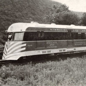
The Missouri and North Arkansas Railroad (M&NA) was a regional carrier that, at its peak, stretched from Joplin, Missouri, to Helena (Phillips County). The railroad was plagued with weather-induced disasters, periods of labor unrest, questionable decisions by absentee managers and owners, unforgiving topography, economic conditions, fires, and bad luck. After the completion of the line, it existed for only four decades. The M&NA was the victim of a territory that could not produce sufficient revenue to support it. It had tough competition from the Missouri Pacific’s two routes through the region and their stronger traffic connections. The railroad was also constructed in a less-than-substantial fashion, which led to its many washouts, floods, and infrastructure failures. The railroad began as a …