Land

Subcategories:
  • No categories
Clear

Entry Category: Land

Amtrak

Amtrak, with a name derived from the words “America” and “track,” is a partially government-funded American passenger rail service. Its parent enterprise is the National Railroad Passenger Corporation. Amtrak was created in 1970 to provide medium- and long-distance intercity service through the consolidation of existing U.S. passenger rail companies. Sharing track with freight trains, Amtrak officially took over most U.S. interstate passenger rail service on May 1, 1971. However, Amtrak’s regular passenger rail service did not begin to serve Arkansas until 1974, when service on the Inter-American train was extended northward from Fort Worth, Texas, to St. Louis, Missouri. Amtrak is the most recent phase in America’s passenger railroad history, in which Arkansas has played a significant part. From the …

Arkansas and Oklahoma Western Railroad

The Arkansas and Oklahoma Western Railroad (A&OW), based in Rogers (Benton County), was incorporated on June 25, 1907, with capital stock of $3,000,000. The standard gauge railroad, previously named the Rogers Southwestern, had twenty-one miles of track built between Rogers and Springtown (Benton County) by the Rogers Southwestern Railroad. The change in the corporate name reflected an intention to build to Siloam Springs (Benton County), as a connection to the Kansas City Southern Railway, and Pryor Creek, Oklahoma, as a connection to the Missouri, Kansas and Texas Railway. The A&OW also announced plans for a thirty-mile extension from Rogers to the health resort of Eureka Springs (Carroll County). The A&OW, assuming it had been built as planned, would have been …

Arkansas Department of Transportation

The Arkansas Department of Transportation oversees the planning, maintenance, and policing of state roads and highways. Act 302 of 1913 established the State Highway Commission and renamed the Department of State Lands as the Department of State Lands, Highways and Improvements. However, there remained no designated highway system in the state. In 1921, a federal law required states to designate a system of state highways, to be managed by a state highway department. In 1923, a few months following the closure of the Department of State Lands, Highways and Improvements due to the Arkansas General Assembly’s failure to appropriate money for the agency, the governor called a special session of the legislature to deal with the resulting problems, eventually signing …

Arkansas Highway 1

Stretching from the Missouri border in the north to McGehee (Desha County), Arkansas Highway 1 spans almost 160 miles in the eastern part of the state. Part of the original state highway system, the roadway continues to be an important route in the Delta. The highway originated from a number of local roads constructed in the nineteenth and early twentieth centuries. A 1916 state road map includes several sections of the future highway, but most of the route does not yet appear. With the establishment of the state highway system in 1923, much of the route appeared on the official map. Improvements to the road over the decades brought Arkansas Highway 1 to modern standards while continuing to follow much …

Arkansas Highway 57 Bridge

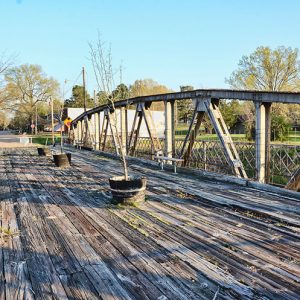
The Arkansas Highway 57 Bridge crosses railroad tracks in Stephens (Ouachita County). Constructed in 1928, the bridge is a Warren pony truss with a pedestrian walkway located on the outside of the superstructure. It was listed on the National Register of Historic Places on September 28, 2005. Once used for vehicular traffic, it later became a pedestrian bridge. Stephens was founded as a stop on the St. Louis, Arkansas and Texas Railway. The St. Louis Southwestern Railway, also known as the Cotton Belt, took control of the line after 1882. With a 160-acre plot to construct a settlement, the owners of the rail line convinced several business owners in nearby Richland (Ouachita County) to move to the new settlement in …

Arkansas Highway 7

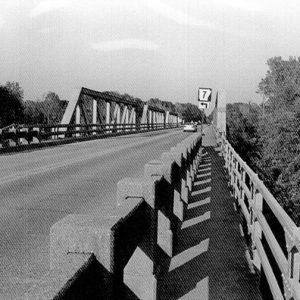
Stretching almost the entirety of the state from south to north, Arkansas Highway 7 crosses eleven counties and measures more than 208 miles. The highway begins at the Arkansas border with Louisiana near the settlement of Lockhart. It is a continuation of Louisiana State Highway 558. The two-lane road crosses into Union County and merges with U.S. Highway 167 south of El Dorado (Union County). The two roads form a concurrency bypass to the northern edge of the city where Highway 7 continues in a northwestern direction to Smackover (Union County). A multi-lane roadway for this portion, the highway crosses into Ouachita County near Louann (Ouachita County) before it enters Camden (Ouachita County). At the interchange with U.S. Highway 79, …

Arkansas Highway Commission

In the early part of the twentieth century, Arkansas’s roads were not designed for the arrival of the automobile. The state’s roads were rough and dusty in dry weather, and were impassable during the rainy season. There was no statewide authority to plan or direct road construction in Arkansas, so road construction was handled at the local level, with county courts in charge of road planning and construction. Most roads were built to serve specific neighborhoods or even individuals, and a connected statewide system of roads was far from a reality. These issues came to a head in 1913 in the Thirty-ninth Arkansas General Assembly, which created the State Highway Commission by Act 302 in response to these transportation issues. …

Arkansas Highway Police

The Arkansas Highway Police is the oldest statewide law enforcement agency in Arkansas and serves as the law enforcement branch of the Arkansas Department of Transportation. The duties of the agency have changed over time, but the emphasis remains on protection of the state’s highway and transportation system. The Highway Police is overseen by an agency director with the rank of chief. The chief serves at the pleasure of the director of the Arkansas Department of Transportation. The Highway Police’s main headquarters are located in Little Rock (Pulaski County) next to the central office of the Department of Transportation. The Highway Police is divided into five districts, each of which is commanded by an officer with the rank of captain. …

Arkansas Railroad Museum

The Arkansas Railroad Museum in Pine Bluff (Jefferson County) grew out of an effort by the Cotton Belt Historical Society to preserve the last steam-powered locomotive built in Arkansas. It has since expanded to include other artifacts of Arkansas’s railroad heritage. The Cotton Belt Rail Historical Society, Inc., was organized on October 18, 1983, primarily for the purpose of saving the Cotton Belt steam locomotive SSW 819, a 4-8-4 Northern-type steam locomotive that was the last steam-powered locomotive constructed in Arkansas. The locomotive had been retired and donated to the City of Pine Bluff in 1955, when machines of its type were being replaced by diesel-burning locomotives. It was placed in a city park, later called the Martin Luther King …

Arkansas Western Railroad

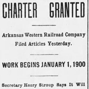
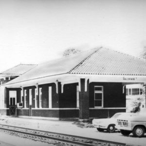
Beginning in 1896, the Kansas City, Pittsburg and Gulf Railroad (later the Kansas City Southern) arrived in Heavener, Indian Territory (present-day Oklahoma). Three years later, the Arkansas Western Railroad Company was incorporated in Arkansas in order to build a thirty-two-mile extension into Arkansas from Heavener to Waldron (Scott County). On October 1, 1901, an engine arrived in Waldron pulling fourteen carloads of steel rails that would finish the track. In 1904, the Kansas City Southern (KCS) organized the Arkansas Western Railway Company, and the Arkansas Western Railroad became a KCS subsidiary. Advertisements soon began running in local newspapers with a “Through Train” schedule. Beginning on July 24, 1904, passengers were able to board a train in Fort Smith (Sebastian County) …

Bauxite and Northern Railroad

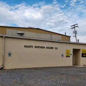
The Bauxite and Northern Railroad (B&N) is a short, three-mile railway built in 1906 by a subsidiary of Alcoa called the American Bauxite Company in what is now Bauxite (Saline County). The B&N transports hundreds of tons of alumina, a key ingredient in the production of aluminum, from the former Alcoa processing plant to Bauxite Junction, where the B&N connects with the Union Pacific. In 2012, the Bauxite and Northern Railroad and its parent company at the time, RailAmerica, Inc., were purchased by Genesee & Wyoming Inc. Bauxite deposits were discovered outside Little Rock (Pulaski County) during road construction in 1887 and were publically identified by State Geologist John C. Branner in 1891. In 1900, Colonel John Rison Gibbons and …

Beebe, Roswell

Roswell Beebe was the first benefactor of the city of Little Rock (Pulaski County); the town of Beebe (White County) was named after him. In the late 1840s and the 1850s, he was one of the most important businessmen and politicians in Little Rock. He donated several pieces of land to the city. Roswell Beebe was born on December 22, 1795, in Hinsdale, New York, to a wealthy English family. When he was seventeen, he talked his father into letting him go to New Orleans, Louisiana. He was behind the cotton bales with Andrew Jackson when the United States turned back the British at the Battle of New Orleans in 1815. Roswell was successful in several businesses. The 1832 New …

Ben Laney Bridge

The Ben Laney Bridge is located in Camden (Ouachita County). Spanning the Ouachita River, the bridge carries traffic from U.S. Highway 79 Business and Arkansas Highway 7. The bridge, which was constructed in 1947, was added to the National Register of Historic Places on June 9, 2000. Camden’s early economy was directly tied to its location as the head of practical navigation on the Ouachita River. As the major commercial center in southern Arkansas, it needed reliable infrastructure in order to continue to grow. However, the city did not have a bridge over the river for decades and, instead, utilized a ferry. During the Camden Expedition of 1864, a pontoon bridge was used by the Union army, while Confederate forces …

Black River Bridge (Historic)

The Black River Bridge is the name given to a historic bridge spanning the Black River in Randolph County. Built as part of U.S. Highway 67, the Black River Bridge was added to the National Register of Historic Places on April 9, 1990, and maintained by the Arkansas Department of Transportation. The Pocahontas (Randolph County) section of Highway 67 opened in February 1931. The confluence of Highways 90 and 115 with U.S. Highway 67 in Pocahontas required a bridge to provide for safe travel across the Black River. To begin the construction of a bridge, the State Highway Commission needed federal approval through the U.S. Congress and through the War Department. This approval was set in place to ensure that …

Blue Star Memorial Highways

Markers for Blue Star Memorial Highways, which honor members of the armed forces, are located along highways across the United States, including several examples in Arkansas. Members of the National Council of State Garden Clubs envisioned creating “living memorials” for members of the armed services who served during World War II, rather than monuments or buildings. The first Blue Star roadway was established in New Jersey in 1945 following work completed the previous year. A five-and-a-half-mile section of road was named Blue Star Drive, and dogwood trees were planted along the road. The state legislature designated the roadway a memorial and banned the posting of billboards along the route. The project was well received and approved by the National Council …