Counties, Cities, and Towns

Entry Category: Counties, Cities, and Towns

Fourche (Perry County)

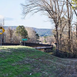
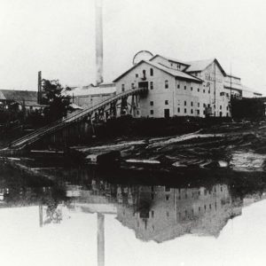
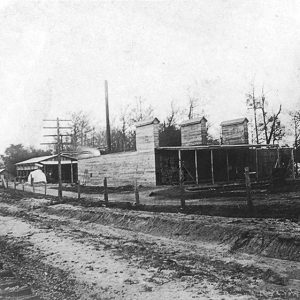
The town of Fourche (the name is pronounced to rhyme with “bush”) is located in northeastern Perry County on the banks of the Fourche La Fave River, for which it is named. Once a thriving lumber town, Fourche is now overshadowed by Bigelow (Perry County), its neighbor to the west. The Fourche La Fave River was explored by a French settler, Peter La Fave, who gave his name to the river, “fourche” being the French word for “fork.” The first white settlers, who arrived after the Civil War, were German, including Gottlob Faisst, who owned a tomato cannery he named Central Arkansas Food Products Company. Faisst and his family also owned a wine saloon, skating rink, and pool hall, all located …

Fox (Stone County)

Fox is located on Highway 263 between Timbo (Stone County) and Rushing (Stone County). Turkey Creek flows a few miles north and northeast of Fox, while Jimmys Creek is to the northwest. With the passage of the Homestead Act in 1862, early settlers began to eke out a living by growing crops along Meadowcreek and the Little Red River. A few hardy frontier families slowly moved up the hill from the river; their settlements would become the community of Fox. Fox was originally called Smart, but when the post office was opened in 1905, another name was required, as there was already a Smart in Arkansas. As the debate over a name was taking place, someone caught a fox in …

Franklin (Izard County)

The town of Franklin is one of the oldest settlements in Izard County. Located on State Highway 56, it is just south of the newest settlement in the county, the retirement community of Horseshoe Bend (Izard County). The Strawberry River meanders through the hills of northern Arkansas, making the land more attractive to visitors than to farmers. At the time of the Louisiana Purchase in 1803, the Osage visited from their homes in the north, coming to the Strawberry River valley to hunt and to fish. By 1825, a series of treaties had moved the Osage west to Indian Territory (now Oklahoma), and white settlers began to claim pieces of land for themselves. Early settlers along the river included the …

Franklin County

Franklin County, bisected by the Arkansas River into a forested northern section and a southern section primarily of farmland, was formed on December 19, 1837, from Crawford County. It is rich in minerals and had one of the first oil strikes in Arkansas. European Exploration and Settlement The area that became Franklin County has been inhabited since the end of the Ice Age, about 12,000 BC. Paleoindians hunted and gathered wild plants and other resources, residing in open air campsites and occasionally using rock shelters. Agricultural settlements began to be established during the Mississippian Period (900—1600 AD), raising corn and other domesticated plants. The Osage used lands to the north of the Arkansas River as hunting grounds, although their villages …

Frenchport (Ouachita County)

Frenchport (Ouachita County) is an unincorporated community located about eight miles southeast of Camden (Ouachita County). The current channel of the Ouachita River is located about two miles east of the community. Originally based close to the river, the community moved west as better roads linked the community to Camden. Arkansas Highway 7 runs to the west of the community. Early settlers in the area included the Fogle, Labeff, and Peveto families. Originally residents of France, the families traveled to New Orleans, Louisiana, and moved up the Mississippi, Red, Black, and Ouachita rivers to the area. Finding a logjam on the river that prevented further movement, the families settled in the area. The name of the community comes from the …

Friendship (Hot Spring County)

Friendship lies along U.S. Highway 67, which runs through the center of the town, and is a quarter of a mile south of Interstate 30 in Hot Spring County. During the Civil War, it was the site of an important salt-making operation. Pre-European Exploration Residents near the Ouachita River in Friendship have reported finding mounds and various artifacts consistent with the Caddo tribe. The town is located just four miles from the junction of the Ouachita and Caddo rivers, an area in which the Caddo have a well-documented history. Louisiana Purchase through Early Statehood Explorers William Hunter and George Dunbar passed through the area during their survey of the new Louisiana Purchase in 1804. With documented stops in Arkadelphia (Clark County) …

Frog Town (Sebastian County)

Frog Town (sometimes rendered Frogtown) is an unincorporated community in southern Sebastian County. It is on State Highway 45 northeast of Hartford (Sebastian County). Frog Town is most noted for violent acts during the Sebastian County Union War of 1914. The Arkansas River Valley and northern Ouachita Mountains have been inhabited for thousands of years. White settlement in the region after Arkansas became a state was sparse, although roughly seventeen families were living between Sugar Loaf Mountain and the Poteau Mountains when Sebastian County was created in 1851. John Tumblin and Thomas Lewis both acquired land patents in the vicinity of Frog Town in 1860. Population increased rapidly beginning in the 1870s with the development of coal mining in the …

Fulton (Hempstead County)

Fulton is a town on the northern bank of the Red River in southern Hempstead County. It is one of the earliest non–Native American settlements in Arkansas, and some claim that it is the oldest continually settled community in the state. Located at a convenient crossing of the Red River, Fulton has long been a transportation hub of southern Arkansas. Due to floods and river erosion, none of the early historic structures of Fulton have survived into the twenty-first century. Caddo Indians inhabited the Red River valley of Arkansas long before any European explorers reached the area. A party of French explorers passed through the area in 1687 and noted several Caddo villages, one of which may have been located …

Fulton County

Fulton County, located in the Ozark Foothills of north-central Arkansas, borders the Missouri state line on the north, Sharp County to the east, Izard County to the south, and Baxter County to the west. The population in the 2020 census was over 12,075, while the county seat, Salem, claimed 1,566 residents. The rolling, forested hills of Fulton County are well suited for pasture, moderately suited for woodland use, and poorly suited for cultivated crops. Past residents of Fulton County turned to the timber and livestock industries as substantial sources of income. Fulton County has four incorporated cities: Mammoth Spring, Salem, Cherokee Village, and Viola. Fulton County is home to Spring River, a popular canoeing site, and the famous baseball player …

Gainsboro (Independence County)

Gainsboro is located between Pfeiffer (Independence County) and Moorefield (Independence County), about seven miles east-northeast of Batesville, the county seat. The community, which never had a post office, grew out of Sharp’s Cross Roads, located about one and a half miles north-northwest of Gainsboro; Sharp’s Cross Roads was earlier called Rust’s. The historic community of Gainsboro is located on Watson Road just south of its junction with Highway 25 (White Drive). Gainsboro likely received its name from the Gaines family, which was farming in the area before the Civil War. A short-lived post office was at Rust’s (1856–1859), with John David McKinney postmaster, but it was replaced by the Sharp’s Cross Roads post office established in 1859, with Samuel Y. …

Galley Rock

aka: Galla Rock (Pope County)
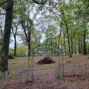
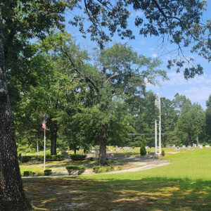
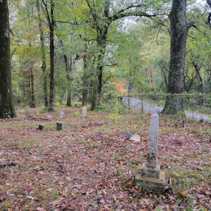
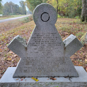
Galley Rock in Pope County is a two-mile shale bluff that rises almost forty feet high on the north bank of the Arkansas River, just northwest of Petit Jean Mountain. It was a natural landmark for early explorers and settlers. The area was a site for Cherokee settlers of the early 1800s and became a thriving river town in the 1830s. However, by the 1870s, the town experienced a decline, and all that remains today is the town cemetery. During the late 1700s, river travel was the safest and most reliable mode of transportation. French explorers and trappers navigated the Arkansas River with only striking, geologic features marking the locations of their trading posts and hunting camps. Galley (or Galla) …

Galloway (Independence County)

Galloway is a historic community shown on an 1860 map of Independence County. It was located southeast of Sulphur Rock (Independence County) in the alluvial bottoms of the Black and White rivers and north of historic Akron (Independence County) near the Magness Ferry, lying between Newark (Independence County) and Cord (Independence County) on what is today Galloway Road. The road crosses Dota Creek. The community received its name from Robert M. (Bob) Galloway, who was appointed its postmaster on November 9, 1858. Robert Galloway married Harriet Robbins in Shelby County, Tennessee, in 1843 and moved the family to the Big Bottom region in the 1850s shortly after his father’s death. The 1860 census shows Galloway to be a slave owner …