

501-918-3025
calsfoundation@cals.org
calsfoundation@cals.org
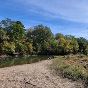
The Little Missouri River in southwest Arkansas rises in the Ouachita Mountains of Polk County and flows southeasterly through Montgomery County and Pike County, where it is impounded by Narrows Dam. It continues southeasterly into the geographical region known as the West Gulf Coastal Plain, where it forms parts of the borders of Pike, Hempstead, Nevada, Clark, and Ouachita counties before emptying into the Ouachita River.
The area through which the Little Missouri River flows has been home to human habitation since approximately 10,000 BC. Among the prehistoric sites along the river is the Kirkham site in Clark County. In historic times, the Caddo Indians occupied much of southwestern Arkansas, and European explorers found several Caddo villages along the Little Missouri River. Later American settlement did not concentrate upon the river; the upper reaches are not suitable for transportation as they contain numerous rapids. The largest city in the river’s immediate vicinity is Murfreesboro (Pike County).
After his resignation from the Confederate army, Albert Pike retired to a place along the Little Missouri River in Montgomery County; the Albert Pike Campground was later established on the spot. The Engagement at Elkin’s Ferry, part of the ill-fated Camden Expedition, was fought near the Little Missouri River on April 3–4, 1864.
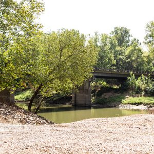
Flooding has long been an issue for those residing in the vicinity of the Little Missouri River. In 1950, the U.S. Army Corps of Engineers completed work on Narrows Dam, located in Pike County six miles north of Murfreesboro. The dam was authorized by the Flood Control Act of 1941 and impounds Lake Greeson. However, many areas, especially on the upper reaches of the river, can experience flash floods when heavy rains collect in the narrow valleys of the Ouachita Mountains. Such a flood on the morning of June 11, 2010, killed twenty campers at the Albert Pike Campground.
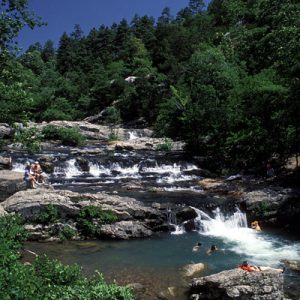
Because the upper reaches of the river have extensive rapids, they have become popular with canoeists, while the portion of the river beneath Narrows Dam is, like many dam tailwaters in Arkansas, well known for trout fishing. Twenty-nine miles of the Little Missouri River above Lake Greeson are part of the Arkansas Natural and Scenic Rivers System, while 4.4 miles of the river were federally designated as “wild” in 1922, with another 11.3 designated as “scenic.” The river also flows through Crater of Diamonds State Park.
For additional information:
Dickinson, S. D. “Cultural History of the Little Missouri River.” Arkansas Gazette, magazine section. May 17, 1942, pp. 8–9, 14.
Saucier, Roger T. “The Physical Setting of the Ouachita, Saline, and Little Missouri Rivers, Southern Arkansas.” Arkansas Archeologist: Bulletin of the Arkansas Archeological Society 25–26 (1984–1985): 63–74.
Staff of the CALS Encyclopedia of Arkansas


Comments
No comments on this entry yet.