


501-918-3025
calsfoundation@cals.org
calsfoundation@cals.org
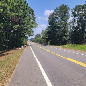
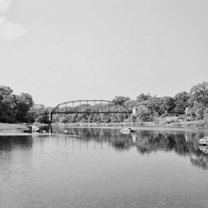
The Ouachita River originates in the Ouachita Mountains of west-central Arkansas near the Arkansas and Oklahoma border and flows 600 river miles before joining the Black and Red rivers in north-central Louisiana. The Ouachita flows through eleven different counties in Arkansas and five parishes in Louisiana.
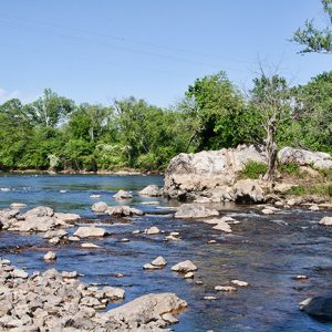
The Ouachita is a river of diverse beauty. It begins as a small mountain stream at Eagleton (Polk County) and flows eastward approximately 120 miles. It winds through lush mountain valleys, steadily building as it flows between huge boulders beneath mountain bluffs. It flows onward on its 600-mile course amid banks of moss-covered oaks and cypress trees in the swampy bottoms of Louisiana.
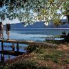
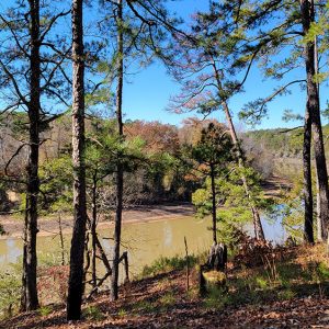
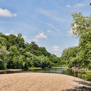
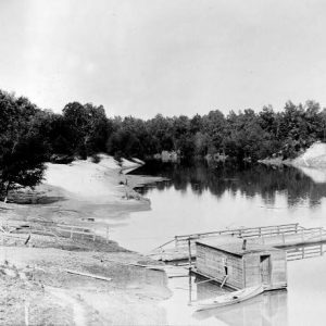
The Ouachita is noted for its great fishing, especially bass, bream, and white perch. Wildlife is prolific along the banks of the river. White-tail deer, turkeys, and even an occasional bear can be seen in secluded areas; alligators and bald eagles have also recently returned to the area, after having been driven out in the early 1900s. The Ouachita is also a major flyway for ducks and geese feeding and resting in the river’s oak-laden backwater flats and cypress swamps, as well as in the rice and bean fields along its banks.
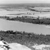
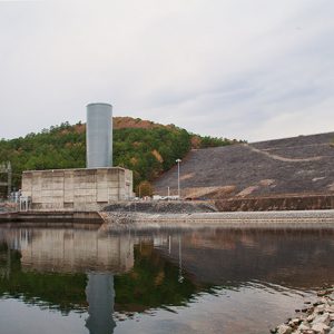
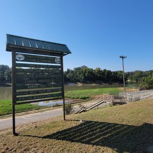
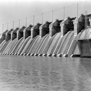
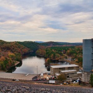
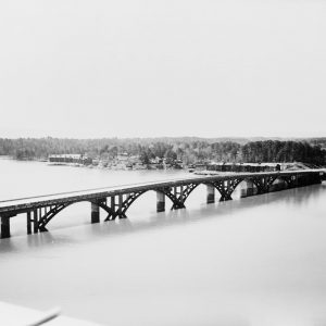
The Ouachita is a vital artery for those living in mid-central Arkansas and is the source of three manmade large lakes in that region—Lake Ouachita, Lake Hamilton, and Lake Catherine—all of which are used for recreational purposes. These lakes are dammed at their outfall, and the flow of the Ouachita powers generators that provide electrical power to Hot Springs (Garland County) and surrounding communities.
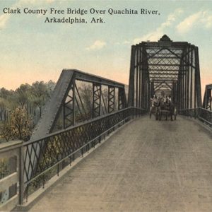
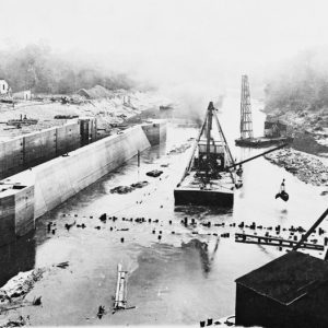
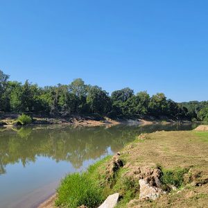
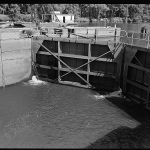
The Ouachita turns south after it leaves Lake Catherine on its course toward Arkansas’s southern border. The river then flows approximately 250 miles through sparsely populated areas, intermittently dotted by the cities of Arkadelphia (Clark County), Camden (Ouachita County), and El Dorado (Union County), and continues into Louisiana for another 200 miles to its juncture with the Black River. The Ouachita played a great role in the establishment of these towns, for it was the river that provided access to these areas from buyers as far away as New Orleans who were purchasing cotton, which was a basic product that supported many Southern communities in the late 1800s and early 1900s. In southern Arkansas, the Ouachita River is impounded at Felsenthal Lock and Dam, which was created as part of the Ouachita and Black Rivers Navigation Project of the of the U.S. Army Corps of Engineers; the dam created Lake Jack Lee, which is surrounded by the Felsenthal National Wildlife Refuge.
The earliest historical records of the Ouachita River come from the Hernando de Soto expedition, which fought with many of the Native American tribes living along the Ouachita who resisted his advancement into their territory. The Ouachita itself was also an obstacle to the de Soto expedition. Much of what is known about the numerous Indian tribes of Native Americans living in the Ouachita River valley came from the de Soto expedition’s records and observations.
In 1803, the United States bought the Louisiana Purchase from France; this included all land in the Ouachita valley. The first exploration of this new uncharted territory was commissioned by President Thomas Jefferson and was conducted by scientist George Hunter and inventor William Dunbar. The Hunter-Dunbar expedition started in October 1804 and ended in January 1805. The expedition by boat was made under extremely difficult and dangerous conditions and covered 450 miles from the mouth of the Ouachita River to Hot Springs.
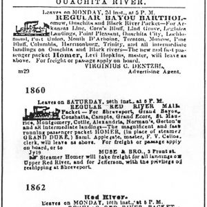
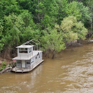
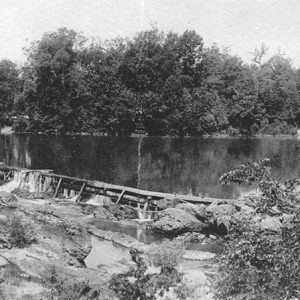
In 1819, the first steamboat came up the Ouachita, making such a strange sound and presenting such a monstrous sight that it was described as “a puffing dragon.” After that frightful debut, steamboats began to play an integral part in the colorful history connected with the Ouachita. From 1819 to 1910, the Ouachita was the great highway of commerce and transportation for the entire river valley. Steamboats came from as far as New Orleans up the Ouachita River, reaching even Camden and Arkadelphia during times of high water; however, steamboats began to vanish in the early 1900s with the proliferation of the railroads.
The U.S. government began Indian Removal east of the Mississippi River in the 1830s; this forced journey was called the Trail of Tears. One seldom-mentioned route was the Ouachita River, which was used to transport hundreds of Indians by boat to Camden. From Camden, they continued on by foot westward another 100 miles to Oklahoma. Another route associated with this removal mandate crossed the Ouachita near Arkadelphia.
The Ouachita continues today to be a conduit of commerce where tugboats have taken the place of steamboats pushing barges loaded with ammonia, fuel oil for industry, and crushed rocks for building highways. Though the Ouachita does have a moderate amount of barge traffic, it has still maintained its primitive nature in most places and remains a favored destination for boaters, fishers, and many others.
For additional information:
Berry, Trey. “The Expedition of William Dunbar and George Hunter along the Ouachita River, 1804–1805.” Arkansas Historical Quarterly 62 (Winter 2003): 386–403.
Berry, Trey, Pam Beasley, and Jeanne Clements, eds. The Forgotten Expedition: The Louisiana Purchase Journals of Dunbar and Hunter, 1804–1805. Baton Rouge: Louisiana State University Press, 2006.
Jenkins-Joyce, Keaton Cade. “Tree-Ring Reconstruction of Ouachita River Streamflow.” MS thesis, University of Arkansas, 2023. Online at https://scholarworks.uark.edu/etd/5173/ (accessed February 21, 2024).
Nichols, David H. “Factors Affecting Temporal and Spatial Changes in Freshwater Mussel Communities of the Upper Ouachita River, Arkansas.” MS thesis, University of Central Arkansas, 2026.
Portis, Charles. “The Forgotten River.” Arkansas Times, September 1991, pp. 42–49, 76, 78, 80, 82. Online at https://arktimes.com/arkansas-blog/2024/10/01/origin-story-the-author-of-true-grit-goes-in-search-of-river-lore (accessed October 3, 2024).
Thompson, Bob, and Wendy Richter. Steamboats: Navigation on the Upper Ouachita River. Arkadelphia: AR: Clark County Historical Association, 2024.
Glenn Gore
Ouachita River Foundation


Comments
No comments on this entry yet.