calsfoundation@cals.org
Springfield (Conway County)
Springfield (Conway County), once the county seat of Conway County, began as the intersection of the Old Cherokee Boundary Line and a principal route of the Western Cherokee in their relocation west of the Mississippi River. The National Road, from St. Genevieve, Missouri, was routed through the area, taking advantage of a large reliable artesian spring. These roads connected the area with developing population centers such as Batesville (Independence County), Clinton (Van Buren County), Lewisburg (Conway County), and Little Rock (Pulaski County).
A small trading post was established that served the first settlers in the area, Cherokee who came in the early nineteenth century. They began clearing farmland plots and established cabins; some of the foundations remain. The trading post was abandoned when the Cherokee left Arkansas Territory after the Treaty of 1828, and the area remained generally uninhabited until after statehood. However, the earliest maps still reflected a very small clearing near the road and the reservation boundary by 1839.
Around 1840, the first post office in the area was established about 2.5 miles to the southwest of present-day Springfield. The community was locally known as the “Georgia Settlement,” and the post office was designated as Stell’s Mill. The Stell brothers had settled near Cypress Creek in 1835 and operated a water-fed grist mill that became a source of ground meal for both locals and travelers.
In 1848, a petition, signed by the majority of Conway County taxpayers, commissioned a relocation of the county seat from the robust river-town of Lewisburg, which was no longer close to the geographic center of the county due to the creation of Pope, Perry, Van Buren, and Yell counties. After deliberations, litigation, and a new election, the decision was announced on June 29, 1850, that the county seat was to be relocated to Springfield as soon as a suitable courthouse and jail could be constructed. A twenty-three-acre tract was donated from public lands, and 112 town lots were sold to raise the funds for the courthouse and jail. A thriving village, with two stage line stops, was then developed by individuals whose family names remain in the area in the twenty-first century, including landowners such as the Moores, Stells, and Venables. A number of merchants, lawyers, and physicians set up shop in the area. On April 12, 1858, much of the developing town, including the courthouse, was destroyed by a tornado. A new and “more commodious” building was completed in 1859.
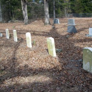
When the Civil War came, two Confederate regiments were formed on the courthouse square in Springfield. In apparent retribution, a Union company, which locals claimed was associated with Conway County resident Captain Thomas Jefferson Williams, burned the “new” two-story courthouse in 1864. Interestingly, the county clerk, Joshua Moses, anticipated such an event and took most of the important records to his home, where they were preserved. In the Springfield Cemetery are five graves reported to contain the bodies of local Confederates killed at Creben Creek on May 24, 1864.
A new courthouse was not completed until 1869, as the taxing authority had been severely limited by the war and its aftermath. During Reconstruction, Springfield was host to much of the political fervor of the time but was spared the outbreaks of violence that took place in Lewisburg. With the election of 1872, the Lewisburg political faction regained full power and immediately led the Arkansas General Assembly to relocate the Conway County seat back to Lewisburg. This occurred by the end of 1873.
In 1874, the Springfield-Des Arc Bridge was constructed; it is the oldest bridge in Arkansas and is listed on the National Register of Historic Places.
The community turned to the development of higher education. The courthouse was used as the Springfield Male and Female College, established in 1887. Again, the crossroads location was helpful in making this school successful for several years. It closed in 1890.
Local business continued to prosper, and medical and pharmaceutical services were available. The decade that followed provided continued local political debate. Springfield’s location between the northern subsistence farmers and the southern plantation owners resulted in major gatherings of the Agricultural Wheel there.
In the post-Reconstruction period, large numbers of African Americans migrated to Conway County from South Carolina and Georgia. These families cleared and settled small- to medium-sized farms and established the church-school communities of Holly Spring (Conway County), Bethlehem (Conway County), and Union Chapel (Conway County). Springfield was the market center for these areas and the nearby white communities of Cedar Creek (Conway County), Hill Creek (Conway County), and Mallettown (Conway County).
Springfield continued as a thriving rural store-front community into the era of the Great Depression and the advent of the automobile. Retailers gradually moved or closed. Changes, such as radio, diminished the town square as the political forum that had once brought hundreds of people to town.
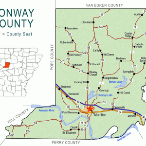
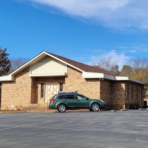
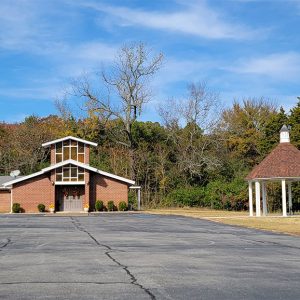
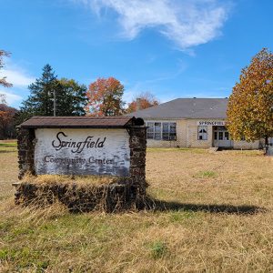
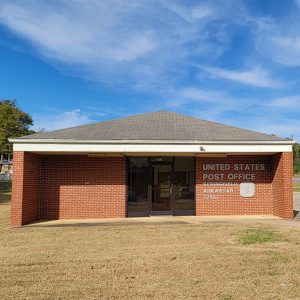
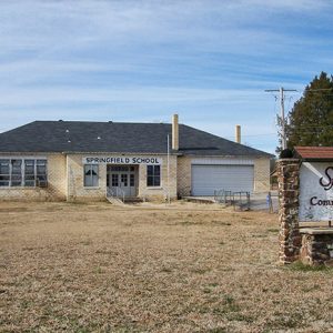
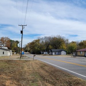
By the 1950s, the town proper had declined, and only one or two small stores remained. The local schools merged with Morrilton (Conway County), but the community continued to gain residents, as families sought homes with acreage. While little of significant historical value exists, Springfield remains as an important post office with a sizeable geographic area. It covers fifty-five square miles and reaches from the old Georgia Settlement, north of the Hill Creek community, to the Catholic Point (Conway County) community, south of Center Ridge (Conway County). About 1,600 people reside in the Springfield area by ZIP code.
Springfield began, in part, as a reliable water source for travelers. It is now known as the north access to Brewer Lake, a 1,200-acre water impoundment of the Cypress Creek that currently provides recognized fishing and a quality water supply for the cities of Conway (Faulkner County), Morrilton, Plumerville (Conway County), and rural Conway County.
For additional information:
Conway County, Arkansas: Our Home, Our Land, Our People. Little Rock: Historical Publications of Arkansas, 1992.
Historical Reminiscences and Biographical Memories of Conway County, Arkansas. Morrilton, AR: Conway County Genealogical Society, 2005.
Shinn, Josiah H. Pioneers and Makers of Arkansas. Chicago: Genealogical and Historical Publishing Company, 1908.
Larry Taylor
Springfield, Arkansas

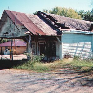







My grandfather, A. A. Sledge (Pete), was the owner of one of the stores mentioned in the 1950s segment of this history of Springfield. His store was simply called A .A. Sledge Grocery. I remember so well my grandfather and this wonderful part of my history. I have photos of the store and my grandpa working there.