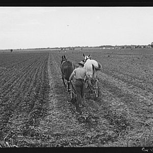
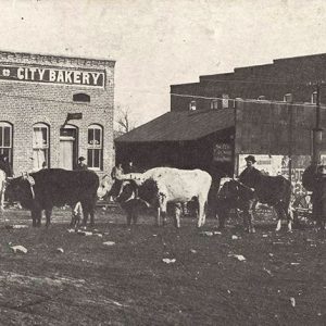
 Plum Bayou Project Farmer
Entry Type: Place
Plum Bayou Project Farmer
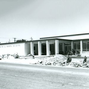
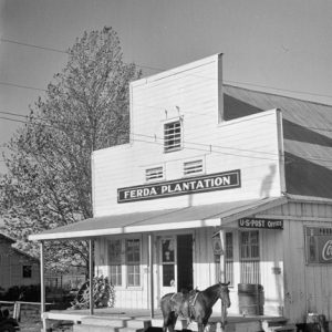 Plum Bayou Project Buildings
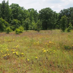
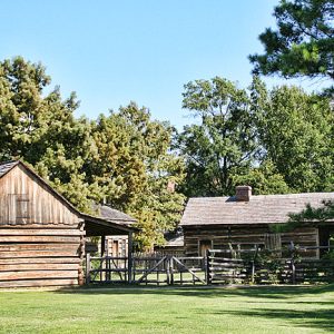 Plum Bayou Restoration
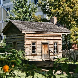 Plum Bayou Restoration
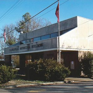 Plumerville Municipal Building
Plumerville (Conway County)
Plumerville was formed as a stagecoach stop in 1858, but the origins of the community are found along the Arkansas River in the early days of the Arkansas Territory. The community moved from the Harrisburg-Portland bottomland area to follow stagecoach and railroad developments. Samuel Plummer came to the area in 1833 and purchased 160 acres of the “first high ground” north of the Arkansas River. Over the next several years, the development of the Military Road from Little Rock (Pulaski County) to Fort Smith (Sebastian County) led to a stop on the Butterfield Overland Mail Company and the construction of the telegraph line across this important choice of land. The later railroad also needed to avoid the overflow areas and …
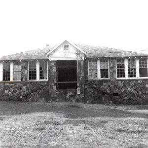 Plumerville School Building
 Plummer House Location
Pocahontas (Randolph County)
Begun as a river port significant to commerce, Pocahontas joins alluvial Delta bottom with the Ozark foothills. The town has served as Randolph County’s only county seat and continues as a strategic educational and agricultural center in the state. European Exploration and Settlement The first residents of the area arrived roughly 12,000 years ago. During the time of European exploration, what would become Randolph County was part of the hunting territory of the Osage, who lived in southern Missouri. French hunters probably crossed the area in the eighteenth century and established temporary camps, but no permanent settlements were developed until after the Osage surrendered their rights to the land in 1808. The earliest documented settler was Ransom S. Bettis, who …
Pocahontas Commercial Historic District
The Pocahontas Commercial Historic District is the historic downtown area of Pocahontas (Randolph County). This area has been the seat of local and county government, as well its commercial center, since the formation of the county in 1836. The commercial district is roughly bounded by Thomasville, Jordan, Broadway, and Vance streets. The downtown area comprises numerous historic buildings, including two courthouses, a service garage, a theater, a Works Progress Administration (WPA) post office, and the former city hall and city-function buildings, as well as other buildings currently utilized for modern business purposes. Both of the courthouses and the WPA post office are individually listed on the National Register of Historic Places. The center of the commercial district is dominated by …
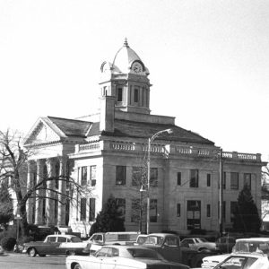
 Pocahontas Courthouse Square
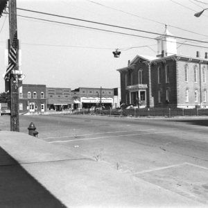 Pocahontas Courthouse Square
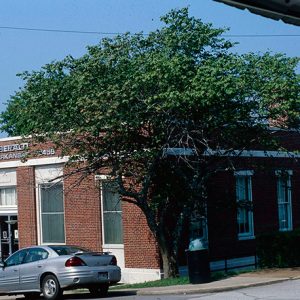 Pocahontas Post Office
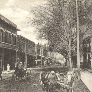
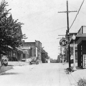 Pocahontas Street Scene
Poinsett County
Poinsett County is located in Arkansas’s northeast corner. The St. Francis River travels north to south in the eastern portion of the county, and the L’Anguille River begins at the north boundary and runs south through the center of the county. Crowley’s Ridge, a highland anomaly that begins in southeast Missouri and terminates near Helena (Phillips County), runs through the center of the county. On the eastern side of the ridge is the rich, alluvial land of the Delta, which primarily hosts cotton farming, while on the western side is prairie land used mostly for the cultivation of rice. European Exploration and Settlement When the first permanent settlers arrived in what was to become Poinsett County, a few communities of …
 Poinsett County Courthouse
Point Cedar (Hot Spring County)
Point Cedar is an unincorporated community located in western Hot Spring County. Located at the intersection of Arkansas Highways 84 and 347, it is about ten miles northeast of Amity (Clark County) and eight miles northwest of Bismarck (Hot Spring County). The name of the community comes from early settlers who found a point covered with cedar trees located at the mouth of a creek emptying into the Caddo River. At the time the first settlers arrived in the area, it was part of Clark County. The establishment of a post office led to the adoption of Cedar Point as the name of the community, but it was discovered that another Cedar Point existed, leading to the shift of the …
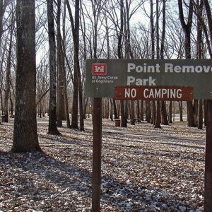 Point Remove Park
Point Remove (Conway County)
The designation of “Point Remove,” popularly employed to describe the confluence of Point Remove Creek in Conway County with the Arkansas River, is almost certainly derived from the French word remous, meaning “eddy” or “whirlpool.” Most instances of the term in early nineteenth-century documents follow this usage. However, the name “Point Remove” was later mistakenly connected to Indian Removal in Arkansas, supposedly marking the principal geographic point in the description of the boundary of Cherokee land in Arkansas, prior to the Cherokee population’s later relocation to Indian Territory (present-day Oklahoma). William Lovely used the term “point remove byo,” the abbreviation “byo” meaning “bayou” and thus designating the creek, in a public document in 1813. In his book Journal of Travels …
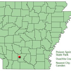
Poison Spring Battleground State Park
Location: Ouachita County Size: 85 acres Poison Spring Battleground State Park, west of Camden (Ouachita County), commemorates a Civil War engagement that was part of the Camden Expedition of General Frederick Steele. The Engagement at Poison Spring is remembered as a Confederate ambush of Union troops, which resulted in the massacre of many African Americans from the First Kansas Colored Infantry. The park contains interpretive exhibits, as well as picnic sites and a short trail. The name Poison Spring was known to Camden area residents at the time of the engagement and was used in battle reports, but its origins are uncertain. Later legends suggested that Union soldiers became ill after drinking the cold spring water, but no contemporary accounts …
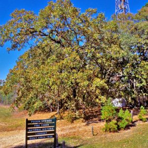 Poison Spring Fire Tower
 Poison Spring State Park: Park Location
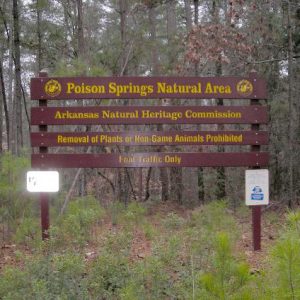 Poison Springs State Forest Sand Barren & Oak-Pine Forest Preserve
 Poison Springs State Forest Sand Barren & Oak-Pine Forest Preserve
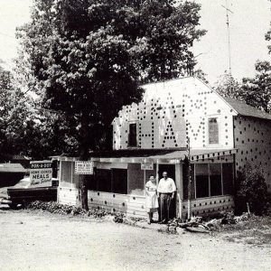 Pok-A-Dot Restaurant
 Poke Bayou
 Poke Bayou
Poke Bayou (Sharp County)
Poke Bayou creek begins near Sidney (Sharp County) at Big Spring in Izard County, flows through Sandtown (Independence County), and empties into the White River just above the bridge at Batesville (Independence County). Izard County historian Denny Elrod stated the following about the area’s history: “It was to this creek many of the early settlers came. Across the White River from Poke Bayou is Wolf Bayou which hosted an Indian camp and trading-post. The creek is picturesque near Sandtown as it flows along the foot of overhanging bluffs.” The original settlement at Batesville dates back to at least an 1814 trading post. When the first post office was established on the confluence of the bayou and the White River on …
 Police and Court Building
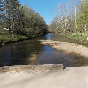
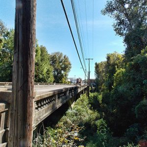 Polk Bayou Bridge
Polk County
Polk County, located on the western edge of Arkansas, was the home of the comedy team of Lum and Abner, country singer T. Texas Tyler, and the controversial Commonwealth College. All of Polk County is in the Ouachita Mountains. Rich Mountain is the site of the historic Queen Wilhelmina State Park. Louisiana Purchase through Early Statehood White settlement in Polk County began about 1830. At that time the region was part of Sevier County. Polk County, named for President James K. Polk, was separated from Sevier County by the legislature on November 30, 1844. The 1860 census gave the Polk County population as 4,090 whites and 172 enslaved persons. Slavery was not common in Polk County because the mountainous terrain …
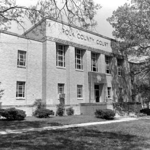 Polk County Courthouse
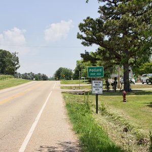
Pollard (Clay County)
Pollard is a city in Clay County, a few miles west of Piggott (Clay County) on U.S. Highway 62, in the foothills of Crowley’s Ridge. Pollard has witnessed the emergence and decline of the railroad and the timber industry; its focus in the twenty-first century is on local agriculture. Even before the Civil War, several families had settled in the hills adjacent to Crowley’s Ridge. A store was operated by a man remembered only as McElroy. New Hope Baptist Church was established before the war began. The Pollard family moved into the area after the war, with Jack Pollard opening the first general store in the area with partner Tom Irwin, and Bill Pollard obtaining a post office (which was …
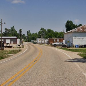 Pollard Street Scene
 Pollard Street Scene
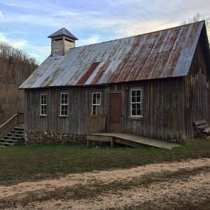 Ponca Church
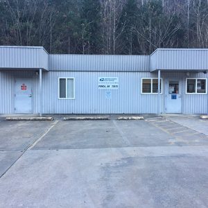 Ponca Post Office
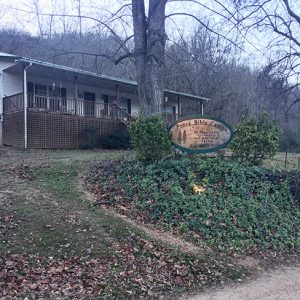 Ponca Bible Camp
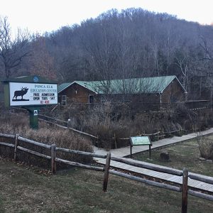 Ponca Elk Education Center
Ponca Elk Education Center
The Ponca Elk Education Center was established in 2002 to serve wildlife enthusiasts coming to Newton County to view elk, which were introduced to the state in 1981. The center is in a handsome log building on Arkansas Highway 43 in the village of Ponca in western Newton County. The building was for a short time used as a charter school by a religious organization and was later leased by the Arkansas Game and Fish Commission (AGFC). The Ponca facility has displays of elk and many other Arkansas wildlife. It features eye-catching photographs and a gift shop selling nature-related items, as well as hunting and fishing licenses. There is also a small meeting room. Porches offer visitors a chance to …
Pond Creek National Wildlife Refuge
Pond Creek National Wildlife Refuge, the 501st refuge in the National Wildlife Refuge System, protects and preserves one of the last remaining bottomland hardwood tracts in the Red River Basin. Established in 1994 under the Emergency Wetlands Resources Act, the refuge encompasses approximately 28,000 acres and is located in southwest Arkansas along the Texas/Oklahoma border. Originally established as Cossatot National Wildlife Refuge, the name was changed in 1997 at the request of citizens to retain the local name, Pond Creek Bottoms. Pond Creek National Wildlife Refuge is one of four refuges managed as part of the South Arkansas National Wildlife Refuge Complex with headquarters at Crossett (Ashley County). Geographically positioned in an area where the Central and Mississippi flyways overlap, …
 Poor Farm Cemetery
 Poor Farm Cemetery
Pope County
Pope County lies in northwestern Arkansas, halfway between the state capital of Little Rock (Pulaski County) and the cities of Fort Smith (Sebastian County) and Fayetteville (Washington County). The county is geographically diverse, with the Ozark National Forest covering most of the northern portion, while the southern portion is located in the Arkansas River Valley and includes the cities of Russellville and Atkins. The county also is home to Arkansas Tech University. Pre-European Exploration Several examples of prehistoric rock art, or pictographs, dating from the Mississippian Period and perhaps earlier are found in Pope County. Four sites containing such paintings are listed on the National Register of Historic Places, although to protect them from being disturbed, their precise location is …
 Pope County Courthouse
 Poplar Street
Portia (Lawrence County)
The area that became the town of Portia in the late nineteenth century was home to some of Arkansas’s earliest settlers. Incorporated in 1886, the town, located on U.S. Highway 63, was once an important business center and timber-producing area. In the twenty-first century, however, its business district is declining. Native Americans were the first to settle the area around Portia, as evidenced by the many artifacts found along the banks of the nearby Spring and Black rivers. The first white settlers to the area probably arrived around 1800 as a result of two Spanish land grants, one of which included the land where the present town is located. In 1816, the General Land Office in Washington DC confirmed the …
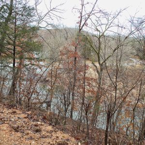
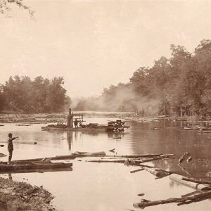 Portia Bay
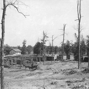 Portia Lumber Co.
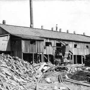 Portia Lumber Company


