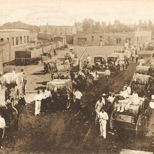
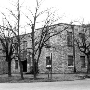
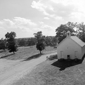
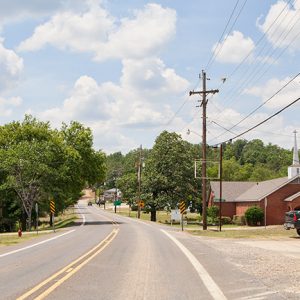
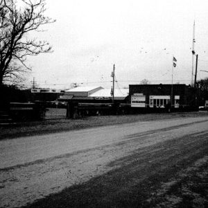
 Newport Street Scene
Entry Type: Place
Newport Street Scene
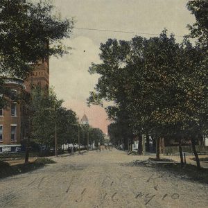 Newport Street Scene
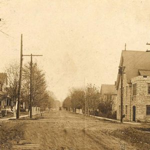 Newport Street Scene
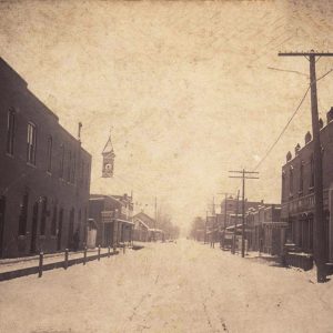 Newport Street Scene
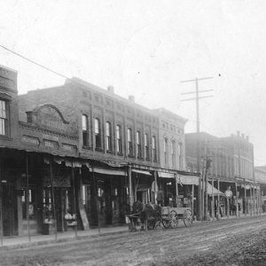 Newport Street Scene
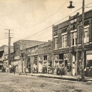 Newport Street Scene
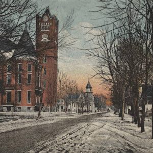 Newport Street Scene
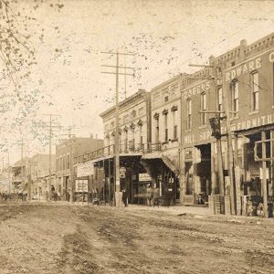 Newport Street Scene
Newton County
Located in the Boston Mountains, Newton County can be described as mountainous, rural, and isolated. The land, once respected and protected by Native Americans, has come full circle with a large portion being protected by the U.S. Department of the Interior as a wilderness area. Louisiana Purchase through Early Statehood The area, rich with game and timber, was watered by the Big and Little Buffalo rivers. Until 1808, the Osage claimed the region, and between 1818 and 1828 the land was part of a reservation granted to the Western Cherokee. The county was part of Carroll County when it was created in 1833, and white settlers quickly moved in. A block of marble taken from a hillside near present-day Marble …
 Newton County Courthouse
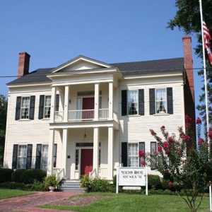 Newton House Museum
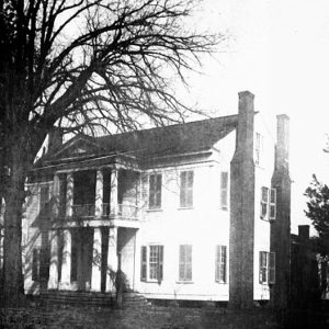 Newton House
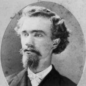 J. H. Niemann
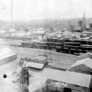
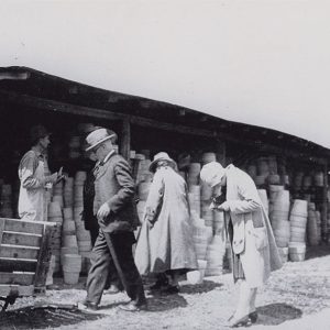 Niloak Customers
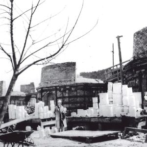 Niloak Kilns
Nimmons (Clay County)
Nimmons is a small town in eastern Clay County. It is near the St. Francis River, which forms the border between northeastern Arkansas and the bootheel of Missouri. Nimmons was created as a rail crossing and lumber town early in the twentieth century. Prior to Euro-American settlement, the land that would become northeastern Arkansas and southeastern Missouri was dominated by swamps and hardwood forests. The area was sparsely inhabited, although the Osage and other Native American nations frequently visited the area to hunt and to fish. French explorers traveled on the St. Francis River, but the location that would become Nimmons remained uninhabited throughout the nineteenth century. With the advent of railroads, businessmen began seeking opportunities to harvest the forests …
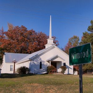
Nimrod (Perry County)
Nimrod is a small community located near the Fourche La Fave River in western Perry County. Never a large community, today it is best known for its proximity to recreational Lake Nimrod, the state’s oldest U.S. Army Corps of Engineers–constructed lake, and the Ouachita National Forest. Fertile soil and the confluence of the Fourche La Fave River with the Arkansas River attracted settlers as early as 1808. However, until the decade preceding the Civil War, most of that settlement centered on the eastern reaches of the river where the town of Perryville (Perry County) was founded. By 1850, James Wilson built the first house at what later became Nimrod. Among other early settlers were the Young, Cherry, James, Cobb, Hill, …
 Nimrod Baptist Church
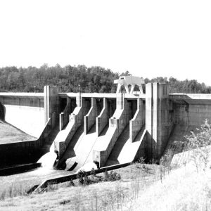 Nimrod Dam
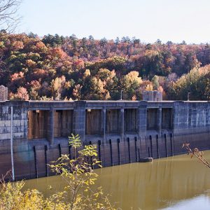 Nimrod Dam
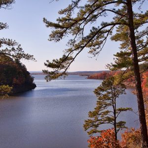 Nimrod Lake
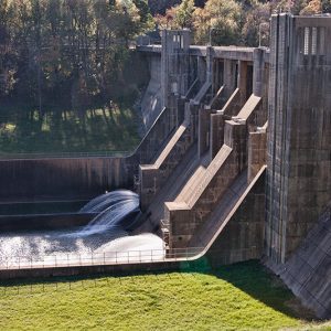 Nimrod Dam
Nimrod Dam and Lake
Nimrod Dam in western Perry County is the oldest project of the U.S. Army Corps of Engineers in the state of Arkansas, created to control flooding along the Fourche La Fave River. Nimrod Lake, the reservoir created by the dam, stretches across the border of Perry and Yell counties and is a popular attraction for fishermen and duck hunters. The dam and lake take their names from the nearby community of Nimrod (Perry County), itself named after the biblical figure. The construction of Nimrod Dam was authorized by the Flood Control Act of 1938. Damming the Fourche La Fave was considered an economical means of protecting communities and valuable crop land in Yell and Perry counties, as well as lessening …
 Nixon Library
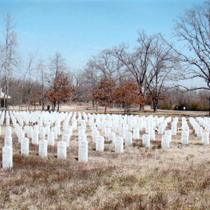 NLR Veterans Cemetery
Nodena Site
The Nodena Site in Mississippi County is an archaeological site representing Native American life in Arkansas during the centuries before European contact. The twelve-to-fifteen-acre pallisaded village was inhabited from approximately AD 1400 to 1650. The name Nodena comes from a later plantation that encompassed the area, while the names Upper Nodena and Middle Nodena represent separate archaeological sites, as well as separate sectors of the later Nodena plantation. The Upper Nodena Site, the larger of the two, is on the National Register of Historic Places and has been listed as a National Historic Landmark. A vast collection of Nodena materials are held at the University of Alabama Museum and its regional repository, the Arkansas Archeological Survey, as well as at …
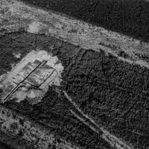 Nodena Site Aerial View
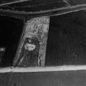 Nodena Site Aerial View
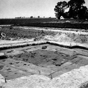 Nodena Site Excavation
 Nola Church of Christ
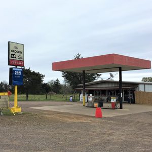 Nola Grocery and Cafe
Nola (Scott County)
Nola formed as a small farming town in eastern Scott County. The unincorporated community was established within the Fourche La Fave River valley near the Yell County border. It is located near Harvey (Scott County), just two miles west along Highway 28. The area where Nola and Harvey are now located was once known as Nebraska. Prior to European exploration, the area where Nola is located was lush with native vegetation and wildlife. Archaeological evidence from the Archaic, Woodland, and Mississippian periods indicate that native people long lived along the river valley where Nola is located. Native American people of the Caddo tribe began settling along the valley around AD 1000. Several thousand burial mounds and other archaeological sites are …
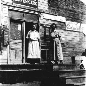 Norfork Post Office
Norfork (Baxter County)
Although it has been known by several names and did not incorporate as a city until the twentieth century, Norfork of Baxter County is one of the oldest extant settlements in Arkansas. Located where the North Fork River empties into the White River, the city of Norfork gave its name to the dam and lake created in the 1940s, and it still benefits from that tourist attraction in the twenty-first century. Jacob Wolf was one of the earliest homeowners in what would become Norfork. He is sometimes identified as an Indian agent, although no record exists of his appointment or activity in this vocation. Some local historians have claimed that Wolf arrived in Arkansas as early as 1811, but his presence …
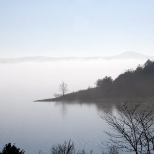
Norfork Dam and Lake
Built on the North Fork River, just upstream from its confluence with the White River in Baxter County in north-central Arkansas, Norfork Dam and Lake are named after the nearby town of Norfork (Baxter County). The dam was authorized by Congress in the Flood Control Act of 1938, and construction began in the spring of 1941, making it one of the oldest U.S. Army Corps of Engineers’ multi-purpose concrete structures. The reservoir extends north from the dam site to near Tecumseh, Missouri, and covers portions of Baxter and Fulton counties in Arkansas and Ozark County in Missouri. The drainage area controlled by the reservoir is about 1,806 square miles. The project also contains a powerhouse that houses the generators and …
 Norfork Lake
 Norfork Lake Ferry
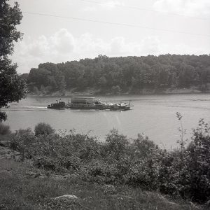 Norfork Lake Ferry Crossing
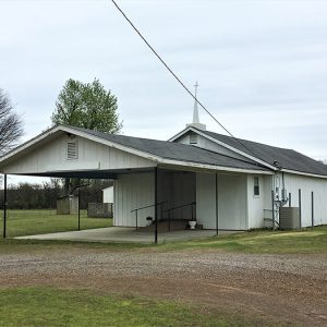
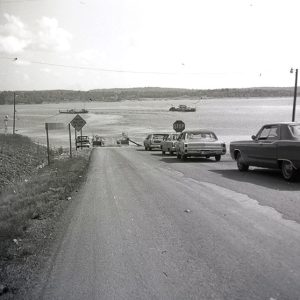
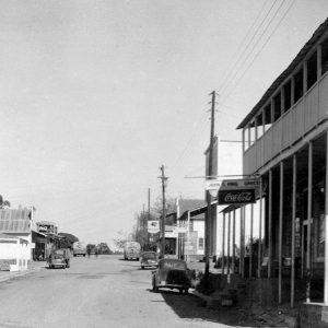 Norfork Street Scene
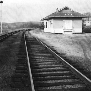 Norfork Train Depot
 Norick's Chapel
 Norman
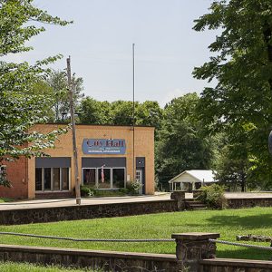 Norman City Hall
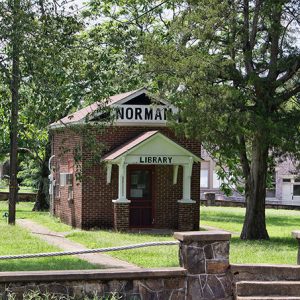 Norman Library
Norman (Montgomery County)
Norman, known as Womble until 1925, is located on the Caddo River in southern Montgomery County. It was created as a result of the building of the Gurdon and Fort Smith Railroad and grew because of the lumber mills that sprang up along its right of way. It was once the home of the Presbyterian Church’s Caddo Valley Academy. In 1905, plans were announced to extend the Gurdon and Fort Smith line from Glenwood (Pike County), then its terminus, to Black Springs (Montgomery County). This announcement brought a large number of land speculators, including Walter E. Womble Sr., into the area. However, in 1907, a dispute over rights of way halted the project near the Caddo River, several miles short …
 Norman Street Scene
Norphlet (Union County)
The city of Norphlet, like nearby Smackover (Union County) and El Dorado (Union County), rose to prominence due to the oil industry. The city is home to one of the most notorious disasters in Arkansas’s history of oil drilling. More recently, however, it has become a bedroom community to El Dorado, the county seat. The forested hills of Union County were thinly populated until after the Civil War and Reconstruction. The railroad industry, combined with the timber industry, brought new life to the area. The St. Louis, Iron Mountain and Southern Railway built a line running from Gurdon (Clark County) through El Dorado that was completed in January 1891. Norphlet was one of several depots created along the railway. The timber industry was …
 Norphlet View
Norristown (Pope County)
Norristown briefly served as the county seat of Pope County and was an important stop along the Arkansas River between Little Rock (Pulaski County) and Fort Smith (Sebastian County). It was located across the river from Dardanelle (Yell County) but no longer exists. Norristown was first settled in the late 1820s by Samuel Norris and quickly became a main shipping point, with area cotton loaded up on boats for shipment downriver and eventually to New Orleans, Louisiana. Norristown was designated the county seat in the early 1830s, though no courthouse was ever built there, and served as such until the 1840 creation of Yell County from part of Pope County necessitated the movement of the seat to Dover (Pope County), …
 Norristown Cemetery


