 Poke Bayou
Entry Type: Place - Starting with P
Poke Bayou
 Poke Bayou
Poke Bayou (Sharp County)
Poke Bayou creek begins near Sidney (Sharp County) at Big Spring in Izard County, flows through Sandtown (Independence County), and empties into the White River just above the bridge at Batesville (Independence County). Izard County historian Denny Elrod stated the following about the area’s history: “It was to this creek many of the early settlers came. Across the White River from Poke Bayou is Wolf Bayou which hosted an Indian camp and trading-post. The creek is picturesque near Sandtown as it flows along the foot of overhanging bluffs.” The original settlement at Batesville dates back to at least an 1814 trading post. When the first post office was established on the confluence of the bayou and the White River on …
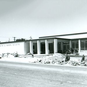 Police and Court Building
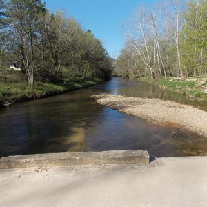
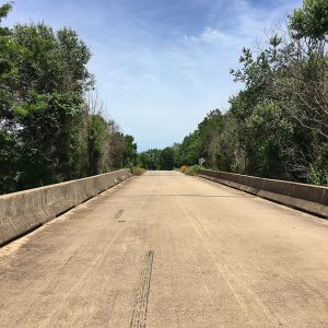
 Polk Bayou Bridge
Polk County
Polk County, located on the western edge of Arkansas, was the home of the comedy team of Lum and Abner, country singer T. Texas Tyler, and the controversial Commonwealth College. All of Polk County is in the Ouachita Mountains. Rich Mountain is the site of the historic Queen Wilhelmina State Park. Louisiana Purchase through Early Statehood White settlement in Polk County began about 1830. At that time the region was part of Sevier County. Polk County, named for President James K. Polk, was separated from Sevier County by the legislature on November 30, 1844. The 1860 census gave the Polk County population as 4,090 whites and 172 enslaved persons. Slavery was not common in Polk County because the mountainous terrain …
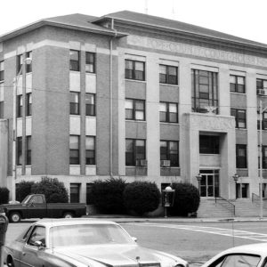
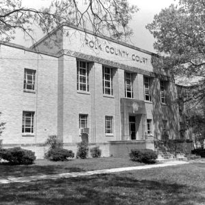 Polk County Courthouse
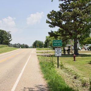
Pollard (Clay County)
Pollard is a city in Clay County, a few miles west of Piggott (Clay County) on U.S. Highway 62, in the foothills of Crowley’s Ridge. Pollard has witnessed the emergence and decline of the railroad and the timber industry; its focus in the twenty-first century is on local agriculture. Even before the Civil War, several families had settled in the hills adjacent to Crowley’s Ridge. A store was operated by a man remembered only as McElroy. New Hope Baptist Church was established before the war began. The Pollard family moved into the area after the war, with Jack Pollard opening the first general store in the area with partner Tom Irwin, and Bill Pollard obtaining a post office (which was …
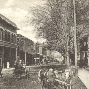
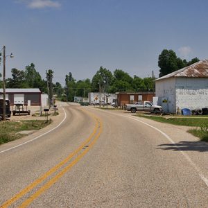 Pollard Street Scene
 Pollard Street Scene
 Ponca Church
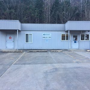 Ponca Post Office
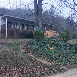 Ponca Bible Camp
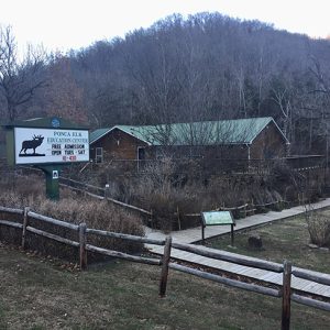 Ponca Elk Education Center
Ponca Elk Education Center
The Ponca Elk Education Center was established in 2002 to serve wildlife enthusiasts coming to Newton County to view elk, which were introduced to the state in 1981. The center is in a handsome log building on Arkansas Highway 43 in the village of Ponca in western Newton County. The building was for a short time used as a charter school by a religious organization and was later leased by the Arkansas Game and Fish Commission (AGFC). The Ponca facility has displays of elk and many other Arkansas wildlife. It features eye-catching photographs and a gift shop selling nature-related items, as well as hunting and fishing licenses. There is also a small meeting room. Porches offer visitors a chance to …
Pond Creek National Wildlife Refuge
Pond Creek National Wildlife Refuge, the 501st refuge in the National Wildlife Refuge System, protects and preserves one of the last remaining bottomland hardwood tracts in the Red River Basin. Established in 1994 under the Emergency Wetlands Resources Act, the refuge encompasses approximately 28,000 acres and is located in southwest Arkansas along the Texas/Oklahoma border. Originally established as Cossatot National Wildlife Refuge, the name was changed in 1997 at the request of citizens to retain the local name, Pond Creek Bottoms. Pond Creek National Wildlife Refuge is one of four refuges managed as part of the South Arkansas National Wildlife Refuge Complex with headquarters at Crossett (Ashley County). Geographically positioned in an area where the Central and Mississippi flyways overlap, …
 Poor Farm Cemetery
 Poor Farm Cemetery
Pope County
Pope County lies in northwestern Arkansas, halfway between the state capital of Little Rock (Pulaski County) and the cities of Fort Smith (Sebastian County) and Fayetteville (Washington County). The county is geographically diverse, with the Ozark National Forest covering most of the northern portion, while the southern portion is located in the Arkansas River Valley and includes the cities of Russellville and Atkins. The county also is home to Arkansas Tech University. Pre-European Exploration Several examples of prehistoric rock art, or pictographs, dating from the Mississippian Period and perhaps earlier are found in Pope County. Four sites containing such paintings are listed on the National Register of Historic Places, although to protect them from being disturbed, their precise location is …
 Pope County Courthouse
 Poplar Street
Portia (Lawrence County)
The area that became the town of Portia in the late nineteenth century was home to some of Arkansas’s earliest settlers. Incorporated in 1886, the town, located on U.S. Highway 63, was once an important business center and timber-producing area. In the twenty-first century, however, its business district is declining. Native Americans were the first to settle the area around Portia, as evidenced by the many artifacts found along the banks of the nearby Spring and Black rivers. The first white settlers to the area probably arrived around 1800 as a result of two Spanish land grants, one of which included the land where the present town is located. In 1816, the General Land Office in Washington DC confirmed the …
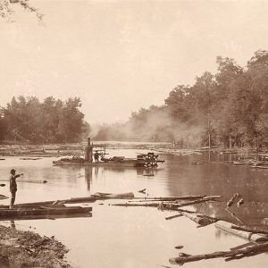 Portia Bay
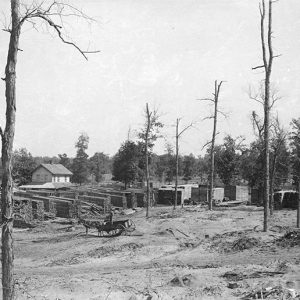 Portia Lumber Co.
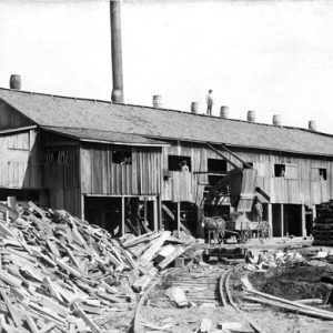 Portia Lumber Company
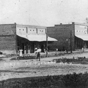 Portland Main Street
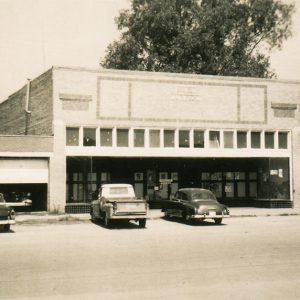 Portland City Hall
Portland (Ashley County)
Portland is a small Delta town in Ashley County. It began as a settlement on Bayou Bartholomew and became a steamboat port, an agricultural center, and a railroad town. Louisiana Purchase through Early Statehood The earliest known settlers were John P. Fisher and William Brady, who were there in the 1830s. Fisher arrived by 1833, established a plantation, and constructed a two-story house on the west side of the bayou. A short distance down the bayou from Fisher’s house, a small settlement emerged on the opposite side. Steamboat captains called this stopping place “the port,” and upon establishment of a post office in 1857, it was named Portland. The bayou village consisted largely of mercantile stores that received their goods …
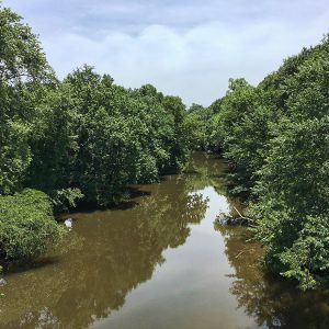
Possum Grape (Jackson County)
Possum Grape is an unincorporated community in Glaize Township located in the western panhandle of Jackson County near Highway 367, about eleven and a half miles southwest of Newport, the county seat, and about four and a half miles northeast of Bradford (White County). Possum Grape lies just west of the White River where the flat land meets the Ozark Mountains. Possum Grape is near the historic riverboat town of Grand Glaise (Jackson County). The community most likely received its unusual name from the wild grape called the possum grape, popular in the area for making jam and wine. A few locals say Possum Grape was named in 1954 following a disagreement on whether to call it “Possum” or “Grape.” …
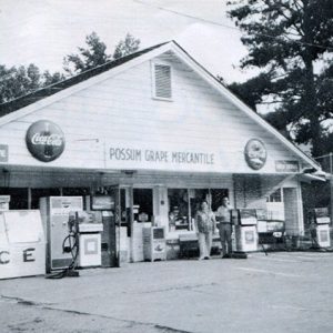 Possum Grape Mercantile
 Post Familie Vineyards and Winery
Postage Stamps with Arkansas Connections
Special stamps are created to recognize people, events, and themes of national interest. They reflect popular culture and provide a unique lens for understanding history. Although stamp designs were initially chosen by the postmaster general, the Citizens’ Stamp Advisory Committee (CSAC) assumed selection responsibilities in 1957. Following official guidelines, the CSAC Committee recommends stamps to the postmaster general, who makes the final decision on stamps selected to be used by the U.S. Postal Service. Some postage stamps related to Arkansas reflect a direct connection with the state, while others have more indirect relationships through agriculture, business, and education. Stamps related to Arkansas include the following, in alphabetical order: Angelou, Maya (2015) This stamp honors Maya Angelou, the author of I …
 Poteau River
 Poteau River
 Poteau River at Fort Smith
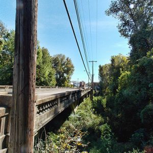
 Poteau River Bridge
Potlatch Cook’s Lake Nature Center
Potlatch Cook’s Lake Nature Center (originally the Potlatch Conservation Education Center at Cook’s Lake) is located near the small community of Casscoe (Arkansas County) approximately twenty miles southeast of Stuttgart (Arkansas County). The general purpose of the facility is conservation education, focusing on the bottomland hardwood forests and upland community of forests that surround the center. This is accomplished by introducing various audiences to hands-on outdoor learning activities. The property is recognized as an important wildlife sanctuary, especially for migrating waterfowl. In 1990, the forty-nine nations of the Ramsar Convention (an international treaty for conserving and sustainably utilizing wetlands) recognized the 200-acre Cook’s Lake and its surrounding property as a “wetland of international importance,” representing the diverse natural features of …
 Potts Inn
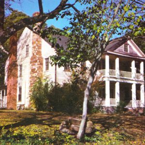 Potts Inn
 Pottsville
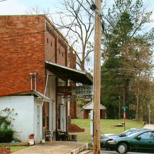
Pottsville (Pope County)
Pottsville is sixty-nine miles northwest of Little Rock (Pulaski County) and six miles east of Russellville (Pope County), the county seat of Pope County. It has one of Pope County’s five school districts and serves as a bedroom community for both Little Rock and Russellville. Early Statehood through the Gilded Age Pottsville was founded by Kirkbride Potts who, in 1820 at age seventeen, traveled from New Jersey to Missouri and then to Arkansas with two slave families. Arriving in Arkansas in 1824, he became acquainted with two brothers, William Logan and Robert A. Logan, soon settling along with them in an area south of the Arkansas River in present-day Logan County. This area was ceded by the Choctaw tribe to …
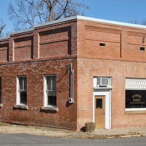 Pottsville Citizens Bank
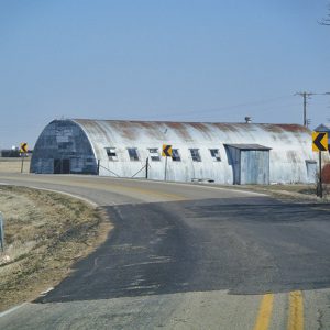 POW Camp in Earle
Powder Magazine (Scott County)
The Powder Magazine is located approximately fifty yards south of the junction of County Roads 96 and 99 in northeastern Scott County. The structure was built around 1935 by the Civilian Conservation Corps (CCC). It was listed on the National Register of Historic Places on October 20, 1993. The structure was built by the 1707th Company of the Arkansas CCC District, which was stationed at the Waldron Camp. The structure was intended to store explosives that were used for bridge and road construction, as well as other conservation projects such as erosion control within the Ouachita National Forest. The Powder Magazine is significant due to its association with the Civilian Conservation Corps, which made significant contributions to American social history. …
Powhatan (Lawrence County)
Powhatan was the Lawrence County seat of government for almost ninety-five years. Founded in the early nineteenth century on the banks of the Black River, the town became the county’s most important port on the Black River. When bypassed by the railroad in the 1880s, the town began a steady decline and is best known today as the site of a historic state park. Louisiana Purchase through Early Statehood White settlers established themselves in the area at about the same time as the creation of the Missouri Territory county of Lawrence. One of the earliest, John Ficklin, settled on the west bank of the Black River and, by 1820, began operating a ferry. Within a few years, the crossing and …
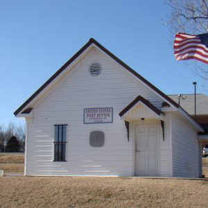 Powhatan Post Office
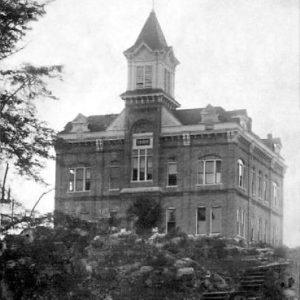 Powhatan Courthouse
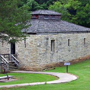 Powhatan Jail
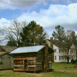
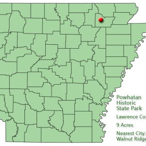 Powhatan Historic State Park: Park Location
Powhatan Historic State Park
Powhatan Historic State Park preserves a small nineteenth-century river port town in Lawrence County, once a hub of northeast Arkansas commerce, industry, and government. Located on the Black River at the juncture of the Ozark Plateau and the Arkansas Delta, Powhatan pioneers had the advantages of easy river access, plentiful resources in the foothills, and fertile land. The first steamboat, the Laurel, arrived around 1829, beginning a series of landings that spanned over 100 years and stimulated civic and regional growth. Footpaths transformed into roads, a river ford into a ferry, and swampy delta into rich farmland, attracting merchants, farmers, and families. In 1837, the settlement name “Powhatan” was selected to honor the Virginia Native American chief, father of Pocahontas. …


