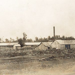
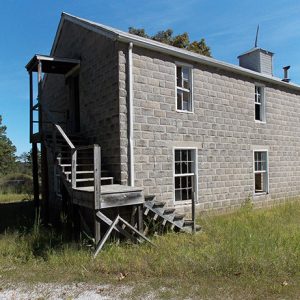
 Lasater and Bailor Stave Mill
Entry Type: Place - Starting with L
Lasater and Bailor Stave Mill
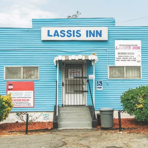 Lassis Inn
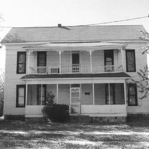 Latimore Tourist Home
Lavaca (Sebastian County)
Located near Arkansas Highways 22 and 96 in Sebastian County, Lavaca can trace its beginnings to the need for a stop for soldiers traveling along the Arkansas River. From its start as a landing in new and undiscovered territory, Lavaca has become a bedroom community of Fort Smith (Sebastian County), the second-largest city in Arkansas. Louisiana Purchase through Early Statehood In 1817, Fort Smith became the first U.S. military installation in the Southwest. Soldiers would travel from Little Rock (Pulaski County) to Fort Smith when they could, but shallow water and jutting bedrock halted boat travel at points, forcing them to travel by land. In 1821, Major Benjamin Moore, a former Virginia resident, and William and Ben Moore Jr. settled …
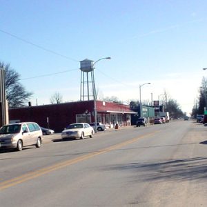
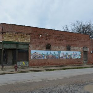
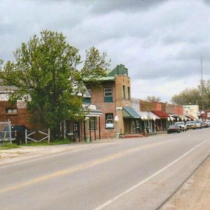
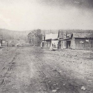
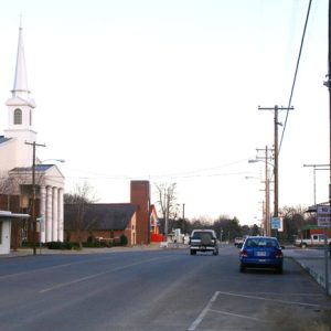 Lavaca Street Scene
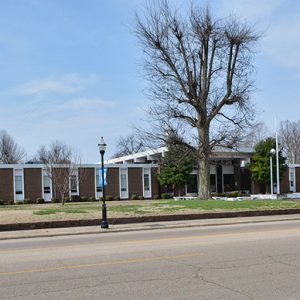
Lawrence County
The “Mother of Counties,” Lawrence County once covered a majority of northern Arkansas, an enormous stretch of land ultimately forming thirty-one counties. Present-day Lawrence County straddles the Black River, a natural boundary separating the lowlands of the Mississippi Delta from the foothills of the Ozark Plateau. Long dominated by cotton production, this agricultural county now produces rice, soybeans, corn, and sorghum. Louisiana Purchase through Early Statehood The Osage hunted in what would become Lawrence County, although they had no settlements there. The eastern portion of the county may have been visited in 1541 during a side trip of the expedition of Hernando de Soto. Arkansas became United States territory with the Louisiana Purchase of 1803. Named for War of 1812 …
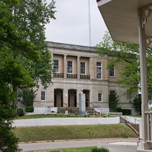
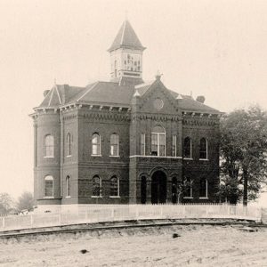
 Lawrence County Courthouse
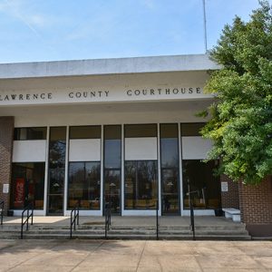 Lawrence County Courthouse
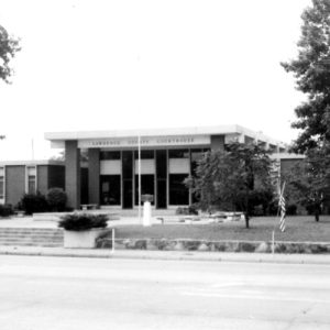 Lawrence County Courthouse
Lawyers’ Row Historic District
Lawyers’ Row Historic District is a group of four buildings located on West Second Street in Malvern (Hot Spring County). Sitting to the northeast of the Hot Spring County Courthouse, the buildings are similar to one another in design and construction. Lawyers’ Row Historic District was added to the National Register of Historic Places on September 28, 2015, with three of the buildings listed as contributing structures. The district is located on the northeast side of West Second Street and runs between Locust Street and an unnamed alley parallel to Main Street. Cooper Funeral Home is located at 118 West Second Street at the corner with the alley. Constructed around 1910, the building was first occupied by an undertaker business. …
Leachville (Mississippi County)
Leachville of Mississippi County was once known as “The Cleanest Town on Buffalo Island, Where Agriculture and Industry Meet.” Established about 1896, Leachville is thirty miles east of Jonesboro (Craighead County) and twenty-eight miles west of Blytheville (Mississippi County). Leachville’s founding fathers were James Wiseman Honnoll, Joshua Gilbert Leach, and Sam McNamee of Holly Springs, Mississippi. Leach and Honnoll incorporated the Leach-McNamee Land Development Company on March 15, 1898. Honnoll named the town in honor of Leach. Although founded in 1896, the town was not incorporated until February 2, 1916. The Gilded Age through Early Twentieth Century The late nineteenth century brought business and industry to the settlement. In 1898, the Cannon family, which had moved to Leachville early on, …
 Leachville Street Scene
Lead Hill (Boone County)
As its name indicates, Lead Hill began as a mining town on the upper White River shortly after the end of the Civil War. In the middle of the twentieth century, the community had to be relocated due to the creation of Bull Shoals Lake. Since that time, the town has relied largely on the tourist industry. At the time of the Louisiana Purchase in 1803, the area that would become northern Arkansas was hunting ground for the Osage, who lived farther north at the time. The land was ceded to the United States by a series of treaties, but the Ozark Plateau did not draw as many settlers as the river valleys or the rich farmland of southern Arkansas. …
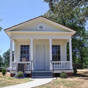 Leake-Ingham Library
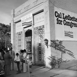 Cal Ledbetter Campaign Headquarters
Lee County
Located in the Delta, Lee County is bounded on its east by the Mississippi River. Two navigable rivers, the St. Francis and the L’Anguille, flow through the county. Marianna, the county seat and largest town, sits on the L’Anguille. Though the county’s fertile land and timber resources built its rural agricultural landscape, its emphasis on agriculture translated in a severe population decline as agricultural modernization progressed in the middle of the twentieth century. European Exploration and Settlement Hernando de Soto and his men were probably the first Europeans to enter what is now Lee County in August 1541. The expedition likely descended the St. Francis River and entered the chiefdom of Quiguate, which the Spaniards described as the largest of …
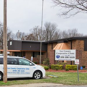 Lee County Cooperative Clinic
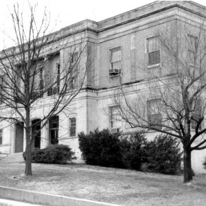 Lee County Courthouse
 Lee County Courthouse
 Lee County Courthouse
 Lee Grocery Store
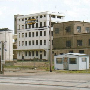
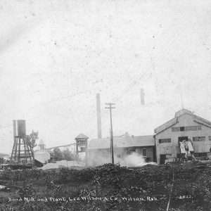 Lee Wilson & Co.
 Lee Wilson & Company
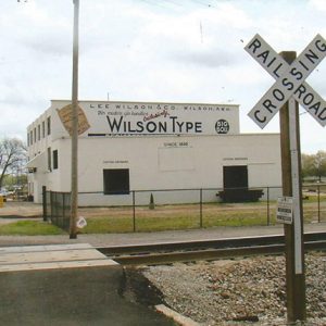 Lee Wilson & Company
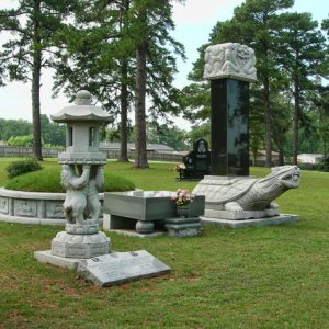 Haeng Ung Lee Memorial
 Lee's Chapel
Lenox (Clark County)
Lenox (sometimes spelled Lennox) was a small community in Clark County, located about four miles northeast of Fendley (Clark County), near DeGray Lake. The origin of the community’s name is unknown—while a Lenox family did reside in Clark County at the beginning of the twentieth century, they did not reside near the community. The earliest settlers in the area arrived in 1860 when Benjamin Easley obtained 280 acres of land from the Federal Land Patent Office. Boley Matlock obtained eighty acres in the area the same year. After the Civil War, more families slowly moved into the area. Asa Holcomb and his family arrived in 1871. In 1913, his grandson obtained forty acres of land in the Lenox area. John …
 Leola
Leola
 Leola
Leola
 Leola
Leola
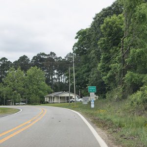
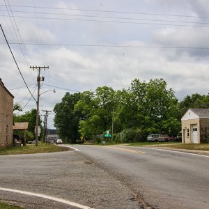
Leola (Grant County)
Formerly known as Sandy Springs, the town of Leola in Grant County was formed early in the twentieth century as a timber town served by the Rock Island Railroad. Although it struggled during the years of the Depression, Leola was revitalized in the middle of the twentieth century and remains a producer of timber in the twenty-first century. Among the earliest white settlers in the area were John Guest, Thomas Toler, William Dyer, and Mary Dyer, who established land claims between 1843 and 1857. Most of the residents were farmers, benefiting from the rich land along the Saline River, which flooded in some years, providing a short-term inconvenience but also enriching the farmland with fresh deposits of rich soil. The settlement …
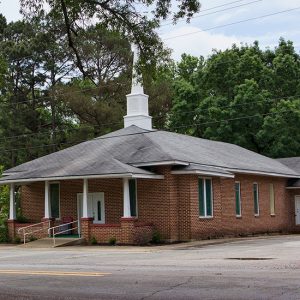
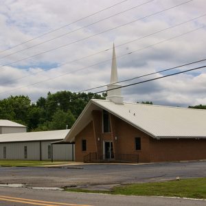 Leola Baptist Church
 Leola Methodist Church
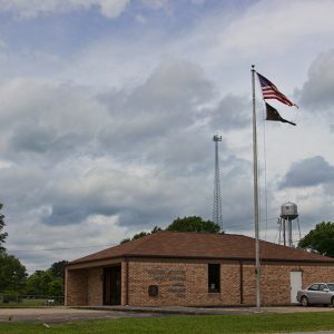 Leola Post Office
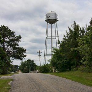 Leola Water Tower
Lepanto (Poinsett County)
A product of the timber industry and the railroads, the city of Lepanto grew through the twentieth century from a western-style logging community into an agricultural center for Poinsett County. Today, the city is most famous for its annual Terrapin Derby and for its appearance in the movie A Painted House. Civil War through the Gilded Age Lepanto is located within the sunken lands of northeast Arkansas. Prior to the construction of levees and drainage ditches, it was merely a high spot in the cane-break swamp, though the area was also heavily forested. The first known settler in the area was George Nichols, who moved to Arkansas from Dunklin County, Missouri, around 1858. More settlers came into the area in …
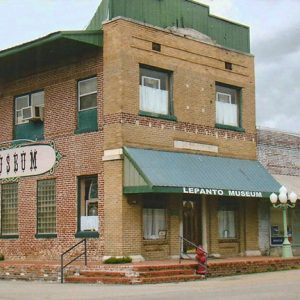 Lepanto Museum
 Lepanto Street Scene
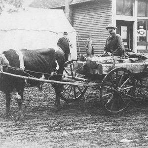
Leslie (Searcy County)
Leslie is situated in southeastern Searcy County amid the rugged Boston Mountains region of the Ozark Plateau. It was once a booming railroad and lumber city and one of the centers of industry in the Ozark region of Arkansas. Louisiana Purchase through Early Statehood The city was originally named Wiley’s Cove. According to some sources, this was in honor of Chief Wiley, said to be a Cherokee resident of Searcy County; however, it likely derived its name from one of the numerous whites named Wiley, Wilie, or Wily who were squatting in northern and central Arkansas in the early nineteenth century. The first post office in the county was established in 1842. In the 1850s, settlers Henry Begley and his …
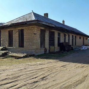 Leslie Depot
 Leslie Manufacturing District
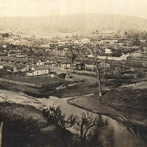
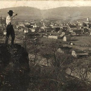 Leslie Overlook
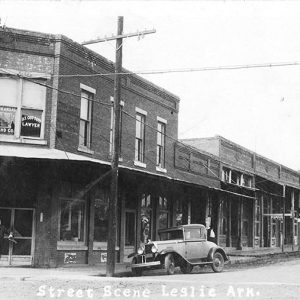 Leslie Street Scene
 Leslie Street Scene
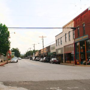 Leslie Street Scene
Lester (Ouachita County)
Lester (Ouachita County) is an unincorporated community located about six miles northwest of Camden (Ouachita County) and about seven miles southeast of Chidester (Ouachita County). It is also about four miles west of the Ouachita River. The community is also known as Lester Junction. The Gee family owned land throughout Ouachita County before the Civil War, including two plots of at least eighty acres east of Lester, although they resided in Camden. They were the largest landowners in the area. Early settlers in the area included Calvin Warren, who obtained 120 acres as part of a federal land patent in 1882. Robert Lester obtained eighty acres in 1888. A post office opened in the community in 1881 and operated until …
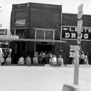 Lester Drug Company
Letona (White County)
Letona is a town in White County, nearly ten miles north of Searcy (White County) on Highway 310. First rising to prosperity as a stop on the Missouri and North Arkansas (M&NA) Railroad, Letona became a center of the timber industry and of agriculture, primarily fruit. The first white settlers in White County, John and Nancy Magness, arrived in the area of what would become Letona in 1815. The area remained sparsely settled, with some farms separated by large wooded areas, throughout the nineteenth century. A Civil War skirmish, known as the Skirmish at Big Indian Creek, was fought in the area on May 27, 1862. Company A of the Thirty-second Arkansas Infantry (CS) attacked a forage train that was part …
 Letona, 1915
Levi Wilcoxon Demonstration Forest
The Levi Wilcoxon Demonstration Forest (LWDF) is located about three miles south of Hamburg (Ashley County) along U.S. Highway 425. Privately owned, the LWDF is a remnant of the old-growth pine forest that once covered much of southern Arkansas. The LWDF is notable for the dimensions of the loblolly and shortleaf pines still found within its boundaries—most of the pines in this roughly ninety-acre stand are between 100 and 200 years old and over 100 feet tall. For example, the “Morris Pine” is a loblolly fifty-six inches in diameter, 117 feet tall, and estimated to be at least 300 years old. The national champion shortleaf is also found in the LWDF and measures thirty-six inches in diameter and 136 feet …


