Entry Category: Land and Resources

Hurricane Katrina/Rita Evacuees

Following the destruction wrought by Hurricane Katrina in late August 2005, the evacuated population of New Orleans, Louisiana, was redistributed throughout America to forty-five states and the District of Columbia. As expected, states in the South took in more of the displaced than the rest of the country. An estimated eighty percent of Katrina evacuees temporarily relocated to Mississippi, Alabama, Texas, Tennessee, Georgia, Florida, or Arkansas. Arkansas received approximately 75,000 evacuees, and Texas initially took in more than 250,000 at the Houston Astrodome, the Reliant Complex, the George R. Brown Convention Center, and other sites in southern Texas. However, no state experienced a population increase larger than Arkansas, whose population jumped 2.5 percent after the evacuees arrived. The first evacuees …

Hurricane Lake

Hurricane Lake is a 332-acre manmade lake located in Benton (Saline County) at the confluence of Hurricane Creek and the Little Hurricane Creek. Construction of the lake began in 1942 with the Hurricane Creek Dam built by Alcoa Mining Company to flood the area. Hurricane Lake’s primary function was to provide water for Alcoa’s Hurricane Creek aluminum plant. Hurricane Lake was also used for recreational activities by company employees and their families. In the twenty-first century, the lake and its surroundings are owned by the Hurricane Lake Estates Development Company. In 1891, bauxite ore, an essential material used in the production of aluminum, was discovered four miles southwest of Hurricane Creek near Benton. Because of the need for aluminum during …

Illinois River

Flowing through the Ozark borderlands of eastern Oklahoma and western Arkansas, the Illinois River is fed by 1,660 square miles of drainage area and serves as the primary tributary for the largest lake in eastern Oklahoma, Tenkiller Ferry Reservoir. The Illinois has historically represented an area of significant economic importance and ecological convergence between the hilly Ozarks and the southern plains. The watershed of the Illinois River comprises five counties in Oklahoma and Arkansas, providing more than 100 miles of recreational opportunities. The Illinois River system consists of the Illinois and its tributaries, Flint and Baron Fork creeks, both of which are major tourist destinations for the south-central United States and provide a substantial portion of tourism income for the …

Independence Steam Electric Station

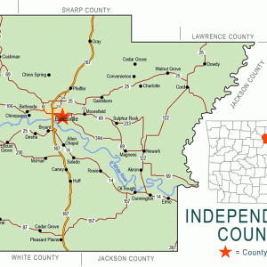
The Independence Steam Electric Station (ISES) is a coal-fired electric-energy-generating plant consisting of two units nameplate-rated at 850 megawatts (MW). Located near Newark (Independence County), the units—constructed by Arkansas Power and Light Company (AP&L, now Entergy Arkansas)—were launched into service in 1983 and 1984 following vigorous litigation before the Arkansas Public Service Commission (APSC) in 1978. The ISES plant burns Powder River Basin low-sulfur coal transported to Arkansas from the Antelope Coal Mine in Wyoming by rail in cars owned by Entergy. ISES—originally proposed by AP&L, Arkansas Electric Cooperative Corporation (AECC), and City Water and Light (CWL) of Jonesboro (Craighead County), and now also co-owned or leased by several other Arkansas municipal utilities—operates in coordination with other generating plants within …

Industrial Sand Mining

Industrial sand is a term normally applied to high-purity silica sand products with closely controlled sizing. Industrial sand is a more precisely sized and shape-graded product than common sand used as aggregates in construction materials, such as concrete and asphalt. Typically, sand is composed predominantly of quartz (SiO2), and, in the case of industrial sand, the shape, size, and composition of the grains are important to determining suitable uses for the product. Sizing of industrial sand is typically done by screening and air sorting of a dried product. The term “sand,” as used by geologists, generally refers to individual grains that range in particle size from 0.00246 to 0.0787 inch (0.0625–2.0 millimeter) in diameter. This grain size ranges from just …

Invasive Animals

aka: Alien Animals
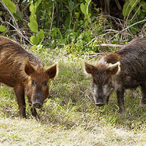
An “invasive species” is defined as a species that is non-native (or alien) to the ecosystem under consideration and whose introduction causes or is likely to cause economic or environmental problems or harm to human health. It typically matures and reproduces quickly and increases its geographic range rapidly, establishing populations and persisting over large areas. There are several reasons for this spread, including favorable environmental conditions and lack of natural predators, competitors, and diseases that normally regulate their populations, allowing invasive species to thrive. Invasive biota not only includes a variety of plants but also incorporates a wide variety of invertebrates and higher taxa from their native sites. As invasive species extend and dominate ecosystems, they invariably reduce native biodiversity …

Invasive Plants

aka: Exotic Plants
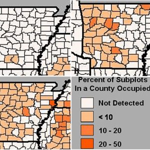
According to the U.S. Department of Agriculture (USDA) Forest Service, an invasive species is “a species that is non-native or alien to the ecosystem under consideration and whose introduction does or is likely to cause economic or environmental harm or harm to human health.” As such, there are a suite of negative effects from exotic plant species that include replacing rare and endangered species, hybridizing and competing with native species, killing trees and shrubs, altering hydrological patterns and stream function, preventing forest regeneration, possibly containing toxins that may be lethal to certain animals, changing fire patterns, and harboring pathogens. The cost to control invasive species and the damages they cause to property and natural resources in the United States is …

Irons Fork Experimental Forest

Shortly after experimental forests were authorized for the U.S. Forest Service (USFS)—an agency of the U.S. Department of Agriculture (USDA)—by the McSweeney-McNary Forest Research Act of 1928, the Ouachita National Forest (ONF) reached out to the USFS’s Southern Forest Experiment Station (SFES). The ONF staff members wanted the SFES to develop an experimental forest to help them learn about managing the shortleaf pine (Pinus echinata)–dominated forests of the Ouachita Mountains in Arkansas. In early 1931, the SFES dispatched a three-man crew to examine possible locations on the ONF, but they did not find any areas they thought were suitable for silvicultural research. The ONF and the USFS’s Washington DC office persisted, and a few years later the SFES suggested an experimental forest on a large tract of virgin and cutover timber along the Irons Fork …

Island 37

aka: Andy Crum (Lynching of)
aka: Bert Springs (Lynching of)
Island 37 is a stretch of land that is in the legal possession of the State of Tennessee but is physically joined to Arkansas. Because competing claims of jurisdiction left it in something of a legal void, Island 37 became, in the early twentieth century, an outpost for bootleggers and other criminals. Police action taken against those criminals resulted in one of the many U.S. Supreme Court cases regarding ongoing boundary disputes between Arkansas and Tennessee. The Mississippi River is a dynamic waterway, often cutting new channels and thus either forming islands or causing former islands to merge with the eastern or western banks. The legal principle of avulsion holds that land cut off by the river from one state …

Ivory-billed Woodpeckers

aka: Campephilus principalis
Long believed to be extinct, the ivory-billed woodpecker (Campephilus principalis) was apparently rediscovered in the Big Woods of east Arkansas in 2004. More than sixty years after the last confirmed sighting in the United States, a research team announced on April 28, 2005, that at least one male ivory-bill survived in the vast bottomland swamp forest. Published in the journal Science, the findings included multiple sightings of the elusive woodpecker and frame-by-frame analyses of brief video footage. The evidence was gathered during an intensive year-long search in the Cache River and White River National Wildlife Refuges in eastern Arkansas, involving more than fifty experts and field biologists working as part of the Big Woods Conservation Partnership, led by the Cornell …

Joe Hogan Fish Hatchery

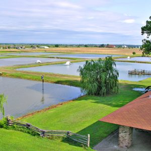
Since 1928, the Joe Hogan State Fish Hatchery near Lonoke (Lonoke County) has produced fish for stocking Arkansas lakes and streams. It is the oldest and largest of the four warm-water hatcheries run by the Arkansas Game and Fish Commission (AGFC) and is the largest and one of the oldest state-owned warm-water pond hatcheries in the United States. Early in 1928, AGFC chairman Lee Miles instructed AGFC secretary Guy Amsler to look for available land near Lonoke for the construction of a fish hatchery. The site purchased for the hatchery was a half mile south of Lonoke and consisted of two adjacent rice farms totaling 266 acres and located along present-day U.S. Highway 70. The commission earmarked $17,544 for purchasing …

Karst Topography

Karst topography refers to natural features produced on a land surface due to the chemical weathering or slow dissolving of limestone, dolostone, marble, or evaporite deposits such as halite and gypsum. The chemical weathering agent is slightly acidic groundwater that begins as rainwater. Rainwater becomes acidic by absorbing carbon dioxide to create carbonic acid as it falls through the atmosphere. It then passes through the soil horizon and, now acidic groundwater, moves through fractures (cracks) and open spaces within rocks. Solution occurs as carbonic acid in groundwater dissolves calcite, which is the principal mineral in limestone and marble and an important mineral in dolostone. Halite and gypsum are easily dissolved in water alone. The region in Arkansas most well known …

Kings River

The Kings River runs for about ninety miles through Madison and Carroll counties to its confluence with the White River arm of Table Rock Lake, located on the Missouri–Arkansas border. As with other rivers that begin on the north-facing slopes of the Boston Mountains, the Kings River flows north. The river divides Carroll County politically; in 1883, the Arkansas legislature recognized two judicial districts, at Berryville (Carroll County) and Eureka Springs (Carroll County), on opposite sides of the river, though the river itself was not the legal boundary until 2011. The Kings River drains from two very different subsections of the Ozarks. Its headwaters form in the oak forests of the Boston Mountains sub-region of the Ozark Plateau near the …

Kudzu

Kudzu (Pueraria lobata) is an invasive vine characterized by aggressive growth and clusters of grape-scented purple flowers. It was recognized as a weed in 1972 by the U.S. Department of Agriculture (USDA). A native plant of Asia, kudzu has been used for over two millennia in Asian cooking and medicine. Kudzu was introduced to the United States at the Philadelphia Centennial Exposition (1876) and to southerners at the New Orleans Exposition (1884–1886). Kudzu’s foothold in the American South is largely the result of the efforts of Charles Pleas, Channing Cope, and the Soil Conservation Service (SCS). Pleas owned Glen Arden Nursery in Chipley, Florida, along with his wife, Lillie. After Pleas discovered kudzu’s usefulness for livestock forage and as a …

L’Anguille River

The L’Anguille River arises west of Harrisburg (Poinsett County) from the confluence of several creeks and agricultural ditches and flows south, always on the western side of Crowley’s Ridge until it nears Marianna (Lee County), where it cuts east across the ridge and empties into the St. Francis River. In the twenty-first century, the L’Anguille River was designated an impaired watershed by the Environmental Protection Agency (EPA) due to excessive siltation and pollution from agricultural runoff. The area around the L’Anguille River has been the site of human habitation as far back as 10,000 BC. Among the many sites of prehistoric habitation along the river basin is the Lace site, a Dalton Period site located in Poinsett County. In fact, …