Entry Category: Historic Preservation

Scott County Historical and Genealogical Society

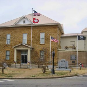
The Scott County Historical and Genealogical Society (SCHGS) was established in 1986 by a group of citizens and historians. The SCHGS strives to promote Scott County’s history, working to research, compile, and archive much of the county’s history and genealogical records. The SCHGS assists interested individuals throughout Arkansas and the United States. The founding officers included Wanda Gray as president, Gary Blythe as president elect, Judy Knapp as vice president, Pat Murdoch as corresponding secretary, Leroy Levisay as recording secretary, and Phillis Cook as treasurer. Likewise, the original board of directors included members Leroy Levisay, Helen Faye Taff, Shirley Blythe, Doris Ridenhour, and June Hawkins. The SCHGS moved into the second story of the Old Scott County Jail in 1987 …

Scott Plantation Settlement

The Scott Plantation Settlement, with its twenty-five exhibits, represents plantation history for the first 100 years of Arkansas statehood. It rests on more than eight acres of the Illallee Plantation donated by Virginia Alexander, daughter of Arthur Alexander and Otelia George Alexander, who purchased the land in 1898. The historical sequence of plantation culture can be seen in the preserved buildings and other exhibits dating from the antebellum period through the early twentieth century. The Scott Plantation Settlement is located in Scott, on the Pulaski–Lonoke county line, approximately twelve miles east of Little Rock (Pulaski County). Its original owner, Chester Ashley, was a prominent attorney, land speculator, and U.S. senator. Joan Dietz, daughter of Virginia Alexander, is credited with the …

Searcy Confederate Monument

The Searcy Confederate Monument is a commemorative sculpture erected in 1917 at the White County Courthouse to honor local men who had served in the Confederate army during the Civil War. White County sent eight companies of infantry and cavalry troops to fight for the Confederacy, and shortly after the turn of the twentieth century, local members of the United Confederate Veterans (UCV) decided it was time to raise a monument in their memory. The Reporter, a trade magazine for monument makers and dealers, included a notice in 1904 saying, “At the recent reunion of Camp Walker-McRea [sic] U.C.V., held at Searcy, Ark., a committee was appointed to co-operate with a committee of the local chapter of the U.D.C. in …

Searcy County Courthouse

The Searcy County Courthouse is in the historic commercial district of Marshall (Searcy County). Built in 1889, this two-story building, made of stone native to the area, stands as one of the oldest courthouses in Arkansas. The Arkansas Historic Preservation Program recognizes the courthouse as architecturally and historically significant as an outstanding example of an Arkansas Adamesque building. It was listed on the National Register of Historic Places on October 12, 1976. Since Searcy County turned eleven acres into its county seat in 1856, three courthouses have managed local affairs. The first was a log cabin, one of the few structures in town at that time along with a two-story hotel, a mercantile store, and a collection of houses. At …

Sebastian County Courthouse

aka: Fort Smith City Hall
The Sebastian County Courthouse stands at 100 South 6th Street, less than a mile from the Fort Smith National Cemetery, in the heart of the frontier city of Fort Smith (Sebastian County). The white, Art Deco–style courthouse is home to one of the county’s two seats of justice (the other is in Greenwood) as well as Fort Smith’s City Hall. This is the only public building in Arkansas that has this dual purpose. The Arkansas Historic Preservation Program recognizes the building for its historical significance due to its New Deal–era construction, as well as its architectural attributes. It was listed on the National Register of Historic Places on June 8, 1993. After Sebastian County’s establishment in 1851, citizens of the …

Sebastian County Road 4G Bridge

The Sebastian County Road 4G Bridge, located on what is now West Harmony Road where it crosses a tributary of Sugar Loaf Creek near West Hartford (Sebastian County), is an open masonry substructure bridge constructed in 1940 through the Works Progress Administration (WPA), a Depression-era public relief agency. Sebastian County leaders in 1939 decided to undertake an ambitious and widespread effort to improve rural roads throughout the county with assistance from President Franklin D. Roosevelt’s New Deal agencies. They applied for funding from the WPA and on December 11, 1939, that organization approved $1,226,362 for a county-wide project to “improve roads, including clearing; grubbing; excavating and grading; constructing curbs, gutters and bridges; draining; laying pipe; surfacing; and performing incidental and …

Sequoyah National Research Center

The Sequoyah National Research Center at the University of Arkansas at Little Rock (UALR) seeks to acquire and preserve the writings and ideas of Native North Americans by collecting the written word, art, and other forms of expression by Native Americans and to create a research atmosphere that invites indigenous peoples to make the center the archival home for their creative work. The mission is fulfilled by serving tribal communities, promoting scholarly research both on the UALR campus and worldwide, creating educational programs, providing access to the center’s collections, and collaborating with like–minded institutions and organizations across the United States. What is now the Sequoyah National Research Center began in 1983 after two tenured faculty members from the English Department …

Shady Grove Delmar Church and School

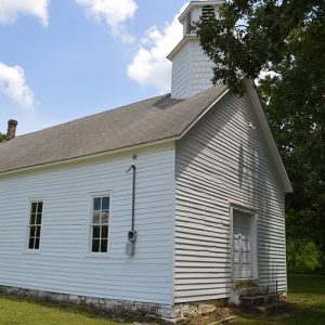
The Shady Grove Delmar Church and School is a historic building located near Delmar (Carroll County). The church is about three miles southeast of Osage (Carroll County). Constructed around 1880, the building housed a school until 1945, and a church regularly met in the building until 1969. It was added to the National Register of Historic Places on January 27, 2015. The first settlers in the Osage Valley arrived around 1830. The population grew slowly, and by 1889, Osage included four homes, three stores, and the school. The land on which the church was constructed was donated to the district by Thomas Sisco, the son of an early settler. Sisco owned several businesses in Delmar, including a post office, sawmill, …

Shady Lake CCC Bridges

The Shady Lake CCC Bridges were nominated to the National Register of Historic Places under Criterion A with local significance for their association with the work of the Civilian Conservation Corps (CCC) in Polk County. The bridges, completed by crews from Camp Shady in December 1936, were constructed as a part of the Shady Lake Dam project begun in October 1935. The CCC originally developed the area for recreational purposes, and the bridges and road still service numerous camping and picnicking sites around the lake in the twenty-first century. The Shady Lake CCC Bridges were also nominated under Criterion C with local significance as a good example of CCC native-stone bridge construction. These single-span structures are supported by arched, corrugated …

Shaw-Blair House

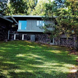
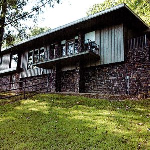
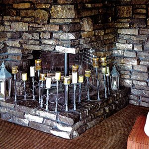
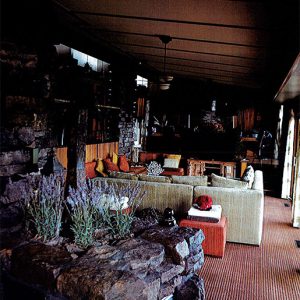
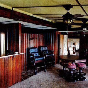
The Shaw-Blair House is located on a large, wooded parcel of land along the southern shore of Beaver Lake near Lowell (Benton County). The house was built between 1967 and 1969, and was designed by architect Robert E. Herndon, who was an architecture student at the University of Arkansas (UA) in Fayetteville (Washington County) when he initially received the commission. Herndon designed the Shaw-Blair House in the Organic Modern style of Mid-Century Modern architecture, following the ideas of by Frank Lloyd Wright, which were promulgated by John G. Williams and E. Fay Jones in the UA architecture program. The house was listed on the National Register of Historic Places on November 3, 2021. The Shaw-Blair House is a frame residential …

Shelton-Lockeby House

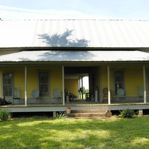
The Shelton-Lockeby House is located on Springhill Church Road, west of Murfreesboro (Pike County) in the Spring Hill community. Constructed in 1905, the single-story, dogtrot-style home was added to the National Register of Historic Places on September 28, 2005. The land upon which the house was constructed was owned by a number of individuals before being purchased by James Shelton in 1896. The taxable value of the land increased in 1905, indicating that a house was constructed on the property at that time. Shelton sold the land to W. M. Riley in 1907, who in turn sold it to James Lockeby in 1915. James and his wife, Lula Ann, raised animals and grew a number of crops on the property, …

Sherman Mound Site

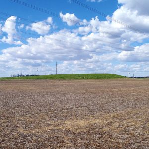
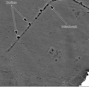
The Sherman Mound is one of the larger and better-preserved Native American earthworks in the Central Mississippi Valley. The site is located in Arkansas’s Delta region within Mississippi County. During the Middle Mississippian archaeological period (AD 1200–1400), the Sherman Mound and its associated village was a large, fortified town covering forty-four acres that served as a civic/ceremonial center for a chiefdom-level society. The Sherman Mound site witnessed multiple occupations. Archaeological evidence, principally pottery analysis, suggests Native Americans initially colonized it during the Late Woodland period (circa AD 400–700) when it was a small-to-medium-sized Baytown phase village. The most significant occupation of the site took place during the Middle Mississippian period (AD 1200–1400), when the site was developed into a large, …

Shiloh Historic District

The Shiloh Historic District near downtown Springdale (Washington and Benton counties) comprises thirty-two acres of structures, trails, and sites reflecting Springdale’s early history—from about 1830 (when the community was called Shiloh) through the early twentieth century. It was listed on the National Register of Historic Places on August 31, 1978, for its significance in early settlement, architecture, and industry. The district is roughly bounded by Spring Creek; Johnson Avenue; and Shiloh, Mill, and Spring Streets. By city ordinances, Springdale formally established the Shiloh Historic District in 1978, created an appeals procedure in 1978, and removed from the district 10.38 acres along Main Street in 1991. The original district included eighteen structures, a number of which have historic/architectural significance; twelve sites …

Shiloh Meeting Hall

aka: Shiloh Church
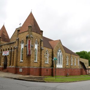
Located on the banks of Spring Creek in downtown Springdale (Washington and Benton counties), the historic Shiloh Meeting Hall—formerly called the Shiloh Church and the Odd Fellows Lodge—is one of the oldest buildings in northwestern Arkansas. Built in 1871, it has served as a gathering place for church congregations, fraternal organizations, and civic clubs, and it has hosted many community events. The two-story frame building was a collaborative project of the Shiloh Regular Baptist Church (also known as the Shiloh Primitive Baptist Church), Liberty Missionary Baptist Church, the Methodist Episcopal Church South, and the Springdale Masonic Lodge No. 316. Land was donated by the Reverend John Holcomb, who was a minister, an elder, and an influential member of the Shiloh …

Shiloh Missionary Baptist Church

The Shiloh Missionary Baptist Church, located at 1200 Hanger Street in Little Rock (Pulaski County), was built in 1919 in the late Gothic Revival style. It was listed on the National Register of Historic Places on March 24, 2020. According to Little Rock city directories, the congregation had constructed a building at the southwest corner of 12th and Hanger under the leadership of the Reverend Jack Steele by 1897. Complete with a bell tower in the center of the front façade, the one-and-a-half-story, wood-frame structure served the primarily African-American congregation until 1919. The longest-serving pastor of Shiloh Missionary Baptist Church was the Reverend Caleb Darnell (C. D.) Pettaway, who served from 1927 until his death in 1968. At the same …

Shiloh Museum of Ozark History

The Shiloh Museum of Ozark History in Springdale (Washington and Benton counties) serves the public by providing resources for finding meaning, enjoyment, and inspiration in the exploration of the Arkansas Ozarks. The museum takes its name from the pioneer community of Shiloh, which became Springdale in the 1870s. In 1881, a five-year-old Nebraska boy named Guy Howard found an arrowhead in the family garden, sparking an interest in Native American lore that would last a lifetime. The Howard family moved from Nebraska to Springdale by covered wagon in the 1890s, and Guy Howard soon discovered that the Ozarks were full of American Indian artifacts. His collection grew and grew. By the 1920s, local people were flocking to the Howard home …

Shoppach House

aka: Sadie Praytor Home
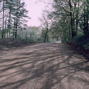
The Shoppach House, located at 503 North Main Street (although some sources, including the National Register nomination form, give the address as 508 North Main Street) in Benton (Saline County), is the oldest surviving brick structure in Saline County. The Shoppach House was built by German immigrant John (or Johann) William Shoppach after he purchased the land in 1853. (Many sources give the building date as 1852, but it was likely a bit later, soon after the 1853 land purchase.) The bricks used to build the house, and its well, were made on site. Shoppach was born in Hessen, Germany, and immigrated to the United States in the mid-1830s, eventually making his way to present-day Saline County, where he built …

Siloam Springs Museum

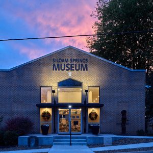
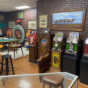
The Siloam Springs Museum has been preserving and exhibiting the history of Siloam Springs (Benton County) and its vicinity since 1969. Permanent and changing exhibits tell the story of this area that was once an Osage hunting ground and now boasts a diverse industrial base, beautiful parks, three National Register Historic Districts, and John Brown University (JBU). Citizens concerned that important pieces of local history were being lost met at Siloam Springs City Hall beginning in July 1969 to discuss the establishment of a museum to preserve this history. The Siloam Springs Museum Society was incorporated on November 13, 1969. The society’s nine-member board of directors oversees operation of the museum and owns the collection. The last run of the …

Simmons First National Bank Tower

Simmons First National Bank Tower is a forty-story skyscraper located at 425 West Capitol Avenue in downtown Little Rock (Pulaski County). It is the tallest skyscraper in Arkansas at a height of 546 feet and an area of 740,000 square feet. (The previous record was held by Regions Center, formerly known as the First National Building, at 454 feet.) Originally known as Capitol Tower (1986–1991), the skyscraper was subsequently renamed TCBY Tower (1991–2004) and Metropolitan National Bank Tower (2004–2014) before its acquisition by Simmons First National Bank. The project originally started when John Flake, a local real estate developer, and Jerry Maulden, president of the Arkansas Power and Light (AP&L), wanted to see a new skyscraper in the Little Rock …

Sink-Crumb Post 72 American Legion Hut

The Sink-Crumb Post 72 American Legion Hut, located on the northeastern corner of 2nd and Cherry streets in the small Clay County community of Knobel, is a tin-roofed cypress log building designed in the Rustic aesthetic common among American Legion buildings erected during the early 1930s. It was listed on the National Register of Historic Places on September 25, 2008. As with other towns around Arkansas, Knobel was home to many World War I veterans, and when the state’s American Legion leadership began encouraging the creation of additional posts in the late 1920s, members decided to band together and create Sink-Crumb Post 72. The post—likely named for local men who died while in military service—was founded in the spring of …

Sloan Site

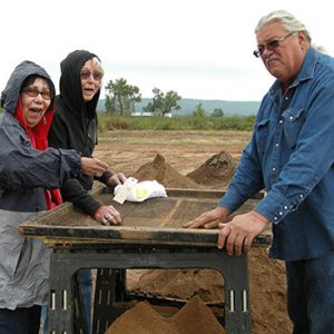
The Sloan site is located on an ice age sand dune in the lowlands of Greene County. People of the Dalton culture buried their dead in ceremonial fashion here about 10,500 years ago. Dalton people were mobile foragers who made and used a distinctive suite of stone tools. These tools have been found at sites across the mid-continental United States. Their material culture that has survived consists primarily of tools made from chert—a highly resistant silica-rich stone that is abundant in the Ozark Mountains, west of the Sloan Site—and in the gravel deposits of Crowley’s Ridge, just east of the Sloan Site. The Sloan Site is one of the oldest, if not the oldest, documented cemeteries in the New World. …