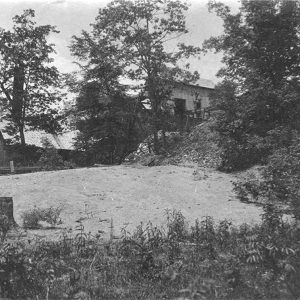
 Davis Mine
Entry Category: Counties, Cities, and Towns - Starting with D
Davis Mine
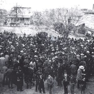 Jeff Davis Campaign
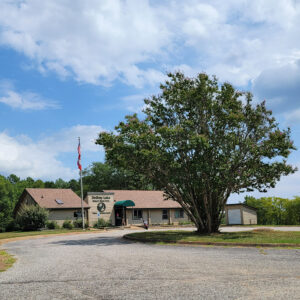
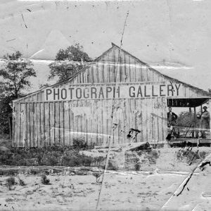 Dayton Bowers’s Photograph Gallery
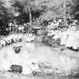 De Ann Baptism
De Gray (Clark County)
De Gray is a community located about five miles northwest of Arkadelphia (Clark County). It is also spelled Degray and DeGray. The community shares its name with both DeGray Creek and DeGray Lake. Early settlers in the area include Isaac Cox and James Golden. Cox appears in the 1829 Clark County Sheriff’s Census, but little additional information is available. In 1854, Golden and Charles Hamner obtained forty acres of land in the area. Golden also obtained an additional eighty acres with Vinson Timms. Golden appears in the 1860 federal census with his wife and six children, farming the land. Other partnerships in the area include Abram Harrington and Francis Foygart, who jointly obtained forty acres in 1854. Harrington lived with …
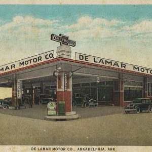 De Lamar Motor Company
De Queen (Sevier County)
De Queen, a railroad town founded just a few years before the start of the twentieth century, is the county seat of Sevier County and also the county’s largest city. De Queen is located at the intersection of two major U.S. highways: U.S. 71, which runs north to south, and U.S. 70, which runs east to west. Post Reconstruction through the Gilded Age De Queen owes its existence to the arrival of what eventually became the Kansas City Southern Railroad, which connects Kansas City, Missouri, with Gulf Coast ports at Port Arthur, Texas. The railroad was the vision of Arthur E. Stilwell, a Kansas City businessman who wanted to build a line from Kansas City to the Gulf of Mexico …
 De Queen Commercial Historic District
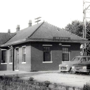 De Queen Depot
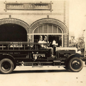 De Queen Fire Department
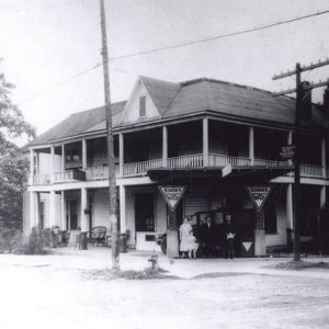 De Queen Hotel
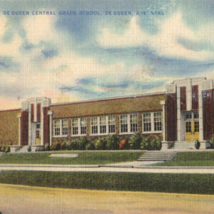 De Queen School
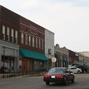
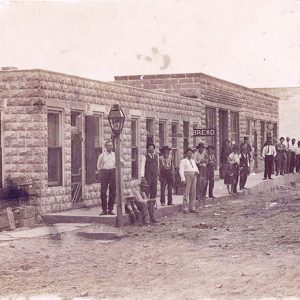
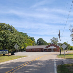
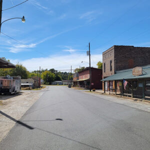
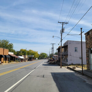
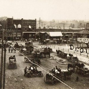 De Queen Street Scene
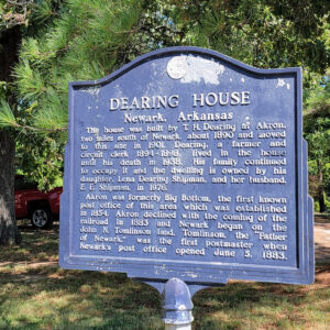 Dearing House Sign
Decatur (Benton County)
Decatur is a second-class city in Benton County, not far from the northwestern corner of Arkansas. About fifteen miles west of Rogers (Benton County), Decatur is in the Ozark hills about halfway between Sulphur Springs (Benton County) and Siloam Springs (Benton County) on State Highway 59. The first known white settler on the land that would become Decatur was William F. Burrow, who was farming in the area before Arkansas became a state in 1836. Burrow chose the land because of its proximity to a fresh-water spring, later given the name St. Elmo Spring. He received a formal deed to his forty acres of land from the U.S. government in 1854. Burrow and his neighbors grew various crops, including tobacco …
 Decatur Street Scene
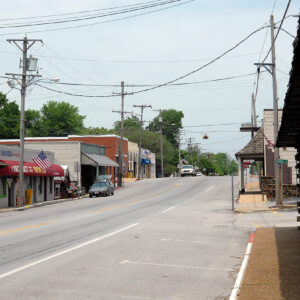 Decatur Street Scene
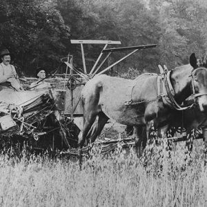 Deering Harvester
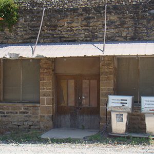 Defunct Business
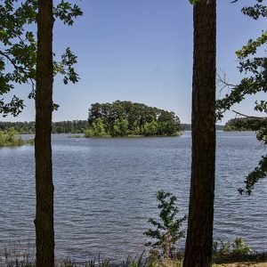 DeGray Lake
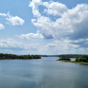 DeGray Lake
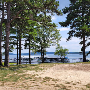 DeGray Lake Dock
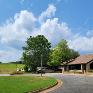 DeGray Lake Golf
 DeGray Lake Visitor Center
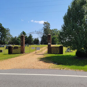 DeLamar Cemetery
Delaplaine (Greene County)
Delaplaine is a town in the northwestern corner of Greene County. State Highways 34, 90, and 304 intersect in Delaplaine, and several drainage ditches flow through the town to empty into the nearby Cache River. Delaplaine was formed by the railroad and the lumber industry, but agriculture, hunting, and fishing are the mainstays of the town’s economy in the twenty-first century. The area had been inhabited for centuries before Euro-American settlement, with nearby Indian mounds containing artifacts such as stone tools, pottery pieces, bones, and charcoal from campfires. The Osage hunted and camped in the region prior to the Louisiana Purchase in 1803, and some local historians believe that a French trading post and mission were established where Delaplaine stands …
Delight (Pike County)
Delight is located in the southeast corner of Pike County. It was a center for the timber industry in the early twentieth century. White settlers began moving into the area near the end of the eighteenth century, settling along Wolf Creek, which flows from northwest of Delight in a southeasterly direction. The settlement became known as Wolf Creek and was granted a post office on January 18, 1832, and became a mail stop between Little Rock (Pulaski County) and the Hempstead County Courthouse, then at Washington. Samuel Hasley purchased about forty-three acres of land from the United States for $1.25 an acre. This acreage is now the town of Delight. Hasley later sold the property to Abner Hancock for …
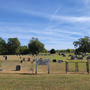 Delight Cemetery
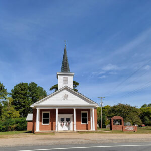 Delight Church
 Delight Church
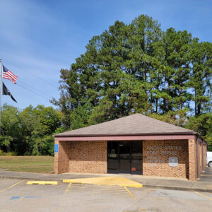 Delight Post Office
 Delight Street Scene
 Delight Street Scene
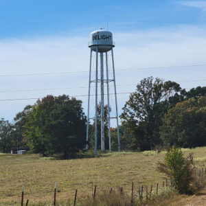 Delight Water Tower
Dell (Mississippi County)
Dell is a town in Mississippi County, a few miles southwest of Blytheville (Mississippi County). State Highways 18 and 181 pass through Dell. When Arkansas became a state, the region around Dell was swampy and forested. Pemiscot Bayou runs into the Little River near Dell, so travelers passed through the area by flatboat and by steamboat. The first landowner in what would become Dell was Thomas J. Blackmore, who acquired about 160 acres of swampland in 1855 through the Swamp Land Act of 1850. Blackmore may not have even visited the land before he sold it, as the land went through several absentee owners until it was purchased by W. B. Sizemore in 1878. During the Civil War, a skirmish …
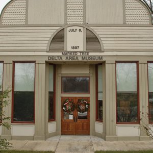 Delta Area Museum
 Delta Country Club
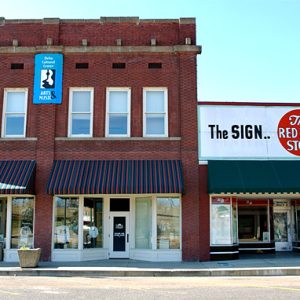 Delta Cultural Center
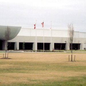
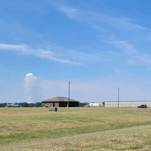 Delta Regional Airport
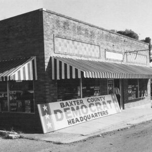 Democratic Headquarters in Mountain Home
Denieville (Independence County)
The historic community of Denieville was located on Spring Creek less than a mile from Limedale (Independence County) on Limedale Road. It was about five miles west-northwest of the county seat, Batesville (Independence County). The White River and the Missouri Pacific railroad tracks run about two miles south of Denieville. Following the Civil War, mining interests in the eastern United States attempted to develop the white lime deposits of Independence County for commercial use, establishing kilns near Batesville. (Quick lime is used for a number of purposes, including mortar, plaster, and the manufacture of paper.) The production of lime in Independence County began in earnest in 1887, emerging on a small scale at Denieville on the Cushman (Independence County) branch …
 Entering Denmark
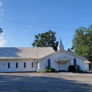 Denmark Church
Denning (Franklin County)
Denning is a town in southern Franklin County. Its northern border is the southern city limit of Altus (Franklin County). Denning was at one time the largest city in Franklin County, with six coal mines providing jobs for more than 1,000 miners. Osage used to come from the north to hunt and to fish in the Ozark Mountains. From 1819 to 1828, the area was part of a Cherokee reservation. Various treaties moved both nations farther west, opening the land to white settlement. In 1839, Samuel Davis acquired a land patent for part of the land where Denning would be established. Coal was discovered south of Altus around 1890, and the Western Coal and Mining Company, based in St. Louis, …
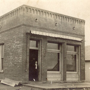 Denning Bank
Dennison Heights (Independence County)
Dennison Heights of Independence County began as a housing development in the 1950s and 1960s on the bluffs overlooking the White River. It was named for the Dennison/Denison family (different branches of the family spelled the name differently) who had a large farm south of the White River and across the river from Eagle Mountain. Dennison Heights is located three miles south of Batesville (Independence County), the county seat. It sits atop Ramsey Mountain (a.k.a. Ramsey Hill), just off Highway 167, also called Batesville Boulevard. At the time of Dennison Heights’ formation, three roads made a triangle at the “top of the hill,” as the Dennison Heights area is commonly called: Highways 14 and 25 led to Desha (Independence County) …
 Denso Plant
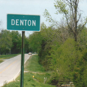 Denton
Denton (Lawrence County)
In the mid-1830s, at the intersection of the Powhatan-Smithville Road and Military Road, one of Lawrence County’s earliest unincorporated communities developed. If it still existed today, Denton would be located about six miles west of Powhatan (Lawrence County) on State Highway 117. The nearby Black River and the fertile land of the Flat Creek valley attracted many settlers to the area prior to the Civil War. In about 1818, a Baptist church known as Bethel was organized as a missionary meeting house. Disagreements among the congregation resulted in a split. As a result, the New Hope Baptist Church was founded on July 22, 1844, with a building constructed in 1853. A new building was constructed in 1940. The church has …
Denton (Scott County)
Denton is an unincorporated community located in western Scott County. Established in 1877 near the confluence of Denton Creek and Ross Creek, the community is named after the Denton family, which settled in Scott County in the 1850s. The agriculture and timber industries have traditionally contributed to the economy and way of life in Denton. Before European contact, the area where Denton is located was a wilderness teeming with native vegetation and wildlife. The area’s first inhabitants included natives from the Archaic, Woodland, and Mississippian periods. Archaeological discoveries suggest that natives of the Caddo tribe made their homes along the Fourche La Fave River near Denton and other prominent waterways in the area. Throughout the late seventeenth and early eighteenth …


