Counties, Cities, and Towns

Entry Category: Counties, Cities, and Towns

Bull Shoals (Marion County)

Bull Shoals is located in Marion County about ten miles south of the Missouri state line. The origin of the town of Bull Shoals is related to the building of Bull Shoals Dam and the formation of Bull Shoals Lake. Bordered on three sides by Bull Shoals Lake, modern-day Bull Shoals is primarily a vacation and retirement community. The town was the creation of Charles S. Woods Sr. A real estate developer, Woods had founded communities in Texas and Georgia. Bull Shoals was to be his fifteenth and final development. With the planned construction of Bull Shoals Dam and the forming of a nearby lake, Woods saw great potential for the area. With the backing of local investors, Woods formed …

Burdette (Mississippi County)

Burdette (Mississippi County) is located nine miles south of Blytheville (Mississippi County) on State Highway 148 just off U.S. Highway 61, known as the Great River Road. Burdette is named after Alfred Burdette Wolverton, who in the early 1900s was one of the first lumbermen to settle in the area. It was incorporated as a company town by workers of the Three States Lumber Company of Wisconsin in May 1905. Prior to Three States Lumber Company’s arrival, the area had been swampland and uninhabitable. Burdette Township split from Fletcher Township in 1908 to create the community of Burdette. Burdette proper is located within the larger Burdette Township (a township being a division of a county), which includes farming and lumber …

Burtsell (Clark County)

Burtsell is a community in Clark County located about five miles southeast of Okolona (Clark County). An alternate spelling of the community’s name is Burtsel. The first settlers to the area arrived in the mid-nineteenth century, attracted by the virgin timber and prime farming land near the Little Missouri River. The population of the area was never very large, and only a few families called Burtsell home at any one time. Robert Welch obtained eighty acres of land in the area in 1837, and Elijah Franklin purchased forty acres nearby in 1848. A Federal army under the command of Major General Frederick Steele passed through the area during the Camden Expedition of 1864. Burtsell was linked with Smithton (Clark County) …

Butterfield (Hot Spring County)

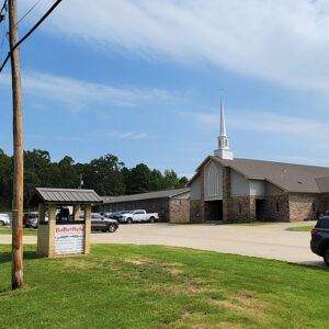
Butterfield lies in the northern part of Hot Spring County, north of Malvern (Hot Spring County) on Arkansas Highway 51. This small residential community once served as an important stop for stagecoach and rail travelers. The Concord Stagecoach line established a stop in the mid-1800s at the present location of Butterfield, and a community emerged around it. The origin of the town’s name is unknown. Some sources state that the name came from the famous Butterfield stage line, while others say the community was named in honor of a Colonel Butterfield who made several stops at the community. Still others state that it was named in honor of a railroad supervisor named D. A. Butterfield. By 1891, the town had …

Cabot (Lonoke County)

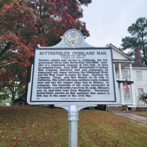
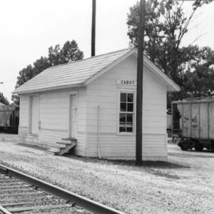
In 2009, BusinessWeek designated the northern Lonoke County city of Cabot as an “Arkansas boomtown” and listed it as the state’s third-fastest-growing city per capita. Incorporated on November 9, 1891, the city—best known for its school system—is home to 23,776 people (as of the 2010 census), making it the largest community in the county. Post Reconstruction through the Gilded Age The development of the area began in the early 1800s about three miles east of the present city at a small town called Austin (Lonoke County). A stretch of the Butterfield Overland Mail Company stage route passed through the area, and, during the Civil War, a large Confederate camp named Camp Nelson was established nearby. Troops moved in and out …

Caddo Gap (Montgomery County)

Caddo Gap is an unincorporated community located along the Caddo River in Montgomery County approximately fifteen miles south of the county seat, Mount Ida. In the twenty-first century, Caddo Gap is a very small community of fewer than 100 people, although it has a long history of Native American habitation, Spanish exploration, and white settlement. According to Arkansas Archeological Survey findings, Native Americans inhabited areas near Caddo Gap dating back to the Dalton culture. In the thirteen, fourteenth, and fifteenth centuries, Caddo Indians lived and farmed in Caddo Gap. For many years, historians believed that Hernando de Soto’s expedition in 1541 encountered and fought the Tula tribe near present-day Caddo Gap. The Arkansas History Commission erected a monument in 1936 …

Caddo Valley (Clark County)

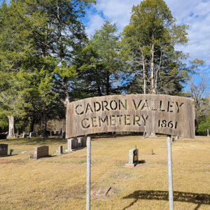
Located near the junction of the Caddo and Ouachita rivers, the city of Caddo Valley is a relatively new but economically important town in Clark County. With an economy based on service industries and a prime location on three highways and near DeGray Lake Resort State Park, Caddo Valley quickly became an important stop between Little Rock (Pulaski County) and Texarkana (Miller County). Settlement in the area began in the early 1800s with the arrival of the first white farmers. The area had previously been occupied by members of the Caddo tribe. Jacob Barkman, an 1811 arrival to the area, constructed a house on the south bank of the Caddo River. The Caddo Valley area proved to be a prime …

Cadron Settlement

aka: Cadron (Faulkner County)
The first permanent white settlement in central Arkansas was near the confluence of Cadron Creek and the Arkansas River, about five miles west of Conway in Faulkner County. In the early 1800s, the term “Cadron Settlement” was used loosely in reference to thirty to forty white families that were scattered along the Arkansas River in the vicinity of Cadron Creek. In 1818, an early settler and trader, John McElmurry, who had arrived before 1818, and three other investors laid out a town, Cadron, on about sixty-four acres at the mouth of the Cadron Creek. Although the original plat map of the town has not been found, historical evidence suggests that as many as fourteen blocks, each with six half-acre lots, surrounded …

Calamine (Sharp County)

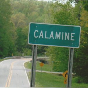
Calamine, home to some of the earliest settlers in what is now Sharp County, was the site of the state’s first commercial zinc mining operation. The boomtown experienced periods of rapid growth in the 1850s and 1870s but today consists only of a few homes. The town is most likely named after the pink mineral calamine; however, a local tradition claims that the name originated from a female mine owner named Callie, thus “Callie mine.” Long before white settlers moved to the area, the Osage used the region for hunting. The first white settlers entered by the early 1830s, many by way of the recently completed military road connecting the area to the Black River. A small settlement began to …

Caldwell (St. Francis County)

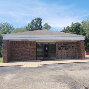
Caldwell is a city on Crowley’s Ridge, a few miles north of Forrest City (St. Francis County). Located on the Union Pacific Railroad and on State Highway 1, Caldwell has long been an agricultural center for the region but is now predominately a bedroom community for Forrest City. Many early settlers of Arkansas gravitated to Crowley’s Ridge, especially with the improvement of the Military Road in 1830s. St. Francis County had already been established in 1827, populated with settlers who had moved west from Tennessee and Kentucky. The settlement of Caldwell did not appear on maps until after the Civil War, when railroad construction increased in Arkansas. The St. Louis, Iron Mountain and Southern Railway was incorporated in June 1874 with plans to …