 Perry
Perry
Entry Type: Place
Perry
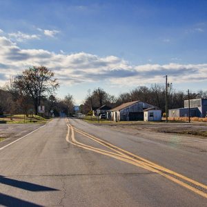
Perry (Perry County)
Perry is a town in Perry County that began as a railroad stop and survived as a lumber town. State Highways 9 and 10 run south as a single highway from Perry to Perryville (Perry County), but they divide in Perry, with Highway 9 running north to Morrilton (Conway County) and Highway 10 running west to Adona (Perry County). Few settlers came to the northwestern side of Perry Mountain before the Choctaw, Oklahoma, and Gulf Railroad was built in 1898. The depot built at this location was known first as North Perryville, but by the time the post office was established in 1899, the name had been shortened to Perry. Railroad workers preferred the well water of Perry to that found at …
Perry County
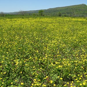
Perry County is in the Ouachita Mountains with the Arkansas River Valley flanking its eastern border and the Fourche La Fave River traversing it from west to east. It has six sub-basins and fourteen watersheds that include more than 800 acres of streams and lakes. The beauty of the mountains, rivers, and lakes is evident at every turn. The soil is rich alluvial in the river bottoms, and the uplands have loam with a clay foundation. The county has more than 287,000 acres of woodlands. Timber companies and the U.S. Forest Service are the major landowners. Despite the county’s central location in the state of Arkansas, the mountains and watercourses made early settlement difficult. Flood control and better roads …
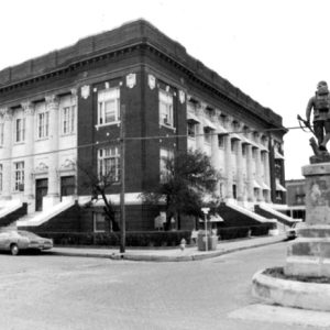
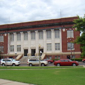
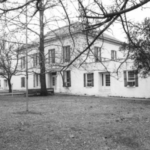 Perry County Courthouse
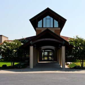
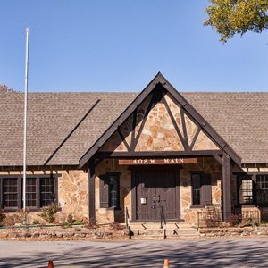 Perry County Historical Museum
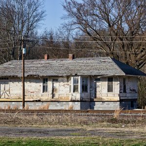 Perry Depot
 Perry Plaza Court
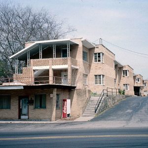
Perry Plaza Court Historic District
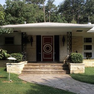
The Perry Plaza Court Historic District consists of a former motel (or “tourist court,” as it was known at the time) on Park Avenue in Hot Springs (Garland County). Constructed in the International Style, it was added to the National Register of Historic Places on February 11, 2004, due to its architectural significance and condition. In the 1970s, the building was converted into an apartment complex. Construction of the motel began in 1947 and was completed the next year. Designed by Hot Springs architect Irven McDaniel, the motel had nineteen units. The International Style, in which the building was constructed, is noted for its horizontal design elements and minimal adornment. The motel was built with steel joist construction, fire walls, …
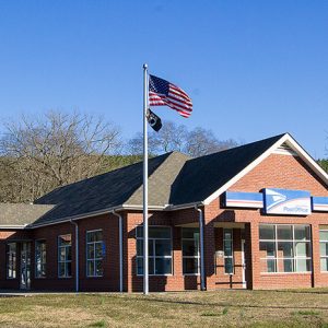 Perry Post Office
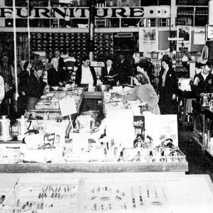 Perryman Hardware
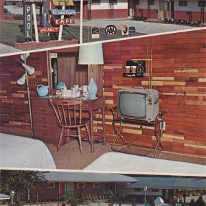 Perry's Congress Motel
Perrytown (Hempstead County)
Perrytown is a town on U.S. Highway 67 about three miles northeast of Hope (Hempstead County). Incorporated in 1963, it is named for local businessman Perry Campbell. Parts of Hempstead County were inhabited by Caddo before the arrival of European explorers and American settlers. Among the first white Americans to claim land in the region that would become Perrytown were Robert Carrington, James Cantley, William Easley, and David Mouser, all of whom received land patents in 1837; Carrington owned the largest portion of land. By this time, the Southwest Trail had been established through Arkansas, running through such communities as Washington (Hempstead County) and Fulton (Hempstead County). The Cairo and Fulton Railroad, intended to connect southern Illinois with many cities …
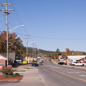
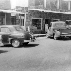
Perryville (Perry County)
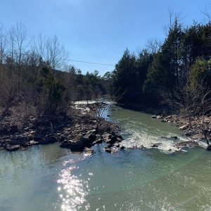
Perryville sits in the Fourche River valley at the base of the Ouachita National Forest. The town is encircled by four major Arkansas cities—Little Rock (Pulaski County), Conway (Faulkner County), Russellville (Pope County), and Hot Springs (Garland County), each less than an hour’s drive away. Its pristine environment and mountainous scenery make a significant statement about the area. The town is sequestered between mountains to its north and south and was first located north of the forks on the Fourche La Fave River. Louisiana Purchase through Early Statehood The shallows were a natural draw for settlers in the early 1830s, and subsequently, the Fourche La Fave Township was formed. In December 1840, the Arkansas General Assembly created the forty-fourth county …
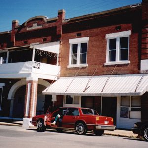
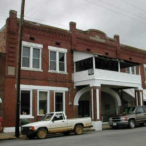
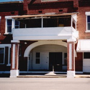
 Perryville Street Scene
 Perryville Street Scene
 Charline Person Home
 Peter Dierks Joers House
 Peter Dierks Joers House
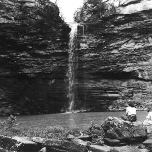
 Petit Jean Mountain View
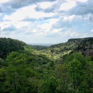
Petit Jean Mountain
Petit Jean Mountain is the name commonly given to the largest portion of the Petit Jean Mountains, a group of connected landforms south and east of the confluence of the Petit Jean River with the Arkansas River. Although other terrain features along the Petit Jean River are also called Petit Jean Mountain, notably the long ridge that culminates near the common corner of Yell, Logan, and Scott counties, this entry discusses the large mesa on the south bank of the Arkansas River in Conway County. It is part of the Arkansas Valley, one of the six natural divisions of Arkansas, and the home of Petit Jean State Park. A relatively flat top gives Petit Jean elevations that vary from approximately …
 Petit Jean River
 Petit Jean River at Danville
 Petit Jean State Park View
 Petit Jean State Park
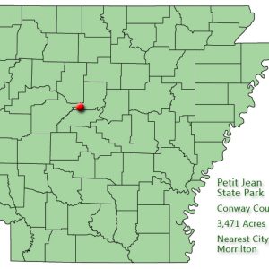 Petit Jean State Park: Park Location
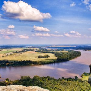
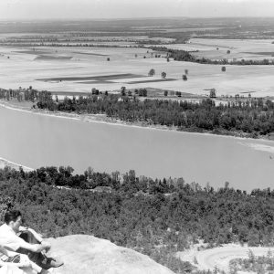
Petit Jean State Park
The natural beauty of Arkansas’s first state park, Petit Jean, inspired the creation of the state park system. Situated on Petit Jean Mountain, the park encompasses forests, ravines, streams, springs, vistas, and unusual geological formations. Today, Petit Jean State Park is one of the most popular state parks in Arkansas. Popular legend holds that the mountain got its name from the story of a young French girl who, in the 1700s, disguised herself as a cabin boy so that she could secretly join a company of explorers and accompany her fiancé to the New World. Petit Jean, or “Little John,” became fatally ill while the explorers were visiting the mountain and requested to be buried there. The idea of creating …
 Petit Jean State Park
 Petit Jean State Park
Pettigrew (Madison County)
During the early twentieth century, Pettigrew, a small Madison County town located near the White River, was known by many as the “Hardwood Capital of the World.” At its peak, the town, which was situated at the end of the railroad line, was the major shipping station for the many area timber operations. Vast acres of virgin timber and the coming of the railroad were the main factors that led to the founding and growth of Pettigrew. By the late 1880s, a small settlement had begun to develop along the White River. In about 1897, George Pettigrew, a civil engineer with the St. Louis–San Francisco Railway (Frisco), selected a track route into the timber lands and laid out the town’s …
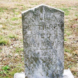 Pettigrew Grave
 Pfeifers Building
Pfeiffer (Independence County)
Pfeiffer in Independence County is located just east of Highway 167 (North St. Louis Street) on Pfeiffer Road about five miles north-northeast of the county seat, Batesville (Independence County), and about eight miles south-southwest of Cave City (Sharp and Independence counties). Pfeiffer Creek is nearby. A marker at Pfeiffer reads, in part, “A light-colored crystalline limestone known as Batesville marble has been mined in this area since 1836. Pfeiffer was also a railhead with wagons coming from many points to pick up freight.” Charles Anton Pfeiffer from Baden, Sigmaringen, Germany, and his father, Joseph Pfeiffer, started the Pfeiffer Stone Company—dealers in stone, marble, and granite—on a moderate scale in 1860 in St. Joseph, Missouri. Joseph Pfeiffer and his family had …
 Philander Smith College
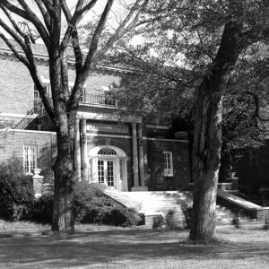 Philander Smith College
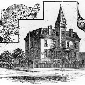 Philander Smith Colored Institute
Philander Smith University
Philander Smith University was the first historically Black, four-year college in Arkansas and the first historically Black college to be accredited by a regional accrediting institution. Like most of the African American colleges and universities in the United States, Philander Smith University originated in the Bureau of Refugees, Freedmen and Abandoned Lands (commonly known as the Freedmen’s Bureau). The War Department organized the Freedmen’s Bureau on March 3, 1865, just before the Civil War ended. Throughout its six-year existence, the bureau sold confiscated properties and raised money to help the freed slaves gain access to the rights that they were denied during slavery. Among these was the right to be educated. In 1869, the bureau directed that schools be made …
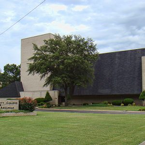 Phillips Community College Fine Arts Center
 Phillips Community College Lewis Library
 Phillips Community College; Stuttgart
Phillips County
Phillips County is part of the Delta region of Arkansas. Located where the St. Francis River empties into the Mississippi River, its significance touches on nearly every aspect of the state’s history. In the twentieth century, Phillips County was known for devastating flooding, harsh racial confrontations, and the development of blues music. Phillips County’s soil consists of alluvial deposits from the Mississippi River, making it prime agricultural land. The southern edge of Crowley’s Ridge provides higher land once used by Native Americans. Helena’s location on the Mississippi River gave it the potential to be an important transportation hub, although it eventually was overtaken in importance by Memphis, Tennessee. Pre-European Exploration Because of its location, the area was well populated …
 Phillips County Courthouse
 Phillips County Courthouse
Phillips County Penal Farm Historic District
The Phillips County Penal Farm Historic District, located on Phillips County Road 353 south of U.S. 49 near Poplar Grove, contains a main jail building constructed of concrete with a large concrete block section at the rear, two additional concrete block jail buildings, and a cast-concrete water tower. The complex is no longer in use and is heavily overgrown, but it still reflects its original use as a county prison farm. According to Goodspeed’s Biographical and Historical Memoirs of Eastern Arkansas, a sturdy jail was a local priority from the earliest days of Phillips County. The first structure built for county use was a two-story log building that housed a courtroom above and a jail below, which were soon replaced …
 Phillips Store
 Phoenix Hotel
 Phoenix Hotel
 Phoenix Hotel Entrance
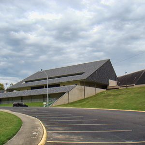
 Physical Education Building
Pickens (Desha County)
Pickens (Desha County) is located three miles south of Dumas (Desha County). The unincorporated community was called Walnut Lake until 1932, when the name was changed to “Pickens” in honor of Burton Cecil Pickens, son of Reuben A. Pickens who settled in the area in 1881 along with his brother, William S. Pickens. The Walnut Lake/Pickens area community was established as the result of the relocation of the St. Louis, Iron Mountain and Southern Railroad from Pine Bluff (Jefferson County) to Napoleon (Desha County) in 1879. Napoleon, once the county seat, was located at the convergence of the Arkansas and Mississippi rivers. The relocation of the railroad into the interior of the county sparked the establishment of other communities along the route. A …
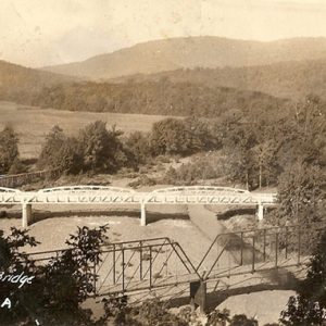 Pig Trail Bridge


