Entry Type: Place

Central High School Neighborhood Historic District
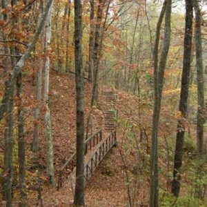
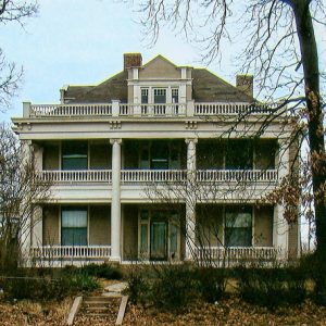
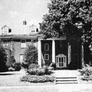
Made nationally famous during the 1957 desegregation crisis, Central High School in Little Rock (Pulaski County) is surrounded by a historic neighborhood district that also bears its name. Central High is both an active high school and a museum protected under the National Park Service as a National Historic Landmark. The surrounding historical district is primarily made up of residential structures and is divided by Wright Avenue, a road historically used by trolleys. Residences in this neighborhood display primarily the Craftsman Bungalow, Tudor Revival, and Colonial Revival styles. The original district—roughly bounded by Dr. Martin Luther King Jr. Drive on the east, Thayer Avenue on the west, West 12th Street on the north, and Roosevelt Road on the south—was added …

Chalybeate Springs (Stone County)

Chalybeate Springs (a.k.a. Chalybeate) is located in the township of Arbana about three and a half miles southwest of Pleasant Grove (Stone County) and about eleven miles southeast of Mountain View (Stone County), the county seat. The community is south of Misenheimer Road, near the confluence of Chalybeate Spring Creek and Little Raccoon Creek, off Tuttle Ridge Road. The locals pronounce the name of the community “Clee’-bit.” Chalybeate Spring is located at the foot of the Boston Mountains about two miles to the east of the Chalybeate community. It forms the waters of one of the small tributaries of Coon Creek, which flows into the Devil’s Fork of the Little Red River. Water from the spring was believed to have …

Champagnolle (Union County)

Champagnolle, located on a bluff on the west bank of the Ouachita River, was an important early 1800s shipping point and social center of southern Arkansas. At its peak in the 1850s, thousands of bales of cotton were shipped yearly as far away as New Orleans, Louisiana. Bypassed by the railroad in the 1890s, the town began a slow decline. Little of the once prosperous settlement survives. The first white settlers to the area were Lawrence, John, and Silas Scarborough, who were attracted by the potential of the river and the availability of potable water. Lawrence Scarborough built a home there and, in 1829, established Scarborough Landing on the river bank below a bluff. Others came, and soon a settlement …

Chant (Scott County)

Chant is a historical community in southern Scott County located along Highway 71. At various times known as Pleasant Valley and Texas, the town was established in 1906 near the Fourche La Fave River and Mill Creek between Boles and Y City. Agriculture has contributed significantly to the economy and way of life in Chant. Prior to European exploration, the area surrounding Chant was a wilderness. Several species of wildlife that no longer inhabit the area, such as elk and buffalo, were present throughout the region. Numerous archaeological sites and burial mounds are located along the banks of prominent waterways such as the Poteau River. Archaeological findings have provided evidence of early inhabitants dating to the Archaic, Woodland, and Mississippian …

Charleston (Franklin County)

Charleston is one of the two county seats of Franklin County, along with Ozark. Located south of the Arkansas River, it is twenty-five miles east of Fort Smith (Sebastian County), near the coal and gas fields of northwest Arkansas, and roughly a mile from one corner of Fort Chaffee. Charleston is most known for being the first community in a southern state to desegregate its school system following the U.S. Supreme Court’s 1954 Brown v. Board of Education of Topeka, Kansas decision. Louisiana Purchase through Early Statehood Land south of the Arkansas River in western Arkansas was ceded to the United States by the Quapaw in 1818, granted to the Choctaw in 1820, and ceded back to the United States …

Charlotte (Independence County)

Charlotte is located just off Highway 25 (a.k.a. White Drive) on Old School Road near the banks of Dota Creek, twelve miles east-northeast of the county seat of Batesville (Independence County) and about five miles west of Cord (Independence County). Rich farmland lies to the south of Charlotte in the Big Bottom alluvial lands along the Black and White rivers. There is also high-quality grazing land for cattle in the Charlotte region. Charlotte is in the township of Dota, which includes three churches—Cedar Grove Church, Center Grove Church, and Pleasant Hill Church. In 1852, seventeen-year-old James Northcroft Churchill crossed the Mississippi River from Tennessee with his family, which settled in Walnut Grove (Independence County). A few years later, he opened …

Charlotte Street Historic District

Located in Fordyce (Dallas County), the Charlotte Street Historic District includes the core of a historic subdivision located on the north side of the city. Constructed from 1906 to 1930 on part of the estate of A. B. Banks, the district includes a number of Craftsman-style homes and associated structures. It was added to the National Register of Historic Places on September 14, 1987. Aloysius Burton (A. B.) Banks was born in Little Rock (Pulaski County) on April 2, 1868. He moved to Fordyce in 1885, shortly after the town incorporated. He worked in the insurance business and opened his own fire insurance company in 1891. He expanded the company to cover accidents and grew the business, becoming wealthy in …

Cherokee Village (Sharp and Fulton Counties)
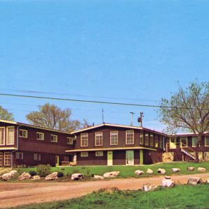
A retirement community in northeastern Arkansas, Cherokee Village was founded in 1954. Started as a 2,400-acre summer resort in the vein of the Wahpeton Inn at Hardy (Sharp County), Cherokee Village became the state’s leading retirement community by the early 1960s. In 1948, West Memphis (Crittenden County) developer John A. Cooper Sr. purchased 400 acres along the south bank of the Spring River near the mouth of Otter Creek. Christening the property Otter Creek Ranch, Cooper used the land as a family summer retreat for several years. After purchasing additional land, Cooper formed the Cherokee Village Development Company in 1953, divided the property into lots, and constructed individual homes. When the property was formally opened in June 1955, Governor Orval …

Cherry Street Historic District

The Cherry Street Historic District is an area in downtown Helena-West Helena (Phillips County) that was added to the National Register of Historic Places on August 17, 1987. Helena—as it was known before its 2006 merger with West Helena (Phillips County)—was incorporated in 1833 and became a thriving river port along the Mississippi River. With a unique location along Crowley’s Ridge and the river, the city became an important transportation hub for nearby agricultural enterprises. Railroad access arrived in the late nineteenth century, making the city even more important for farmers wishing to connect to distant markets. As one of the most prosperous towns in eastern Arkansas, Helena attracted major investments. A flood in 1867 destroyed many of the businesses …

Cherry Valley (Cross County)

The second-class city of Cherry Valley (Cross County) began as a small settlement near the junction of Cooper’s Creek and the Harrisburg Road sometime around the Civil War. The construction of north-south railroad tracks on the lowlands west of Crowley’s Ridge caused the town to move closer to the rails in the 1880s. An agriculturally rich area, Cherry Valley also capitalized on its position at the intersection of Arkansas State Highways 1 and 42. As of 2012, the town of 651 people primarily focuses on agriculture and related businesses. While the Casqui, Quapaw, Osage, and Cherokee, among others, probably traversed or claimed the Cherry Valley area over time, no actual signs of habitation exist. The Cherry Valley Mounds, located near …

Cherry, Lewis Williamson

Lewis Williamson Cherry was an important businessman in Little Rock (Pulaski County) who founded several enterprises and served in a leadership role in various banks, as well as managing a robust real estate business. Lewis W. Cherry was born on November 22, 1858, in Memphis, Tennessee, to Calvin Washington Cherry and Sarah Blount Williamson Cherry. His father, a banker, was son of Daniel Cherry, a wealthy North Carolina–born land speculator in early nineteenth-century Tennessee who founded Cherryville in Haywood County. After an initial education in Memphis public schools, Lewis W. Cherry was educated at a number of private schools in Tennessee and Kentucky, completing his education at James Byars’s academy in Covington, Tennessee. Cherry began his career as bookkeeper for …

Chester (Crawford County)

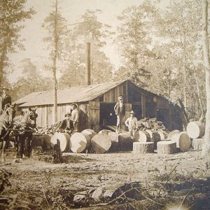
Surrounded by some of the higher peaks of the Ozark Mountains and by the Ozark National Forest, Chester is a town in northern Crawford County. Chester, once a timber town on the St. Louis–San Francisco Railway, later became a local tourist attraction. Interstate 49 passes near the town. Osage once traveled south to hunt and fish in northern Arkansas. The Ozark Mountains remained sparsely populated even after Arkansas became a state. The first settlers to own land at the future site of Chester were Solomon Rush and James Wright, both of whom purchased land grants from the federal government in 1854. However, a log cabin school had already been built in the area ten years earlier. Rush and Wright were …

Chickalah (Yell County)

Chickalah is an unincorporated community in the northeastern portion of Yell County located on Arkansas Highway 27, approximately nine miles west of Dardanelle (Yell County). The community is reportedly named after a man named Chikileh, a Cherokee leader who resided in the area in the late 1700s and early 1800s, making his home somewhere between Little and Big Chickalah creeks. In addition to the community and the creeks, Chickalah Mountain, a 925-foot peak, also bears this name. The peak is approximately twelve miles to the west of the Chickalah community near Spring Lake in the Ozark National Forest. Chickalah history is closely linked to the Harkey Valley (Yell County) and Sulphur Springs (Yell County) communities, both of which lie to the …

Chicot County

Chicot County is the southeasternmost county in Arkansas. It is bounded by Louisiana to the south and the Mississippi River to the east. The county is located in the heart of the Mississippi Delta; therefore, it is a prime location for agriculture, with some of the richest soils in the state. Because of this, the county continues to have strong ties to the land and is consistently one of the largest producers of cotton in Arkansas. With Lake Chicot as the largest natural lake in Arkansas and the largest oxbow lake in North America, the county provides residents and tourists with ample opportunities for year-round fishing. According to the 2020 Census, the county had a population of 10,208, with three …

Chidester (Ouachita County)

Chidester is a second-class city located in northwestern Ouachita County. Like many Arkansas cities that emerged in the nineteenth century, Chidester is a result of the railroad construction that brought many changes to the state. Jefferson Smith acquired land in the area that would become Chidester in 1858 and established a farm; he added an additional parcel of land to the west of his farm in 1860. Moses K. Robertson also owned land adjacent to Smith’s farm. During the Civil War, Smith served as a sergeant in Company D of Arkansas’s Thirty-third Confederate infantry between 1862 and 1864. His unit was active at Prairie Grove (Washington County), in the defense of Little Rock (Pulaski County), and also in the Red …