Transportation

Subcategories:
Clear

Entry Category: Transportation

U.S. Highway 62

aka: Highway 62
U.S. Highway 62 crosses the northern counties of Arkansas. It passes through eleven counties, from Washington County in the west to Clay County in the east. Some portions of Highway 62 were proposed by William Hope “Coin” Harvey, who wanted to facilitate automobile traffic to his tourist destination, Monte Ne (Benton County). Route U.S. Highway 62 begins in El Paso, Texas, and runs through ten states to Niagara Falls, New York. It is the only east-west highway in the United States that connects Mexico to Canada. The entire length of the highway is 2,245 miles, of which 329.9 miles cross the state of Arkansas. U.S. Highway 62 enters Arkansas from Oklahoma as a two-lane highway. It runs through Summers (Washington …

U.S. Highway 63

U.S. Highway 63 enters Arkansas at Junction City (Union County) and leaves Arkansas at Mammoth Spring (Fulton County). Between these two cities, it also serves Pine Bluff (Jefferson County), West Memphis (Crittenden County), and Jonesboro (Craighead County). Much of the highway is part of the interstate system, including sections of I-530, I-40, I-55, and I-555. Route U.S. Highway 63 extends from Ruston, Louisiana, to Benoit, Wisconsin, a path of 1,286 miles. In Arkansas, it travels through fourteen counties, covering a little more than 400 miles. The highway enters Arkansas in Junction City, a municipality that exists in both Arkansas and Louisiana, making it the southernmost community in Arkansas. The four-lane highway runs concurrently with U.S. Highway 167 from its origin …

U.S. Highway 64

aka: Highway 64
aka: U.S. 64
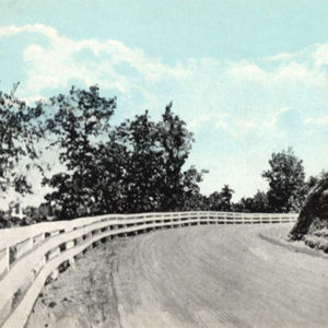
U.S. Highway 64 crosses the state of Arkansas, connecting Fort Smith (Sebastian County) to West Memphis (Crittenden County). It passes through eleven counties of the state. In western Arkansas, it travels the Arkansas River Valley and parallels Interstate 40; in eastern Arkansas, it transverses the Mississippi River Delta significantly north of the Arkansas River and the interstate highway. Route Highway 64 runs 2,326 miles from Arizona to North Carolina, passing through six states, including Arkansas. Its route covers 246 miles in Arkansas. The highway enters Arkansas as a four-lane bridge over the Arkansas River. It rises over the Harry E. Kelley River Park, Belle Point, and the Fort Smith National Historic Site and continues through Fort Smith as Garrison Avenue. …

U.S. Highway 65

aka: Highway 65
aka: U.S. 65
U.S. Highway 65 is a major north-south corridor in Arkansas. Passing through eleven counties, the highway includes Pine Bluff (Jefferson County), Little Rock (Pulaski County), Conway (Faulkner County), and Harrison (Boone County) among the cities it serves. Route U.S. Highway 65 begins in Clayton, Louisiana, and crosses Arkansas, Missouri, and Iowa before ending in Minnesota. The entire highway is 966 miles, of which 313 miles are in Arkansas. The highway enters Arkansas as a two-lane road in Chicot County not far from the Mississippi River. It runs parallel to the railroad tracks through Eudora (Chicot County), Chicot (Chicot County), and Lake Village (Chicot County), where it widens to four lanes. The highway continues north to McGehee (Desha County) before cutting …

U.S. Highway 67

aka: Highway 67
U.S. Highway 67 stretches from the southwestern corner of Arkansas in Texarkana (Miller County) to the northeastern corner of the state north of Corning (Clay County). It passes through thirteen counties, generally following the course of the military road known as the Southwest Trail, which was established across Arkansas during territorial times. In 2009, the Arkansas General Assembly designated a portion of the road as the Rock ’n’ Roll Highway—a reference to the musical heritage of the road. Route U.S. Highway 67 extends 1,560 miles, beginning in Presidio, Texas, at the border with Mexico, and ending near Sabula, Iowa. The Arkansas portion of the highway is roughly 280 miles. The highway enters Arkansas in the city of Texarkana as a …

U.S. Highway 70

U.S. Highway 70 runs from southwestern Arkansas through Hot Springs (Garland County) and Little Rock (Pulaski County) to West Memphis (Crittenden County). It passes through thirteen counties in Arkansas. Until the completion of Interstate 40, it was the main highway linking Little Rock to Memphis, Tennessee, and it continues to be the principal route bringing travelers to Hot Springs. Route U.S. Highway 70 begins in Globe, Arizona—originally a mining settlement—and runs east 2,385 miles to Atlantic, North Carolina—an unincorporated community on the East Coast. About 280 of those highway miles are in Arkansas. The highway enters Arkansas about eight miles west of De Queen (Sevier County), where it is called the Collin Raye Highway. In De Queen, it runs through …

U.S. Highway 71

In Arkansas, U.S. Highway 71 stretches from the southwestern border of the state south of Kiblah (Miller County) to the northwestern corner north of Bella Vista (Benton County). It passes through nine counties in Arkansas, generally following an alignment of the Ozark Trail. Route U.S. Highway 71 extends 1,532 miles beginning near Krotz Springs, Louisiana, and passes through Louisiana, Texas, Arkansas, Missouri, Iowa, and Minnesota before ending at the U.S.-Canadian border north of Bemidji, Minnesota. The Arkansas portion is approximately 300 miles. The highway enters Arkansas south of Kiblah as a two-lane highway heading north, passing through Doddridge (Miller County) and Fouke (Miller County) before reaching Texarkana (Miller County). At Texarkana, Highway 71 has a short concurrence with U.S. Highway …

USNS General William O. Darby (AP-127/T-AP-127)

aka: USS Admiral W. S. Sims (AP-127)
aka: USAT General William O. Darby (AP-127, IX-510)
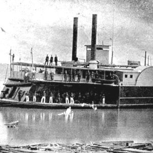
The USNS General William O. Darby was an Admiral W. S. Benson–class transport vessel initially named after a naval leader but renamed after a Fort Smith (Sebastian County) war hero after it was turned over to the U.S. Army. The vessel was first named for William S. Sims, a Canadian-born sailor whose thirty-seven-year career after graduating from the U.S. Naval Academy at Annapolis, Maryland, culminated in commanding the U.S. Navy’s activities around Great Britain during World War I. He died in 1936. The keel for the USS Admiral W. S. Sims was laid down on June 15, 1944, at the Bethlehem-Alameda Shipbuilding Corporation at Alameda, California. The ship was christened by Anne Hitchcock Sims, the admiral’s widow. The 9,676-ton Sims …

Van Buren County Road 2E Bridge

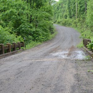
The Van Buren County 2E Bridge is an open masonry substructure bridge crossing a tributary of Driver’s Creek near Scotland (Van Buren County) built under the auspices of the Works Progress Administration (WPA), a Depression-era federal relief agency. In 1940, Van Buren County received a $117,789 grant from the Works Progress Administration to “improve and construct roads. Work includes clearing, grubbing, excavating and surfacing; moving fences, constructing and reconstructing bridges and drainage structures, and performing incidental and appurtenant work.” The construction of a bridge across a Driver’s Creek tributary on a rural Van Buren County road was almost certainly part of this project since no individual WPA project card exists for the bridge. Its designer is not known but could …

Wallace Bridge

aka: Nimrod Bridge
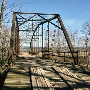
Constructed in 1908, the Wallace Bridge was nominated to the National Register of Historic Places as the best example of a Camelback through truss bridge in the Nimrod (Perry County) vicinity. The bridge was also nominated for its associations with the development of vehicular transportation in Perry County. Listed on the National Register of Historic Places on August 1, 2008, it is the last remaining example of this type of bridge in Perry County and one of only three remaining in Arkansas. It is unknown if there was a prior bridge at the current location of the Wallace Bridge. A loss of county records prevents a detailed understanding of the historical locations and types of bridges in Perry County, but at least one …

Walnut Ridge Army Flying School

The Walnut Ridge Army Flying School was one of seven U.S. Army Air Forces pilot training schools established in Arkansas as part of the nationwide expansion of World War II pilot training. Contract primary flying schools were located in Camden (Ouachita County), Helena (Phillips County), and Pine Bluff (Jefferson County). Newport (Jackson County) and Walnut Ridge (Lawrence County) had basic flying schools, while Blytheville (Mississippi County) and Stuttgart (Arkansas County) had advanced twin-engine flying schools. The Walnut Ridge Army Flying School enrolled during its existence 5,310 students, 4,641 of whom graduated. In early April 1942, a board of three army air forces officers—Lieutenant Colonel Burton Hovey Jr., Lieutenant Colonel John R. Cume Jr., and Captain Blanton Russell—went in search of …

Waverly [Steamboat]

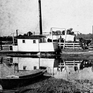
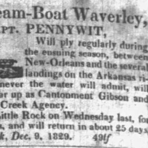
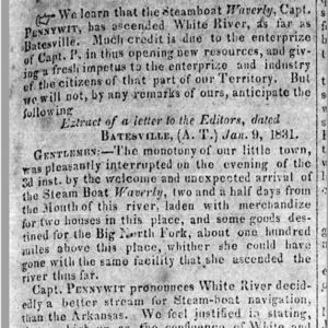
The Waverly, under Captain Phillip Pennywit, was the first steamboat to ply the White River as far up as Batesville (Independence County), arriving there on January 4, 1831. Phillip Pennywit was a veteran river boat captain who, in 1828, had established the first regularly scheduled service on the Arkansas River, going as far west as Cantonment Gibson in the Indian Territory (modern-day Oklahoma) with his vessel the Facility. In addition to moving freight and passengers, the Facility in June 1829 “had a keel-boat in tow, containing several Cherokee families, who are emigrating from the old nation …to the new nation, on the west side, of the Mississippi.” In December 1829, Pennywit had a new boat, the Waverly, that was designed to …

Webster [Steamboat]

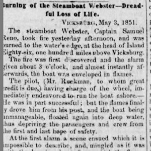
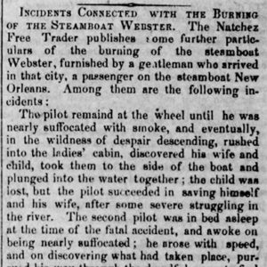
The Webster was a steamboat that caught fire near Island 86 in the Mississippi River off Chicot County on May 2, 1851, resulting in the deaths of forty passengers and crew members. The Webster, a 324-ton sidewheel paddleboat built in Cincinnati, Ohio, in 1848, was 182 feet long and twenty-seven feet wide with an eight-foot draft. Commanded by Captain Samuel Reno, the Webster was steaming up the Mississippi with about 100 passengers and crew when it caught fire around 3:00 a.m. on May 2, 1851. The flames spread rapidly, and a newspaper portrayed what happened as “a scene ensued which it is impossible to describe, and, mingled as it was with the burning boat, from which the flames were spouting …

White River

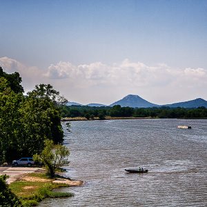
The 722-mile-long White River flowing through northern Arkansas and southern Missouri is a major tributary of the Mississippi River. The river begins in northwestern Arkansas in the Boston Mountains and flows east toward the Fayetteville (Washington County) area, where it then turns north. Near Eureka Springs (Carroll County), the river enters Missouri. It then flows southeast back into Arkansas past Bull Shoals (Marion County), Mountain Home (Baxter County), and Calico Rock (Izard County). At Batesville (Independence County) begins the second section of the river, known as the lower White. From Batesville, the White River flows south for 295 miles through Arkansas’s Delta region, past Augusta (Woodruff County), Des Arc (Prairie County), Clarendon (Monroe County), and St. Charles (Arkansas County), before …

Wilmington [Steamboat]

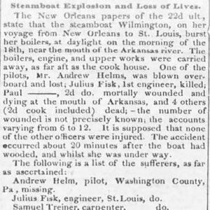
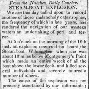
The Wilmington was a steamboat that burst a boiler while traveling on the Mississippi River near the mouth of the Arkansas River on November 18, 1839, killing several passengers and crew members. Baltimore’s Watchman & Bratt firm built the Wilmington for the Raleigh Rail Road Company, working from a design by shipwright Langley B. Culley and launching the steamboat in early September 1839. The $60,000, 400-ton steamboat was 182 feet long and forty feet wide, with a ten-foot draft. Powered by a 135 horsepower Watchman & Bratt engine, the Wilmington (according to promotional material) “has one of Raub’s patented double self-acting safety valves, the first which has ever been introduced to operate successfully, on board of any boat on our …

Winslow Tunnel

In September 1880, the St. Louis–San Francisco Railway Company (Frisco) created a railroad subsidiary, the Missouri, Arkansas and Southern Railway of Arkansas. The new subsidiary was authorized “to build in a southerly direction”—likely from Fayetteville (Washington County)—“to some point on the Little Rock & Fort Smith Railway, not east of Clarksville, with total mileage of about 55 miles.” The Little Rock and Fort Smith (LR&FS) in 1876 began rail service between Argenta—now North Little Rock (Pulaski County)—and Van Buren (Crawford County). The broad language of the authorization clearly reflected the uncertainty in constructing a railroad line through the Boston Mountains range of the Ozark Mountains, the highest range between the Alleghenies and the Rockies. The range, the highest elevation of …