Entry Category: Land and Resources

Mulberry River

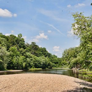
The Mulberry River, a tributary of the Arkansas River, rises from the intersection of several streams in the Ozark Mountains of northern Franklin County and Johnson County. It flows generally southwest from its source and empties into the Arkansas River south of the city of Mulberry (Crawford County), for a total length of approximately seventy miles. Reportedly named for the number of mulberry trees growing in its vicinity, it is today well known among canoeists. The area around the Mulberry River has been the site of human habitation as far back as approximately 10,000 BC. In historic times, the Osage Indians claimed much of this part of Arkansas, including the area drained by the Mulberry River, as their hunting grounds. …

Muscadine

aka: Vitus rotundifolia
Muscadines (Vitis rotundifolia) are grapes native to Arkansas and other parts of the southeastern United States. The grapes have thick skins, large seeds, and a unique, soft, musky-flavored pulp. Cultivars can vary in color from almost white to nearly black. Common names for dark-fruited muscadines include bullace, bull grape, and Southern Fox. The term “scuppernong” is often used to refer to all bronze-fruited varieties, but it is actually the name of a specific muscadine cultivar. The muscadine cultivars most commonly grown in Arkansas for commercial juice and wine production include Carlos, a bronze cultivar that produces light-colored products and white wine, and Noble, a dark cultivar that makes deep-red products. Consumers who are accustomed to the unique qualities of muscadines, …

Museum of the Arkansas Grand Prairie

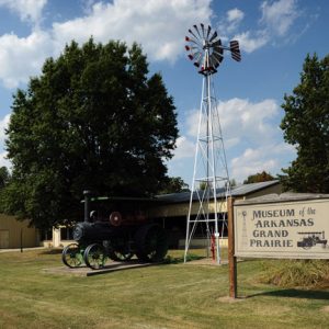
The Museum of the Arkansas Grand Prairie in Stuttgart (Arkansas County)—also known as the Stuttgart Agricultural Museum and the Arkansas County Museum—was formed in 1974 by two lifelong Arkansas County residents, Bennie Burkett and Jack Crum, in order to preserve Arkansas County’s heritage as a center for rice production and duck hunting. The museum is funded partly by quarterly donations from the city but mostly by yearly contributions from “the donor club.” Its board of trustees is appointed by the city council. The construction of the museum began after a nonprofit group of interested citizens raised funds to build a 1,500-square-foot building on the property of the city park. It was finished in 1974. Through the years, four additions have …

National Fish Hatcheries

Thirty-five states are home to a total of seventy national fish hatcheries (NFHs). Arkansas is home to three: Mammoth Spring, Norfork, and Greers Ferry. Arkansas’s role in the federal fish hatchery system—designed to conserve, protect, and enhance the fish population nationwide for the benefit of all Americans—is key. Arkansas is the systems leader in trout production, has the single Gulf Coast striped bass facility in the world, and engages universities in collaborative research efforts. The United States Fish and Wildlife Service (USFWS) in the Department of the Interior administers the world’s largest fish hatchery system, comprising not only hatcheries, but also Fish Health Centers and Fish Technology Centers. Federal fish hatcheries trace their formation to a joint resolution of the …

Natural Steps (Pulaski County)

Natural Steps is an unincorporated community located on Highway 300 between Lake Maumelle and the Arkansas River in Pulaski County. It takes its name from a unique sandstone formation in the shape of parallel stair steps. A 1932 archaeological investigation into the Natural Steps area conducted by staff at the University of Arkansas (UA) in Fayetteville (Washington County) uncovered fifty-seven burials, as well as pottery from both the Quapaw and Caddo tribes. An exact sequence of Native American habitation of the area, however, remains unknown. A Spanish land grant conveyed land at Natural Steps to Eli Stidwell. Another early white settler was John Standlee, who was in the area from 1778 to 1780. In the 1810s, merchant John Taylor purchased …

Nature Conservancy of Arkansas

The Nature Conservancy of Arkansas is part of the international Nature Conservancy headquartered in Arlington, Virginia. The Nature Conservancy’s mission is to preserve the plants, animals, and natural communities that represent the diversity of life on earth by protecting the lands and waters they need to survive. The Nature Conservancy was incorporated on October 22, 1951, in Washington DC as a nonprofit organization. The Arkansas field office, established on April 12, 1982, became the organization’s twenty-ninth state program. The Arkansas program, which opened with about 250 members and a staff of three, has grown steadily in capacity and achievement. The conservancy now has about 6,000 members in Arkansas (the worldwide membership is about one million) and a staff of more …

New Madrid Earthquakes of 1811-1812

The New Madrid Earthquakes took place between December 1811 and April 1812 along an active fault line that extends roughly from Marked Tree (Poinsett County) in a northeasterly direction, crossing several states for about 150 miles. The earthquakes and aftershocks caused extensive damage throughout northeast Arkansas and southeast Missouri, altering the landscape, affecting settlement of the area, and leaving noticeable reminders that another huge earthquake could happen at any time. The town of New Madrid, Missouri, on the Mississippi River, was founded by Revolutionary War hero George Morgan in 1789. The town was named by Morgan in an attempt to ingratiate himself and receive a land grant from the King of Spain. Its later pronunciation placed the emphasis on the …

New Madrid Fault

aka: New Madrid Seismic Zone
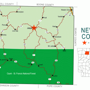
The New Madrid Fault, also called the New Madrid Seismic Zone, is actually a series of faults, or fractures, at a weak spot in the earth’s crust called the Reelfoot Rift. It lies deep in the earth and cannot be seen from the surface. The fault line runs roughly 150 miles from Arkansas into Missouri and Illinois. In 1811–1812, it was responsible for the most violent series of earthquakes in the history of the continental United States (though there have been larger individual earthquakes). Scientists predict that another large earthquake is due which could inflict great damage to Arkansas as well as up to half the nation. The New Madrid seismic zone runs roughly northeast from Marked Tree (Poinsett County). …

Nimrod Dam and Lake

Nimrod Dam in western Perry County is the oldest project of the U.S. Army Corps of Engineers in the state of Arkansas, created to control flooding along the Fourche La Fave River. Nimrod Lake, the reservoir created by the dam, stretches across the border of Perry and Yell counties and is a popular attraction for fishermen and duck hunters. The dam and lake take their names from the nearby community of Nimrod (Perry County), itself named after the biblical figure. The construction of Nimrod Dam was authorized by the Flood Control Act of 1938. Damming the Fourche La Fave was considered an economical means of protecting communities and valuable crop land in Yell and Perry counties, as well as lessening …

Nix, Joe Franklin

Joe Nix is a water chemist, environmentalist, naturalist, and educator considered by many to be the watchdog of Arkansas rivers and lakes with respect to water quality and usage patterns. His mission has been to have society use good scientific data in making decisions about environmental matters. Joe Franklin Nix was born on August 28, 1939, the only child of Frank and Era Nix, in Malvern (Hot Spring County). His father was a mechanic; his mother was a homemaker. He was a sickly child, so the doctor advised that he spend a lot of time outdoors. As a youth, he fell under the personal tutelage of family friend and former state geologist Joe Kimzey of Magnet Cove (Hot Spring County). …

North Fork River

North Fork River drains an area of about 1,830 square miles in Missouri and Arkansas and is about 110 miles long. Its headwaters begin in Wright County, Missouri, near the town of Mountain Grove. From there, it flows generally south through Douglas and Ozark counties, Missouri. About the last half of its length is in Baxter County, Arkansas. The U.S. Army Corps of Engineers impounded the North Fork with the construction of Norfork Dam near the town of Norfork (Baxter County). Norfork Dam was the first of several Corps of Engineers flood control and hydropower dams on the White River and its tributaries. Variant names for the river have included Big or Great North Fork of White River, North Fork …

Northern Snakehead

aka: Channa argus
aka: Snakehead
The northern snakehead (Channa argus) is a modern bony fish belonging to the family Channidae. It is native to China, eastern Russia, and parts of the Korean peninsula. The fish was discovered in Arkansas in 2008, leading to attempts to eradicate it. The northern snakehead has an elongate body, with long dorsal and anal fins, and a truncated tail. Coloration is dark tan to brown with darker spots laterally, extending above and below the midline. The jaws have sharp, pointed teeth. The fish can reach a size of one meter and weigh as much as eight kilograms. The northern snakehead breathes with gills but also possesses a suprabranchial organ, which consists of chambers filled with folded tissue that allow atmospheric …

Official State Grape

aka: Cynthiana Grape
Approximately 150 commercial vineyards and wineries have operated in Arkansas since 1870. In 2009, the Arkansas General Assembly took note of this agricultural mainstay when it designated the Cynthiana, a native grape, as Arkansas’s official state grape. Act 547 was introduced as House Bill 2193 by Representatives Beverly Pyle of Cedarville (Crawford County) and Kathy Webb of Little Rock (Pulaski County). The measure was introduced at the suggestion of Audrey House, proprietor of the Chateau Aux Arc vineyards in Franklin County, to draw attention to the survival and rising reputation of Arkansas vintages. Arkansas’s grape-growing industry is small, however, in comparison to that of such viticultural powerhouses as California. Between 2007 and 2009, acres of cultivated grapes ranged between 750 …

Oil Industry

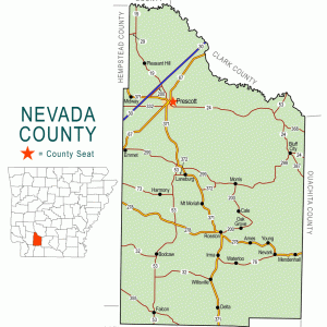
The oil industry in Arkansas, which includes exploration and the production, refinement, and distribution of petroleum-based products, exploded onto the state’s economic scene in the early 1920s, and once-local production expanded into an international business. From 1920 to 2003, more than 1.8 billion barrels of oil were produced in Arkansas. Ten counties in Arkansas produce oil, all in the southern region of the state: Ashley, Bradley, Calhoun, Columbia, Hempstead, Lafayette, Miller, Nevada, Ouachita, and Union. Historically, most of this production has been in Union, Lafayette, Columbia, and Ouachita counties. These four counties have been responsible for more than eighty-five percent of the oil produced in the state. Evidence of oil in the state existed well before the oil boom of …

OMNI Center for Peace, Justice and Ecology
The OMNI Center for Peace, Justice and Ecology of Fayetteville (Washington County) began its work as a traditional peace advocacy organization before moving into local community engagement linked to state, national, and global networks. The organization’s mission is as follows: “OMNI Center educates, empowers and connects, for a world that is nonviolent, sustainable and just.” The OMNI Center is a 501(c)(3) nonprofit organization. The OMNI Center’s founders were James R. (Dick) Bennett and Dana Copp. When Bennett retired from the University of Arkansas (UA) in Fayetteville in 1998, after a forty-year career as a professor of English, he wanted to start a peace organization and change the world. Copp agreed to help, and in the spring of 2001, they set …

Ouachita Mountains

aka: Ouachitas
The Ouachita Mountains, one of the six natural divisions of Arkansas, are generally characterized as folded ridges and valleys composed of Paleozoic rocks. They are unusual in North America in that the ridges are generally aligned east to west, unlike the Rocky Mountains or Appalachian Mountains, where the ridges usually run north to south. The most striking result of this orientation is that there is an extensive south-facing slope on each ridge that is exposed to the heat and light of the sun, as well as a north-facing slope that is protected from direct solar radiation and is consequently cooler and moister. The dry south-facing slopes are often covered with pine forests or woodlands, or even drier oak woodlands, while …