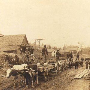
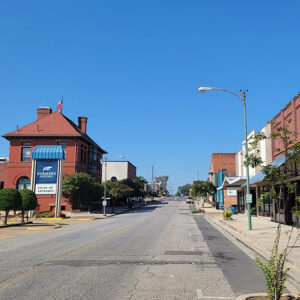
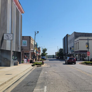
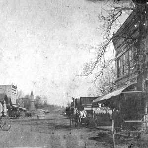
 Calico Rock Street Scene
Entry Category: Cities and Towns
Calico Rock Street Scene
Calion (Union County)
Calion is a second-class city in the northern part of Union County, on Highway 167 and on the south bank of the Ouachita River. The city is known principally as a timber industry center, although increasing emphasis is being placed on tourism opportunities associated with Lake Calion. The African-American neighborhood of Jelly Roll in Calion was the subject of an anthropological study published in 1986. Native American artifacts of the prehistoric era—including Koroa and prehistoric Caddo—have been discovered across the river from Calion in southern Calhoun County. Some historians have attempted to demonstrate that Hernando de Soto’s expedition wintered in that region, since it is known that the expedition did travel along the Ouachita River. In the nineteenth century, the …
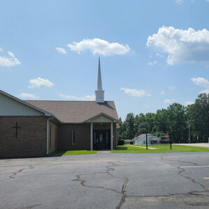 Calmer Church
Camden (Ouachita County)
Camden is the county seat of Ouachita County and is located in south-central Arkansas on the Gulf Coastal Plain, about fifty miles north of Louisiana. Since it began life as Ecore a Fabre, a French trading post, its history has been closely tied to the Ouachita River. At the head of practical navigation, Camden was the “Queen City” of the Ouachita during the steamboat era. In 1864, it became the unintended focus of a major Civil War effort called the Red River Campaign, resulting in several significant battles. With the development of railroads, Camden was able to exploit its rich timberlands and remain an important transportation hub. Camden has also been important in both industry and education. Politically, Camden has …
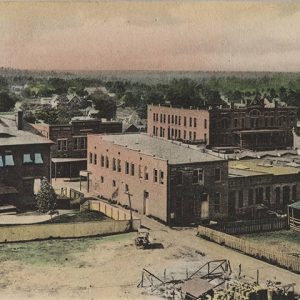
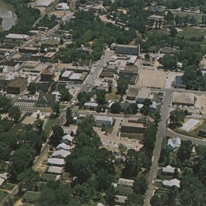 Camden Aerial View
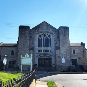
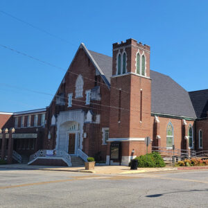
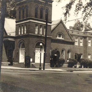 Camden Baptist Church
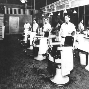 Camden Barbers
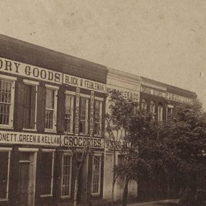 Camden Businesses
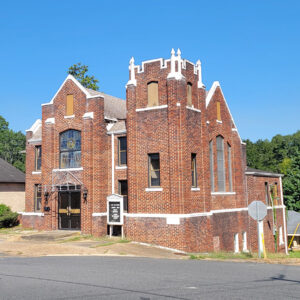
 Camden Church
 Camden Church
 Camden Church
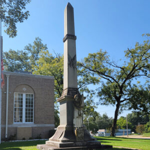 Camden Confederate Monument
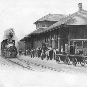 Camden Depot
 Camden Federal Building
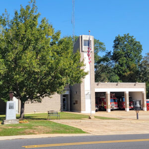 Camden Fire Department
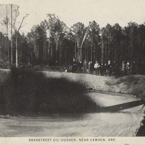 Camden Gusher
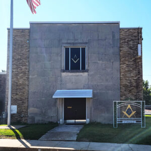 Camden Masonic Lodge
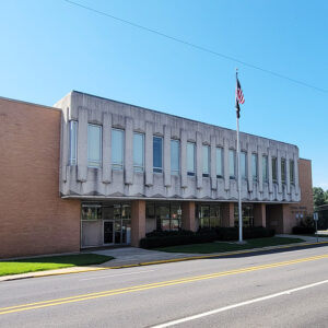
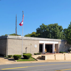 Camden Municipal Building
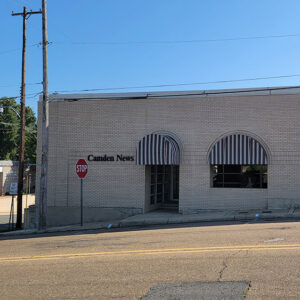 Camden News Building
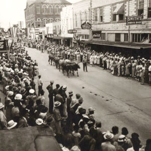 Camden Parade
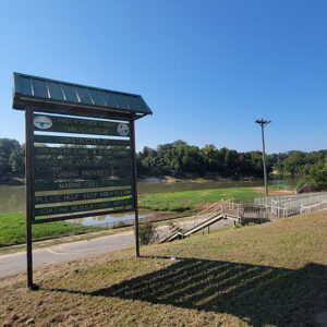 Camden River Access
 Camden Scene
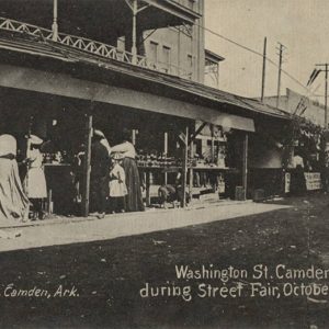 Camden Street Fair
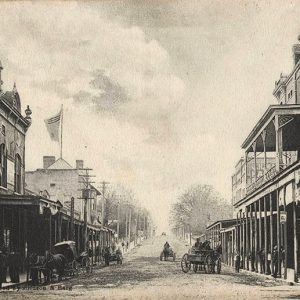 Camden Street Scene
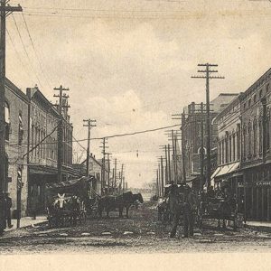 Camden Street Scene
 Camden Street Scene
 Camden Street Scene
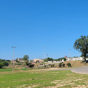
 Camden View
Cammack Village (Pulaski County)
The enclave of Cammack Village is a legally incorporated community surrounded entirely by the city of Little Rock (Pulaski County). Created as a site for federally subsidized housing in 1943, it has developed into an exclusive neighborhood renowned for a low crime rate and high property values. The land on which Cammack Village is located was owned by Wiley Dan Cammack, who had allowed it to be used for a Works Progress Administration roads project in the 1930s. In the 1940s, Cammack attempted to have the area annexed by Little Rock, the western edge of which abutted his land, but the city demurred. Cammack therefore turned the land over to a federally subsidized housing project designed to alleviate housing shortages …
Camp (Fulton County)
The unincorporated community of Camp, settled in the early 1800s, was home to some of Fulton County’s earliest settlers. Located near present-day State Highway 9, the somewhat isolated community became a typical rural gathering place for trade and commerce. Settlers were attracted to the area by available land and a plentiful water source provided by Camp Creek and several springs, which were said to never go dry. North Carolina brothers Joe and Nathan Benton, who arrived there in the early 1800s, were the first white settlers. Though more settlers moved to the area, a town did not begin to develop until the 1870s. In 1877, the man who was responsible for the development of the area’s commercial interests arrived. Within …
Campbell (Searcy County)
The historic community of Campbell in Campbell Township is located near County Road 68 (Gum Tree Lane) a short distance from where it intersects with Highway 66 about two miles north of Oxley (Searcy County) and about six miles east-northeast of Leslie (Searcy County). Campbell is located approximately eleven miles east-southeast of Marshall (Searcy County), the county seat. Campbell lies in a fertile valley of the foothills of the Boston Mountains. The caves and bluffs were utilized by Native Americans dating back to the Late Archaic Period. A Native American site, Cooper’s Bluff, northwest of Campbell near what is today Snowball (Searcy County), was added to the National Register of Historic Places on May 4, 1982. The Cooper’s Bluff Site …
Campbell Station (Jackson County)
Campbell Station—originally known only as Campbell—is a city in Jackson County located along the Union Pacific Railroad tracks and U.S. Highway 367. It is adjacent to the city of Diaz (Jackson County) and is between Newport (Jackson County) and Tuckerman (Jackson County). Campbell Station claims a portion of the Rock ‘n’ Roll Highway 67. The earliest settlements in Jackson County, such as Jacksonport (Jackson County) and Newport, were stops along the transportation corridor of the White River between the Mississippi River and Batesville (Independence County). The rest of the county was dominated by hardwood forests and farmland. Jacksonport was significant as a crossroads, as well as a common White River stop, as the Southwest Trail connecting southeastern Missouri to northwestern Texas …
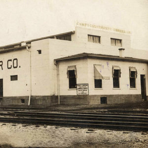 Campbell-Thorpe Grocer
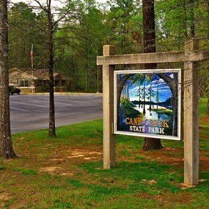 Cane Creek State Park
Cane Hill (Washington County)
Cane Hill, settled by Europeans in 1827, was the earliest settlement in Washington County. It was known as an educational center because the first college in Arkansas to admit women was in Cane Hill. In addition, it had the state’s first public school, library, and Sunday school. Several of the oldest houses in northwest Arkansas still stand in Cane Hill. It was also the site of an all-day skirmish in the days before the Battle of Prairie Grove (December 7, 1862). Most of the early settlers came from the Crystal Hill–Little Rock area (Pulaski County), attracted by the rich soil, plentiful freshwater springs, and the canebrakes in the temperate mountain climate. In addition, many Cherokee had recently been removed from …
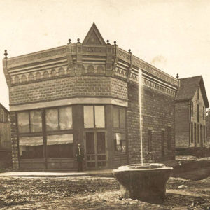 Cane Hill Bank
 Cane Hill College
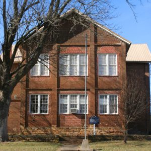 Cane Hill College
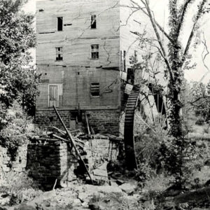 Cane Hill Mill
 Cane Hill Street Scene
 Cane Hill Street Scene
 Cane Hill Street Scene
 Cane Hill: 1891
Caney (Hot Spring County)
Caney is an unincorporated community in southwestern Hot Spring County. Centered on the intersection of Arkansas Highways 128 and 283 and Caney Road, the community is about one mile north of the Clark County line and seven miles southeast of Bismarck (Hot Spring County). The community is located in Montgomery Township and is about two miles east of DeGray Lake. Early landowners in the area included John Riddles, who obtained a federal land patent for 160 acres in the area in 1856. (Riddles is also spelled Riddle in some documents.) Little information on John Riddles is available, but other Riddles family members in the area also obtained land patents around the same time. Eli Riddles received a land patent for …
Caney (Independence County)
Caney Creek begins as a spring in the hills of the Ed Taylor Holler at McHue (Independence County), moves east through Southside (Independence County), and empties into Salado Creek near the Old Rock Bridge between Salado (Independence County) and Rosie (Independence County). Caney, a pioneer community, emerged along its banks in the early 1800s on what is today Kyler Road, where it intersects with Highway 167 South (Batesville Boulevard). Pioneer farmers found the alluvial land along the banks of Caney Creek to be ideal for the growing of grain crops, including corn (which could be used in the profitable moonshine business). One of the first to make his home in Caney was John Kyler from Tennessee, who appeared on the …
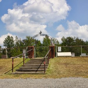 Caney Cemetery
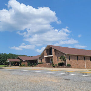 Caney Church
 Caney Creek
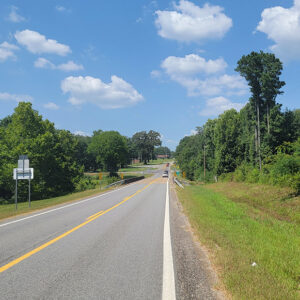
 Entering Caney Valley
Caney Valley (Pike County)
Caney Valley of Pike County is a community located about five miles west of Amity (Clark County) and six miles northeast of Kirby (Pike County). The area was formerly known as Pine Land. The first landowner in the area was Micajah McCawley, who obtained eighty acres in 1860. Caney Valley remained sparsely settled until after the Civil War, and other several land patents were issued in 1882. The families in the area grew numerous crops, including corn, cotton, wheat, oats, sweet potatoes, and melons. Some of the timber in the area began to be harvested in the late 1800s and shipped to nearby mills in Amity. A post office operated in the community from 1883 to 1890, when service was …


