
501-918-3025
calsfoundation@cals.org
calsfoundation@cals.org
| Latitude and Longitude: | 34º46’41″N 092º20’57″W |
|---|---|
| Elevation: | 515 feet |
| Area: | 0.28 square miles (2020 Census) |
| Population: | 778 (2020 Census) |
| Incorporation Date: | April 5, 1943 |
Historical Population as per the U.S. Census:
|
1810 |
1820 |
1830 |
1840 |
1850 |
1860 |
1870 |
1880 |
1890 |
1900 |
|---|---|---|---|---|---|---|---|---|---|
|
– |
– |
– |
– |
– |
– |
– |
– |
– |
– |
|
1910 |
1920 |
1930 |
1940 |
1950 |
1960 |
1970 |
1980 |
1990 |
2000 |
|
– |
– |
– |
– |
987 |
1,355 |
1,165 |
920 |
828 |
831 |
|
2010 |
2020 |
|
|
|
|
|
|
|
|
|
768 |
778 |
|
|
|
|
|
|
|
|
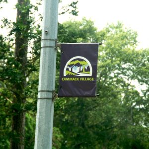
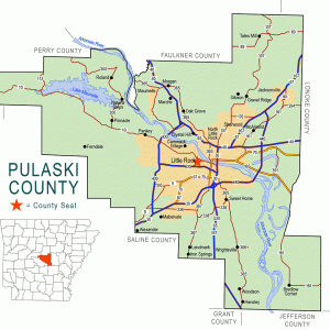
The enclave of Cammack Village is a legally incorporated community surrounded entirely by the city of Little Rock (Pulaski County). Created as a site for federally subsidized housing in 1943, it has developed into an exclusive neighborhood renowned for a low crime rate and high property values.
The land on which Cammack Village is located was owned by Wiley Dan Cammack, who had allowed it to be used for a Works Progress Administration roads project in the 1930s. In the 1940s, Cammack attempted to have the area annexed by Little Rock, the western edge of which abutted his land, but the city demurred. Cammack therefore turned the land over to a federally subsidized housing project designed to alleviate housing shortages at Camp Joseph T. Robinson. The houses were laid out in rows and built with 870 square feet per unit, according to U.S. Army specifications for family housing. In order to provide for police and fire protection, Cammack pushed for the incorporation of the new neighborhood, which occurred on April 5, 1943.
On November 19, 1946, an election was held to decide whether Cammack Village should be annexed by Little Rock, with 141 in favor and 139 opposed. On November 26, county judge L. A. Mashburn issued an order annexing the city. However, annexation opponent John Cornyn filed suit in the Third Division Circuit Court contesting the election, alleging that a number of votes were invalid and that there were technical difficulties in the annexation petitions and the procedure for calling an election. Opponents of annexation eventually won, and Cammack Village remained separate from Little Rock.
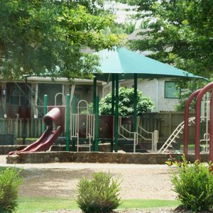
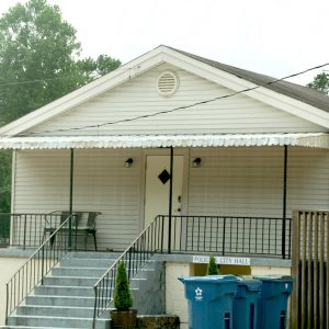
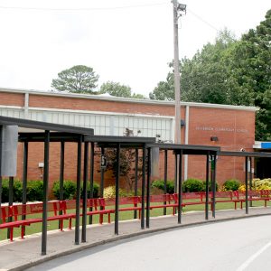
Cammack Village primarily comprises the original military housing, though several mansions were later built on its north end. The city relies upon Little Rock for its water, waste collection, fire protection, and power services, though it does maintain a police force. The city’s operating budget comes from its share of the countywide sales tax; it is also a notorious speed trap. City government consists of an elected mayor and aldermen, along with a city attorney, recorder, and treasurer. No businesses operate in Cammack Village. The city maintains two parks, and Jefferson Elementary School of the Little Rock School District is located within its borders.
Cammack Village was historically a “sundown town,” a place where African Americans were traditionally forbidden from residing. Federally subsidized housing projects during World War II were strictly segregated, and Cammack Village was no different, having been built solely for a white population. African Americans first appear on the U.S. Census records for Cammack Village in 1970, when four black people resided there. The next two censuses found none, and in 1998, reporter John Brummett noted that the city remained all white. In 2010, however, the U.S. Census reported four African-American residents of the city (down from eight at the 2000 census). The city also has nine Asian residents and eighteen Hispanic residents, according to the 2010 census.
Despite its insularity, Cammack Village has not been safe from disaster. On April 3, 2008, a tornado passed through, destroying several homes and causing damage to a wide area.
For additional information:
Brummett, John. “A Town of Its Own.” Arkansas Democrat-Gazette, October 2, 1998, pp. 1E, 4E.
Cammack Village. http://cammackvillage.org/ (accessed April 27, 2022).
Satterfield, W. W. “Pulaski County’s Unique City.” Pulaski County Historical Review 67 (Winter 2019): 121–127.
Staff of the CALS Encyclopedia of Arkansas


Comments
No comments on this entry yet.