


501-918-3025
calsfoundation@cals.org
calsfoundation@cals.org
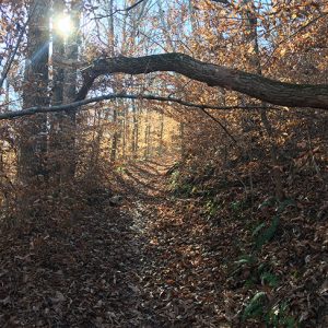
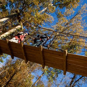
Hiking is one of the most popular outdoor recreational activities in Arkansas. Hikers can choose from over 250 trails to meet a range of objectives—casual strolls, exploration of history, nature appreciation, scenic beauty, vigorous day hikes in rugged terrain, or backpacking. Trails range in length from less than a mile to over 200 miles and range in difficulty from the easiest, handicapped accessible trails to rugged and extremely difficult trails. The largely rural state has an estimated 1,800 miles of trail, taking advantage of two mountain ranges, 600,000 acres of lakes, 9,700 miles of streams and rivers, and varied terrain. Each of the six geographic divisions of Arkansas has hiking trails.
The large extent of public lands in Arkansas is a big factor in the popularity of hiking. The Ozark-St. Francis National Forest and the Ouachita National Forest together cover three million acres of forest, with 1,000 miles of trail, and some of the most rugged hiking in the state. Within these two forests are twelve designated wilderness areas, wildlife management areas, creeks, rivers, waterfalls, and scenic vistas.
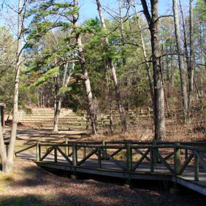
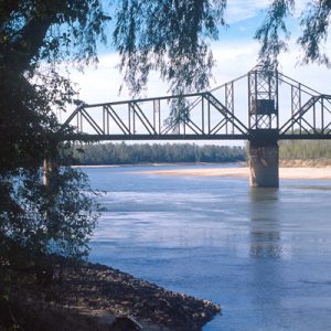
National Park Service lands are also important. The Buffalo National River has 100 miles of trail and some of the most dramatic scenery in the state. Hot Springs National Park offers twenty-six miles of trail, primarily for day hikers. Trails in Pea Ridge National Military Park offer a walk through a historical venue. Each of the fifty-two Arkansas state parks offers hiking trails. These trails are usually less rigorous than forest trails but are often more scenic.
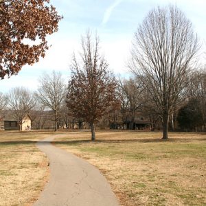
Hikers can choose from a variety of trail types. Day hikes can range from less than an hour to all-day affairs. Casual walking trails, such as the River Walk Trail in Little Rock (Pulaski County), are available without leaving the city. Nature trails, such as Village Creek Trail at Village Creek State Park on Crowley’s Ridge, provide opportunities to observe both flora and fauna. Trails such as the Delta Heritage Trail, a seventy-three-mile rails-to-trails project in the Mississippi River Delta area of southeastern Arkansas, explore the rich history of Arkansas. Interesting bits of history, such as pioneer homesteads and nineteenth-century cemeteries, are found along trails across the state.
Those wanting longer trails or the challenge of backpacking can look to three National Recreation Trails. The Ouachita National Recreation Trail is the longest of the three, running 223 miles east-west through the Ouachita Mountains, and includes a string of shelters over much of its length. The Ozark Highlands Trail, 165 miles through the Ozark National Forest, will someday connect to the Ozark Trail, extending to St. Louis, Missouri. The Buffalo River Trail, fifty-two miles (in two sections), follows the Buffalo National River, above and below steep bluffs. All three offer a variety of terrain, scenic beauty, good camp sites, and usually reliable water supplies. Each has sufficient access points for use by day hikers. Over thirty other National Recreation Trails can be found across the state, ranging from the half-mile Grand Promenade in Hot Springs National Park to the sixteen-mile backcountry Pigeon Creek Trail System near Norfork Lake in Baxter County.
Hiking terrain varies greatly as well. The most rugged hiking is in the Ozark and Ouachita mountains and along the Arkansas River Valley. Although the highest point in the state, atop Mount Magazine in Logan County, is only 2,753 feet above sea level, trails can be unexpectedly rugged. Steep climbs and sharp bluffs are not uncommon. Municipal trails and those in the Delta and Gulf Coastal Plain are flatter and typically easier to hike.
Arkansas’s climate allows hiking year round. Spring hiking is highlighted by good weather, abundant wildflowers, and running water. Forest trails are used less in summer due to high humidity levels, rapid overgrowth, and insects. Summer in Arkansas is best for urban and park trails. Fall color and cooler temperatures make autumn popular with hikers. During winter, hikers typically find clear, dry days with broad vistas available only when the ridge tops are without leaves on the trees.
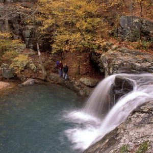
Eagle Rock Loop in the Ouachita National Forest offers a representative sample of hiking found in the mountains of Arkansas. The twenty-six-mile loop comprises three trails. The most difficult leg is the ten-mile Athens-Big Fork Trail, considered one of the toughest hikes in the state. The legacy of a 100-year-old mail route between the towns of Athens (Howard County) and Big Fork (Polk County), the north-south route crosses eight ridges, each with a climb of 800 to 1,000 feet vertically. When combined, however, the hiker gains over 6,000 vertical feet in ten miles. The next leg is easier and more scenic. The Little Missouri River Trail follows the river for ten miles past scenic highlights including Little Missouri Falls, the bluffs near Albert Pike Campground, and Winding Stairs scenic area. Climbs are less severe than Athens-Big Fork, but there are several tricky creek crossings and two good swimming holes. Several access points allow options as short as two miles for day hikers. The final leg of the loop is the easiest. Viles Branch Trail follows a creek parallel to one of the Athens-Big Fork ridges. It is shared with equestrians. The entire region is rich in wildlife, making all portions of the loop popular with nature lovers and bird watchers.
Hiking clubs throughout the state provide opportunities for hikers who do not like to go it alone. Clubs range from small, informal, local groups to large, well-organized clubs with extensive schedules. The group Ouachita Mountain Hikers, centered in Hot Springs (Garland County), has over 200 members and a hike schedule that takes the group all over the state.
Arkansas hikers as a group volunteer thousands of hours yearly to trails. Trail associations organize trail maintenance activity. The Ozark Highlands Trail Association built and still maintains the Ozark Highlands Trail. Friends of the Ouachita Trail (FoOT) organized to help maintain the 223-mile Ouachita Trail. Smaller groups work locally to maintain individual trails. The “Trail Dogs,” for example, work with three federal agencies to maintain and extend the new Lake Ouachita Vista Trail.
For additional information:
Arkansas State Parks. http://www.arkansasstateparks.com (accessed January 25, 2023).
Buffalo National River. National Park Service. http://www.nps.gov/buff (accessed January 25, 2023).
Ernst, Tim. Arkansas Hiking Trails. 2nd ed. Fayetteville, AR: Wilderness Vision Press, 1998.
Friends of the Ouachita Trail. https://friendsoftheouachita.org/wp/ (accessed January 25, 2023).
Hot Springs National Park. National Park Service. http://www.nps.gov/hosp/index.htm (accessed January 25, 2023).
Jones, Janie, and Wyatt Jones. Hiking Arkansas. Guilford, CT: The Globe Pequot Press, 2004.
Lake Ouachita Vista Trail. http://lakeouachitavistatrail.org/WP/ (accessed January 25, 2023).
Moran, Matthew. Guide to the Trails of Petit Jean State Park. N.p.: Moran Books, 2014.
Ouachita Mountain Hikers. https://omhikers.club/(accessed January 25, 2023).
Jim Gifford
Friends of the Ouachita Trail


Comments
No comments on this entry yet.