501-918-3025
calsfoundation@cals.org
calsfoundation@cals.org
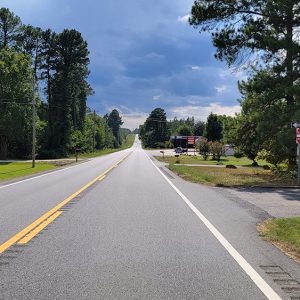
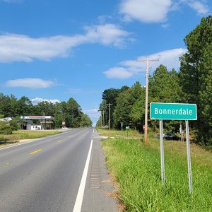
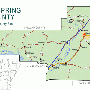
Bonnerdale is an unincorporated community located in extreme western Hot Spring County. Located at the intersection of Mazarn Road and U.S. Highway 70, the community is closely associated with the nearby communities of Cross Roads (Hot Spring County) and Mount Moriah (Hot Spring County). Bonnerdale is located about ten miles northeast of Glenwood (Pike County) and about nineteen miles southwest of Hot Springs (Garland County). The nearby community of Old Bonnerdale is located just over the county line in Garland County.
During the early days of the Arkansas Territory, Bonnerdale was part of Clark County. With the establishment of Hot Spring County on November 2, 1829, the area around what is now Bonnerdale became part of the new county. One of the earliest settlers in the area was Hiram Careley. He began acquiring land in western Hot Spring County and what is now Garland County, obtaining forty acres in 1850; by the end of the decade, Careley had at least 406 acres of land in the area, including about forty-three near Bonnerdale. A native of North Carolina, Careley appeared in the 1850 Census as a farmer living with his wife Eveline and five children. The family also owned a number of slaves, including two men, one woman, and one male infant.
Few new settlers arrived in the area until after the Civil War. William Rucker obtained land patents for 160 acres of land to farm in the area in 1889. He appeared in the 1900 Census with his wife Hester and their sons John and Albert. Rucker lived in the area until his death in 1924 and is buried in the Mazarn Chapel Cemetery.
A native of Missouri, the uniquely named Doctor Topper Smith moved to Hot Spring County with his family as a small child. Serving in the Fourth Arkansas Cavalry (US) during the Civil War, he returned to Hot Spring County after the war and obtained eighty acres of land near what is now Bonnerdale in 1890. Smith lived on the land with his wife Sarah and their children until her death in the late nineteenth century and remained on his land with his second wife Sintha. Smith died in 1901 and is buried in the Mazarn Chapel Cemetery. Other land patents were issued in the area in the late nineteenth and early twentieth centuries, with the last patent issued in 1908 to Thomas Wilson and Roy McDonald.
The original community centered on a settlement named Memdag, located about two miles north of present-day Bonnerdale. Located in Garland County, the community was named for the Memphis, Dallas and Gulf Railroad that passed through the area. Founded in the late nineteenth century, it contained multiple stores, a doctor’s office, a pool hall, a cotton gin, and a railroad depot, along with other businesses. Plans were made in 1910 to lay out numerous city streets and construct a city park, schools, a courthouse, and other structures, although these plans did not come to fruition.
A school operated in the community when it was known as Memdag. It was located in a boxcar parked on a siding in the community before a purpose-built building was constructed in the late nineteenth century. About thirty students attended the school, which offered coursework through the eighth grade. In the mid-1940s, the school consolidated with the Glenwood District, and the school building was moved to that town, where it was used as a cafeteria on the school campus.
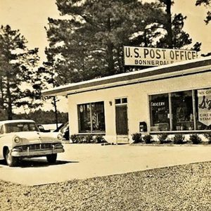
Founded as a logging community, Memdag ceased to exist when the surrounding countryside no longer contained enough timber to support continued operations. By 1986, only a few concrete walls remained in the former community. The post office in Memdag opened in 1914 and closed in 1919. It moved about two miles south to its present location, and the Bonnerdale office opened in 1919; it was still operating more than a century later.
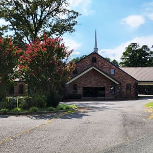
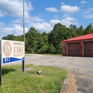
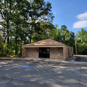
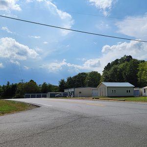
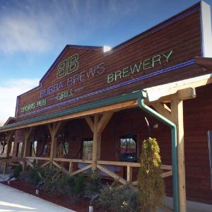
In the twenty-first century, the community of Bonnerdale consists of several homes, a post office, and the headquarters of the Seventh-Day Adventist–associated Ministry of Future for America. Students in the area attend the Centerpoint School District, located in Pike County. Some residents work in Hot Springs, and the area remains rural, with timber production as a major economic driver. The community is located on the edge of the Ouachita National Forest. Several businesses, including a brewery and a liquor store, are located near the community and have Bonnerdale addresses but are actually located in Garland County. The Bonnerdale Volunteer Fire Department is located in Cross Roads.
For additional information:
Blanton, Norma. “Once There Was a Place Named Memdag.” The Heritage 38 (2011): 46–48.
Weatherford, Bennie Wright. “Bonnerdale-Bonner-Memdag.” The Record 27 (1986): 98–104.
David Sesser
Henderson State University


Comments
No comments on this entry yet.