calsfoundation@cals.org
Beaver (Carroll County)
| Latitude and Longitude: | 36°28’25”N 093°46’03”W |
| Elevation: | 932 feet |
| Area: | 0.31 square miles (2020 Census) |
| Population: | 67 (2020 Census) |
| Incorporation Date: | September 6, 1949/November 28, 1980 |
Historical Population as per the U.S. Census:
|
1810 |
1820 |
1830 |
1840 |
1850 |
1860 |
1870 |
1880 |
1890 |
1900 |
|
– |
– |
– |
– |
– |
– |
– |
– |
– |
– |
|
1910 |
1920 |
1930 |
1940 |
1950 |
1960 |
1970 |
1980 |
1990 |
2000 |
|
– |
– |
– |
– |
– |
24 |
– |
– |
57 |
95 |
|
2010 |
2020 |
|
|
|
|
|
|
|
|
|
100 |
67 |
|
|
|
|
|
|
|
|
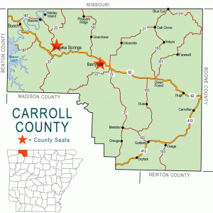
Named for early settler Wilson Ashbury Beaver, the Carroll County town of Beaver is on State Highway 187 about seven miles north of Eureka Springs (Carroll County).
Osage hunted and fished in the Ozark Mountains when European and American explorers first entered the region. White settlers gradually displaced the Osage presence. John and Sarah Williams received title to the land that would become Beaver in 1852, although their house had been built on that land around 1836. They sold this house and land to Wilson Asbury (or Ashbury) Beaver in 1857.
Beaver established several businesses on his land, including a 350-acre farm, a grist mill, a trading post, a ferry across the White River, and an inn, all of which bore the Beaver name. According to local lore, Beaver Inn sheltered General Sterling Price and his officers either on their way to Pea Ridge (Benton County) or upon their retreat from the Battle of Pea Ridge in March 1862; official sources, however, record Price crossing the White River elsewhere. Following the Civil War, Beaver’s ferry was part of a regular stagecoach route that also made a regular stop at his inn. Beaver established a post office on his property in 1879, first named Beaver Ferry and later shortened to Beaver.
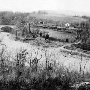
However, the area remained sparsely populated until the development of Eureka Springs in the 1880s. The Eureka Springs Railway was chartered in 1882 with terminals at Seligman, Missouri, and Eureka Springs. This railroad, which would bear several names through its history and would be extended across Arkansas to Helena (Phillips County), passed through a formation near Beaver called the Narrows, which became a tourist attraction for residents and visitors from Eureka Springs. Developer Cash Mark Swope acquired Beaver Inn, moving it several hundred yards, and was named postmaster of Beaver. He renamed the business Riverside Inn and stocked it with vegetables, fruit, meat, and poultry raised on his farm. Swope also built a general store, a bathhouse, a baseball field, a boat rental operation, and steamboat tours of the White River near Beaver.
Rock quarries near Beaver provided building material for Eureka Springs, including the Crescent Hotel, as well as for buildings on the University of Arkansas (UA) campus in Fayetteville (Washington County), a railroad bridge in Fort Smith (Sebastian County), and other construction projects as far away as St. Louis, Missouri, and Memphis, Tennessee. The town of Beaver and another town called Brooklyn (Carroll County) prospered during the height of the quarry work, with a total of thirty saloons between the two communities. Carrie Nation is said to have conducted one of her last campaigns against alcohol in the town of Beaver.
Until the era of school consolidation, school children from Beaver attended classes at the Butler schoolhouse near Beaver or crossed the river on the railroad bridge to attend the schoolhouse in Brooklyn. Children later began being bused to the schools in Eureka Springs.
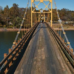
A concrete bridge was built across the White River at Beaver in 1926, closing the ferry. The bridge was destroyed by flooding in 1943 but was replaced with a suspension bridge that was completed in 1949. The suspension bridge was added to the National Register of Historic Places on September 6, 1990, and was featured in the 2005 movie Elizabethtown. Portions of the miniseries The Blue and the Gray were also filmed near Beaver in 1982.
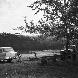
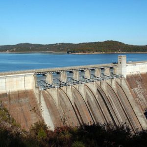
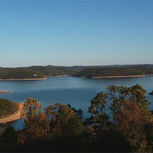
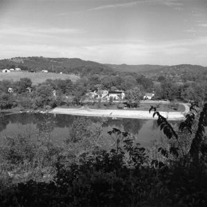
Table Rock Dam was built in Missouri beginning in 1954, creating Table Rock Lake in Missouri and Arkansas. The Carroll County Historical and Genealogical Society formed plans to move the 1836 house once owned by Beaver, but the U.S. Army Corps of Engineers went ahead with its planned razing in 1962, before the CCHS could carry out any preservation efforts. When the lake was completed, the Corps of Engineers created a park at Beaver with camping sites, boat launches, and swimming areas. The park was leased by the town of Beaver in 1981. Beaver had lost its incorporation, but it reincorporated on November 28, 1980.
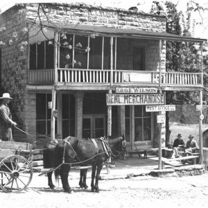
In 1978, Beaver had a general store, a service station, a post office, and at least a dozen houses. In 2003, the Beaver Volunteer Fire Department closed, giving its equipment and responsibilities to the Holiday Island (Carroll County) Rural Fire Department.
For additional information:
Beaver, AR. Carroll County. http://carrollcountyar.com/beaver.php (accessed April 13, 2022).
Beaver, Arkansas. http://www.beavertownarkansas.com/ (accessed April 13, 2022).
Braswell, Klute. “The Narrows: A White River Settlement Back in 1836.” Carroll County Historical Society Quarterly 23 (Spring 1978): 1–11.
Croley, Victor A. “City of Beaver Bears Pioneer’s Name.” Arkansas Democrat Sunday Magazine, December 24, 1967, p. 7.
Edmisten, Robert. “History, Legend Plentiful at Beaver.” Arkansas Gazette, April 14, 1974, p. 5E.
History and Families of Carroll County, Arkansas. Paducah, KY: Turner Publishing Company, 2003.
Hull, Clifton. “The Legend of Squire Beaver Still Endures.” Arkansas Gazette, November 10, 1968, p. 5F.
———. “Progress Meant the End for Historic Beaver Cabin.” Arkansas Gazette, August 6, 1980, p. 3B.
Kennedy, Steele T. “Beaver’s River Becomes a Lake.” Arkansas Democrat Magazine, January 17, 1960, pp. 8–9.
Lair, Jim. An Outlander’s History of Carroll County, Arkansas. Marceline, MO: Walsworth Publishing Company, 1983.
Steven Teske
Butler Center for Arkansas Studies




Comments
No comments on this entry yet.