County: Randolph

Hudson, Joel Carrington

Joel Carrington Hudson was a career diplomat at the U.S. Department of State who served in various posts around the world, including being stationed in Germany on the cusp of World War II. Joel Hudson was born in Ravenden (Lawrence County) on September 4, 1899. Hudson’s father was William R. Hudson, who is referred to at times as “Reverend” and at other times as “Doctor.” His mother was Ida Tanner Hudson, who died before 1910. His parents lived in Lonoke (Lonoke County) with the seven-month-old Hudson at the time of the 1900 census. In 1910, Hudson and his father were each enumerated as “roomer” in Houston, Texas, where Hudson’s father was the founding minister of the Third Baptist Church. Little …

Marr’s Creek Bridge

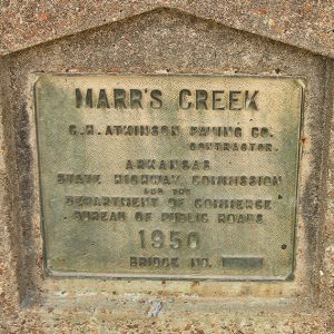
The Marr’s Creek Bridge is a reinforced concrete bridge with an open spandrel arch. It was built to carry U.S. Highways 62 and 67, as well as South Bettis Street, over Marr’s Creek in Pocahontas (Randolph County) near its confluence with Black River, although the bridge is no longer an active part of Highway 67. The Marr’s Creek Bridge was an important component of New Deal recovery programs in Arkansas and was constructed in 1934 as one of the Public Works Administration (PWA) projects in Arkansas. The construction of Highway 67 and its subsequent bridges, including the 135-foot-long Marr’s Creek Bridge, was a part of a larger modernization campaign to rebuild Highway 67 into Pocahontas. This campaign created jobs within …

Maynard (Randolph County)

Maynard is in northern Randolph County, located at the intersection of State Highways 328 and 115. The town is known for its academic heritage and for preserving the history of the area with the Maynard Pioneer Park and Museum. Three freshwater springs have long made the area of Maynard desirable for brief refreshment or for more permanent settlement. When the United States acquired the Louisiana Purchase in 1803, Osage hunters and travelers frequented the area, although their homes were farther north in Missouri. Early highways crossed near the springs—the Old Military Road (also known as the Southwest Trail) that connected St. Louis, Missouri, to parts of the Red River valley and Texas, passed near the springs, where it intersected the …

Maynard Baptist Academy

aka: Abbott Institute
aka: Ouachita Baptist Academy
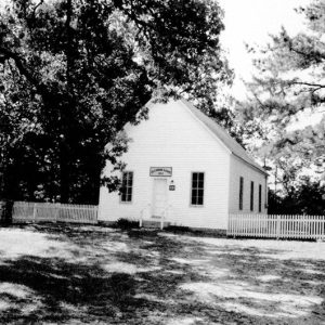
The Maynard Baptist Academy—first known as the Abbott Institute and then as the Ouachita Baptist Academy—was a boarding school founded in 1894 in Maynard (Randolph County). At the time, most schools typically had only one room and went only as far as the eighth grade. The Abbott Institute was founded in 1894 by the Abbott (or Abbot) family from the Maynard area. While they themselves lacked much education, they saw great value in educating the young people of the area and surrounding areas. Eli Abbott had been very successful in land speculation in the Fourche River and Current River bottomland while also farming. The institute drew students from a wide area of Arkansas and from other states. The school had …

Maynard Pioneer Museum and Park

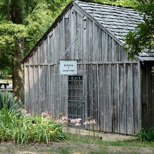
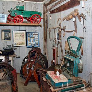
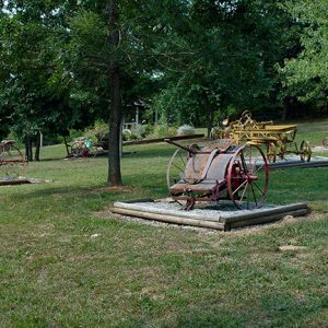
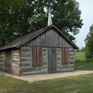
Located on State Highway 328 on the outskirts of the small town of Maynard (Randolph County), the Maynard Pioneer Park and Museum was founded in 1980. The park and museum reflect life in the Ozarks around the end of the nineteenth century, and the museum also preserves pictures, documents, and artifacts of that time. Each September, the park hosts a craft fair and festival that is attended by thousands of people. Built along the old Southwest Trail and near the historic Columbia community, the settlement of Maynard dates to the decade following the Civil War. The first businesses were a gristmill, sawmill, pharmacy, and post office. In 1894, the Abbott Institute (later the Maynard Baptist Academy) was established, drawing students …

O’Kean (Randolph County)

  The town of O’Kean (Randolph County) first developed in the Black River bottoms, the area to the south and east of the Black River in Randolph County, shortly after the Civil War. Attracted by plentiful game and productive ground, most pre-war settlers in the area lived near the road from Pocahontas (Randolph County) to old Greensboro (Craighead County) and Gainesville (Greene County), or along the Cache River. The history of the actual settlement and naming of O’Kean remains clouded. There were settlers near the junction of the track and road, but the name of that settlement, if it had one, is unknown. The name O’Kean came from Father James O’Kean, the former priest of St. Paul’s Catholic Church. He …

Old Jackson (Randolph County)

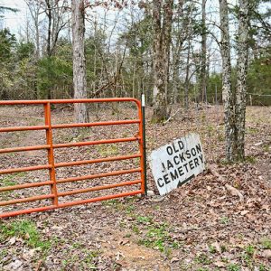
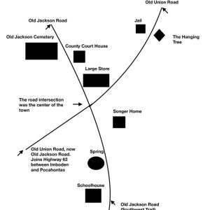
Jackson was a town once located in Lawrence County, approximately two miles northeast of the current town of Imboden (Lawrence County) and several miles west of the Eleven Point River. The town was centered on the Old Jackson and Union roads. Jackson, one of the few towns located on the Southwest Trail, served as the county seat for Lawrence County from 1829 to 1837. It was also an important location on the Trail of Tears due to its placement along the Fort Smith to Jackson Road. After boundaries were redefined in 1861, the town was located in Randolph County. By the 1880s, little was left of the town, which had become known as Old Jackson. Many sources show 1830 or …

Old Randolph County Courthouse

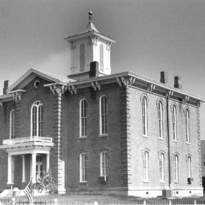
The Old Randolph County Courthouse sits in the middle of historic downtown Pocahontas (Randolph County). The second courthouse to serve Randolph County, the Old Courthouse is made of bricks and wood and decorated with wood trimming. A cupola adorns the roof. The building once had a vault, but it was removed sometime in the 1930s. Although the Old Courthouse is no longer home to the court system, it is still an important landmark for the city of Pocahontas. The Randolph County courts moved their offices diagonally across the street from the Old Courthouse to the new courthouse in 1940, after more than sixty years of service for the Old Courthouse. Since that time, the Old Courthouse has had several uses, …

Old Union School

Early residents of Randolph County settled in the Ozark Plateau area of the county. While many of these communities are gone, remnants of their existence can be seen. For the Birdell (Randolph County) community, the Old Union School survives as an example of the early history of this once thriving community. Located approximately two miles northwest of the community, the school is a prime example of what early education looked like in rural Arkansas. The early community of Birdell constructed a hewn-log school out of material readily available, which was a common building technique in early Arkansas. It is believed that the original school was built sometime prior to the Civil War. This school burned in 1910, and classes were …

Patterson, Missouri, to Cherokee Bay, Scout from

Union troops in southeastern Missouri regularly ran scouting expeditions in that area and into northeastern Arkansas in search of Confederate troops and guerrillas; the scout from Patterson, Missouri, to Cherokee Bay (Randolph County) in Arkansas was typical of such operations. Captain Abijah Johns of Company A, Third Missouri State Militia Cavalry (US), led a small force of troopers from Patterson on January 23, 1864, toward Cherokee Bay, a term used loosely by Union commanders to describe the area between the Black and Current rivers in Randolph County. At some point, the Third Missouri cavalrymen—including some described as “swamp scouts”—ran into a party of twenty men led by Colonel Timothy Reeves of the Fifteenth Missouri Cavalry (CS), a Baptist preacher whose …

Philip Hall Likes Me, I Reckon Maybe

Philip Hall Likes Me. I Reckon Maybe. is a juvenile novel published in 1974, written by Bette Evensky Greene and illustrated by Charles Lilly. It won a Newbery Honor Award in 1975, and, in 1977, it was the runner-up for the Charlie May Simon Children’s Book Award. Greene was born in Memphis, Tennessee, on June 28, 1934, and spent much of her childhood in Parkin (Cross County), where her parents owned a dry-goods store; she clerked there as she grew older. Her family moved to Memphis when she was thirteen, but she returned to Arkansas for summer camp at Hardy (Sharp County), passing through Pocahontas (Randolph County) on the way. While her first book, Summer of My German Soldier (1973), …

Pitman’s Ferry, Skirmish at (April 1, 1862)

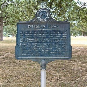
The April 1, 1862, Skirmish at Pitman’s Ferry took place as Brigadier General Frederick Steele moved his division of the Union army from southeastern Missouri to join Major General Samuel Curtis’s Army of the Southwest in Arkansas. On March 19, 1862, Steele ordered Colonel William P. Carlin to establish a base at Doniphan, Missouri, or Pitman’s Ferry on the Current River to gather supplies for his division as it moved into Arkansas. Pitman’s Ferry, located on the Southwest Trail, was a major route for travel between Arkansas and Missouri and would be the site of four skirmishes in 1862—on April 1, July 20, October 27, and November 25. Carlin led his own Thirty-eighth Illinois Infantry along with the Twenty-first Illinois …

Pitman’s Ferry, Skirmish at (October 27, 1862)

On October 27, 1862, Union Colonel William Dewey surprised Confederate Colonel John Q. Burbridge’s Brigade at Pitman’s Ferry (Randolph County). Dewey’s rapid combined-arms attack temporarily won control of the ferry and allowed for the reconnoitering of the Pocahontas (Randolph County) area. This was the last major Civil War engagement in Randolph County. The location of Pitman’s Ferry on the Current River made it an important possession for the antagonists in Arkansas. Settled by William Hix about 1803, the location served as the key entry point from Missouri on the Southwest Trail (also called the Military Road, Congress Road, or the Natchitoches Trace) into northeast Arkansas. Purchased by Dr. Peyton Robinson Pitman before Arkansas statehood, Pitman’s Ferry had a strategic importance …

Pocahontas (Randolph County)

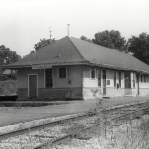
Begun as a river port significant to commerce, Pocahontas joins alluvial Delta bottom with the Ozark foothills. The town has served as Randolph County’s only county seat and continues as a strategic educational and agricultural center in the state. European Exploration and Settlement The first residents of the area arrived roughly 12,000 years ago. During the time of European exploration, what would become Randolph County was part of the hunting territory of the Osage, who lived in southern Missouri. French hunters probably crossed the area in the eighteenth century and established temporary camps, but no permanent settlements were developed until after the Osage surrendered their rights to the land in 1808. The earliest documented settler was Ransom S. Bettis, who …

Pocahontas Commercial Historic District
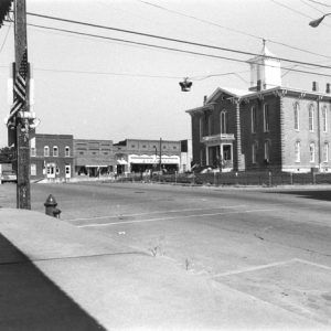
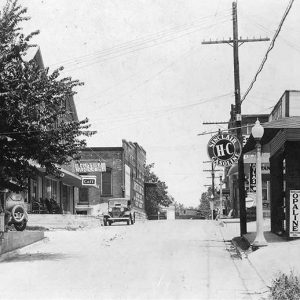
The Pocahontas Commercial Historic District is the historic downtown area of Pocahontas (Randolph County). This area has been the seat of local and county government, as well its commercial center, since the formation of the county in 1836. The commercial district is roughly bounded by Thomasville, Jordan, Broadway, and Vance streets. The downtown area comprises numerous historic buildings, including two courthouses, a service garage, a theater, a Works Progress Administration (WPA) post office, and the former city hall and city-function buildings, as well as other buildings currently utilized for modern business purposes. Both of the courthouses and the WPA post office are individually listed on the National Register of Historic Places. The center of the commercial district is dominated by …

Pocahontas Post Office (Historic)

The historic Pocahontas Post Office is a one-story, brick-masonry building built between 1936 and 1937. Located a few blocks away from the historic downtown square of Pocahontas (Randolph County), this building served as the post office for the area until 1986, when post office operations moved to new facilities. The old post office was built in the Art Deco style, which was a common form of architecture for Works Progress Administration (WPA) post offices at that time. This style of architecture is represented by vertical pilasters and brick segments with stylized ornamental decorations within the pilasters. Pocahontas got its first post office after the town was voted the Randolph County seat in 1835. By 1936, that original post office building …

Randolph County

Randolph County’s five rivers, proximity to land transportation routes, and rich agricultural promise drew settlers to the area before the Louisiana Purchase. As dependence on water-based transportation fell, land and railroad routes allowed agriculture and industry to maintain the county’s economic prominence in northeastern Arkansas. The county is home to the Rice-Upshaw House, the oldest standing structure in the state, and Davidsonville Historic State Park, devoted to one of Arkansas’s earliest settlements. The county has six incorporated communities: Biggers, Maynard, O’Kean, Pocahontas, Ravenden Springs, and Reyno. Pre-European Exploration Hundred of archaeological sites exist in Randolph County, some dating back to 11,000 BC or perhaps earlier. As time progressed from the Dalton Period through the Archaic,the number of sites and the duration …

Randolph County Courthouse

The Randolph County Courthouse is an Art Deco–style brick and concrete building erected in 1940–1941 as a Works Progress Administration (WPA) project in Pocahontas (Randolph County). The courthouse was built in a natural depression of one city block across the street to the west from what became known as the Old Randolph County Courthouse, the former seat of county government. The Randolph County Courthouse, which houses the offices and government of Randolph County, was added to the National Register of Historic Places on August 22, 1996. Citizens of Randolph County voted their approval for the building of a new courthouse in 1940. After the election, Judge Joe S. Decker appointed an advisory board and building commissioners for the construction of …

Randolph County Heritage Museum

Located on the historic court square in Pocahontas (Randolph County), the Randolph County Heritage Museum officially opened in 2006 during the Pocahontas Sesquicentennial Celebration and is owned by Five Rivers Historic Preservation, Inc., a non-profit, volunteer organization dedicated to the preservation and celebration of Randolph County history and culture. The museum includes three room-sized exhibits. The River Room is dedicated to the five rivers of Randolph County and their contributions through transportation, industry, recreation, and support to the local economy. The largest of the five rivers, the Black River, supplied the shelling and pearling industry of the late nineteenth century through the mid-twentieth century. Included are a working button machine and a collection of original tools and implements, as well …