501-918-3025
calsfoundation@cals.org
calsfoundation@cals.org
| Latitude and Longitude: | 36°10’09″N 090°48 51″W |
|---|---|
| Elevation: | 276 feet |
| Area: | 1.02 square miles (2020 Census) |
| Population: | 192 (2020 Census) |
| Incorporated: | November 29, 1913 |
Historical Population as per the U.S. Census:
|
1810 |
1820 |
1830 |
1840 |
1850 |
1860 |
1870 |
1880 |
1890 |
1900 |
|---|---|---|---|---|---|---|---|---|---|
|
– |
– |
– |
– |
– |
– |
– |
– |
– |
– |
|
1910 |
1920 |
1930 |
1940 |
1950 |
1960 |
1970 |
1980 |
1990 |
2000 |
|
– |
205 |
184 |
138 |
165 |
137 |
244 |
291 |
250 |
201 |
|
2010 |
2020 |
|
|
|
|
|
|
|
|
|
194 |
192 |
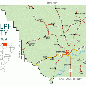
The town of O’Kean (Randolph County) first developed in the Black River bottoms, the area to the south and east of the Black River in Randolph County, shortly after the Civil War. Attracted by plentiful game and productive ground, most pre-war settlers in the area lived near the road from Pocahontas (Randolph County) to old Greensboro (Craighead County) and Gainesville (Greene County), or along the Cache River.
The history of the actual settlement and naming of O’Kean remains clouded. There were settlers near the junction of the track and road, but the name of that settlement, if it had one, is unknown. The name O’Kean came from Father James O’Kean, the former priest of St. Paul’s Catholic Church. He stopped at the small settlement to take the road to Pocahontas on his periodic trips there, and the stop became known as O’Kean.
While a railroad was planned through the Black River bottoms from Walnut Ridge (Lawrence County) to Knobel (Clay County) and into Missouri—one that would cross over the old road before the Civil War—it did not develop until after the war, with the first train passing through in December 1872. Originally the St. Louis and Iron Mountain, it was merged with the Cairo and Fulton and eventually became part of the Missouri Pacific, then Union Pacific.
Access to rail transportation quickly changed the economy of O’Kean. O’Kean was known as a “tie town” due to railroad tie production, and its townsfolk also made reasonable livings working in timber, chemical wood, trade, and agricultural production, and as employees for the railroad. By 1894, the town consisted of a railroad section house, railway stop, several businesses, and at least three residences. Due to the continued economic and physical growth of the town, it was incorporated in 1913.
O’Kean School District No. 74 opened in 1888. A new building was constructed for the school in 1927, and the school was consolidated with Delaplaine District No. C-7 in 1948. The high school students were immediately moved to Delaplaine (Greene County), but an elementary school remained in O’Kean until 1962, when students were moved to Delaplaine, as well.
As row crop agriculture began to dominate the local economy, the town fluctuated with the agrarian markets. A much needed boost occurred in 1953 when State Highway 34 was paved, allowing for easier road travel to Walnut Ridge. The city installed a water system in 1966, but sewer and gas access were not available to citizens until 1990. A city hall building was constructed in 1975, and a stand-alone fire station was built in 1998.
Census numbers show that the population fell from 201 in 2000 to 194 in 2010. As agriculture remains the primary economic activity around O’Kean, the people of the town will most likely maintain its population by providing support and services for the farmers in the region.
For additional information:
Dalton, Lawrence. History of Randolph County Arkansas. Little Rock: Democrat Printing and Lithographing Company, 1946.
Randolph County Historical and Genealogical Review. Special issue on O’Kean (Winter 1999).
Derek Allen Clements
Black River Technical College


Comments
No comments on this entry yet.