Physical Geography

Subcategories:
  • No categories
Clear

Entry Category: Physical Geography

New Madrid Fault

aka: New Madrid Seismic Zone
The New Madrid Fault, also called the New Madrid Seismic Zone, is actually a series of faults, or fractures, at a weak spot in the earth’s crust called the Reelfoot Rift. It lies deep in the earth and cannot be seen from the surface. The fault line runs roughly 150 miles from Arkansas into Missouri and Illinois. In 1811–1812, it was responsible for the most violent series of earthquakes in the history of the continental United States (though there have been larger individual earthquakes). Scientists predict that another large earthquake is due which could inflict great damage to Arkansas as well as up to half the nation. The New Madrid seismic zone runs roughly northeast from Marked Tree (Poinsett County). …

Nimrod Dam and Lake

Nimrod Dam in western Perry County is the oldest project of the U.S. Army Corps of Engineers in the state of Arkansas, created to control flooding along the Fourche La Fave River. Nimrod Lake, the reservoir created by the dam, stretches across the border of Perry and Yell counties and is a popular attraction for fishermen and duck hunters. The dam and lake take their names from the nearby community of Nimrod (Perry County), itself named after the biblical figure. The construction of Nimrod Dam was authorized by the Flood Control Act of 1938. Damming the Fourche La Fave was considered an economical means of protecting communities and valuable crop land in Yell and Perry counties, as well as lessening …

North Fork River

North Fork River drains an area of about 1,830 square miles in Missouri and Arkansas and is about 110 miles long. Its headwaters begin in Wright County, Missouri, near the town of Mountain Grove. From there, it flows generally south through Douglas and Ozark counties, Missouri. About the last half of its length is in Baxter County, Arkansas. The U.S. Army Corps of Engineers impounded the North Fork with the construction of Norfork Dam near the town of Norfork (Baxter County). Norfork Dam was the first of several Corps of Engineers flood control and hydropower dams on the White River and its tributaries. Variant names for the river have included Big or Great North Fork of White River, North Fork …

Ouachita River

The Ouachita River originates in the Ouachita Mountains of west-central Arkansas near the Arkansas and Oklahoma border and flows 600 river miles before joining the Black and Red rivers in north-central Louisiana. The Ouachita flows through eleven different counties in Arkansas and five parishes in Louisiana. The Ouachita is a river of diverse beauty. It begins as a small mountain stream at Eagleton (Polk County) and flows eastward approximately 120 miles. It winds through lush mountain valleys, steadily building as it flows between huge boulders beneath mountain bluffs. It flows onward on its 600-mile course amid banks of moss-covered oaks and cypress trees in the swampy bottoms of Louisiana. The Ouachita is noted for its great fishing, especially bass, bream, …

Palarm Creek

Palarm Creek arises in rural Faulkner County between Vilonia (Faulkner County) and Holland (Faulkner County) and empties into the Arkansas River near the Pulaski County line. Despite being a relatively small waterway, it has been the site of some significant events in Arkansas history. From its point of origin, the creek flows westerly until it intersects with Arkansas Highway 36, after which it proceeds in a more southerly direction, crossing U.S. Highway 64 and then turning to the southwest, whereupon several other creeks merge with it before Palarm empties into Lake Conway. At the southern end of the lake, the creek exits from Palarm Creek Dam and again proceeds in a generally southerly direction, crossing through what is now Bell …

Petit Jean Mountain

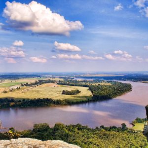
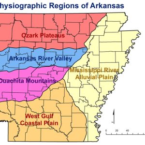
Petit Jean Mountain is the name commonly given to the largest portion of the Petit Jean Mountains, a group of connected landforms south and east of the confluence of the Petit Jean River with the Arkansas River. Although other terrain features along the Petit Jean River are also called Petit Jean Mountain, notably the long ridge that culminates near the common corner of Yell, Logan, and Scott counties, this entry discusses the large mesa on the south bank of the Arkansas River in Conway County. It is part of the Arkansas Valley, one of the six natural divisions of Arkansas, and the home of Petit Jean State Park. A relatively flat top gives Petit Jean elevations that vary from approximately …

Petit Jean River

The Petit Jean River rises from the confluence of several streams in the northern Ouachita Mountains of western Arkansas near Waldron (Scott County). From there, it flows primarily eastward for 113 miles before emptying into the Arkansas River just north of Petit Jean State Park. Many ascribe the name of the river, and of Petit Jean Mountain, to the legend of a young French woman who disguised herself as a man to follow her lover to the New World, though others believe the original French name of the river to have been Petit Jaune, or “little yellow,” possibly in reference to the river’s color. The river is dammed just west of Havana (Yell County), creating Blue Mountain Lake. It is …

Poteau River

The Poteau River rises in Arkansas from springs east of Waldron (Scott County) and flows westward for approximately thirty-nine miles before entering Le Flore County, Oklahoma. From there, the river continues to flow west until entering Wister Lake. Exiting the north side of the lake, the river flows northeast until finally emptying into the Arkansas River in Fort Smith (Sebastian County). The river flows for a total length of 141 miles. Early inhabitants were located along the Poteau River during the Archaic, Woodland, and Mississippian eras. There are numerous archaeological sites located along the river, giving evidence indicating that the Caddo Indians once inhabited the area. The Poteau River and its banks served as hunting and fishing grounds for early …

Red River

The Red River emerges from two forks in the Texas panhandle and flows east approximately 1,290 miles, forming the border between Oklahoma and Texas as well as part of the border between Texas and Arkansas. In southwestern Arkansas near Fulton (Hempstead County), the Red River takes a decidedly southern turn before entering Louisiana, where it flows southeasterly before emptying into the Mississippi River northeast of the town of Simmesport. Although only approximately 180 miles of the Red River touches upon or passes through the state of Arkansas, it has had a major impact upon the people of southwestern Arkansas from prehistoric times to the present day. Important prehistoric Caddo artifacts have been unearthed in the Red River valley, particularly the …

Rich Mountain

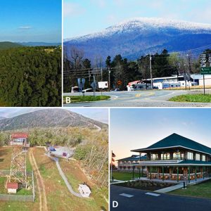
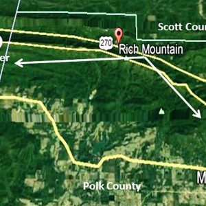
Rich Mountain, at 2,681 feet above sea level, ranks as Arkansas’s second-highest peak and the highest point in the U.S. Interior Highlands and the Ouachita National Forest. Its long ridge in western Arkansas (Polk County) is occupied by the fifty-four-mile Talimena Scenic Byway, a National Scenic Drive that traverses the entire ridge to extend farther westward into Oklahoma to the Winding Stair Mountains of Le Flore County. In Arkansas, the ridge begins on Arkansas Highway 88 (Skyline Drive) north of Mena (Polk County) and eventually turns into State Highway 1 on the Oklahoma side and begins just north of Talihina near Talimena State Park. At the apex of Rich Mountain is a fifty-eight-foot observation tower constructed in 1952 and used …

River Designations

aka: Wild and Scenic Rivers
aka: Arkansas Natural and Scenic Rivers System
Designation of rivers as a method of protection grew out of the environmental movement of the late 1960s and early 1970s. In discussions of designation, the terms “river” and “stream” are used interchangeably. At the national level, the Wild and Scenic Rivers Act of 1968 was landmark in recognizing that certain rivers have value and should be preserved in their free-flowing condition. This legislation served as a model for state initiatives. The federal and state models for designation concentrated on activities in the principal channel of the river, such as damming and dredging. At the time, these activities were the biggest threats to rivers. Issues such as gravel mining, minimum stream flow requirements, and property rights activism had not yet …

Rivers

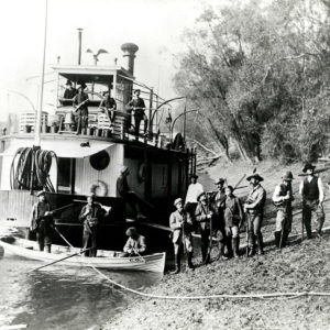
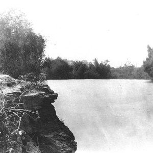
Arkansas has approximately 90,000 miles of rivers and streams. Thirty-three rivers are generally recognized as passing through Arkansas or along one of its borders; more than half of Arkansas’s rivers also enter or run along the borders of other states. While river travel has many hazards—including rapids and hidden snags—until the second half of the nineteenth century, the rivers of Arkansas often provided the best means of transportation for residents and visitors, and many cities and towns were established because of their proximity to rivers. A river is a narrow body of water with land on two sides, generally flowing downhill until it empties into another river or into a lake, sea, or ocean. All rivers are streams, but smaller …

Saline River

The Saline River is known throughout the South for its scenic beauty and its unique characteristic of being a mountain stream at its origin in the Ouachita Mountains and a Delta-type bayou near its mouth at Felsenthal (Union County), where the stream converges with the Ouachita River. It is the last free-flowing river in the Ouachita basin. The river derived its name from a salty marsh located near its mouth, called by the French the “Marias Saline,” though some historians claim that a salt works started near Benton (Saline County) as early as 1827 gave the river its name. At one time, these salt works supplied the bulk of salt used in the territory as well as surrounding states. Although …

Soils

Arkansas has a diversity of rich soils that developed in a favorable environment for growing plants. The soils of Arkansas are the foundation of the number-one industry in the state—agriculture. Arkansas soils are natural, dynamic bodies of broken-down and weathered mineral and organic matter, in some places altered by human activity, capable of growing plants. Soils are unique and exist as a creation of five soil-forming factors: parent material, climate, topography, organisms, and time. Soil parent material is the geological source of the mineral component, defined as particles less than two millimeters in diameter. Arkansas soils developed from residium, loess, alluvium, and old marine sediment parent materials. Residium is weathered rock, and Arkansas’s residium is mostly soil derived from sandstone, …

Spring River

Flowing through northeastern Arkansas for approximately seventy-five miles in a southeastern direction, the Spring River empties into the Black River near Black Rock (Lawrence County). Mammoth Spring (Fulton County), adjacent to the Arkansas-Missouri state line, serves as the headwater for the Spring River. It expels more than nine million gallons of water each hour through a vent located eighty feet below the surface of Spring Lake, a low-turbidity body of water created by a dam downstream from the spring in what is now Mammoth Spring State Park. Although the water from the spring flows into the lake with great force, the vent’s depth prevents viewers on the surface from seeing the characteristic bubbling that springs typically produce. The consistent discharge …

Springs

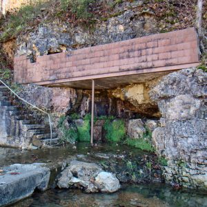
Springs are naturally occurring geologic features that transport emerging groundwater to the land surface. They also represent a transition from groundwater to surface water. This water can be released through one opening, multiple openings, or numerous seeps in the rock strata or soil. Springs have unique properties such as discrete habitats with relatively constant conditions like temperature, dissolved oxygen concentration, and flow. The underground reservoirs from which springs arise may be cavernicolous limestone, gravel, sand, sediment, soil, or other permeable formations. A spring’s presence depends on the nature and relationship of permeable and impermeable units, the position of the water table, and the land topography. Faults often play an important role in the location of springs by damming up an …

St. Francis River

The St. Francis River originates in the northeast corner of Iron County, Missouri, and flows for twenty-five miles through the St. Francois Mountains, where it is a clear, fast-flowing whitewater stream until it reaches the Mississippi Alluvial Plain north of Poplar Bluff, Missouri, at which point the river becomes a sluggish, silt-laden stream. The river there turns south and travels 207 miles, forming the boundary between the Missouri bootheel and northeast Arkansas and then coursing between Crowley’s Ridge and the Mississippi River. The mouth of the St. Francis where it flows into the Mississippi is in the St. Francis National Forest just north of Helena-West Helena (Phillips County). The St. Francis River valley has been the site of human habitation …

Strawberry River

The Strawberry River rises southwest of Salem (Fulton County) and flows southeast from there for approximately ninety miles before emptying into the Black River in northeastern Independence County. The town of Strawberry (Lawrence County) takes its name from the river. Forty-three miles of the river have been have been designated part of the Arkansas Natural and Scenic Rivers System. The Strawberry River is a popular stream for canoeists and fishers. In addition to the smallmouth bass, the river is home to thirty-nine species of freshwater mussel, many of them rare, as well as the Strawberry River orangethroat darter (Etheostoma fragi), which lives only in this river system. The area around the Strawberry River has been the site of human habitation …

Sunken Lands

The term “sunken lands” (also called “sunk lands” or “sunk country”) refers to parts of Craighead, Mississippi, and Poinsett counties that shifted and sank during the New Madrid earthquakes which took place between 1811 and 1812. Because the land was submerged under water, claims to property based on riparian rights by large landowners generated controversy which lasted decades and ultimately reached the U.S. Supreme Court. When the New Madrid earthquakes began in December 1811, the territory which is today northeastern Arkansas was sparsely populated. An early chronicler described the earthquakes’ effect as the ground moving like waves on the land, when suddenly the earth would burst, sending up huge volumes of water and sand, leaving chasms where the earth had …

Table Rock Dam and Lake

Although Table Rock Lake lies mostly in the Ozark Mountains of Missouri, it plays an important role in water resource development for the White River basin, most of which lies in Arkansas. Its dam and reservoir are part of a flood-control system designed to reduce flooding in Arkansas’s Delta and the Mississippi drainage. Its hydroelectric power supplies electricity that the Southwest Power Administration sells to municipalities and rural cooperatives across northern Arkansas, southern Missouri, and several adjoining states. Recreational development resulting from the lake contributes to the economies of both Missouri and Arkansas. Table Rock Dam is located at river mile 528.8 on the White River about eight miles southwest of Branson, Missouri. The lake extends westerly from the dam …

Tyronza River

The Tyronza River rises in Mississippi County and flows primarily southwest until it empties into the St. Francis River just north of Parkin (Cross County). It no longer resembles the stream that it was up until the early twentieth century, as it has been channelized, ditched, and had its meander loops cut-off. Before the formation of the levee and drainage districts in the late nineteenth century that rerouted and channelized existing streams, the Tyronza River arose out of a body of water called Carson Lake located southwest of Osceola (Mississippi County). From there, it flowed across low swampy land, a region the locals referred to as the “scatters of Tyronza,” into Tyronza Lake before narrowing down into the regular path …