 Big Rock
Entry Category: Land and Resources - Starting with B
Big Rock
Big Rock
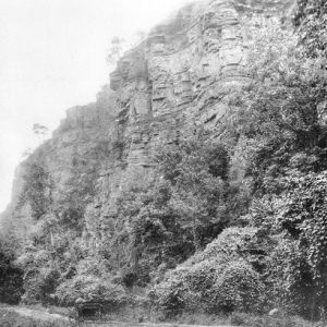
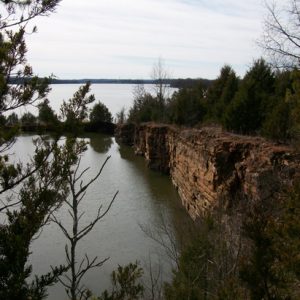
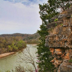
Big Rock is the name now given to a 200-foot bluff located on the north bank of the Arkansas River in North Little Rock (Pulaski County). It is the first major outcrop of rock along the river, 121 miles upstream from the confluence of the Arkansas and Mississippi rivers and about two miles upstream from a smaller outcrop known as the Little Rock, where the capital city of Arkansas developed. The first European to record the bluffs was French explorer Jean-Baptiste Bénard de La Harpe on April 9, 1722, when he took possession in the name of the French king, Louis XIV. His journal records that he named it “Le Rocher Français” (“French Rock”) and described it as having three …
 Big Rock
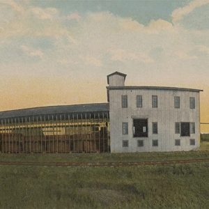
 Big Rock Quarry
 Big Rock Quarry
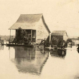 Biggers Flood
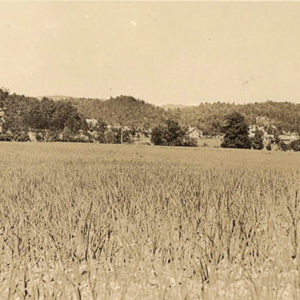 Biggs Onion Farm
Bioregionalism
aka: Ozark Area Community Congress
Bioregionalism is both a deep ecological philosophy and an apolitical, decentralized, volunteer egalitarian movement. Whereas environmentalists conserve to preserve the human environment—an anthropocentric view—bioregionalists re-inhabit, living simply and sustainably, to preserve all species—a biocentric view. Bioregionalists hold that if humanity is to avoid ecological and social collapse, people must recognize, nurture, sustain, and celebrate relations to land, air, plants, and animals; springs, rivers, lakes, groundwater, and oceans; and families, friends, neighbors, and community. They also engage in local systems of production and trade whenever possible. A bioregion is a geographically defined landform, bounded by watersheds with distinct plants and animals. The Ozark Plateau is one of fifty discrete ecoregions on the North American continent. The Ozark Highlands cover north-central and northwestern …
Black Fork Mountain Wilderness
The Black Fork Mountain Wilderness is located in the Ouachita National Forest in western Arkansas and eastern Oklahoma. At an elevation of 2,403 feet, the east-west-oriented Black Fork Mountain, formed by a geologic uplift, features rock screes, or flows. The large rock flows, sometimes called “glaciers,” and sandstone bluffs stand above a forest dominated by oak and shortleaf pine. The U.S. Congress designated 13,139 acres as the Black Fork Mountain Wilderness in 1984. Managed by the U.S. Forest Service of the U.S. Department of Agriculture and shared by Oklahoma and Arkansas (Arkansas has approximately 8,350 acres, while Oklahoma has approximately 4,789 acres), this area contains the thirteen-mile-long rugged ridge of Black Fork Mountain. In both states, the ridge rises to …
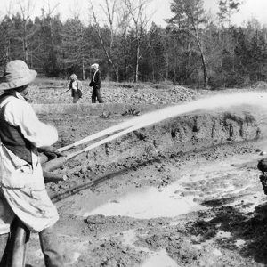 Black Gumbo Sluicing
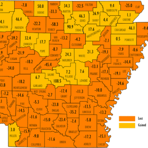 Black Population Change 2020
Black River
The Black River has played a significant, but shifting, role in the lives of residents of northeast Arkansas. For the early Native Americans who lived in the area, it was an essential food and transportation source. This remained true for European settlers in the days before roads and railroads. The river was also an essential “highway” for the flatboats and river steamers that transported people and goods to and from the area. The river supported the development of local industry as the means for moving timber from the forests to places such as the Sallee Brothers Handle Mill in Pocahontas (Randolph County), while mussel fishing supplied pearls and mother of pearl for the local button-making industry for many years. While …
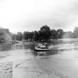 Black River Ferry
Blaisdell, Frances Lillian (F.L.)
Frances Lillian (F. L.) Blaisdell, a Little Rock (Pulaski County) businesswoman, was Arkansas’s first published woman cartographer and one of the first woman map makers in the nation. Shortly before her death in 1924, she became the first woman to serve on the Pulaski County Board of Equalization. Her maps and her atlas of Arkansas were widely distributed. F. L. Blaisdell was born in Augusta, Georgia, in January 1884, the only child of civil engineer, architect, and pioneer landscape architect Frank M. Blaisdell and his wife, Belle Burr Brace Blaisdell. From an early age, Blaisdell was fascinated with her father’s work in designing city parks and other landscapes. She was especially fascinated by surveying and map making. The family moved …
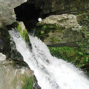
Blanchard Springs Caverns
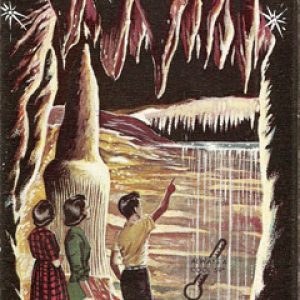
Blanchard Springs Caverns (BSC) is a magnificent limestone cave system starting more than 200 feet underground in the Sylamore Ranger District of the Ozark–St. Francis National Forest, fifteen miles northwest of Mountain View (Stone County). The only cave administered by the U.S. Forest Service, it is considered one of the most beautiful in the country. Three guided tours through the caves are open to the public: the Dripstone Trail (open all year), the Discovery Trail (open during the summer), and the Wild Cave (open by special reservation). The limestone rock from which the cave developed was formed by fossilized sediment from sea creatures at the bottom of an ancient inland sea estimated to exist about 350–500 million years ago. When …
 Blanchard Springs Discharge
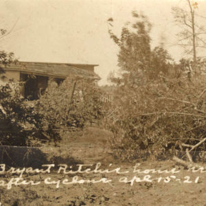 Blevins Tornado, 1921
Blue Mountain Dam and Lake
Blue Mountain Lake is a manmade lake, or reservoir, on Petit Jean River in Logan County. A portion of the lake extends into Yell County. The dam was built in the 1940s as a flood-control project, but since its completion, the lake has also provided numerous recreational opportunities. It is named for Blue Mountain, an outcropping of Mount Magazine. Land patents on farmland where the lake now lies were granted to William Mobly, James Henard, and Augustus Ward, all in 1861. By 1891, an unincorporated community called Patsie had developed in the area. Several cemeteries had to be relocated during the development of the lake. In 1899, when the Choctaw, Oklahoma and Gulf Railroad was built to the north of …
 Blues Highway
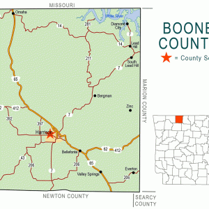 Boone County Map
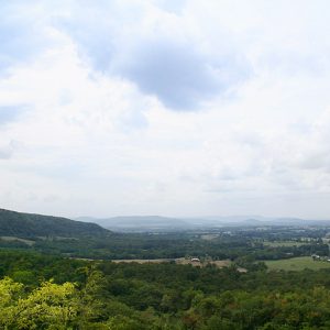 Boston Mountains
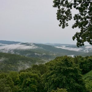 Boston Mountains
Boston Mountains
The Boston Mountains in north-central Arkansas are the southern portion of the Ozark Plateau geologic area. The Ozark Mountains extend across northern Arkansas and southern Missouri; this dome of rocks has been a relatively high area for the past 1.5 billion years. The most recent uplift of the Ozarks, including the Boston Mountains, occurred about 300 million years ago, and the mountains have been weathering and eroding since that time. This highland has the greatest relief (difference in the elevation from the valley bottoms to the mountain tops) of any formation between the Appalachian Mountains and the Rocky Mountains. The Boston Mountains portion of the Ozarks extends north of the Arkansas River Valley as a rectangle twenty to thirty-five miles …
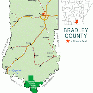 Bradley County Map
 Bradley Pink Tomato
 Brandy Distillery
 Brewer Lake
Buffalo Island
Buffalo Island is a local name given to western Mississippi County and eastern Craighead County. It consists of the land south of Big Lake between the Little River (not to be confused with a stream of the same name in southwestern Arkansas) and the St. Francis River, containing the communities of Manila (Mississippi County), Monette (Craighead County), Leachville (Mississippi County), Black Oak (Craighead County), and Caraway (Craighead County). The first written mention of the area was by Hernando de Soto, who passed through the area in 1541. De Soto’s party described Big Lake as existing on a high, dry area near the Mississippi River and feeding a moat around a large village believed to be in the area of contemporary Gosnell (Mississippi …
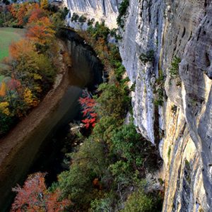
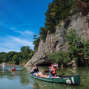
Buffalo National River
aka: Buffalo River
The Buffalo National River, which runs through Newton, Searcy, Marion, and Baxter counties, became the first national river in the United States on March 1, 1972. It is one of the few remaining free-flowing rivers in the lower forty-eight states. The Buffalo National River, administered by the National Park Service, encompasses 135 miles of the 150-mile long river. President Richard M. Nixon signed Public Law 92-237 to put the river under the protection of the National Park Service 100 years after the establishment of Yellowstone National Park, the first national park. The law begins, “That for the purposes of conserving and interpreting an area containing unique scenic and scientific features, and preserving as a free-flowing stream an important segment of …
 Buffalo River
 Buffalo River at Gilbert
 Buffalo River
 Bull Shoals Caverns Brochure
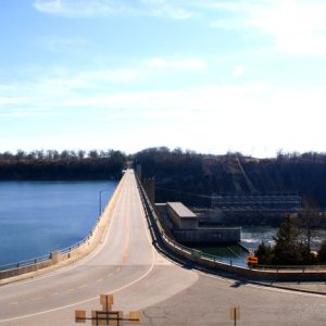 Bull Shoals Dam
 Bull Shoals Dam
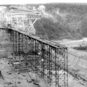
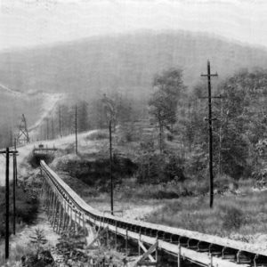 Bull Shoals Dam Conveyer Belt
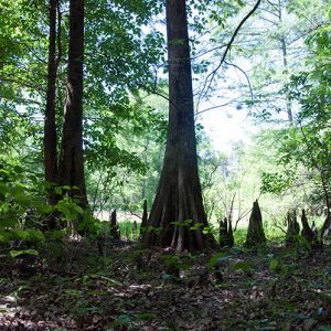 Byrd Lake Natural Area


