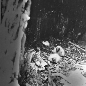
 Baby Buzzards
Entry Category: Land and Resources - Starting with B
Baby Buzzards
Bachman, Joseph
Joseph Bachman is widely recognized as Arkansas’s leading developer of grape varieties. During his career, he received national and international attention for his development of grape vines, winning several awards and supplying cuttings and plants to numerous nurseries. Joseph Bachman was born in 1853 in Lucerne, Switzerland. Little is known about his childhood, including his family, education, and early career. According to immigration records, Bachman arrived in New York on May 9, 1878, on a ship that had departed Le Havre, France, earlier that year. By 1881, following the advice of his relatives, Bachman had settled in the town of Altus (Franklin County), where many of his other countrymen resided. He held a wide array of occupations, serving as the …
Back-to-the-Land Movement
During the late 1960s and early 1970s, nearly one million people throughout the United States left urbanized areas for rural settings, intent on establishing themselves as “back-to-the-landers.” While many of these people moved to the Northeast or the West, which had long been centers of counter-cultural movements, a significant number were drawn to the Ozark Mountains of Arkansas. It is difficult to state how many back-to-the-landers (BTLs) moved to Arkansas between 1968 and 1982, but rough estimates suggest that it was somewhere between 2,000 and 6,000. Nearly all of the BTLs who moved to the region were in their early to mid-twenties. On the whole, the BTLs were well educated, with over seventy percent having completed an undergraduate degree. Approximately …
Baitfish Industry
Arkansas leads the nation in the farming of bait and feeder fish, providing sixty-one percent of the value of all cultured baitfish in the country. Baitfish are small minnows used as fishing bait to catch predatory game fish such as crappie, catfish, walleye, and largemouth bass. Feeder fish are small fish sold as live food for fish and animals in aquariums and zoos. Six billion bait minnows—predominantly golden shiners, fathead minnows, and goldfish—are raised in Arkansas each year and shipped throughout the country. In 1998, the Census of Aquaculture recorded sixty-two baitfish farms in Arkansas. The annual farm-gate value of Arkansas baitfish production was $23 million; with an economic impact of six to seven times this amount, baitfish production contributes …
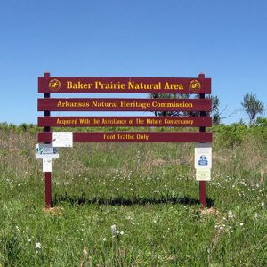 Baker Prairie Natural Area
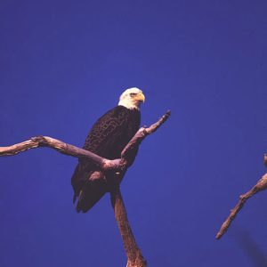 Bald Eagle
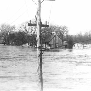
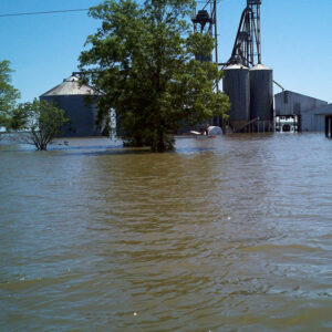 Bald Knob Flood
Bald Knob National Wildlife Refuge
The Bald Knob National Wildlife Refuge (NWR) consists of 14,800 acres of forest wetlands and croplands lying along the Little Red River in White County. The refuge provides a habitat for migratory waterfowl and other birds and various endangered species, as well as recreational and environmental educational opportunities. The refuge is located approximately two miles south of Bald Knob (White County). The Bald Knob refuge was acquired as part of the North American Waterfowl Management Plan in 1993. Most of the land consists of a rice farm that had been owned by John Hancock Insurance Company. Unlike many wildlife refuges, Bald Knob NWR includes cropland that continues to be farmed, but much of the crop is left unharvested to feed …
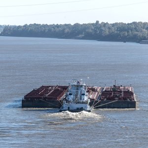 Barge
Barge
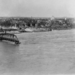 Baring Cross Bridge; 1927
 "Sunpie" Barnes
 Batesville 1915 Flood
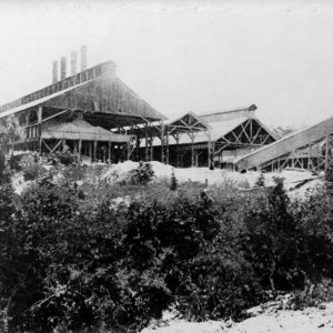 Bauxite Mill
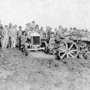 Bauxite Miners
Bauxite Mining
Bauxite is the principal ore of aluminum and is a mixture of aluminum oxides and hydroxides that formed from intense chemical weathering of a soil in tropical environments. Soils formed under these conditions are termed laterites. In Arkansas, the aluminum-enriched soils are the result of the decomposition and lateritic weathering of nepheline syenite, an intrusive igneous rock. During the weathering process, leaching by rain, groundwater, and salt spray decomposed the original syenite minerals (feldspar and nepheline). Weathering removed much of the silica and concentrated the newly formed aluminum oxides and hydroxides as the rock termed bauxite. Geologically, the soils formed from syenite and weathered to laterites in the Paleocene Epoch (65–55 million years ago) along the west edge of a …
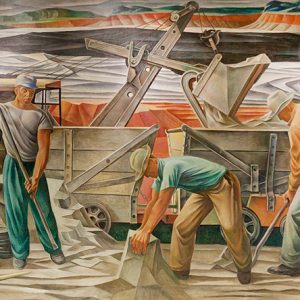 Bauxite Mural
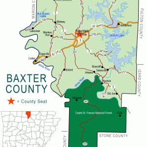 Baxter County Map
Bayou Bartholomew
Located in southeast Arkansas, Bayou Bartholomew was, until the construction of railroad lines in the area in 1890, the most important stream for transportation in the interior Delta. While the Arkansas and Mississippi rivers served their adjoining areas, it was the bayou that provided a transportation route into an otherwise landlocked area. This route allowed the development of one of the richest timber and agricultural tracts in the Delta. Bayou Bartholomew has the distinction of being the longest bayou in the United States, beginning its meandering 359 miles in Jefferson County and passing through Lincoln, Desha, Drew, Chicot, and Ashley counties before proceeding into Morehouse Parish, Louisiana, where it eventually empties into the Ouachita River near Sterlington. The present bayou …
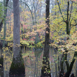 Bayou DeView
Bayou Meto
Bayou Meto is a slow-moving stream that originates in northern Pulaski County at the confluence of several creeks west of Little Rock Air Force Base and travels 150 miles south and east through Lonoke, Arkansas, and Jefferson counties before emptying into the Arkansas River a few miles southwest of Gillett (Arkansas County); it forms parts of the boundary lines between Lonoke and Prairie counties and Arkansas and Jefferson counties. The bayou has lent its name to different communities along its path, a Civil War action in Pulaski County, and the first wildlife management agency (WMA) established by the Arkansas Game and Fish Commission (AGFC). The origins of the bayou’s name are a matter of debate. Some early French documents dub …
 Bear Creek Recreation Area
 Bear Creek Recreation Area
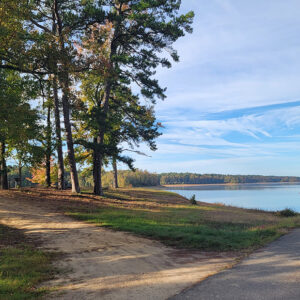
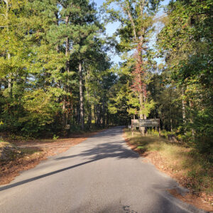
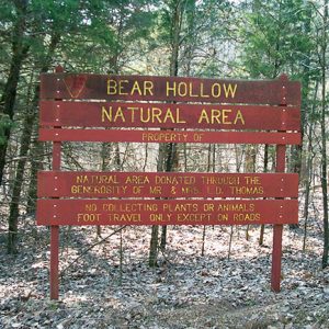 Bear Hollow Natural Area
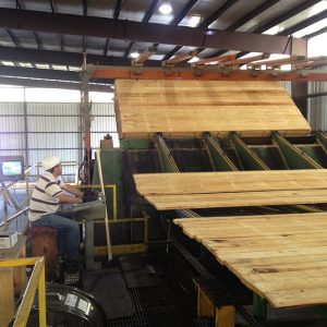 Bearden Plant Planer Mill
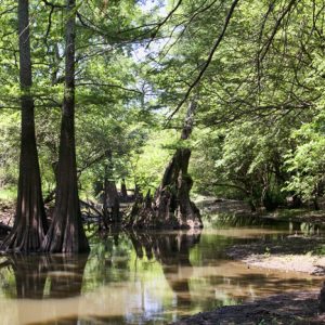
 Black Fork Creek
Beaver Dam and Lake
Beaver Lake was created by Beaver Dam in Carroll County. The lake—technically a reservoir since it was created by a manmade dam in order to store water—is located on the White River in the Ozark Highlands region of northwest Arkansas. Approximately seventy-three miles long and a maximum of two miles wide, the lake reaches from Eureka Springs (Carroll County) roughly to Fayetteville (Washington County). About 450 miles of shoreline extend through three counties: Benton, Carroll and Washington. The multi-purpose project provides flood control, hydroelectric generation, water supply, and recreation. While the possibility of a dam on the upper White River was examined as early as 1911, the first feasibility studies by the U.S. Army Corps of Engineers for constructing such …
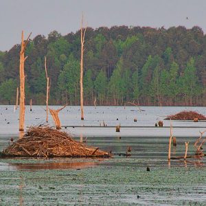 Beaver Lodges at Columbia Lake
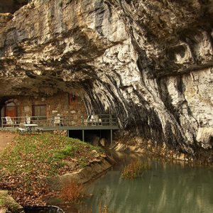 Beckham Creek Cave
Beef Industry
aka: Cattle Industry
The raising of beef cattle has been carried out in Arkansas since before the area became an American territory. Though not as prominent as the state’s poultry industry, the beef industry has an estimated $1.4 billion annual economic impact upon Arkansas. Undomesticated bison were present in Arkansas before the arrival of European explorers and settlers. Both the expedition of Hernando de Soto and the Marquette-Joliet expedition reported the presence of these animals. Frenchmen in the area of Arkansas Post judged the land fit for raising cattle, and a general census of Arkansas Post in 1749 lists sixty cows among the livestock kept there. Early Anglo-American settlers brought cattle with them, as did the Cherokee, who began moving to Arkansas in …
 Beef Promotion
Beekeeping
By 2010, more than 1,500 Arkansas beekeepers had registered with the Arkansas State Plant Board, the vast majority of whom were hobbyists. Hobbyist beekeepers maintain fewer than five hives and do not rely upon beekeeping as their primary source of income. An estimated twenty-five to thirty commercial beekeepers operate in the state. The two types of beekeepers collectively manage more than 50,000 colonies, making Arkansas a significant national producer of honey. Commercial apiaries in Arkansas vary in size. Some commercial apiaries include Coy’s Honey Farm in Brookland (Craighead County), which is one of the largest; Clyde Gray in Jonesboro (Craighead County), who has hives from Jonesboro to Wynne (Cross County); Culp’s Honey Farm in Jonesboro; Richard’s Apiaries in Benton (Saline …
 Bell Slough
 Bell Slough Trail
Bell Slough Wildlife Management Area
When Lake Conway was completed in 1951 in the Palarm Creek bottoms of southern Faulkner County, land for the development of the lake was left over, some of it being government surplus as part of Camp Joseph T. Robinson. Because the area was home to a wide variety of wildlife—deer, squirrels, and migrating ducks especially—the Arkansas Game and Fish Commission (AGFC), which had overseen the creation of Lake Conway, created Bell Slough Wildlife Management Area (WMA), which encompasses Grassy Lake. Bell Slough WMA covers 2,040 acres and is a mix of moist-soil wetlands, bottomland hardwood forest, prairie, and upland hardwood and pine forest. The wetlands are managed as a waterfowl resting area, with water-control structures that allow the AGFC to …
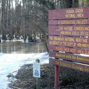 Benson Creek Natural Area
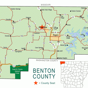 Benton County Map
Benton Utilities
Benton Utilities, also known as Benton Municipal Light and Waterworks, is one of the oldest continually operating institutions in Saline County. In the twenty-first century, the company serves most of Benton and its surrounding areas in Saline County. In its early days, Benton got its drinking water from the Saline River. It was not until 1914 that plans for a modern city-owned water and sewage system were laid out. In April 1914, R. C. Bailey was elected mayor of Benton on a platform of creating a municipal waterworks. In May 1914, Bailey and the city council “laid out plans for a system of engaging a firm of engineers to submit plans” for a municipal waterworks. On June 8, 1914, the …
 Thomas Hart Benton and Son
 Bert Johnson Orchards
 Bethesda Tornado
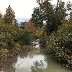
 Big Cedar Creek
 Big Chalybeate Spring
Big Chalybeate Spring
The Big Chalybeate Spring is located approximately three miles north of downtown Hot Springs (Garland County) on present-day Park Avenue. Pronounced “kuh-lee-bit,” the spring is aptly named for its abundant iron and mineral content. References to the spring date as far back as December 7, 1804, during the Hunter-Dunbar Expedition commissioned by President Thomas Jefferson to survey the Louisiana Purchase, and again by Major Stephen Harriman Long during his January 1818 visit to Hot Springs. Having an average temperature of 79˚F, the spring is designated “thermal” by the United States National Oceanic and Atmospheric Administration. References to the spring appear in the Arkansas Gazette in both 1827 and 1829 as a potential resort destination due to its strong hydrological discharge …
 Big Creek Natural Area
 Big Fork Creek Natural Area
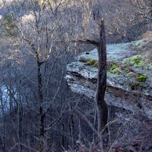
Big Island
aka: Montgomery Island
Big Island in Desha County was once the largest island in the continental United States. It is bordered on the east by the Mississippi River. The northern boundary is formed by the White River and the new channel of the Arkansas River, and the western and southern boundaries are formed by the old channel of the Arkansas River. The island is indicated on some maps as “Big Island,” while others—including U.S. Army Corps of Engineers maps—show it as “Montgomery Island,” named after William Montgomery, a prominent early settler in the area. Big Island is about eleven miles long and seven miles wide. However, the meanderings of the three rivers have caused many changes in the appearance of the island over the …
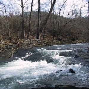
Big Lake National Wildlife Refuge
Big Lake National Wildlife Refuge is one of the oldest inland national wildlife refuges. This 11,038-acre area is located in northeast Arkansas outside of Manila (Mississippi County), eighteen miles west of the Mississippi River. The refuge is one of over 540 national wildlife refuges administered by the United States Fish and Wildlife Service and is an important link for birds using the Mississippi migration corridor. The area was a free-flowing river system until the New Madrid Earthquakes of 1811–1812 shifted the land to its current environment of swamps and lake. The major habitat types of the refuge are bottomland hardwood forest, wooded swampland, and open water. These natural habitats support a wide variety of mammal, bird, and fish species. There …
Big Lake Wars
Competition and contention over an abundant (and unregulated) storehouse of northeastern Arkansas wildlife from the mid-1870s until 1915 led to violence and controversy known as the Big Lake Wars. Big Lake refers to a section of western Mississippi County created by the massive New Madrid Earthquakes of 1811–1812. “War” may be a misleading description of the events because there were no formalities, declarations, truces, or settlements. However, the conflict had a lasting impact on the state and even on the nation. The Big Lake Wars pitted local residents, who were mostly poor, against affluent northerners, chiefly from St. Louis, Missouri. Early Arkansas maps labeled the sparsely populated area between Crowley’s Ridge and the Mississippi River as “the Great Swamp.” After …
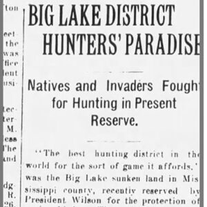 Big Lake Article
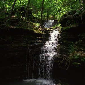 Big Piney Creek Waterfall


