Entry Category: Geography

Earthquakes

Numerous earthquakes occur every year throughout the state of Arkansas, but most go unnoticed. Earthquakes that are felt can be startling and serve as good reminders that Arkansas is located near one of the most hazardous earthquake zones in the country. Earthquakes have been documented in Arkansas as early as 1699 by missionaries traveling down the Mississippi River near Helena (Phillips County). Although it is uncommon for major earthquakes to occur a great distance from active tectonic boundaries, earthquakes associated with the New Madrid Seismic Zone (NMSZ) have been some of the largest earthquakes ever to strike North America. The NMSZ is an active earthquake zone extending from Cairo, Illinois, into Marked Tree (Poinsett County). Earthquakes are caused by movement …

Eleven Point River

The Eleven Point River rises in the Ozark Mountains of Missouri near the town of Willow Springs and flows south-southeast, passing through the Mark Twain National Forest and entering Arkansas in Randolph County. It empties into the Spring River west of what is now Davidsonville Historic State Park and lends its name to the town of Eleven Point (Randolph County). The part of the Ozark Plateau through which the Eleven Point River flows was home to human habitation approximately as long ago as 10,000 B.C., according to archaeological excavations near Greer Springs, which empties into the Eleven Point. In addition, a few Indian mounds dating from the Mississippian Period have been located in the valley of the Eleven Point. In …

Floods

Floods are one of the most commonly occurring natural hazards in the United States. Their effects can be local, impacting a neighborhood or community, or can occur in large scale, affecting entire river basins and several states. About 3,800 towns and cities in the United Sates with populations of more than 2,500 lie on floodplains. The National Weather Service has documented some ninety-two flood deaths per year in the United States since 1903. This figure does not include flood-related deaths associated with Hurricane Katrina (2005). Since 1997, more than half (about fifty-seven percent) of all flood deaths have been vehicle-related fatalities. Throughout its history, Arkansas has been drastically affected by floods, with the most notable being in 1927 and 1937. …

Fourche Creek

Fourche Creek is a winding stream that flows more than twenty-four miles through southern Little Rock (Pulaski County). It is within the city limits for most of its length, from its headwaters south of Lawson Road at an elevation of 354 feet above mean sea level (AMSL) to its convergence with the Arkansas River near Interstate 440 (227 feet AMSL). Due to the density of the population around Fourche Creek, almost 200,000 Arkansans live within its watershed, more people than reside in the watershed of any other stream that both begins and ends in Arkansas. Fourche Creek was named by French explorers who became associated with the Quapaw who inhabited the bottomlands around Fourche Creek in the mid-seventeenth century. The …

Fourche La Fave River

The Fourche La Fave River rises in the Ouachita Mountains near Boles (Scott County) and flows east-northeast for approximately 140 miles through Yell County and Perry County before emptying into the Arkansas River south of the town of Fourche (Perry County), which takes its name from the river. It is impounded in Perry County by Nimrod Dam. The origin of the river’s name is open to debate; “fourche” is French for “fork,” and “La Fave” may be in reference either to a family that once lived along the river or to early settler Peter La Fave. The “fork” of the river is the South Fourche La Fave River, which rises in the Ouachita Mountains near Onyx (Yell County) and empties …

Fourche River

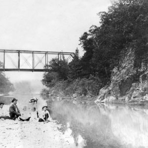
The Fourche River arises in Ripley County, Missouri, from the confluence of several streams and flows through Randolph County for twenty miles before emptying into the Black River near Pocahontas (Randolph County). It is not to be confused with the Fourche La Fave River, itself occasionally called the Fourche River, in central Arkansas. On some maps, the waterway is designated Fourche Creek for at least part of its length. The Ozark foothills, through which the Fourche River flows, have been the site of human habitation since at least 10,000 BC. In the historical period, the Osage Indians claimed this area as part of their hunting grounds, though they were forced to cede their claims in 1825. Among the earliest white …

Galley Rock

aka: Galla Rock (Pope County)
Galley Rock in Pope County is a two-mile shale bluff that rises almost forty feet high on the north bank of the Arkansas River, just northwest of Petit Jean Mountain. It was a natural landmark for early explorers and settlers. The area was a site for Cherokee settlers of the early 1800s and became a thriving river town in the 1830s. However, by the 1870s, the town experienced a decline, and all that remains today is the town cemetery. During the late 1700s, river travel was the safest and most reliable mode of transportation. French explorers and trappers navigated the Arkansas River with only striking, geologic features marking the locations of their trading posts and hunting camps. Galley (or Galla) …

Geographical Center of Arkansas Marker

The Geographic Center of Arkansas Marker was dedicated on April 12, 1936, as part of the state’s first centennial celebration. The marker was placed at a spot designated by the Arkansas Department of Transportation as the physical center of the state on Highway 5, then called the “Hot Springs Highway.” The presiding officers who participated in the dedication ceremony were Mrs. Charles H. Miller and Jeanne Weinmann, both representing the Colonel Samuel Cherry chapter of the Arkansas Society of the Daughters of American Colonists in Little Rock (Pulaski County). The Little Rock branch had been formed just four years before on January 29, 1932. That chapter was also responsible for a number of other historical markers across the state between 1928 …

Geography and Geology

Geography has played an important and continuing role in the history and culture of Arkansas. From settlement patterns to Civil War battlefields to centers of economic development and political party affiliation, geographic patterns are obvious. These are often related to the distinct physical/biological landscapes of the state, each one of which has a unique combination of limitations and potentials for human use. These landscapes often occur in regions where the character is set by the underlying geology, which in turn influences soil and vegetation. Also, climate varies across the state as a result of changes in latitude, elevation, and local topography. All of these factors combine in varied ways to make Arkansas surprisingly diverse. One approach to understanding the patterns …

Gold Mine Springs Mines

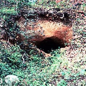
Abandoned mines play an important ecological role as temporary or permanent habitats for various biota. Many of these mines were merely short shafts dug out of the earth during a search for precious minerals or metals, whereas others became lengthy. Moreover, abandoned mines represent unique ecological resources for both invertebrates and vertebrates that utilize the mines on a permanent or temporary basis as sites for breeding, hibernating, feeding, or avoiding predators. In Arkansas, most of these abandoned mines are located within the uplands, especially the Ouachita Mountains, but some are within the Ozark Mountains. For instance, there were numerous abandoned lead and zinc mines scattered about much of the Arkansas Ozarks. Some communities were even named after the mines, such …

Grand Prairie

The Grand Prairie is a subregion of the Mississippi Alluvial Plain (commonly called the Delta) in eastern Arkansas that is known today as a major site of rice cultivation. Prairie County takes its name from this subregion. Located between the bottomlands of the White River and the Arkansas River, it was once a large, flat area of native grassland stretching across what are now Arkansas, Prairie, Lonoke, and Monroe counties, distinguished from the surrounding Delta land, which was largely swampy land dominated by bottomland hardwood. However, since the clear cutting of the Delta, the Grand Prairie is no longer as distinct a feature, though it remains agriculturally significant. Native Americans inhabited and hunted upon the Grand Prairie; the Museum of …

Hell’s Half Acre

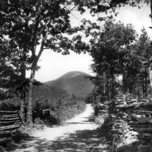
Hell’s Half Acre is a talus hillside (a slope formed by an accumulation of broken rocks) located on Indian Mountain, about four miles northeast of downtown Hot Springs (Garland County). Since the first white settlers arrived in Arkansas, the unique contrast of blighted rock surrounded by otherwise ordinary forest has captured the imaginations of locals. Through the efforts of tourism boosters and storytellers, the area earned its name and its popularized reputation as an area haunted by the Devil himself. A Hot Springs tourist guide published in 1892 described Hell’s Half Acre as “[a] barren, weird, forbidding conglomeration of boulders, an arsenal for Titans. Not a blade of grass, not a shrub, not even a lichen dares brave the atmosphere …

Hurricane Lake

Hurricane Lake is a 332-acre manmade lake located in Benton (Saline County) at the confluence of Hurricane Creek and the Little Hurricane Creek. Construction of the lake began in 1942 with the Hurricane Creek Dam built by Alcoa Mining Company to flood the area. Hurricane Lake’s primary function was to provide water for Alcoa’s Hurricane Creek aluminum plant. Hurricane Lake was also used for recreational activities by company employees and their families. In the twenty-first century, the lake and its surroundings are owned by the Hurricane Lake Estates Development Company. In 1891, bauxite ore, an essential material used in the production of aluminum, was discovered four miles southwest of Hurricane Creek near Benton. Because of the need for aluminum during …

Illinois River

Flowing through the Ozark borderlands of eastern Oklahoma and western Arkansas, the Illinois River is fed by 1,660 square miles of drainage area and serves as the primary tributary for the largest lake in eastern Oklahoma, Tenkiller Ferry Reservoir. The Illinois has historically represented an area of significant economic importance and ecological convergence between the hilly Ozarks and the southern plains. The watershed of the Illinois River comprises five counties in Oklahoma and Arkansas, providing more than 100 miles of recreational opportunities. The Illinois River system consists of the Illinois and its tributaries, Flint and Baron Fork creeks, both of which are major tourist destinations for the south-central United States and provide a substantial portion of tourism income for the …

Island 37

aka: Andy Crum (Lynching of)
aka: Bert Springs (Lynching of)
Island 37 is a stretch of land that is in the legal possession of the State of Tennessee but is physically joined to Arkansas. Because competing claims of jurisdiction left it in something of a legal void, Island 37 became, in the early twentieth century, an outpost for bootleggers and other criminals. Police action taken against those criminals resulted in one of the many U.S. Supreme Court cases regarding ongoing boundary disputes between Arkansas and Tennessee. The Mississippi River is a dynamic waterway, often cutting new channels and thus either forming islands or causing former islands to merge with the eastern or western banks. The legal principle of avulsion holds that land cut off by the river from one state …