Exploration and Archaeology

Entry Category: Exploration and Archaeology

Louisiana Purchase Survey

The purchase of the vast Louisiana Territory from France in 1803 practically doubled the size of the United States, yet little of it was marked off by the American land survey method, which divides land into square tracts, an orderly prerequisite for land ownership in the nineteenth century. The survey of this vast, new American West began in what would later become the state of Arkansas and is commemorated at Louisiana Purchase State Park on U.S. Highway 49 between Brinkley (Monroe County) and Helena (Phillips County). Since Arkansas was first, the survey enabled early sale of land that contributed to Arkansas’s being the third state admitted into the Union west of the Mississippi River (after Louisiana and Missouri). The survey …

Mallet Expeditions

French-Canadian brothers Pierre (1704–1751?) and Paul Mallet (1706?–1753?) participated in three expeditions into North America’s interior that were designed to establish trade between French Louisiana and Santa Fe, New Mexico. The brothers traveled the Rocky Mountains and Great Plains, and their return journeys to New Orleans led them through Arkansas, stimulating interest in the possibility of Spanish trade through the continent’s interior via Arkansas Post (Arkansas County). Originally from Montreal, the Mallets lived as traders in the Illinois country after 1734 before beginning their first expedition (1739–1741). Spurred on by contemporary belief that Santa Fe lay eight days from the headwaters of the Missouri River, the brothers ventured west. Accompanied by seven men, they traveled up the Missouri before beginning …

Marquette-Joliet Expedition

In 1673, Father Jacques Marquette, a Jesuit missionary, and Louis Joliet (or Jolliet), a fur trader, undertook an expedition to explore the unsettled territory in North America from the Great Lakes region to the Gulf of Mexico for the colonial power of France. Leaving with several men in two bark canoes, Marquette and Joliet entered the Mississippi River and arrived in present-day Arkansas in June 1673. They were considered the first Europeans to come into contact with the Indians of east Arkansas since Hernando de Soto’s expedition in the 1540s. The goal given Marquette, Joliet, and their men was to document, for French and Canadian officials, an area that had been largely unknown until the late seventeenth century. Both explorers …

Menard-Hodges Site

Archaeological investigations at the Menard-Hodges site near Nady in Arkansas County since the late 1800s have yielded information about both Native American and European colonial settlement of the region of the lower Arkansas River. Two large mounds, thirty-nine-foot-tall Mound A and flanking thirteen-foot-tall Mound B, overlook a square plaza some two acres in area, with smaller mounds around the other sides of the plaza. Also adjacent to the plaza are the locations of two nineteenth-century farmsteads of French descendants. The Menard-Hodges Site was widely considered to be the location of the first Arkansas Post and also the location of the Quapaw village of Osotouy. However, recent research indicates that while the Menard-Hodges Site is an important part of an early historic …

Mississippian Period

The Mississippian Period is one of several broad categories (including Paleoindian, Archaic, and Woodland) that archaeologists use to subdivide the American Indian past of the Southeast and Midwest. Between AD 900 and about AD 1600, Mississippian people farmed maize extensively; lived in societies known as chiefdoms led by hereditary rulers; conducted long-distance trade in copper, marine shell, and other valuables; resided in towns, villages, and farmsteads; built monumental architecture in the form of earthen, flat-topped mounds; conducted warfare, often fortifying their towns with stockades; and shared religious and iconographic traditions. When the first Europeans (the Hernando de Soto expedition) arrived in Arkansas in 1541, the people they encountered were Mississippians. The Rise of Agriculture Perhaps fueled by a climate shift …

Moore, Clarence Bloomfield

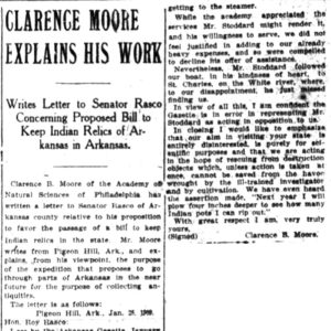
Clarence Bloomfield Moore was an amateur archaeologist from Philadelphia, Pennsylvania, who investigated hundreds of Native American mounds and archaeological sites in several Southern states, including Arkansas. He published lavishly illustrated volumes, based on his excavations, which have been reprinted recently. Clarence Moore was born on January 14, 1852, in Philadelphia. He was the son of Bloomfield Haines Moore and Clara Sophia Jessup. His father was the head of the prosperous Jessup & Moore Paper Company of Wilmington, Delaware. His mother was a prolific writer, mostly of books on etiquette and advice to young women. Clarence had two sisters, Ella and Lillian, both of whom married Swedish aristocrats. As a child, he was educated in Philadelphia, France, and Switzerland. He entered …

Native American Pottery

Indians in Arkansas began making pottery containers about 2,500 years ago, during the Woodland Period, and they continued this craft until their handmade containers were replaced by industrial counterparts made in metal, glass, and clay in the eighteenth and nineteenth centuries. Broken pieces of Indian pottery, called sherds or potsherds, are among the most common artifacts remaining at abandoned settlements, and they provide a wide range of information today about the cultural traditions of the people who made them. Complete pottery vessels display both sophisticated craftsmanship and the complex aesthetics of their makers. Southeastern Indian pottery-making began in the area of eastern Georgia, South Carolina, and Florida about 4,000 years ago and spread gradually from there to cultures across eastern …

Nodena Site

The Nodena Site in Mississippi County is an archaeological site representing Native American life in Arkansas during the centuries before European contact. The twelve-to-fifteen-acre pallisaded village was inhabited from approximately AD 1400 to 1650. The name Nodena comes from a later plantation that encompassed the area, while the names Upper Nodena and Middle Nodena represent separate archaeological sites, as well as separate sectors of the later Nodena plantation. The Upper Nodena Site, the larger of the two, is on the National Register of Historic Places and has been listed as a National Historic Landmark. A vast collection of Nodena materials are held at the University of Alabama Museum and its regional repository, the Arkansas Archeological Survey, as well as at …

Nuttall, Thomas

Thomas Nuttall, a preeminent and far-ranging field naturalist, participated in the early scientific exploration of Arkansas and is remembered both for identifying a number of the state’s plants and for his description of early Arkansas life. His notes on people living in the territory—both Native Americans and American settlers—have provided valuable information for historians and researchers ever since they were first published in 1821. Thomas Nuttall was born to James Nuttall and Margaret Hardacre Nuttall on January 5, 1786, in Long Preston, Yorkshire, England. He was the oldest of three siblings; he had two sisters, Susan (Susannah) and Elizabeth. He never married and had no children. After attending the village school, Nuttall worked as a journeyman printer for his uncle …

Paleoindian Period

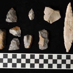
The term “Paleoindian” refers to a time 13,500 years ago (11,500 BC) at the end of the last ice age when the first traces of humans appeared in the archaeological record in North America. One of the first groups to enter the New World was the Clovis culture. They encountered many species of now extinct, large terrestrial animals and hunted them with spears tipped with stone points; these animals, dubbed “megafauna” because of their larger size when compared to modern forms, included the mastodon, mammoth, horse, tapir, ground sloth, giant bison, giant beaver, giant tortoise, American lion, short-faced bear, and saber-toothed tiger. The fossilized remains of many of these now extinct animals have been found in Arkansas. Early Paleoindian stone …

Palmer, Edward

Edward Palmer conducted most of the fieldwork for the first major study of Indian mounds in Arkansas. His research helped dispel myths about who built the mounds. Edward Palmer was born in England, near Hockwold-cum-Wilton in southwestern County Norfolk, into a family of gardeners. The year of his birth is uncertain, but it was probably 1830; the date was definitely January 12. His father’s name is listed variously as William or Robert, and his mother’s maiden name was Mary Ann Armiger; Palmer’s own middle name is unknown. Little is known about Palmer’s early life. He came to America in 1849 and moved to Cleveland, Ohio, where he was strongly influenced by the eminent naturalist Jared Kirtland. He worked as a …

Parkin Archeological State Park

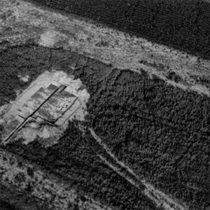
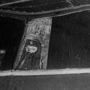
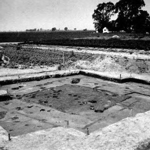
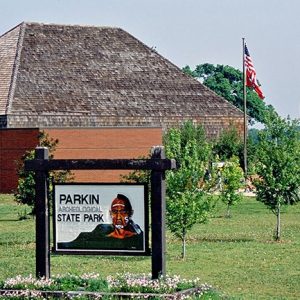
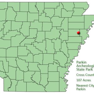
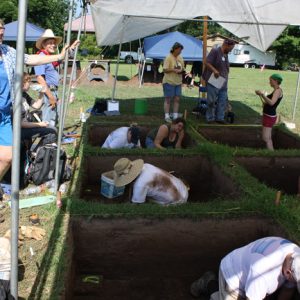
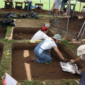
Parkin Archeological State Park in northeast Arkansas preserves and interprets a Mississippian-period Native American village that existed from approximately AD 1000 to 1550. European-made trade items from the era of Hernando de Soto’s expedition recovered at the park and written descriptions of the village support theories that the Spanish visited the Parkin Site in 1541. Many archeologists believe the site may be Casqui, mentioned prominently in the de Soto journals. Remnants of Indian villages similar to the Parkin Site were once numerous in eastern Arkansas, but soil erosion, careless digging, and farming destroyed virtually all of them during the nineteenth century. The prehistoric village on the eastern bank of the St. Francis River covered about seventeen acres and was enclosed …
Parkin Historic Site

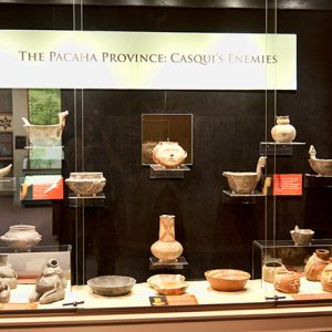
The Parkin Historic Site is a seventeen-acre Native American village site along the St. Francis River in Cross County. Archaeological and geographical information indicates that it is probably the location of the town of Casqui mentioned in the narratives of the Hernando de Soto expedition, which passed through northeast Arkansas in the summer of 1541. In recognition of its national significance, the Parkin site was designated a National Historic Landmark in 1964 and has been on the National Register of Historic Places since 1966. The site is at the north end of Parkin and is the main focus of Parkin Archeological State Park. The Arkansas Archeological Survey established a research station at the site in 1990, and research on the …

Peeler Bend Canoe

The Peeler Bend Canoe is an extremely rare and well-preserved relic of Arkansas’s Native American heritage. Found by chance in 1999, the canoe is believed to have been made by members of the Caddo tribe. Radiocarbon dating places the canoe’s creation sometime between AD 1160 and 1300. After spending several years at the Historic Arkansas Museum (HAM) in Little Rock (Pulaski County), the Peeler Bend Canoe was placed on display in Riverside Park in Benton (Saline County). The canoe has been loaned to the City of Benton by the Department of Arkansas Heritage for exhibition until March 15, 2020. In August 1999, Benton resident Charles Greene was fishing in the Saline River near the Peeler Bend access located just outside …

Petit Jean Rock Art Sites

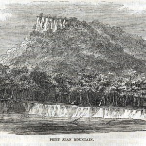
Petit Jean Mountain in west-central Arkansas boasts a large concentration of ancient Native American rock art that includes, as of 2023, seventy-six known individual sites with more than 1,000 pictographs (rock paintings) executed in red or black pigments, as well as petroglyphs (rock engravings). The study of this cultural resource began in 1914 when the wife and son of Dr. T. W. Hardison, the founder of the Arkansas state park system, found rock paintings in a cave near their home on the mountain. The pictographs received national attention after 1923 with the establishment of Petit Jean State Park. Discoveries continue to this day, as most of the paintings have been documented just since 2006 with the advent of new photographic …

Plum Bayou Culture

Plum Bayou culture was a people who built religious centers with a formal arrangement of earthen platforms or mounds that bordered a rectangular open area used for religious and social activities. The misnamed Toltec Mounds site in central Arkansas (preserved by the Plum Bayou Mounds Archeological State Park) was the primary center. Plum Bayou culture, dating about AD 650 to 1050, was one of the first cultures to have such centers in Arkansas. Most of the Plum Bayou people lived in small villages and hunted, fished, gathered wild plant foods, and farmed. Villages were present primarily on the floodplains of the Arkansas and White rivers, but they were also in the adjacent uplands. Plum Bayou developed out of the earlier …

Plum Bayou Mounds Archeological State Park
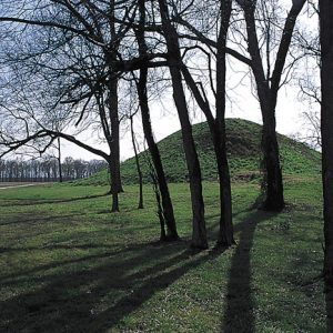
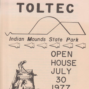
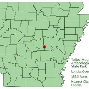
Plum Bayou Mounds Archeological State Park (previously the Toltec Mounds Archeological State Park) near Scott (Pulaski and Lonoke counties) is one of Arkansas’s most significant pre-European archaeological sites. The Toltec Mounds Site, with the state’s tallest Indian mounds, is also a National Historic Landmark. In 1812, Louis Bringier, a French explorer from New Orleans, Louisiana, traveled to present-day Arkansas and became the first European to discover the mounds. His description of the site’s “tolerably regular” alignment of mounds and the height of the two tallest mounds in contrast to the surrounding alluvial flatlands, the first such description, was reported in newspapers in 1821. William Peay Officer and his wife, Mary Eliza, purchased the area in 1849. There they maintained a …
Rock Art, Native American

Rock art is a term archaeologists use to describe images on rock surfaces created both prehistorically and historically. Arkansas has one of the richest concentrations of rock art in eastern North America, primarily in the Ozark and Ouachita mountain areas of the state, with a concentration in the central Arkansas River Valley. Rock art has also been discovered along the Mississippi River escarpment toward the eastern part of the state. Most rock art is found in bluff shelters, but it also occurs on exposed boulders, bedrock outcrops, and in caves. Along with the other archaeological resources in the state, rock art is important to understanding the lives of Native Americans living within the region during the pre-colonial era. Rock art …

Schoolcraft, Henry Rowe

Henry Rowe Schoolcraft published the first written description of the Arkansas Ozarks’ geography, vegetation, wildlife, and inhabitants. His Journal of a Tour into the Interior of Missouri and Arkansaw, published in London, England, in 1821, is an account of a three-month exploration by Schoolcraft and one companion, Levi Pettibone. From November 1818 to February 1819, Schoolcraft explored land from Potosi, Missouri, southwest to the White River, northwest to near Springfield, Missouri, then south by canoe on the White River to present-day Batesville (Independence County), and finally northeast again to Missouri. Schoolcraft’s great-grandfather was a British soldier in New York in the early 1700s who settled with a German wife in Schoharie County, New York. His son John served in the …

Sloan Site

The Sloan site is located on an ice age sand dune in the lowlands of Greene County. People of the Dalton culture buried their dead in ceremonial fashion here about 10,500 years ago. Dalton people were mobile foragers who made and used a distinctive suite of stone tools. These tools have been found at sites across the mid-continental United States. Their material culture that has survived consists primarily of tools made from chert—a highly resistant silica-rich stone that is abundant in the Ozark Mountains, west of the Sloan Site—and in the gravel deposits of Crowley’s Ridge, just east of the Sloan Site. The Sloan Site is one of the oldest, if not the oldest, documented cemeteries in the New World. …

Spanish Explorers and Settlers

The only Spanish expedition into present-day Arkansas began when Hernando de Soto led his party across the Mississippi River on June 18, 1541. The Spaniards had already endured two years of wandering throughout the American southeast, hoping to duplicate the conquest and colonization of a wealthy and powerful nation, as had been done twenty years earlier with the Aztecs of Mexico. De Soto’s band of fortune seekers trudged on for another two years after crossing into Arkansas, where they encountered many large, agriculturally prosperous native chiefdoms, but none of the gold or silver that they sought. By the end of the expedition, approximately half their number, including de Soto himself, had died from sickness, hunger, exposure, or conflict with the …

Spanish Land Grants

Arkansas inherited a complex legacy of land grants from its time as part of Spanish Louisiana. Beginning in 1769, royal governor Alejandro O’Reilly established regulations concerning the size of permissible concessions and the conditions by which applicants could perfect titles to their land. Subsequent governors upheld and expanded similar regulations, but in practice, most grants made during Spanish rule were approved upon request only by the commandant of the nearest settlement. Formal surveys of the grants were rarely made, which further frustrated attempts to determine rightful ownership of granted land once Spanish Louisiana became part of the United States. O’Reilly’s regulations prescribed a three-year probationary period during which claimants were expected to clear the frontage of their land, build ditches …